Isabella se cuenta entre los escritores del recién publicado libro guía de las Islas Canarias. Aquí te ayuda a decidir cuál de las islas es la adecuada para tus vacaciones ideales.
Las apartadas Islas Canarias de España se han ganado con justicia el título de uno de los destinos de viaje más populares de Europa, pero ofrecen mucho más de lo que sugiere el famoso lema de “sol de invierno”. Ocho islas asombrosamente diversas componen este fascinante archipiélago volcánico frente a la costa atlántica de Marruecos, donde paisajes de lava esculpidos de un modo extraño se extienden desde playas de arena negra y relucientes piscinas marinas hasta brumosos bosques de laurisilva (lauráceos), fragantes pinares y curiosos picos escarpados.
Puedes visitar cada año consecutivamente (como hacen muchos viajeros), explorando una isla distinta cada vez, y seguir sorprendiéndote en cada viaje a las Islas Canarias.
Para quienes visitan por vez primera, es común sentirse atraídos hacia las Canarias más grandes y conocidas, en especial Tenerife y Gran Canaria, aunque cada isla tiene sus propias características. Lanzarote y Fuerteventura en el oriente poseen una vibra más costeña, surfera y relajada, mientras que las tres islas occidentales – La Palma, La Gomera y El Hierro – atraen mucho menos turismo que las demás.
No tienes que limitarte a una sola isla tampoco, pues hay excelentes conexiones aéreas y marinas que facilitan planear un viaje prolongado de isla en isla. Según tu estilo de viaje, aquí tienes una guía para hallar la isla Canaria ideal para ti.
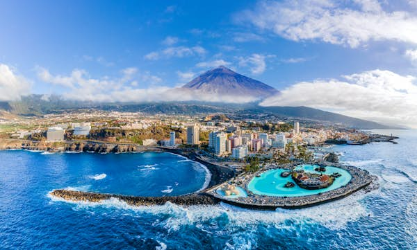
1. Tenerife
La mejor isla para caminatas épicas, paisajes montañosos y viajes en familia
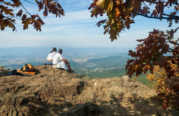
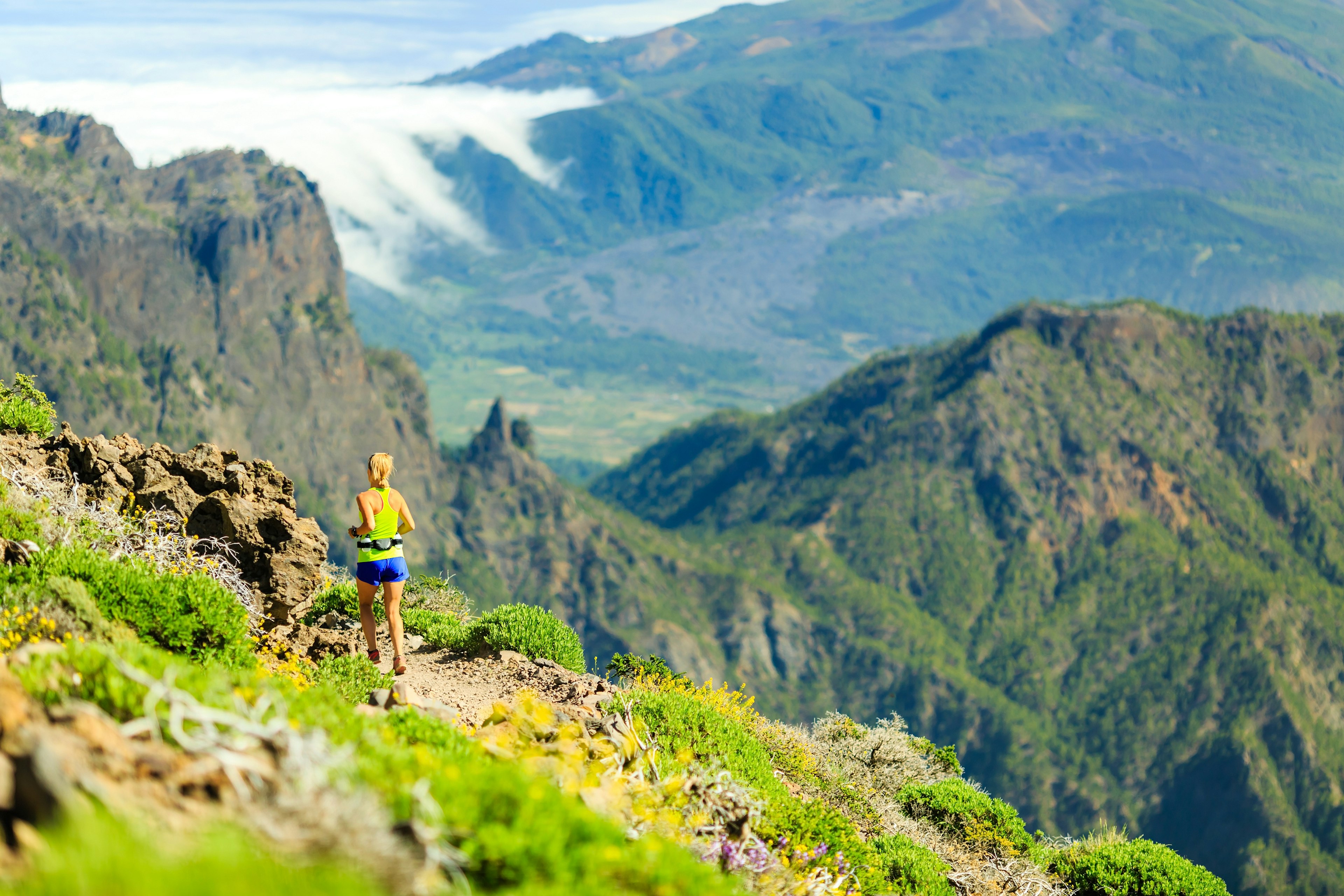
La mayor y más visitada isla del archipiélago combina playas doradas bañadas de sol y una floreciente escena gastronómica con un sinfín de actividades, desde avistamiento de cetáceos en el primer Sitio de Patrimonio Ballenero de Europa hasta surf, kitesurf y senderismo de nivel avanzado. Tenerife es una elección sumamente popular entre las familias vacacionistas, pero ofrece suficiente diversidad para entretener a una gama amplia de visitantes, especialmente más allá de los principales pueblos playeros del sur.
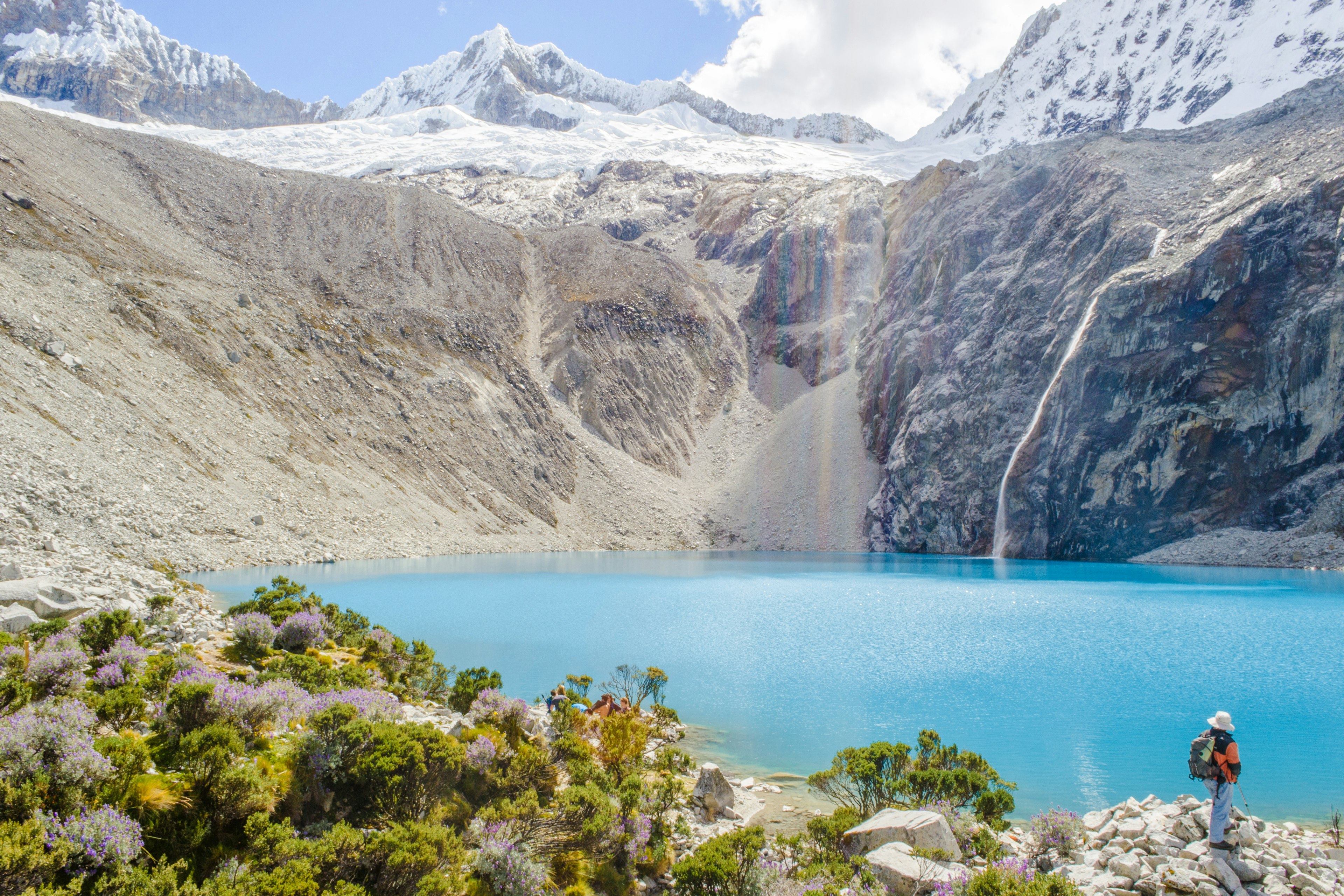
Está el asombroso Parque Nacional del Teide, donde se alza el pico más alto de España a 3718m y donde se extienden senderos por un valle de altitud elevada parecido a la luna. Avistar El Teide – conocido inicialmente como Echeyde por las comunidades indígenas guanches de la isla – es sin duda uno de los momentos impresionantes de las Canarias. Se avecinan más caminatas emocionantes en las montañas biodiversas de Anaga, donde bosques de laurisilva tapizan los paisajes del norte, o a través del salvaje y apartado Parque Rural de Teno en el noroeste.
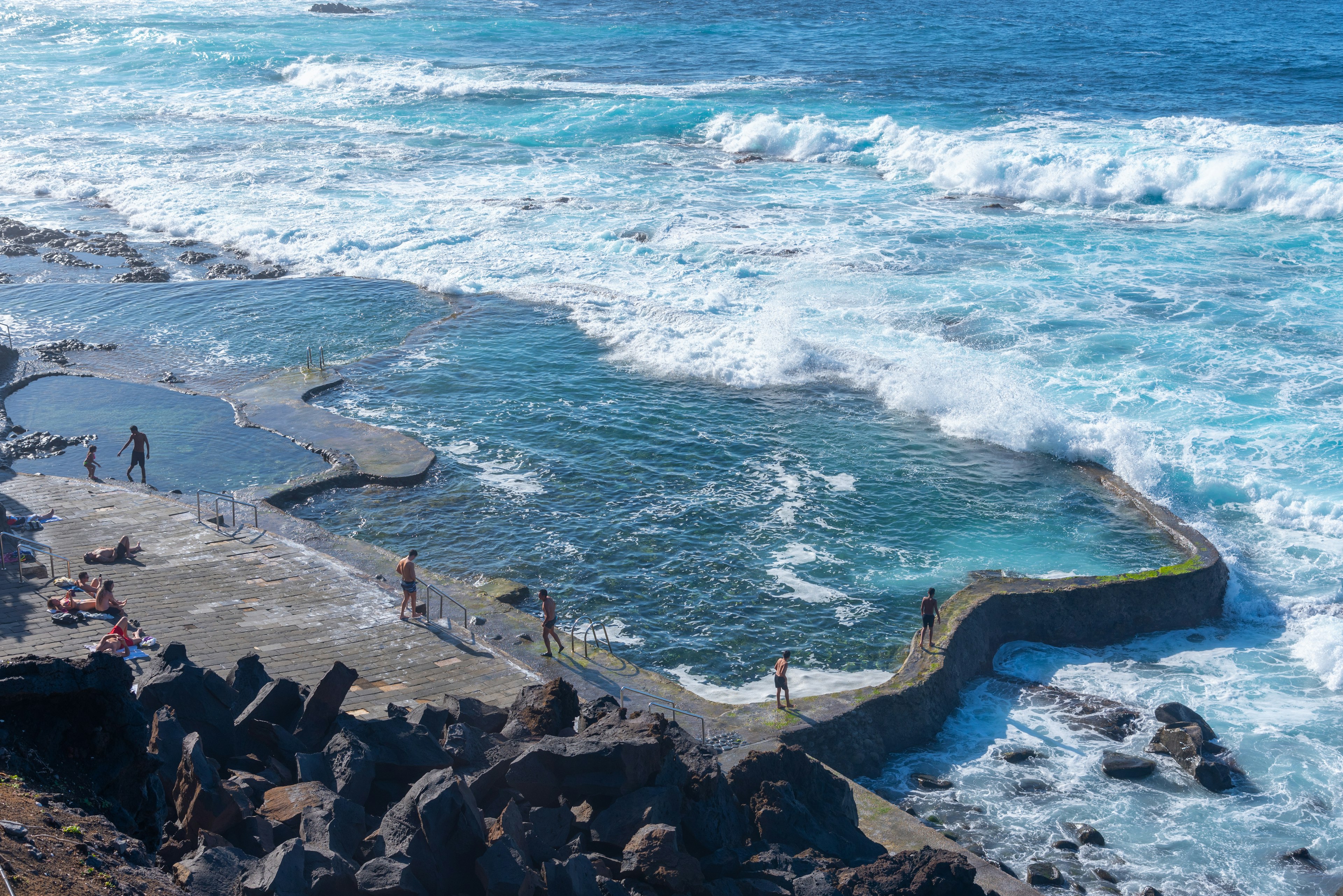
La capital cultural de Tenerife, Santa Cruz, es una ciudad atractivamente relajada salpicada de jardines subtropicales, galerías creativas y arte callejero audaz, que también alberga el Carnaval más espectacular de España cada invierno. La costa norte menos desarrollada, por su parte, cuenta con una riqueza de piscinas marinas naturales, laderas cubiertas de viñedos volcánicos, granjas de plátanos orgánicos y aldeas históricas como Garachico para explorar.
Consejo de planificación: Si tienes planes de subir a la cima de El Teide, necesitarás reservar un permiso gratuito con la máxima anticipación posible.
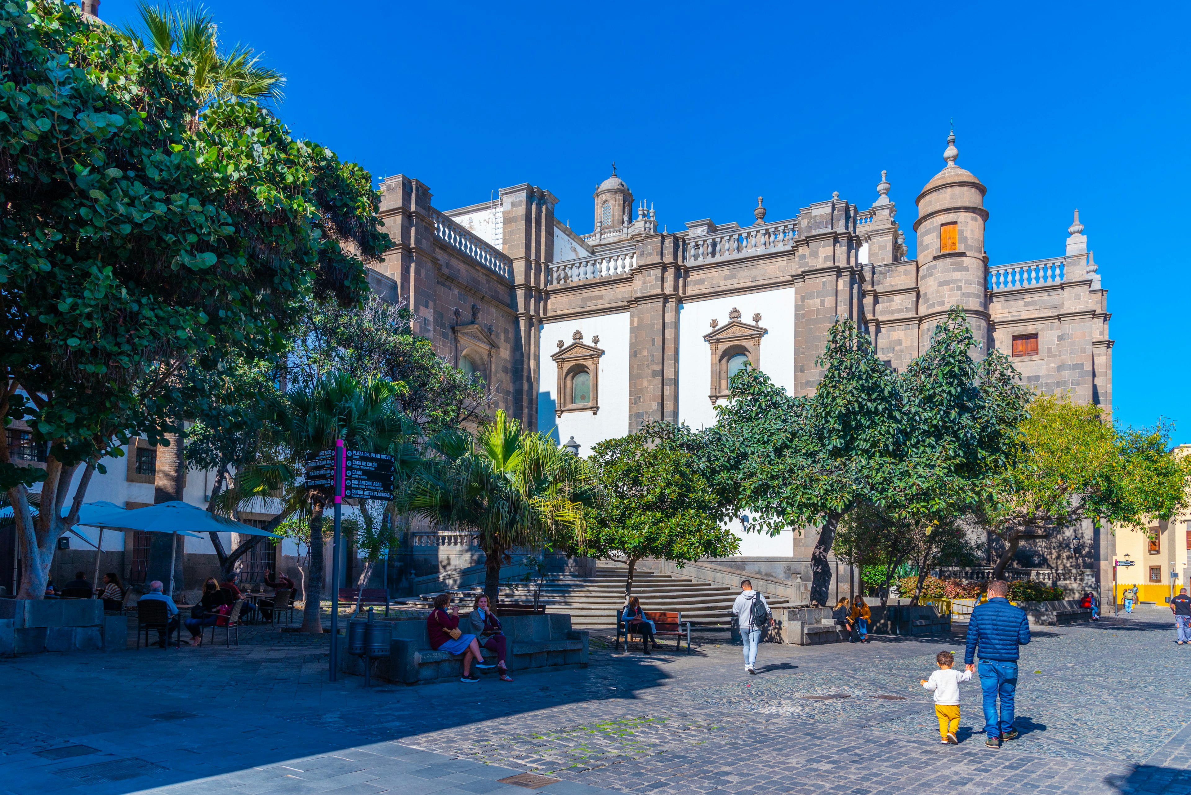
2. Gran Canaria
La mejor isla para costas, cultura y ambiente urbano
La isla más poblada de las ocho, Gran Canaria es más conocida por sus animados complejos turísticos de playa en el sur, en particular Maspalomas bañada por el sol, que es un centro de la escena LGBTIQ+ europea y cuenta con una adorada extensión de dunas doradas. La isla tiene fama de contar con su propio microclima, que varía de un rincón al siguiente.
Pero hay mucho más que descubrir aquí además de las playas y las fiestas, comenzando por la capital insular Las Palmas de Gran Canaria, novena ciudad más grande de España y hogar de uno de los grandes carnavales de invierno del mundo. Con su casco antiguo repleto de arquitectura de Vegueta, la playa sin igual de Playa de las Canteras y una inigualable escena culinaria urbana, resulta ser una escapada urbana gratificante si solo dispones de unos días.
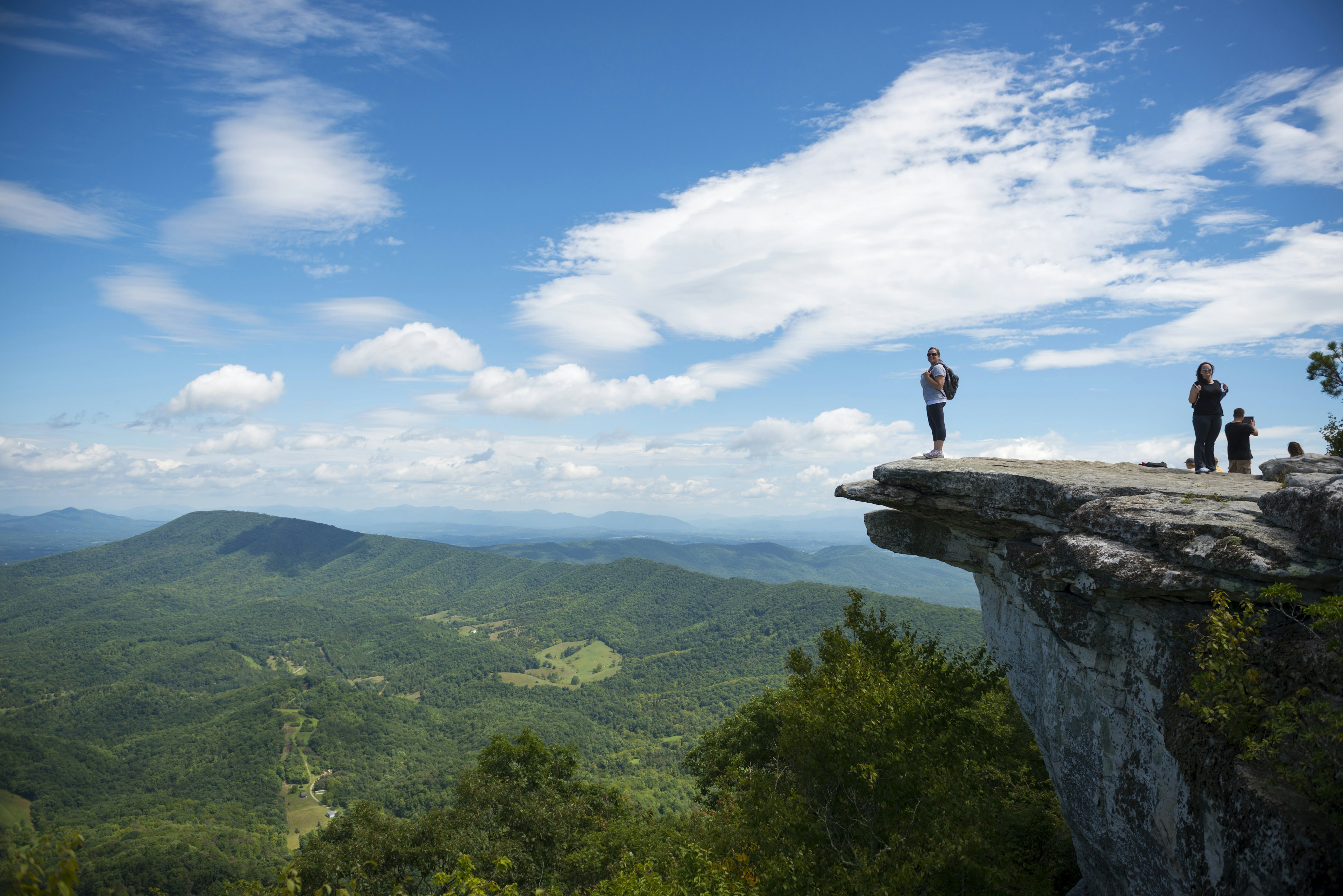
En otros rincones de la isla, remolinos de montañas cubiertas de bruma se transforman en campos desérticos y exuberantes bosques de laurisilva y pinos, mientras que sitios intrigantes anteriores a la conquista española como la Cueva Pintada de Gáldar narran la historia de las comunidades indígenas de Gran Canaria. Explora más en un viaje por carreteras de giros y vueltas a través del centro de la isla a gran altitud, cuyos momentos culminantes culminan en los sorprendentes monolitos Roque Nublo y Roque Bentayga. Luego, visita aldeas elevadas como Artenara y Tejeda, y aprovisiónate de cremoso queso de flor (flor de queso) y otras delicias locales en uno de los bulliciosos mercados de agricultores.
3. Lanzarote
La mejor isla para arte, playas y bodegas
Con conos volcánicos intimidantes, brillantes playas de guijarros negros y algún que otro valle salpicado de palmeras, Lanzarote se siente como un lienzo natural gigante que cambia de color. Así que es lógico que la más oriental de las Canarias capturara el corazón del artista local nacido en el siglo XX y defensor ambiental César Manrique, cuya influencia y obras imposibles de ignorar esperan por toda la isla, desde las casas blanqueadas con ventanas azul cielo de los pueblos costeros hasta la única casa de campo de lava en la Fundación César Manrique.
En los últimos años, Lanzarote se ha convertido en un destino tentador para los amantes del arte, el diseño y la arquitectura, pero también está lleno de diversión al aire libre y tiene una floreciente escena gastronómica con raíces locales. No puedes perderte las extensas áreas volcánicas del Parque Nacional de Timanfaya, que jugaron un papel clave en la creación de la respetada región vinícola de Lanzarote, La Geria, donde las vides crecen en arenas volcánicas ricas en minerales.
Las playas aquí se encuentran entre las más encantadoras de las Islas Canarias, particularmente alrededor de la reserva natural de Papagayo, al sur de Lanzarote, y la salvaje Famara, que es uno de los mejores lugares para surfear en Europa.
Consejo de planificación: Lanzarote, especialmente el norte, cuenta con algunos de los alojamientos más mágicos de las Canarias, incluidos mansiones restauradas como el Hotel Palacio Ico y refugios con diseño vanguardista como Alava Suites.
4. La Palma
La mejor isla para la naturaleza, la observación de estrellas y el senderismo alternativo
Es imposible no enamorarse de la verde La Palma. Apodada merecidamente “La Isla Bonita”, la isla entera es una Reserva de la Biosfera de la UNESCO, con colinas boscosas empinadas y alrededor de 850 km de rutas de senderismo. Los deportes de aventura abundan, desde kayak hasta kitesurfing, y la encantadora capital, Santa Cruz de la Palma, está llena de elaboradas mansiones del siglo XVI.
Las más emocionantes rutas de senderismo de La Palma giran en torno al ineludible Parque Nacional de la Caldera de Taburiente de 50 km², donde una depresión de varios kilómetros se formó por un volcán que se colapsó sobre sí mismo. Y tras la erupción del volcán Tajogaite en 2021 en el sur de la isla, los negocios locales han resurgido, ofreciendo nuevas experiencias de observación de volcanes en esta zona devastada.
La Palma también es uno de los lugares de primer orden en el mundo para observar estrellas, y fue nombrada la primera Reserva Starlight del mundo en 2012. Visitar el reconocido observatorio Roque de los Muchachos y contemplar los oscuros y claros cielos en una experiencia guiada de observación de estrellas con expertos locales (como Astro La Palma) es un punto culminante a nivel de Canarias.
Consejo de planificación: Es mejor incluir cierta flexibilidad en las experiencias de observación de estrellas, ya que los cambios climáticos pueden causar reprogramaciones de último momento.
5. Fuerteventura
La mejor isla para playas y deportes acuáticos
Una Reserva de la Biosfera de la UNESCO desde 2009, la segunda más grande de las Canarias (después de Tenerife) atrae visitantes con sus playas deslumbrantes, su clima soleado todo el año y su belleza lunar cruda. Azotada por el viento y evocadoramente árida, Fuerteventura tiene las arenas más soñadas del archipiélago: desde las dunas de color miel del protegido Parque Natural de Corralejo en el norte, hasta las extensiones aisladas e inexploradas de Playa de Cofete en la punta sur de la isla (véalo al atardecer y lo entenderá).
La isla rivaliza con Famara de Lanzarote como el principal destino de surf de Canarias, con una escena de surf relajada –para todo tipo de niveles– centrada en los antiguos pueblos pesqueros del norte, El Cotillo (con arenas azotadas por el oleaje bajo acantilados) y Corralejo (más parecido a un resort). También puedes navegar, practicar windsurf, kitesurf, paddle surf y buceo, o aventurarte encaminatas, incluida alrededor de la reserva natural de Isla de Lobos cerca de Corralejo.
Consejo local: No debes pasar por alto el interior más verde de Fuerteventura, donde se encuentra la antigua capital Betancuria y algunos de los mejores restaurantes de la isla.
6. El Hierro
La mejor isla para bucear, caminar y escapar de todo
Quien llega a la pequeña isla del extremo occidental de Canarias pronto se da cuenta de su singularidad. Rodeado de acantilados volcánicos inaccesibles, El Hierro ha sido un Geoparque de la UNESCO desde 2014 y se siente mucho más fuera de lo común que el resto del archipiélago, aunque está a solo 40 minutos de vuelo (o 2.5 horas en ferry) desde Tenerife. Esto se debe principalmente a sus fuertes y constantes esfuerzos por limitar el desarrollo turístico y convertirse en la primera isla autosuficiente energética del mundo.
En los últimos años, El Hierro ha surgido suavemente en el mapa de viajes para los visitantes españoles, pero sigue siendo un lugar para la aventura remota, las leyendas locales y la cocina tradicional canaria. Numerosos senderos tranquilos culminan en el Camino de la Virgen de 27 km de longitud, que atraviesa toda la isla siguiendo el camino de la procesión Bajada de la Virgen, que se celebra cada cuatro años.
La costa dentada, mientras tanto, está salpicada de fascinantes piscinas naturales de mar, como La Maceta en La Frontera. Y las serenas aguas atlánticas frente a la costa sur de El Hierro ofrecen posiblemente el mejor buceo en Canarias, con la reserva marina Mar de las Calmas ahora encaminada para convertirse en el parque nacional más nuevo de España.
Consejo para planificar: Los mejores meses para hacer senderismo en El Hierro son de marzo a mayo (para disfrutar de paisajes llenos de flores) y septiembre/octubre (generalmente buen clima).

7. La Gomera
La mejor isla para caminatas tranquilas y refugios verdes
Colinas densamente boscosas, dramáticos valles volcánicos y una cadena de pintorescos pueblos pintados en tonos pastel hacen de la bohemia La Gomera el sueño de cualquier excursionista. Aunque está ubicada justo al suroeste de Tenerife, la isla, hasta ahora, ha logrado mantener a raya el turismo a gran escala, con la mayoría de los alojamientos en pequeños hoteles rurales, casas de campo reformadas o apartamentos con cocina.
El Parque Nacional de Garajonay, con una extensión de 40 km² en el corazón de La Gomera, está repleto de senderos que cruzan el histórico bosque de laurisilva cubierto de niebla, mientras que en otros lugares los caminos cautivadores se adhieren a paredes de valle escarpadas o serpentean a lo largo de la costa volcánica ennegrecida. Cuando hayas caminado todo lo que puedas, pasea por la colorida capital costera de San Sebastián de la Gomera y relájate en sus encantadoras plazas sombreadas, tal vez disfrutando de especialidades como potaje de berros (guiso de berros), papas arrugadas (papas arrugadas) y queso fresco de cabra. También hay una escena de playa tranquila, principalmente alrededor de Valle Gran Rey y Playa Santiago en la costa sur.
Consejo para planificar: La Gomera tiene una rica herencia de artesanía local; Gomera Corazón Verde ofrece talleres sobre cómo hacer salsas mojo, tejer cestas de hojas de palma y más.
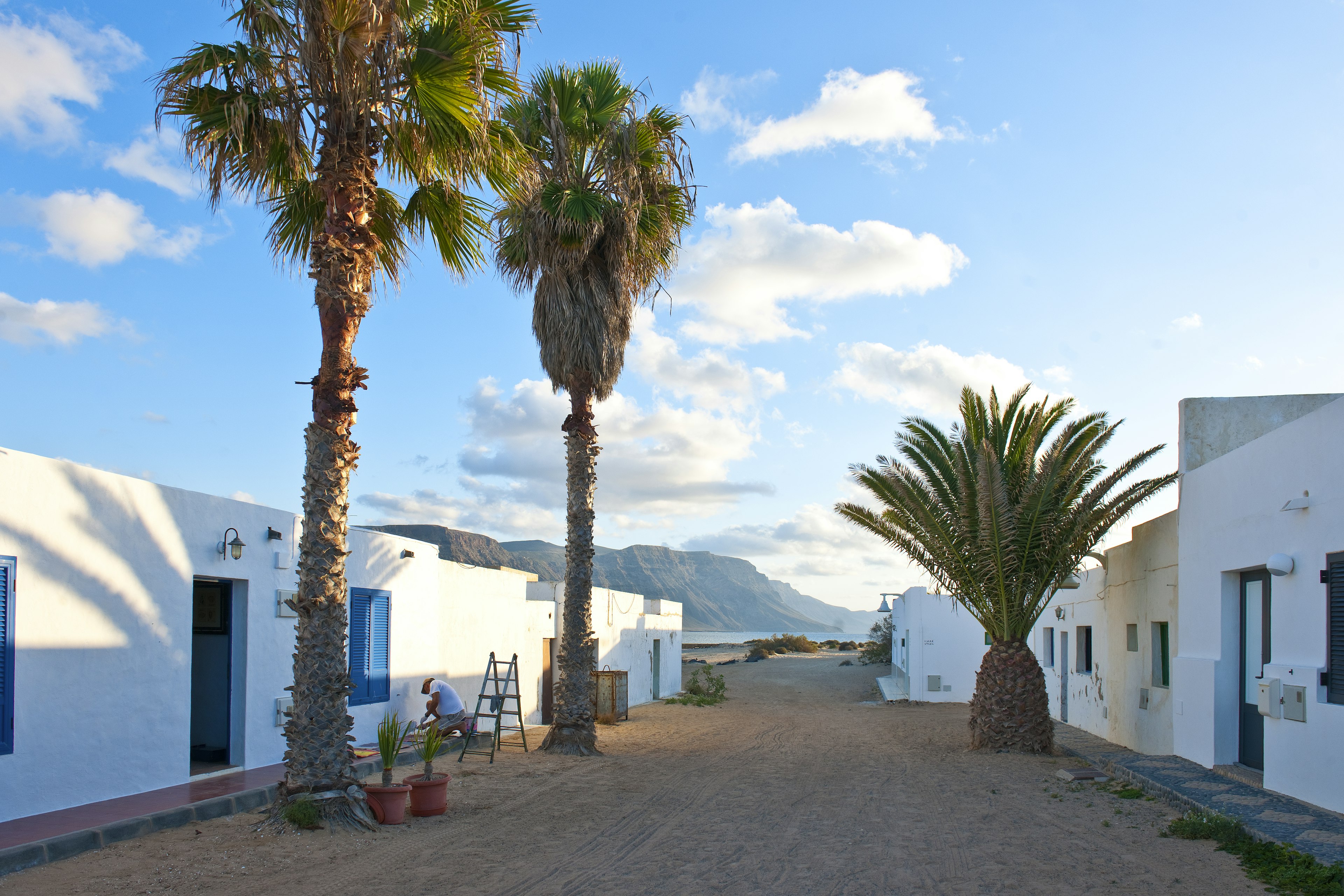
8. Isla Graciosa
Mejor isla para playas poco concurridas
Declarada la octava isla oficial del Archipiélago Canario en 2018, tranquila La Graciosa está ubicada solo a media hora en ferry al norte de Lanzarote, pero se siente increíblemente remota. En esta pequeña y llana isla, playas salvajes de dorado-blanco rodean conos volcánicos quemados, y la única forma de recorrerla es a pie, en bicicleta o mediante un tour en jeep. Todo es parte del archipiélago Chinijo, el cual es un parque natural protegido donde podrían avistarse delfines, tortugas y una amplia variedad de aves. Caminando o pedaleando se puede llegar a las aisladas Playa de las Conchas o Playa Francesa que ofrecen vistas a los acantilados de Lanzarote, antes de relajarse en uno de los restaurantes de mariscos relajados en la diminuta “capital” cubierta de arena, Caleta de Sebo.
Consejo de planificación: La mayoría de los turistas exploran La Graciosa en excursiones de un día desde Lanzarote, pero quedarse una noche (o algunas) es una perfecta escapada inusual. Desde Órzola en el norte de Lanzarote, los ferries salen cada media hora hacia Caleta de Sebo (y de vuelta) con Líneas Romero o Biosfera Express.