healthyng

Category Wildlife and Nature

The best hikes in the Hudson Valley

With its pristine forests, panoramic peaks, world-renowned bridges and historic ruins, the Hudson Valley is a hiker’s heaven. There are trails to suit all experience levels, all just a stone’s throw from New York City. If you thought New York State was all about city sprawl, prepare to be surprised.

There’s a reason Thomas Cole and the artists of the Hudson River School spent so much time recording this region in their 19th-century paintings. The highlands, forests and meadows flanking the country’s fourth-longest river are part of an American Arcadia that dazzles in all four seasons. Walking through this wondrous terrain is one of the best things to do in the Hudson Valley.

Whether you’re taking a day trip north from New York City or spending a weekend or longer investigating the area’s quirky enclaves, here are the best hikes to add to your Hudson Valley itinerary.

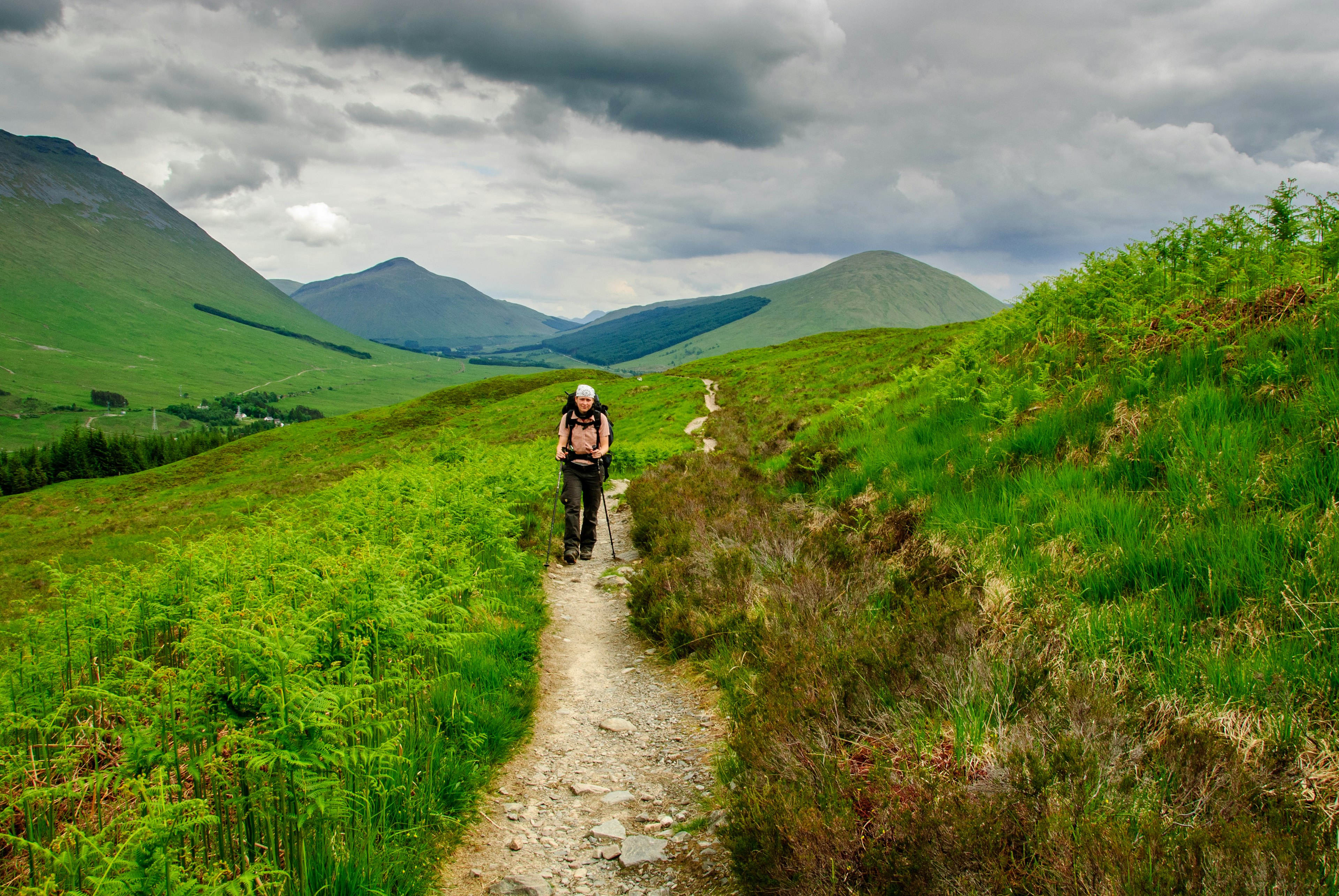
Two hikers in the forest in the Hudson Valley area, USA.
Hikes in the Hudson Valley can be as easy or as challenging as you like. Brook Pifer/Getty Images

1. Bull Hill Hike

Best day trip from NYC
5.4 miles roundtrip; 3-4 hours; moderate

It’s little wonder the loop around 1421ft Bull Hill (also known as Mt Taurus) is one of the Hudson Valley’s most popular treks. Starting just 50 miles north of NYC near the village of Cold Spring, this rewarding outdoor adventure is an easy day trip for hike-hungry urbanites. It’s also a visual crash course in the history of the Hudson Highlands.

The hike begins on the Washburn Trail and ends on the Cornish Trail, exploring scenic overlooks and mysterious ruins that attract eager hikers year-round. Pick up the trail across the street from Little Stony Point, a green space by the Hudson River, and climb quickly to the old Mt Taurus Quarry – an industrial stone-mining operation abandoned in the mid-20th century.

A challenging haul through areas of bare rock and patchy thickets leads to several lookout points with awe-inducing views of Storm King Mountain, the Hudson River, and on clear days, the distant NYC skyline. After the summit of Bull Hill, the hike becomes a gentle forest stroll; squirrels rustle in the underbrush, birds flit among tree branches, and a gurgling creek adds a meditative soundtrack.

Highlights of this section include the stone remains of the Cornish Estate, built in 1910 and deserted after a fire in the 1950s. Peer inside the ruins sprinkled along the trail and imagine the property’s Gatsby-era grandeur before finishing the loop. To walk here, plan for an early start – parking spaces fill fast and overflow to the road by mid-morning.
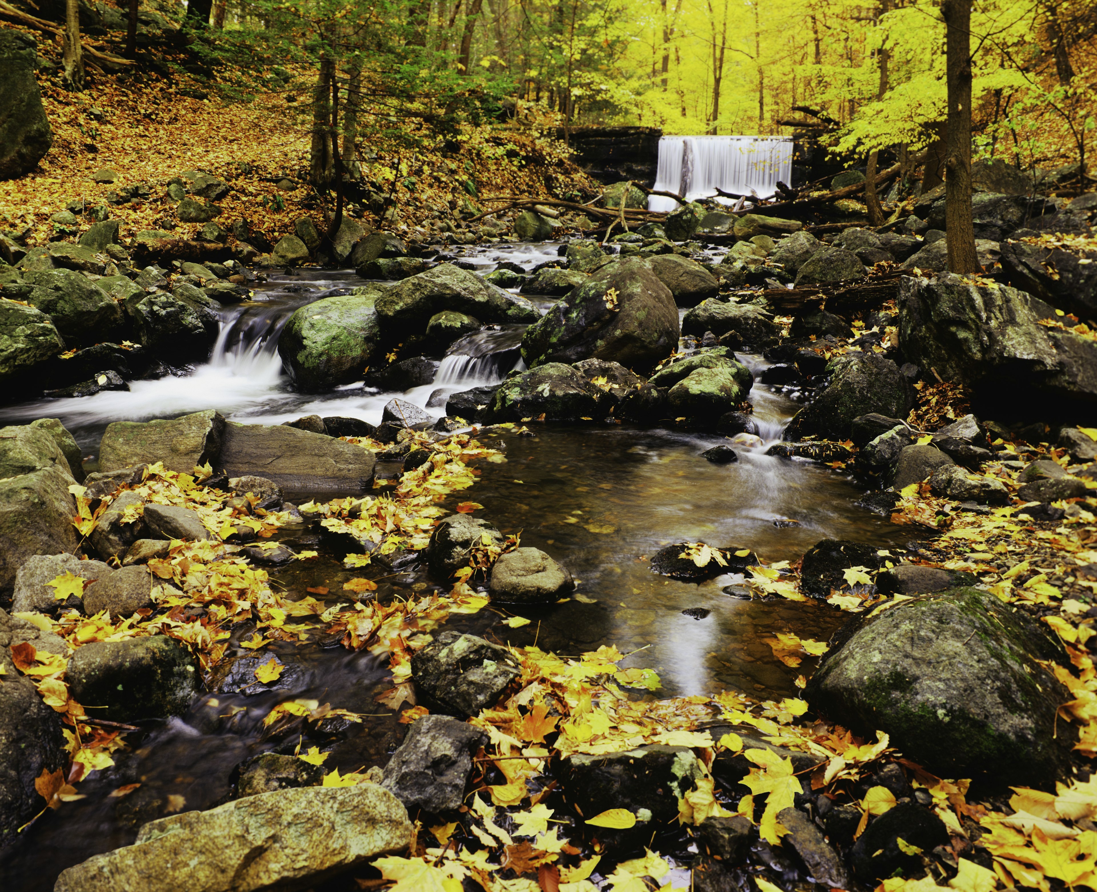
Beech trees and sugar maples in gold and brilliant yellow line the trails of the Hudson Valley.
The Hudson Valley’s trails are painted in vivid colors when the leaves change in fall. Ron Thomas/Getty Images

2. Storm King Mountain

Best starter hike in the Hudson Valley
2.4 miles roundtrip; 1-2 hours; easy to moderate

Summit Storm King’s 1300-ft-high crown to see why this mountain deserves its monarchical title. Rocky outcrops scattered around the trail act as nature-made thrones, lording it over the Hudson Valley. Take a seat by one of the overlooks and soak in views of the Hudson Highlands undulating to the east and the Catskills rising to the west. In fall, the colors can be wonderful.

The region’s eponymous river swirls like a ribbon below, while views to the north take in the century-old bones of Bannerman Castle, an abandoned artillery fort on Pollepel Island. At the end of the walk, consider heading 15 minutes north to the Storm King Art Center – a famous outdoor sculpture garden near the town of Cornwall – to make this an all-day outing.

The hike begins at the parking lot off Route 9W, located on the Hudson River’s west side, and follows orange trail markers going clockwise around the path. After a steep climb with several simple rock scrambles, yellow and blue markers lead through a grove filled with maple, oak and sycamore trees.

The first peak you’ll reach is Butter Hill, serving a taste of vistas yet to come. Continue north until the hike’s most awe-inducing panoramas reveal themselves. After admiring the kingdom laid out below, follow white trail markers through the woods and back to the parking lot. On weekends, arrive early to beat the crowds.

3. Breakneck Ridge

Best full-body workout
3.2 miles roundtrip; 3 hours; difficult

Hop on the Breakneck Ridge-bound train at Grand Central Terminal, and you’ll be in good company. On warm weekends, hordes of car-free hikers take the 90-minute trip from Manhattan to brave the East Hudson Highlands’ most challenging trail. This short but strenuous slog is best suited for experienced hikers – rocky scrambles and near-vertical ascents call for sure-footed souls who are unafraid to use their hands.

Hikers can choose from multiple trail options, but for the classic route, follow the white trail to the red trail, then continue down the yellow path to complete the loop. Keep your eyes peeled for views of Storm King Mountain’s rounded crown across the Hudson River, while Bull Hill makes an appearance to the south.

If you’re reasonably fit, this Hudson Highlands hike won’t break you, but you’ll break a sweat. To minimize the chance of mishaps, wear closed-toe shoes with proper grip and don’t hike in wet or icy conditions. Carry water and snacks to refuel throughout the adventure.

The Walkway Over the Hudson – the world's longest elevated pedestrian bridge.
The Walkway Over the Hudson is the world’s longest elevated pedestrian bridge. Jay Gao/Shutterstock

4. Walkway Over the Hudson

Best ADA-compliant trail
1.28 miles one way; 1 hour; easy

Stroll or roll across the bridge connecting the towns of Poughkeepsie and Highland for New York State bragging rights. At 6768ft long and 212ft high, the Walkway Over the Hudson is the longest elevated pedestrian bridge in the world. It’s also one of the region’s most accessible trails, accessible via a 21-story-high glass elevator from Poughkeepsie, leading to a smooth path. Audio tours are offered in multiple languages.

The bridge began its life as part of a bustling train network built in the late 19th century, but the declining use of commercial railroads and a 1974 fire turned it into a ghostly reminder of the Hudson River’s industrial golden age. Today, it’s hard to imagine the years of disuse – in summer, dog walkers, joggers and families with strollers glide across the cement while boats and barges race cormorants in the water below.

The atmosphere changes with the seasons. In spring, dogwoods sprout delicate petals along the riverbank, and in autumn, a blaze of color ignites the surrounding woodlands. Even a winter visit is worthwhile – the bridge offers expansive vistas of the Hudson Valley’s snowy scenery. If you want a more challenging journey, consider following the 4.4-mile Walkway Loop Trail, which crosses the bridge before winding through historic villages and handsome parks along the waterfront.
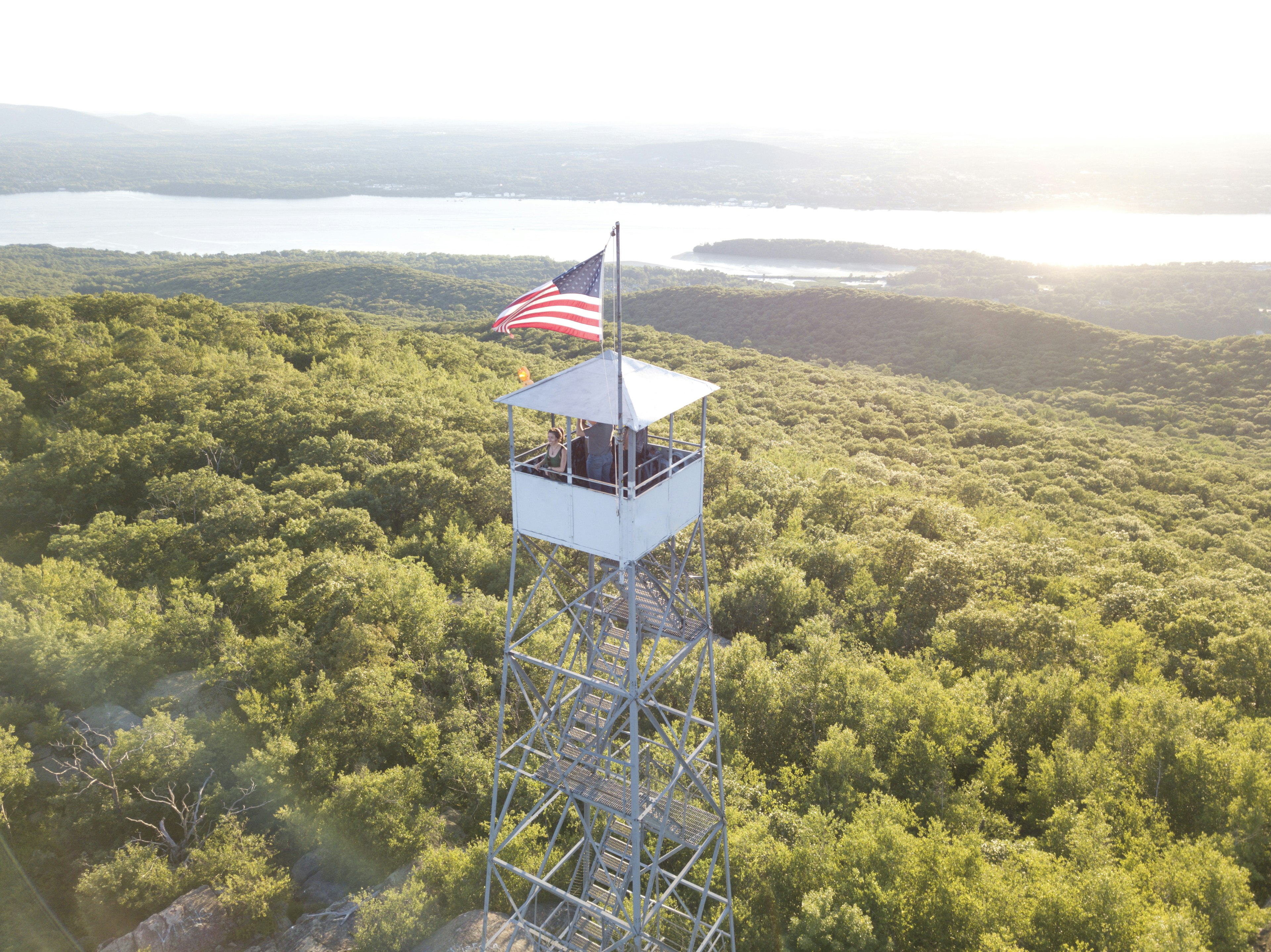
A woman in a tower with an American flag, looking out over the Hudson River, greenery and mountains
The breathtaking hike to the Mt Beacon Fire Tower is the highlight of a trip along Route 9D. Michael Duva/Getty Images

5. Mt Beacon Fire Tower

Best for 360-degree views
4 miles out and back; 3 hours; moderate

The breathtaking hike to Mt Beacon Fire Tower is the best-kept secret on Route 9D. While the crowds clamor to climb nearby Bull Hill and Breakneck Ridge, in-the-know locals take this less-congested path for the region’s best 360-degree views over the Hudson Valley scenery.

Scale the 1600ft summit of Mt Beacon to see the Catskills, Shawangunks and Hudson Highlands rolling out in all directions. On clear days, the Manhattan skyline appears like a distant mirage. Graffiti scribbled atop the 60-ft fire tower says it best: “This sight is beyond a dream.”

The hike is easily divided into two sections. The first follows a 200-step staircase and a rocky path, tracing the route of the former Mt Beacon Incline Railway – once the world’s steepest passenger funicular – which operated from 1902 to 1978. Ruins from the railway and an early 20th-century casino await, with splendid views of the town of Beacon below.

For even better views, continue upward to the fire tower. In summer, birch, hemlock, oak and maple trees create a shady canopy as the track traverses the fern-filled forest. If the final climb to the mountain’s rocky ridge doesn’t make your heart race, the fire tower ascent certainly will. Pack snacks and plenty of water and enjoy the bird’s-eye view as falcons and eagles soar overhead.

6. Brace Mountain

Best hike in the eastern Hudson Valley
3.6 miles out and back; 3-4 hours; difficult

Join the paragliders who flock to the highest peak in Dutchess County, and you can watch daredevils swoop above the Hudson Valley’s eastern border. Brace Mountain – a 2311-ft peak in the southern Taconic Range – is a great vantage point for taking in the Hudson Valley vistas.

The rugged hike to Brace Mountain begins on Quarry Hill Rd, north of Millerton. Weave between red oak trees, bound over boulders and pass creeks feeding photogenic waterfalls. Upon reaching the cairn-marked summit, spin around to see the Berkshires, the Catskills and miles of Hudson Valley farmland below.

Keep your eyes peeled for a diversity of wildlife along the way. Skittish black bears and curious deer occasionally make an appearance, and timber rattlesnakes are common in summer. In July, blueberry bushes near the top provide a sweet treat after a challenging trek.

If this heart-pumping trail isn’t enough of a workout, include Mt Frissell as part of the journey. This combined hike traverses the borders of New York, Massachusetts and Connecticut, and it passes a stone pillar identifying the tristate marker.

A river winds through lush fall foliage with a bridge in the distance
With more than 50 trails catering to all types of hikers, it’s easy to find a perfect Bear Mountain hike. Tony Shi/Getty Images

7. Bear Mountain State Park

Best for hiking variety
3.8 miles; 3 hours; easy to moderate

Bear Mountain State Park is a 5205-acre antidote to New York’s urban sprawl, which makes seeing the Manhattan skyline from its 1303ft peak even more mind-boggling. NYC might be 50 miles south, but this sylvan landscape seems light-years away.

With more than 50 trails catering to all types of hikers, you’ll be spoilt for choice on Bear Mountain. If you want to see the Big Apple’s silhouette, follow the scenic route from the Major Welch Trail to Perkins Memorial Tower (erected in 1936) and descend on a section of the Appalachian Trail. This counter-clockwise loop is less daunting than the Appalachian through-hike from Georgia to Maine, but it’s still a remarkable journey.

The hike begins along Hessian Lake before turning into an oak forest and mounting rocky terrain lined with blueberry bushes. At the peak, ascend the Perkins Memorial Tower for unobstructed views in all directions. Finish the circuit by descending more than 1000 hand-cut granite steps and zig-zagging along a well-maintained woodland trail.

If nature’s Stairmaster sounds stressful, consider driving to the summit instead. Cars can access the same vista along Perkins Memorial Drive between April and November. Turn this into a full-day event by taking advantage of the park’s seasonal activities. You can boat, swim, cross-country ski, visit the zoo, or dine at the rustic Bear Mountain Inn – there’s something here for all tastes.

8. High Falls

Best waterfall hike
1.4 miles roundtrip; 1 hour; easy

Nature newbies will fawn over the hike to High Falls; this short trail offers sizable rewards for minimal effort. On weekends, a mix of young families, Brooklyn hipsters and flannel-wearing locals from nearby Hudson town trek through the shady hemlock forest searching for Columbia County’s tallest cascade.

High Falls drops an impressive 150ft, and the trails winding through this conservation area lead to two must-see viewpoints. Begin by heading to the overlook for a picture-perfect shot of the waterfall. From here, it’s possible to see a dam at the precipice – a 19th-century remnant of the area’s milling history. Next, weave down to Agawamuck Creek and walk upstream. A smaller waterfall appears a few minutes from the main cascade’s base.

This hike is open year-round, but High Falls is most impressive in early spring or after a storm. The path is often muddy, so don proper footwear and be ready to get grimy.
Epic adventures in Spain’s outdoor playground

From the lofty mountains in the north and south of the country, to the plains and olive groves of the interior, and the beaches of the Atlantic and Mediterranean coasts, Spain’s diverse topography offers endless scope for outdoor adventure.

Trekkers head for the rugged peaks of the Pyrenees, Picos de Europa and the Sierra Nevada, hit the myriad coastal and forest hiking trails, or join other pilgrims along the Camino de Santiago. Rock climbers tackle precipitous routes on rock faces across Catalonia and Andalucía, while those in search of extra thrills soar above mountain peaks in a paraglider or canyon down river gorges. Windsurfers, kitesurfers and wingboarders head for Andalucia’s Costa de la Luz and the Canary Islands, while surfers find their own private paradise along Galicia’s wave-battered coastline. All over Spain, cyclists take to quiet backcountry roads or off-road tracks to discover the best of the country’s diverse landscapes.

No matter what your level of adventure might be, there’s an outdoor experience for you in Spain. Here are some of our favorites:

Hiking

The second-most mountainous country in Europe, Spain is renowned for its superb hiking trails that traverse its diverse topography, be it the alpine meadows of the Pyrenees, the craggy Picos de Europa, the rugged foothills of the Sierra Nevada or the coastal cliffs and white-sand beaches of Andalucía’s Cabo de Gata.

Peak-baggers set their sights on Andalucía’s Mulhacén (11,400 feet) – mainland Spain’s highest peak – or Monte Perdido (11,000 feet) in the Pyrenees. Hikers seeking multi-day challenges tackle Galicia’s 125-mile-long Camiño dos Faros trail along the magnificent Costa da Morte (Death Coast); the spectacular GR11 (Senda Pirenáica) that connects the Atlantic (Hondarribia in the Basque Country) to the Mediterranean (at Cap de Creus in Catalonia); the 70-mile-long Anillo de Picos that links the Picos de Europa’s most scenic spots; or the 186-mile-long, stunning high altitude GR 240 in the Sierra Nevada, where you also trek between refugios (mountain huts).

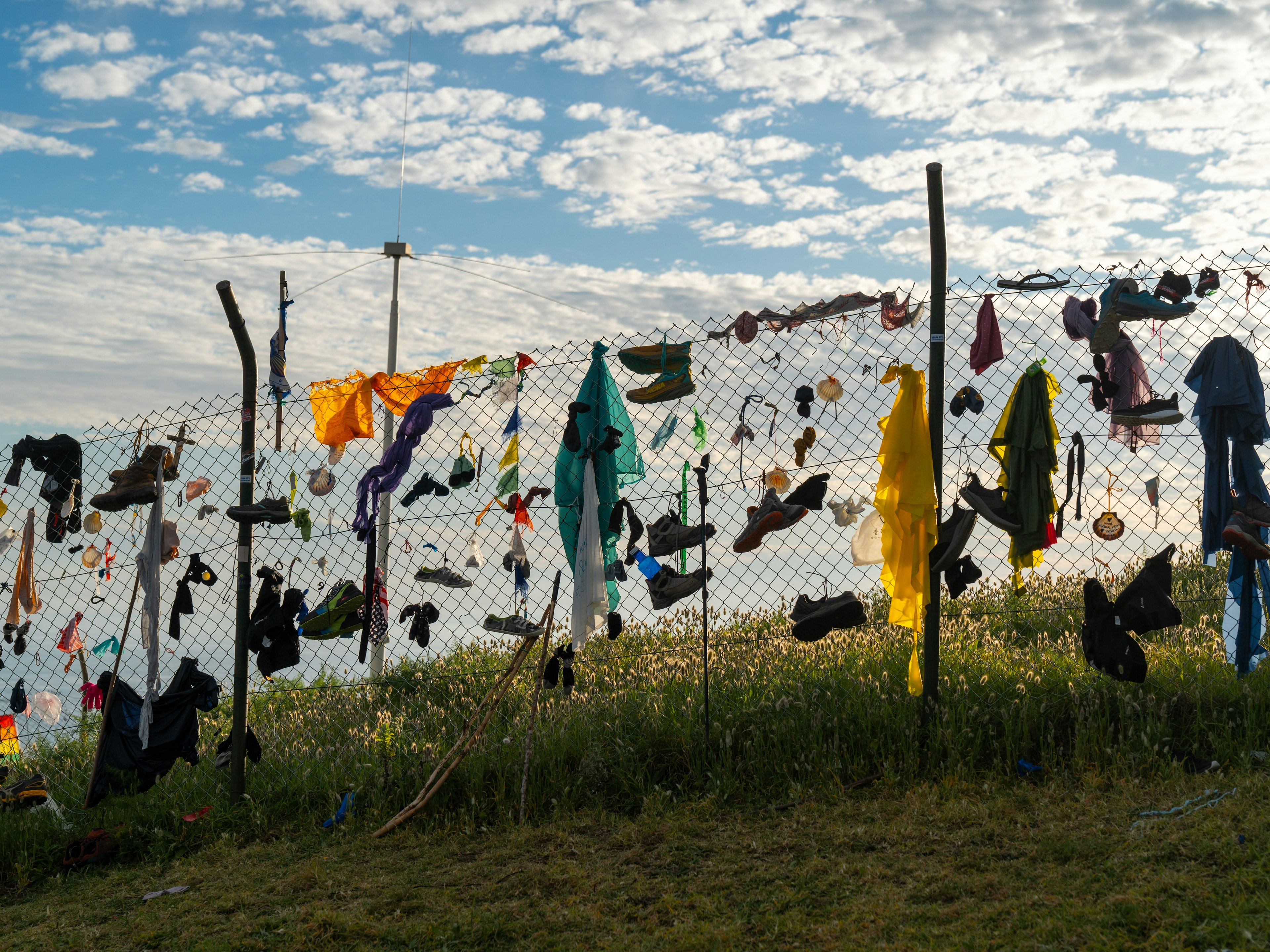
After finishing their pilgrimage at Santiago de Compestla’s cathedral, some hikers on the Camino de Santiago leave behind their clothes and boots in Finisterre to signify a new start. Coke Bartrina for Lonely Planet; Blake Horn for Lonely Planet

And then there is one of the world’s most famous pilgrimage trails – the original 490-mile-long Camino de Santiago (or Camino Francés) route to the Santiago de Compostela cathedral in Galicia.

Some of Spain’s best day hikes are found along the Costa Brava’s Camí de Ronda, in Almería’s Parque Natural de Cabo de Gata-Níjar, amidst the cork-oak woodlands of Andalucía’s Sierra de Aracena, and the volcanic landscapes of Catalonia’s Parc Natural de la Garrotxa.

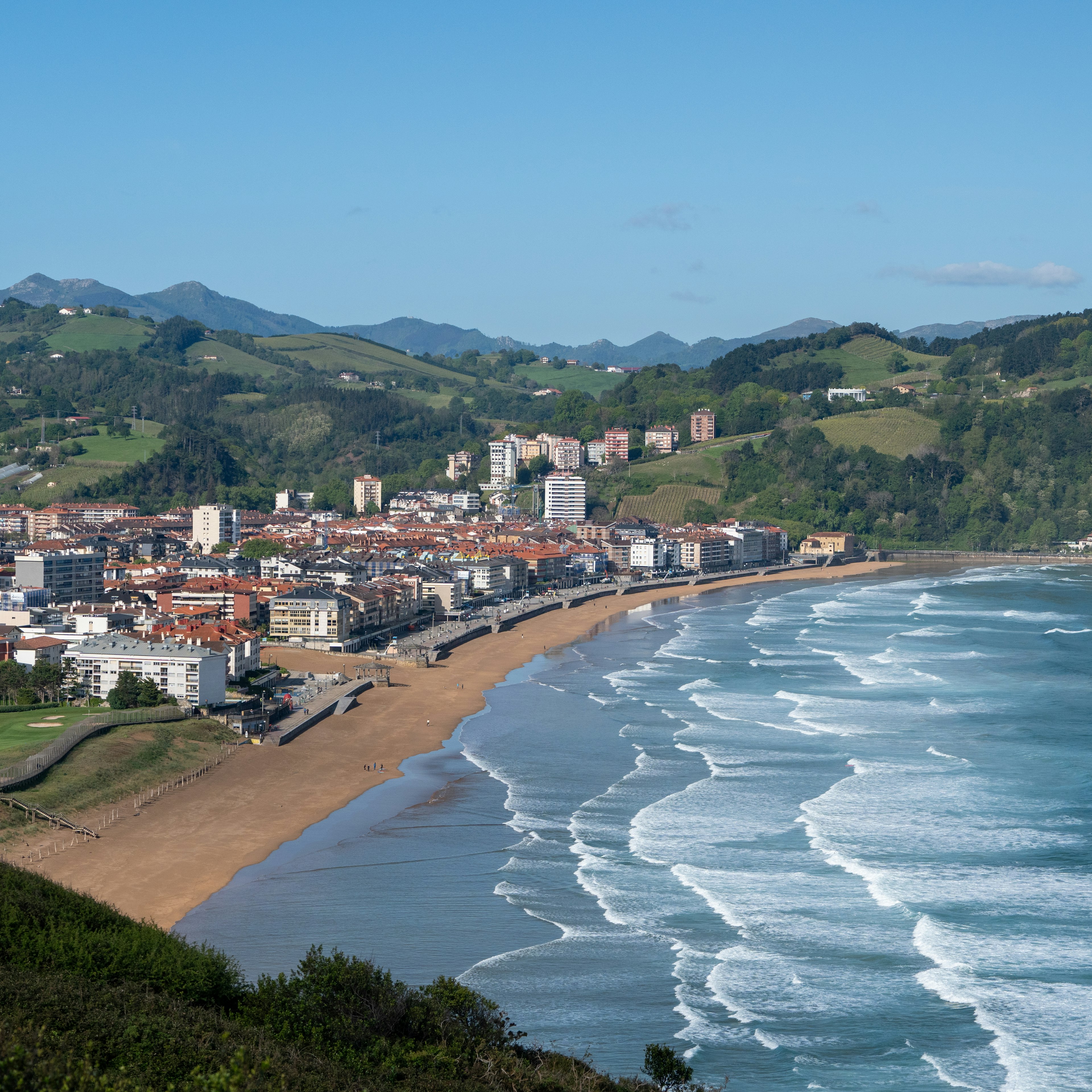
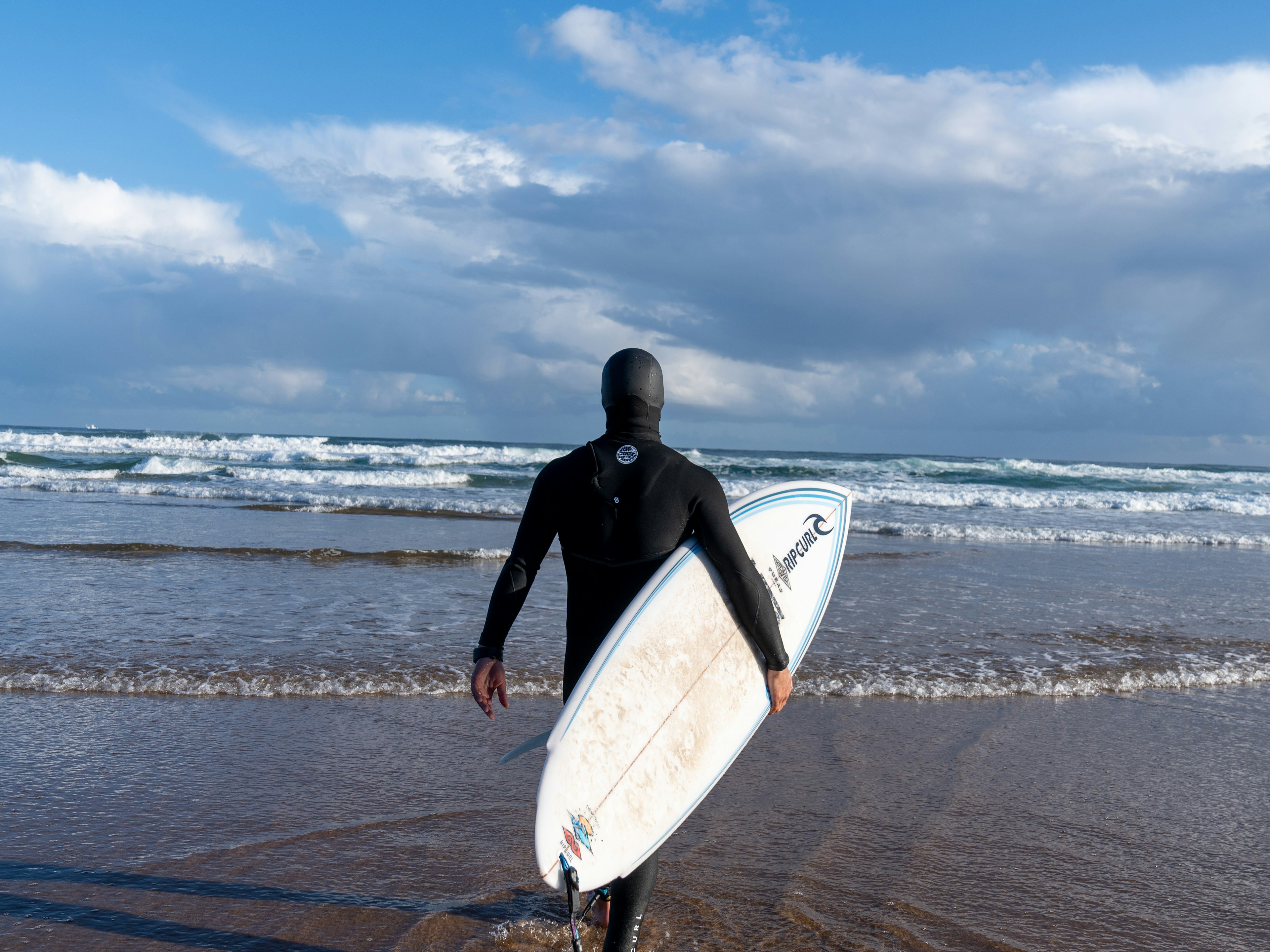
The Zarautz coastline near Bilbao is a popular surf break in Basque Country. Blake Horn for Lonely Planet

Above and below the waves

Legendary winds – the gentler, cooler poniente (west wind), and the fierce, warm levante (east wind) that blows from Africa – have made Tarifa, Spain’s southernmost point, one of the world’s top kitesurfing, windsurfing, and wingfoiling destinations, particularly during peak season of April to October. Further up the Costa de la Luz, Los Caños de Meca is a quieter kitesurfing spot, while elsewhere in Spain, kitesurfers reap the wind in Empuriabrava, Delta de L’Ebre and Castelldefels in Catalonia; plus Murcia’s Mar Menor.

Spain’s north coast offers excellent surfing for beginners and experienced surfers alike. Top spots include the Mundaka river break in Basque Country; Playa Rodiles in Asturias and Playas de Somo and Liencres in Cantabria. Galicia’s Atlantic coast is no slouch either, from isolated breaks along the treacherous reefs of the Costa da Morte to Praia de Pantín in the Rías Altas. Heading south, El Palmar, just northwest of Cabo de Trafalgar, is the pick of Andalucía’s powerful winter beach breaks.

Surfing, windsurfing and kitesurfing are also popular on the Canary Islands, and schools offering classes and equipment rental are easy to find on the windier coasts. There are a variety of spots to choose from, ranging from the beginner-friendly sandy beach breaks of Fuerteventura to the heavy reef breaks of Lanzarote and Gran Canaria.

There also are plenty of SUP (stand-up paddleboarding) spots along the Andalucian coast, on Catalonia’s Costa Brava, and in Santander in Cantabria.

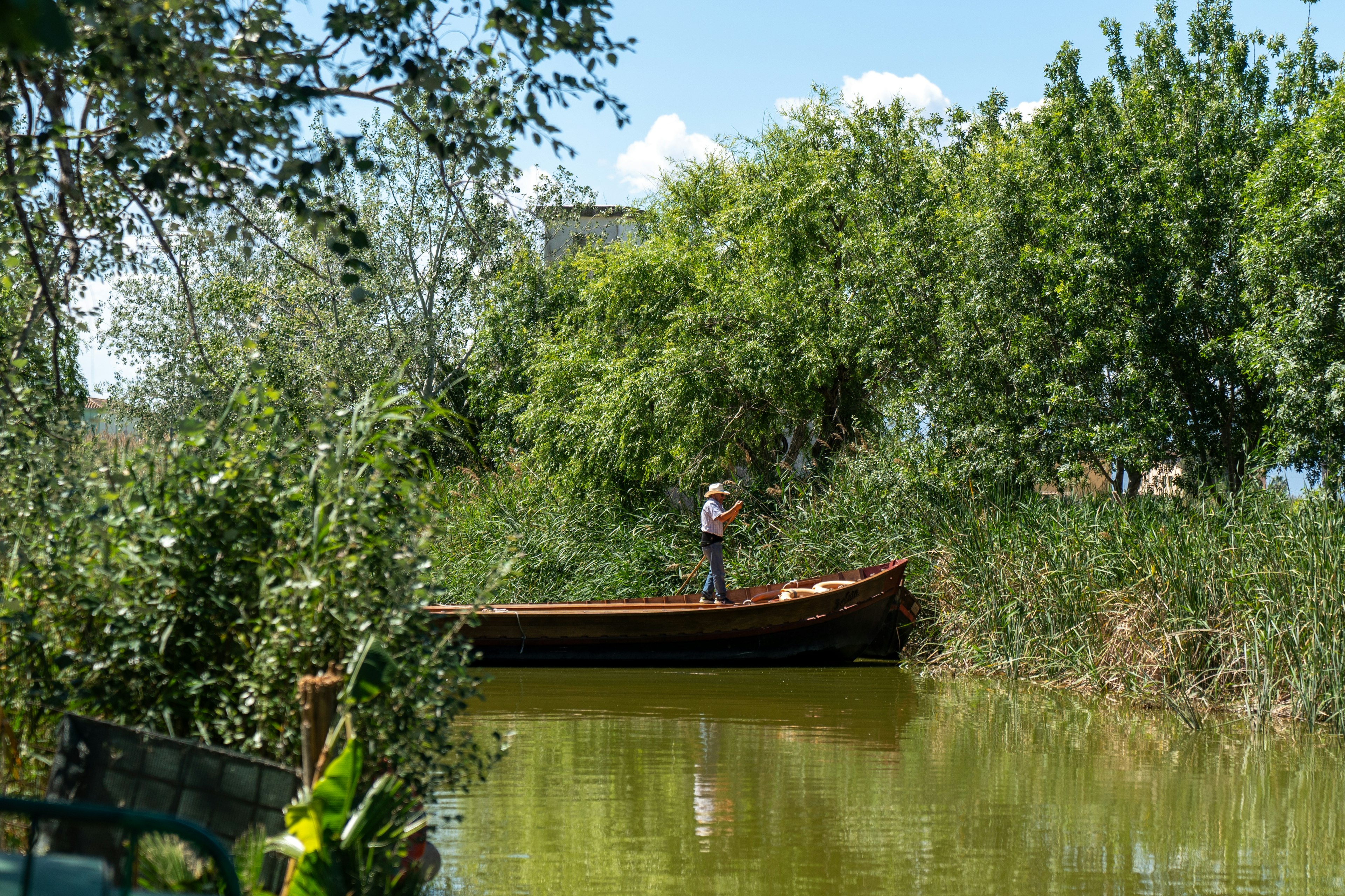
There are plenty of boating opportunities in Spain, from catamaran cruises to quiet waterway explorations like this one in Albufiera.
There are plenty of boating opportunities in Spain, from catamaran cruises to quiet waterway explorations like this one in Albufiera. Blake Horn for Lonely Planet

Beneath the waves there’s even more to explore. The variety of marine life and the warm, relatively calm waters of the Canary Islands make them a great place for diving or snorkeling. The volcanic coast is made up of beautiful rock formations and caves and you can spot around 350 species of fish and 600 different kinds of algae. In Andalucía, the best diving and snorkeling is around Cabo de Gata, the marine reserve’s posidonia seagrass meadows, El Vapor wreck, caverns and canyons attracting eagle rays, sunfish, moray and conger eels, grouper, angelfish and barracuda.

Cabo de Palos, the southern limit of Murcia’s Mar Menor saltwater lagoon, is the jumping-off point for the Islas Hormigas marine reserve, where there are good reef and wreck sites. Off Catalonia’s Costa Brava, Palamós is the access point for the Boreas shipwreck, teeming with octopus and spiny lobster. But the Costa Brava’s undisputed highlight are the protected Islas Medes, accessed from l’Estartit, with their wealth of underwater caverns and swim-through tunnels, covered in sponges and sea fans.

Watersports aren’t all relegated to the coasts – there’s plenty of tranquil kayaking and canoeing to be done on Spain’s hundreds of rivers, including the Sella (Asturias) and Deva (Cantabria).

When you’re ready to ramp up the excitement, Catalonia’s turbulent Noguera Pallaresa, Aragón’s Gállego and Ésera, Cantabria’s Carasa and Galicia’s Miño are best for white-water rafting and white-water kayaking, with May and June being the best months. Some operators also offer hydrospeeding (water tobogganing).

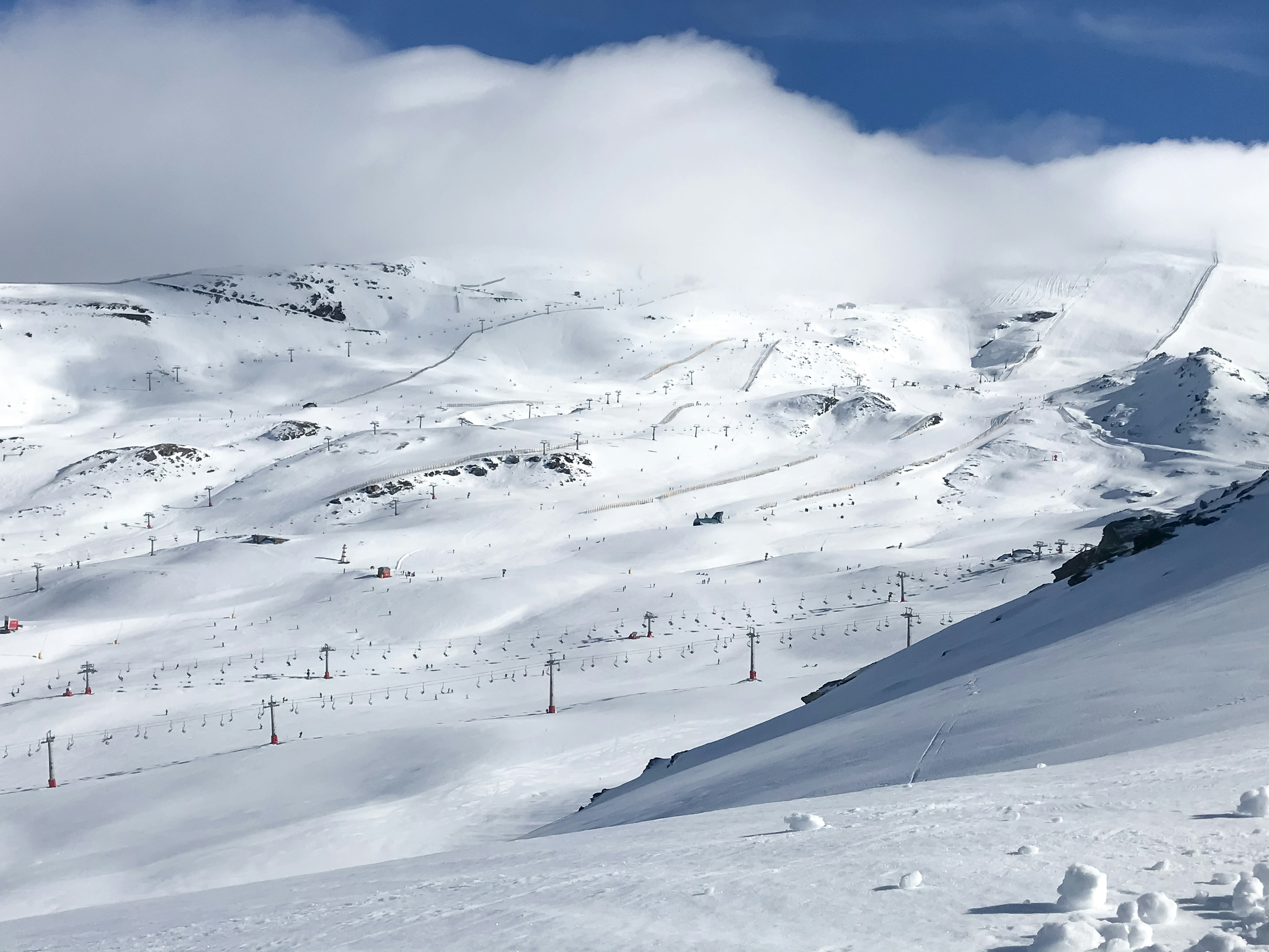
Skiing doesn't get any better than at Parque Nacional de Sierra Nevada.
Skiing doesn’t get any better than at Parque Nacional de Sierra Nevada. Anna Kaminski for Lonely Planet

Skiing

From late November to April, Spain’s skiers hit the slopes. Most of the country’s ski resorts are in the Pyrenees – Catalonia’s 72-piste Baqueira-Beret-Bonaigua with its 65 miles of downhill runs is considered the best snow. La Molina (Spain’s first resort), Masella, Espot and Núria are other popular Catalonian ski resorts, while in Aragón, you can carve through fresh powder in Formigal and Candanchú. The latter has 37 miles worth of runs, and 22 miles of track for cross-country skiers.

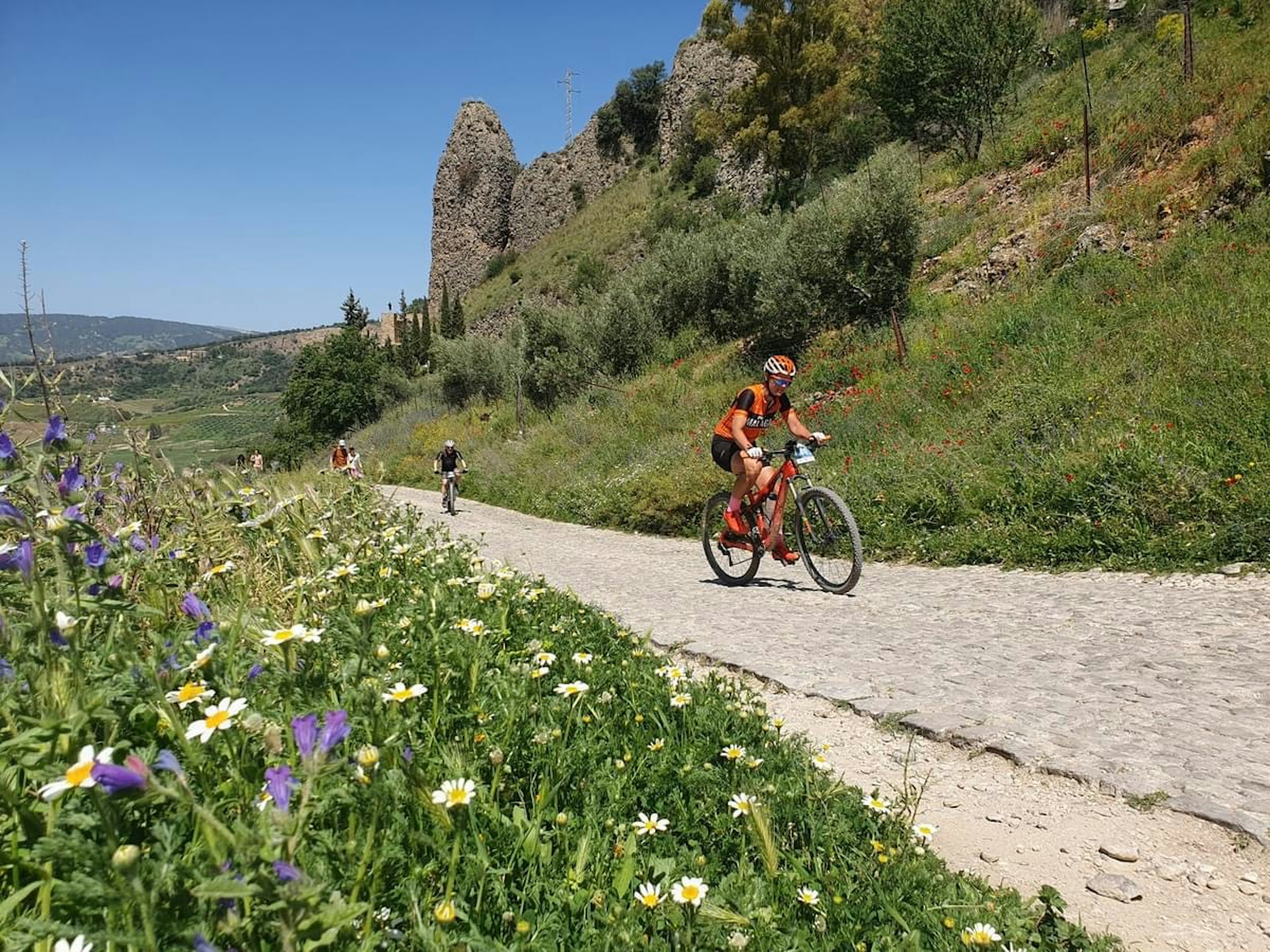
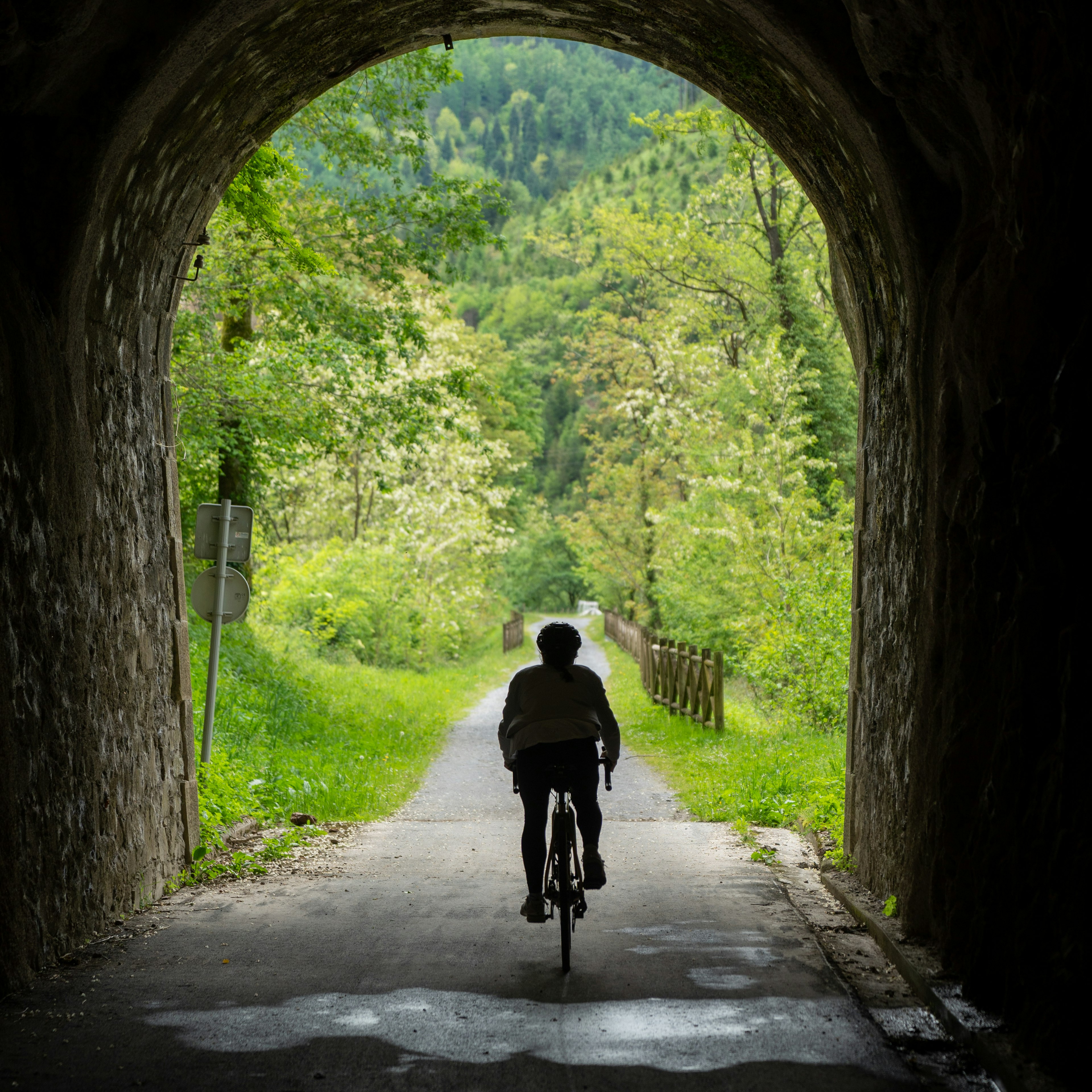
Spain has a variety of different cycling experiences, from Vias Verdes to single-track in the Sierra Nevada. Anna Kaminski for Lonely Planet; Blake Horn for Lonely Planet

Cycling

From tranquil day rides to challenging multi-week expeditions, Spain is full of two-wheeling possibilities. Besides a countrywide network of quiet country roads, each Spanish region has designated touring trails and routes for cyclists, both on and off-road.

BTT (bici todo terreno, meaning ‘mountain bike’) enthusiasts should hit the pistas forestales (forestry tracks) in the sierras (mountain ranges). Besides the original Camino de Santiago, popular long-distance touring routes include Asturias’ Senda del Oso, the Ruta de la Plata, and the 373-mile-long Camino del Cid, while the Pyrenees foothills around Aínsa and Benasque-Castejón de Sos in Aragón, Galicia’s Ribeira Sacra region and Andalucía’s Sierra Nevada are popular with off-roaders.

Additionally, Spain’s growing network of Vías Verdes (decommissioned railway tracks converted into easy bicycle/hiking trails) allow you to explore more than 2,100 miles of scenic countryside.

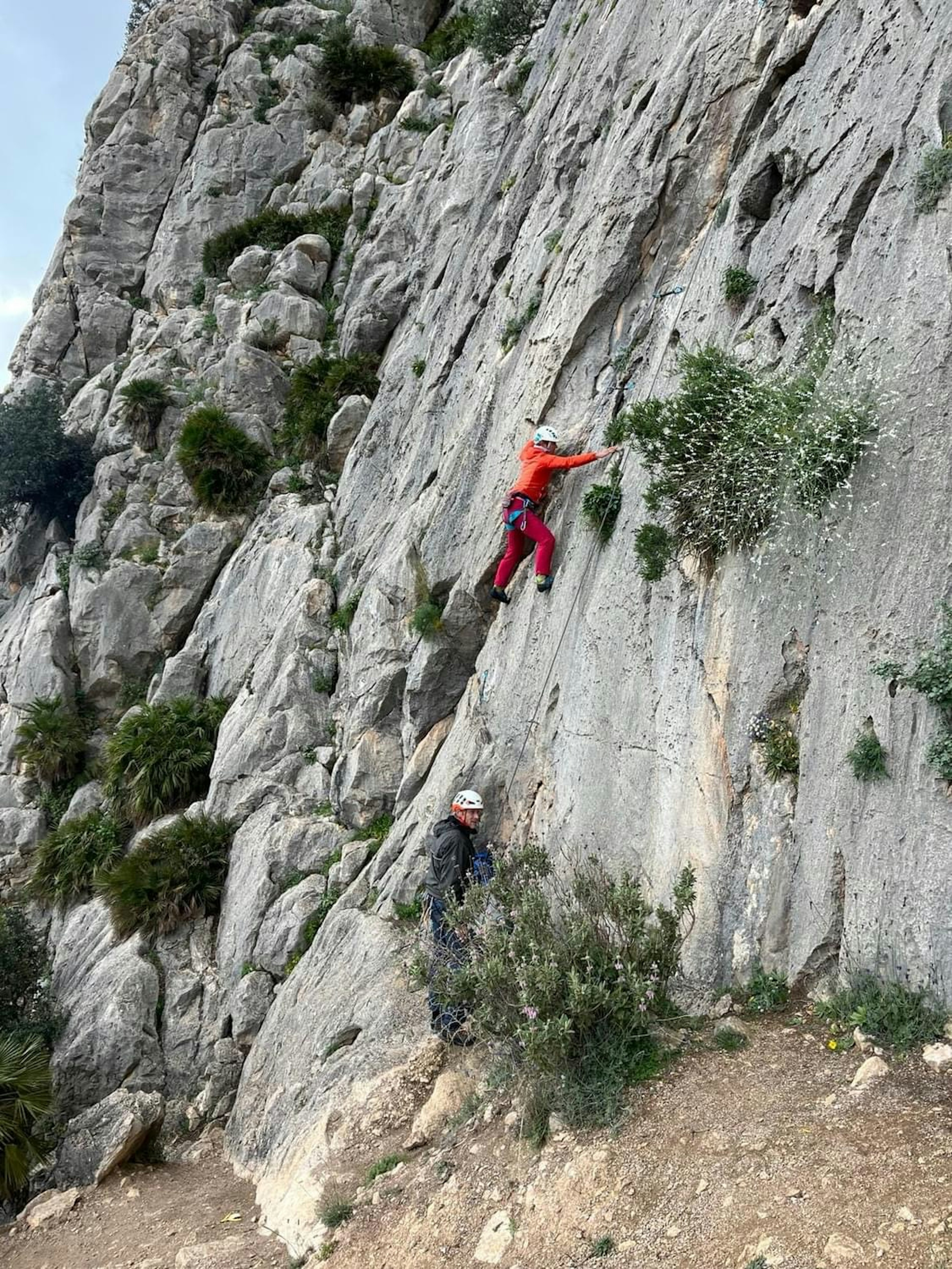
Rock climbing in Torcal de Antequera, Andalucia.
Rock climbing in Torcal de Antequera, Andalucia. Anna Kaminski for Lonely Planet

Rock Climbing

There are numerous opportunities to contemplate Spain’s mountains and gorges from a more vertical perspective. For expert rock climbers, the Picos de Europa’s Naranjo de Bulnes peak, the Pyrenees’ Sobrarbe and Ansó Valley, and La Hoz del Júcar near Cuenca are prime attractions, while climbers of all abilities can learn the ropes in La Pedriza in the Sierra de Guadarrama, near Madrid; in the Basque Country’s Gorbea and Anboto mountains, and in Torcal de Antequera in Andalucía.

Vie ferrate (lofty playgrounds consisting of footholds, ladders and steel cables strung across sheer chasms) are another way to explore Spain’s rock faces. There are routes of varying difficulty in Sorrosal and Foradada del Toscar in the Pyrenees, Larraona in Navarre, El Caliz in Cantabria, Peña Karria in Burgos, Montserrat near Barcelona, plus Andalucía’s El Chorro and the Ronda gorge.

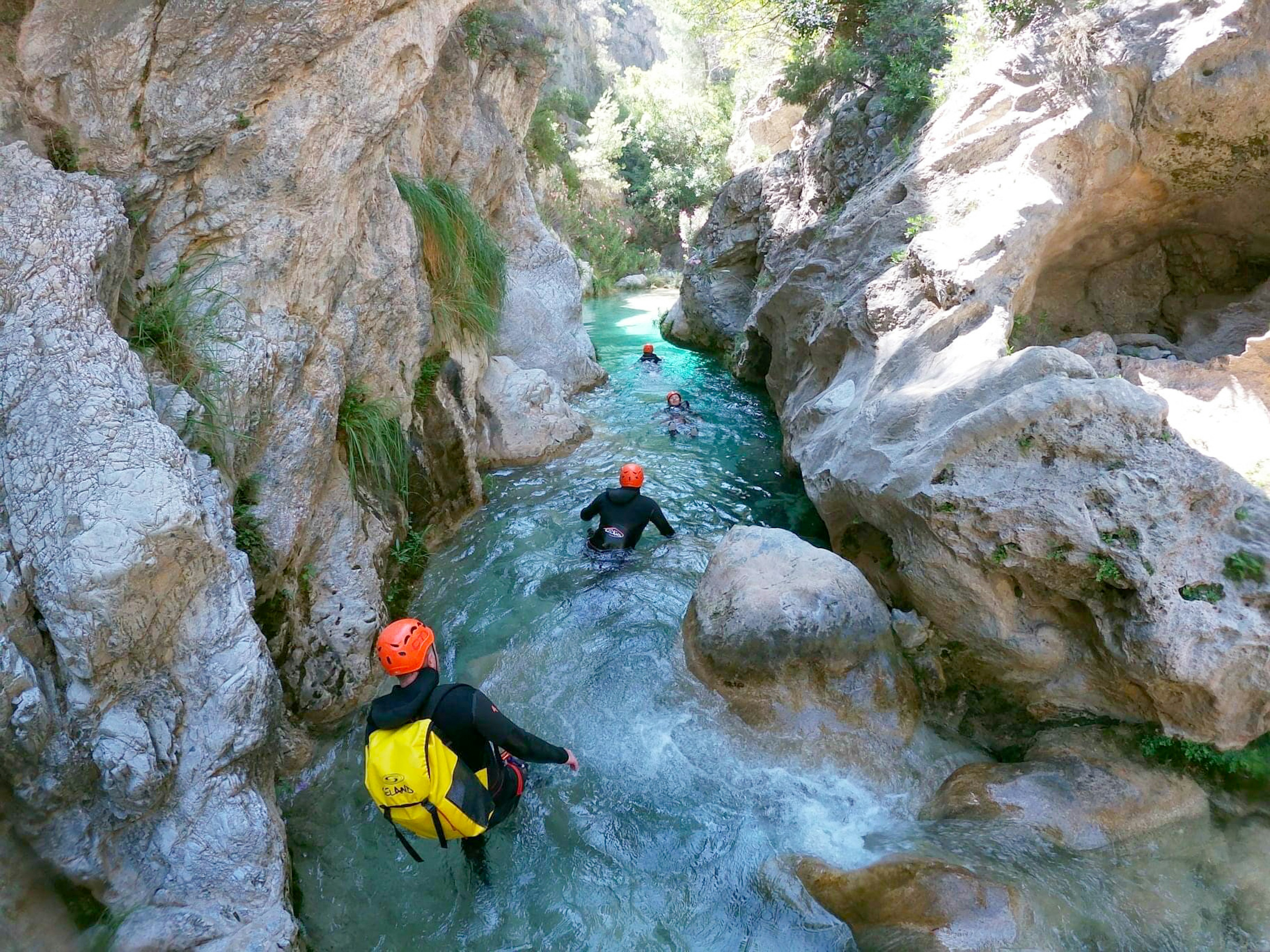
For an exhilerating natural adventure, try canyoning through Spain's steep-walled mountain passes.
For an exhilerating natural adventure, try canyoning through Spain’s steep-walled mountain passes. Anna Kaminski for Lonely Planet

Extreme sports

Spain’s mountain ranges throw down a gauntlet if you want to engage in more adrenaline-packed activities like canyoning. Donning helmets and wetsuits, fresh air fiends can descend steep-walled canyons, abseiling down waterfalls, sliding along natural water slides and leaping into turquoise pools. Exhilarating canyoning excursions are particularly popular in Alquézar in Aragón, Cangas de Onís in the Picos de Europa, Sierra de Grazalema and Sierra Nevada in Andalucía, and Pallars Sobirà in the Catalan Pyrenees.

In Andalucía’s Parque Natural Sierras de Cazorla, as well as Andalucía’s Sierra de Grazalema and Castejón de Sos in Aragón, novices may try their hand at either ala delta (hang-gliding) or parapente (paragliding) with the help of local operators.

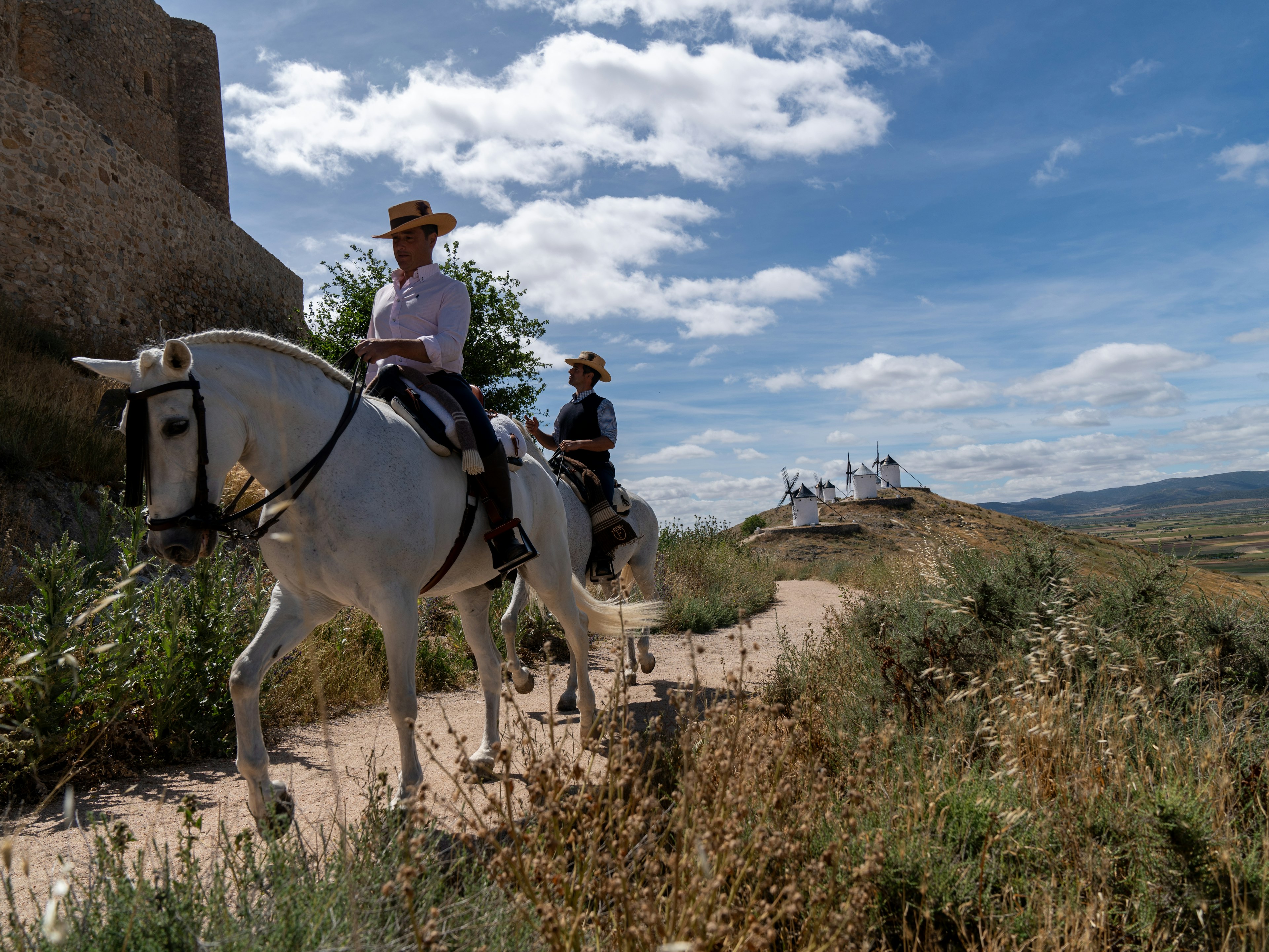
Castilla-La Mancha is the perfect place for horseback riding. Centro Ecuestre Los Caireles is an equestrian school, and leads tours of the Consuegra’s famous windmills. Blake Horn for Lonely Planet

Horseback riding

Horseback riding is the perfect way to see Spain’s diverse landscapes, from rugged mountains to rolling vineyards. Ride along the centuries-old muleteer trails, known as ‘Caminos de los Arrieros’ or ‘Caminos de los Muleteros,’ which were historically used for transporting goods like wine, olive oil, grains, and textiles.

Alternatively, you’ll feel like Don Quixote with a horseback tour of Castilla-La Mancha. Equestrian school Centro Ecuestre Los Caireles leads tours of the region’s rolling hills, vast plains and – most iconic – Consuegra’s famous windmills.

Spain has an outdoor activity custom-made for any adventurer. So, pack your gear, set your sights on one or more of these diverse landscapes, and let the endless possibilities unfold.

Sponsored by Turespaña

As a travel entertainment and inspirational media outlet, we sometimes incorporate brand sponsors into our efforts. This activity is clearly labeled across our platforms.

This story was crafted collaboratively between Turespaña and Lonely Planet. Both parties provided research and curated content to produce this story. We disclose when information isn’t ours.

With sponsored content, both Lonely Planet and our brand partners have specific responsibilities:

  • Brand partner

    Determines the concept, provides briefing, research material, and may provide feedback.

  • Lonely Planet

    We provide expertise, firsthand insights, and verify with third-party sources when needed.

Eco-friendly cars connect to the best of Spain’s Basque Country

Green and blue as far as the eye can see – the dramatic beauty of Basque Country is the stuff of legends (not to mention the backdrop for shows like Game of Thrones). A road trip through the region allows you to explore beyond the gorgeous capitals of Bilbao, Vitoria-Gasteiz and San Sebastián, where the hidden jewels of this region lie.

As long as you’re driving, grab an eco-friendly electric vehicle (EV). We are in a moment of transition for road trips as more electric vehicles populate the roads. In 2021, Basque Country created the e-Basque Route, designed to organize and promote resources for electric drivers and provide easy access to charging stations. Driving in an EV, you reduce your environmental impact by cutting greenhouse gas emissions, and save money on fuel. Roll down the windows and you’ll be connected with the sound of life, wind and waves without the rumble of a combustion engine or the smell of gas.

For this trip, start in San Sebastián and cruise your way along the coast. There are plenty of opportune stops for perfect panoramas and pintxos (small snacks) along the way to Bilbao before routing through the countryside to Vitoria-Gasteiz. You’ll appreciate not just the sights and culture but also knowing that you’ve left this pristine region just as you found it.

Playa de la Concha is easily among the best city beaches in Europe.
Left: Playa de la Concha is easily among the best city beaches in Europe. Coke Bartrina for Lonely Planet Right: Monte Igueldo is accessed via a quaint cable car. Coke Bartrina for Lonely Planet
Monte Igueldo is accessed via a quaint cable car.

Day 1: Donostia / San Sebastián

Donostia / San Sebastián is the ideal starting point, a Basque coastal capital with a wealth of gorgeous landscapes and even better food. Start the day with one of Europe’s most captivating views, the iconic Playa de la Concha. There are several reasons it is named one of the best beaches in the world – the gorgeous city skyline, perfect for promenading; the old Tudor-style palace that presides over it all so picturesquely; and the lovely Santa Clara Island, ideal for swimming out to during low tide. Tucked away in the port on the eastern side of La Concha is Kofradia, a restaurant that maintains a close link to local fishermen. Attend one of their product tastings and meet the people who provide the restaurant with sustainably fished seafood, or just enjoy the menu with views over the city’s port.

Spend the afternoon on the city’s surf-oriented beach, the Playa de la Zurriola, where you can rent a surfboard if the waves are sound. Then, work up an appetite by strolling west to the quaint cable car on Monte Igueldo, which zips you up to the amusement park at the top of the mountain. Finish the evening at Rekondo, whose traditional farmhouse hides one of the continent’s most spectacular wine cellars, including the most extensive collection of Vega Sicilia worldwide.

The Drive: Today, you’re in San Sebastián, but if you have a bit of extra time, drive the car along the mountain road before dinner at Rekondo for some sweeping, dramatic landscapes that dive into the endless sea. EV tip: Make sure you choose a car with plenty of range. Modern EVs have enough capacity to give you the freedom to go sightseeing all day and only charge at night.

By choosing an electric vehicle, you’ll be helping to hasten the transition to cleaner and more sustainable transport options.
Try the famous Basque cider straight from the barrels at Petritegi Sagardotegia.
Left: By choosing an electric vehicle, you’ll be helping to hasten the transition to cleaner and more sustainable transport options. Coke Bartrina for Lonely Planet Right: Try the famous Basque cider straight from the barrels at Petritegi Sagardotegia. Coke Bartrina for Lonely Planet

Day 2: Hondarribia to Astigarraga

With its brightly painted fisherman’s quarter and France across the water, Hondarribia is another postcard-worthy scene. Just 20 minutes from San Sebastián, it bustles with locals and visitors, and its medieval quarter offers a lovely contrast and even better views. Once you’ve explored both areas, hop in your EV and sweep silently up the 1,700-foot peak of Monte Jaizkibel, stopping at Santuario de Guadalupe if you fancy a stroll to see the crumbling towers and fabulous miradores whose views stretch for miles. Zip inland towards the village of Astigarraga, where sweeping vistas are substituted with apple orchards, and you can try the unique Basque cider straight from the barrels at Petritegi Sagardotegia.

The Drive: Avoiding the autopista (AP- or A- labeled highways) makes for a more scenic route. But it’s best to save time and travel on AP-8 for this stretch. EV tip: Download the Electromaps app for your smartphone. It will connect you to all the available charging points for electric vehicles in Basque Country.

Day 3: Ordizia to Getaria

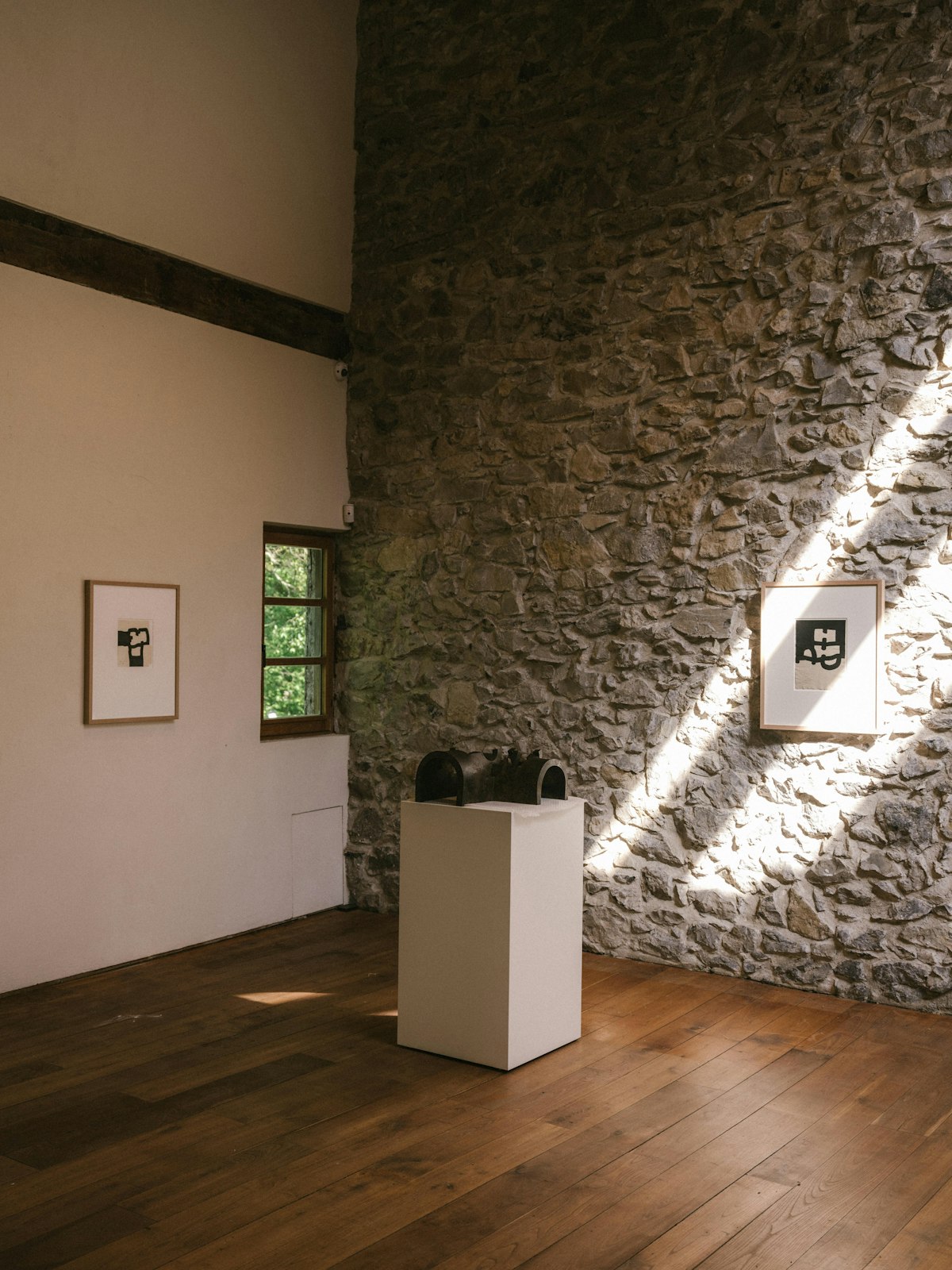
You’d be hard-pressed to find a village more Basque than Ordizia – not just because Euskera is spoken in the streets but also because it’s a town that revolves around food. Its fabulous market dates back to 1512, making it one of the oldest in Spain. If lucky, you’ll coincide with its annual Idiazabal cheese competition in September. However, if not, you can still sample the local cheese among the many stalls at this Wednesday morning market. After you’ve stocked up, head towards Getaria, but don’t miss a stop at the Chillida Leku Museum, more a private home than a museum, albeit one that just happens to be packed with giant iron and rock sculptures by the Basque artist Eduardo Chillida.

Wind your way through the green hills that line the ocean and take your EV into the vineyards that begin to pop up. These are Hondarrabi Zuri, a Basque varietal used to make txakoli, which you can taste in situ at Txomin Etxaniz winery. For dinner, head down to the village of Getaria, where outdoor grills line the streets – Elkano restaurant has what is perhaps the best grilled turbot in the world, thanks to its sustainable sourcing practices and the tradition and culinary knowledge passed down over generations.

The Drive: Take the national highway N-634, a treat that winds through several small villages on the way from Hernani to Getaria. EV tip: When booking accommodations, look for places that feature EV recharging. Many offer complimentary charging with your stay, which can substantially impact the cost of your trip. Also, be on the lookout for free charging stations that some major cities in Spain offer as incentives for EV use.

The Flysch Route on the Basque Coast features rugged cliffs showcasing millions of years of geology.
Tide pools in the eroded stone teem with marine life.
The Mirandaola Foundry dates to the 14th century and is one of the oldest industrial sites in Spain.
Bilbao (seen here from the Ribera market bridge) features a slower pace of life and a reverence for art.
Clockwise from top left: The Flysch Route on the Basque Coast features rugged cliffs showcasing millions of years of geology. Coke Bartrina for Lonely Planet. Tide pools in the eroded stone teem with marine life. Coke Bartrina for Lonely Planet. Bilbao (seen here from the Ribera market bridge) features a slower pace of life and a reverence for art. Coke Bartrina for Lonely Planet. The Mirandaola Foundry dates to the 14th century and is one of the oldest industrial sites in Spain. Coke Bartrina for Lonely Planet

Day 4: Zumaia to Bilbao

The next town on the road from Getaria is Zumaia, home to the famed Basque flysches. Get out of your EV to enjoy the Flysch route at Basque Coast Geopark, where the rugged, layered limestone and sandstone cliffs showcase 60 million years of Earth’s history. Erosion of the softer layers of marl and clay has created showstopping visuals and tide pools that teem with marine life. These sights epitomize the Basque reverence for the landscape and dedication to sustainability. A bit further down the coastal highway, you’ll find San Juan de Gaztelugatxe, a hermitage dating back to the 800s that sits dramatically above the sea, reachable only by scaling its 241 steps.

Continue on to Bilbao, following the coastal road to catch a glimpse of beautiful fishing villages like Lekeitio and the surfing capital of Mundaka. Bilbao, Basque Country’s largest capital, is all about contemporary art and architecture, best seen in Frank Gehry’s revolutionary Guggenheim Museum, the bridge and airport by Spanish architect Calatrava or the larger-than-life street art scattered throughout the city.

The Drive: Take the coastal road for as long as you can handle its curves – your patience will be rewarded, especially along the stretch from Zumaia to Lekeitio. EV Tip: Electric vehicles offer advanced technology features, such as regenerative braking, smart navigation systems and remote monitoring capabilities that enhance the driving experience.

Detour: Mirandaola Foundry

If you can, a visit to this fascinating 15th century ironworks is well worth the 30-minute jaunt off the route from Zumaia to Bilbao. The Mirandaola Foundry is expertly preserved, with a water wheel powering the giant bellows and crashing hammer. Workers here wear the same protective clothing they wore 500 years ago – and watching a glowing slab of molten ore turn into a gleaming sword through their craftsmanship is extraordinary. You can see the ironworks in action on the first Sunday of each month during autumn and winter, and every Sunday from April through the summer. Don’t miss the chapel next door, which features a ‘miracle’ cross created spontaneously by the forge.

Parque Natural de Urkiola is one of the most beautiful spots in Basque Country.
Urkiola is considered a sacred place in Basque mythology and tradition.
Left: Parque Natural de Urkiola is one of the most beautiful spots in Basque Country. Coke Bartrina for Lonely Planet Right: Urkiola is considered a sacred place in Basque mythology and tradition. Coke Bartrina for Lonely Planet

Day 5: Urkiola to Vitoria-Gasteiz

Start bright and early at one of the most beautiful spots in Basque Country –the Urkiola National Park. Leave your EV at Santuario de Urkiola and explore the beech, fir and birch forests to hike past the Three Crosses for a glimpse of the Atxarte gorge and the mountains rumored to be the home of the Basque goddess Mari. Loop around for lunch to the Valle de Atxondo, where world-famous Asador Etxebarri serves up impeccably grilled local produce, from baby eels to St. George mushrooms, in a magical setting. After lunch, head to Vitoria-Gasteiz, Basque Country’s greenest capital and home to some fantastically preserved medieval architecture. The Plaza de la Virgen Blanca is the perfect spot to kick your feet up and reflect on the ideal balance of natural beauty, cultural richness and sustainability of your EV road trip.

The Drive: Take the BI-623 to get to Vitoria-Gasteiz, which cuts through the national park and is much more scenic (and still under an hour). EV Tip: By choosing an electric vehicle over one with a combustion engine, you’ll be helping to hasten the transition to cleaner and more sustainable transport options. Popularity leads to investment and progress.

From our sponsors: Visit the official tourism website of Basque Country to start planning your trip today.

Sponsored by Basque Country

As a travel entertainment and inspirational media outlet, we sometimes incorporate brand sponsors into our efforts. This activity is clearly labeled across our platforms.

This story was crafted collaboratively between Basque Country and Lonely Planet. Both parties provided research and curated content to produce this story. We disclose when information isn’t ours.

With sponsored content, both Lonely Planet and our brand partners have specific responsibilities:

  • Brand partner

    Determines the concept, provides briefing, research material, and may provide feedback.

  • Lonely Planet

    We provide expertise, firsthand insights, and verify with third-party sources when needed.

How to plan an epic hike through Armenia on the Transcaucasian Trail

In Lonely Plan-It, we take you step by step through how we put together some of the most complicated travel adventures. Here, travel writer and outdoors enthusiast Anna Richards explains how she hiked the Armenian section of the under-the-radar Transcaucasian Trail.

I knew very little about Armenia before deciding to hike the Transcaucasian Trail (TCT), which winds hundreds of miles through this under-explored country. When I told friends of my plans, most knew little more than the scraps I did – a turbulent, tragic recent history, some vague connection to the Kardashians.

But what I found there simply amazed me: millennia-old monasteries, vast volcanic plateaus and rust-colored gorges that crumbled like breadcrumbs as you hiked them.

The full TCT spans 932 miles (1500km) across Georgia and Armenia. A separate section is in progress to cross Azerbaijan, which would bring the full trail to almost 1900 miles (3000km). Unfortunately, due to current border conflicts, linking the two sections is a far-off goal.

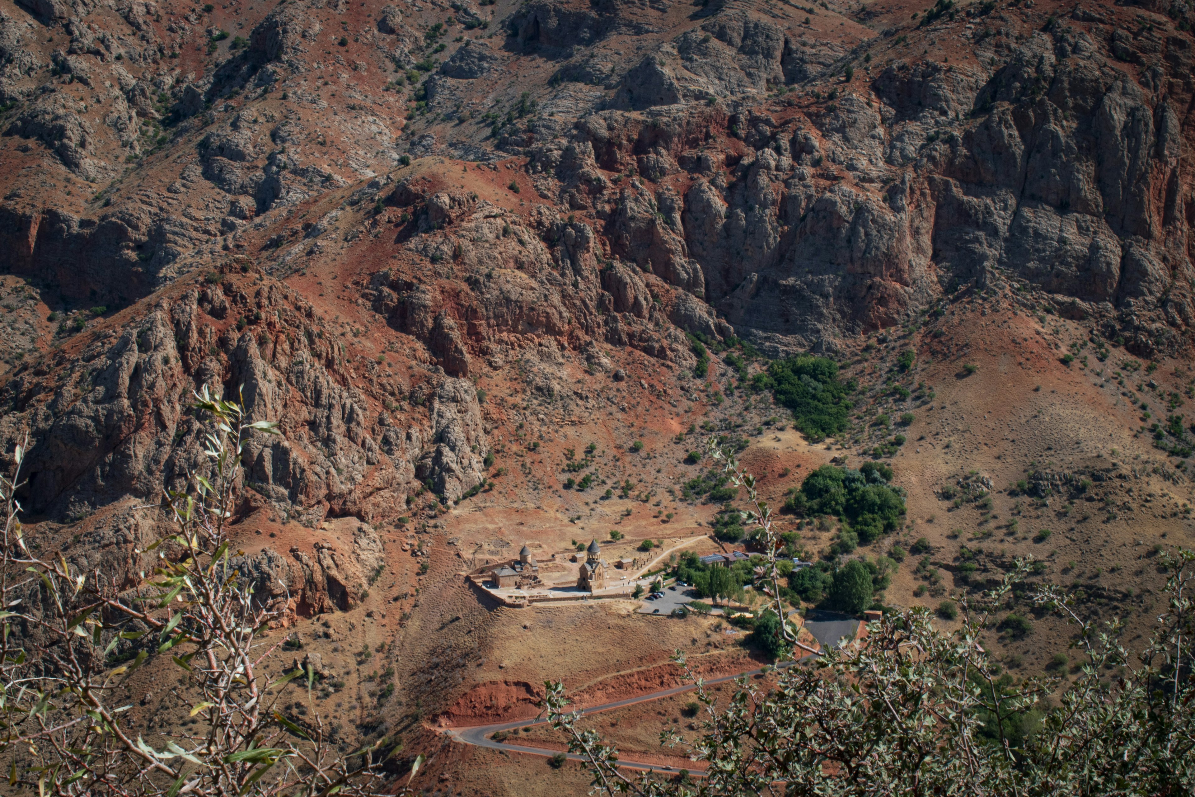
The approach to Noravank Monastery, Vayots Dzor. It was every bit as dry and hot as it looked, and by the time I reached the monastery I was so covered in dust that I looked as though I'd emerged from several years.
The approach to Noravank Monastery, Vayots Dzor. It was every bit as dry and hot as it looked, and by the time I reached the monastery I was so covered in dust that I looked as though I’d emerged from several years. Anna Richards/Lonely Planet

Totaling 516 miles (832km), the Armenian segment of the TCT opened to the public in 2022. I was one of the guinea pigs that got to beta-test when it first opened ⁠– although the distance I covered over four weeks (360 miles / 580km) made me feel more like a hamster on a wheel.

Some numbers for context: the USA’s Pacific Crest Trail (PCT) issues 8000 hiker permits a year. Around 3000 thru-hikers attempt the Appalachian Trail annually. Fewer than 100 hikers completed a multiday section of the TCT in 2024 – making this a track that is truly…off the beaten track.

In order to (safely) get away from the hiking masses, you’re going to have to plan ahead. Here’s how to plan a trip to hike the Transcaucasian Trail.

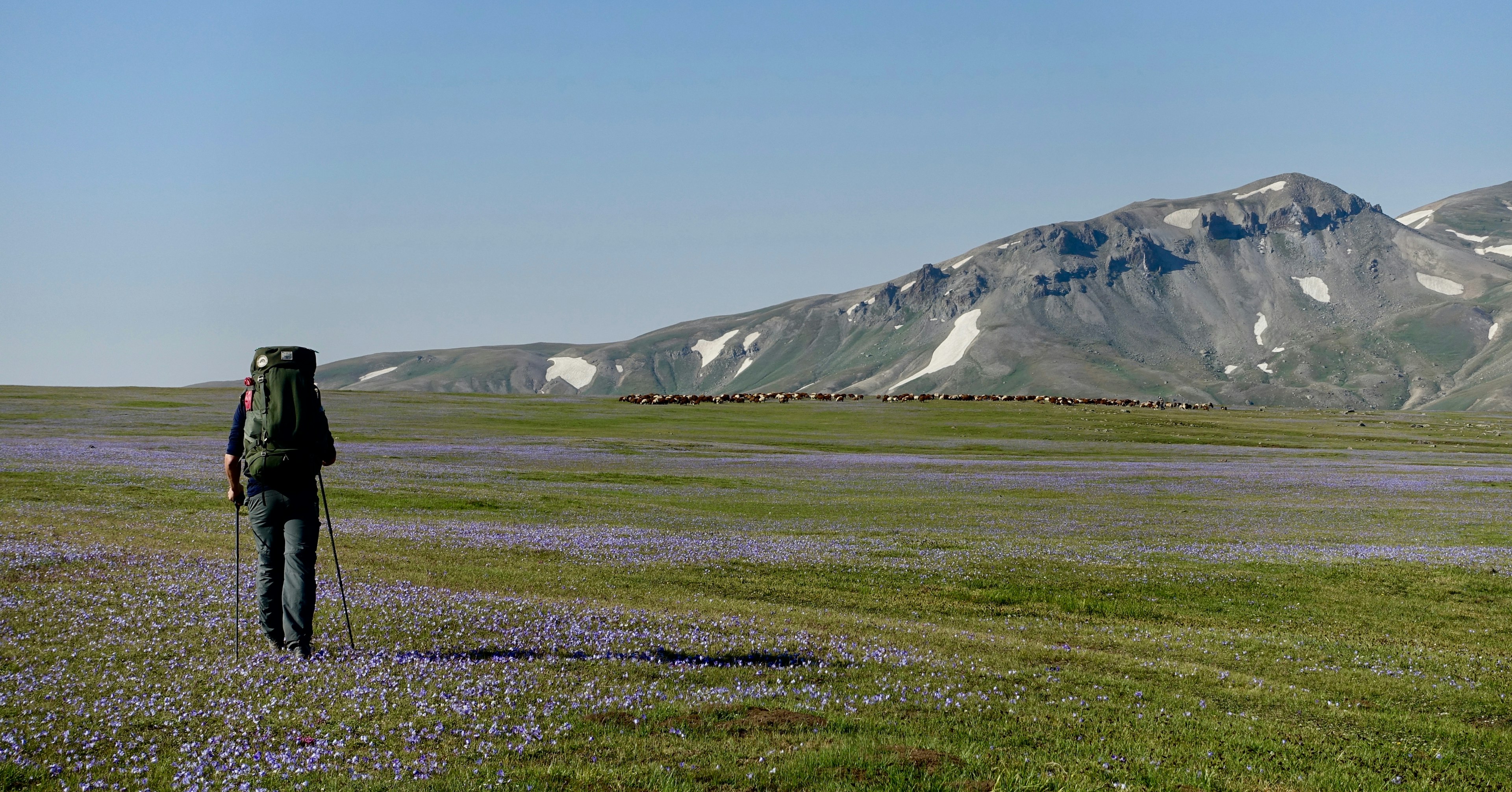
Hiker in a meadow with flowers along the Transcaucasian Trail in the Gegham Mountains, Armenia
Since you’ll spend many days along the Transcaucasian Trail without seeing another human being, you have to take great care when packing for the thru-hike. Meagan Neal/Transcaucasian Trail Association

Step 1: Prepare, prepare, prepare

With maps, GPS and careful planning for water

This trail requires a lot of preparation. It should only be hiked between June and September, as outside of this season snow makes parts of the trail inaccessible. (Even when I hiked in August, some snow lingered in the Gegham Mountains.) Yet while the warm summer months clear the trails for hiking, the season brings challenges: in July and August temperatures along much of the route soar to more than 32°C (90°F). Since water is scarce, you’ll need bottles with a few liters’ capacity, as well as a filter-purifier to refill them. To hike the full Armenian section of the TCT you’ll need to allow for around six weeks, hiking almost 20 km per day. If you’d prefer to take it at a more leisurely speed, factor in two months. Fastpackers and trail runners can cover the ground in significantly less time.

It’s essential to download route-planning apps. While there are no physical maps of the TCT, GPX files are available through the TCT website (a suggested donation of US$100 gets you access to route guides, plus a Slack channel run by trail planners and recent hikers). I’m not exaggerating when I say the trail would be impossible without these resources.

Step 2: Pack wisely, and plan for resupply package

There will be lots of gear involved – so really think this through

While there were times that I wished I was an ultralight packer, I don’t regret taking with me such “luxuries” as my Kindle and deodorant. As you pack, keep in mind that you need to be totally self-sufficient for the TCT. This means carrying up to seven days’ worth of food for certain areas, as well as the means to prepare it (cooking or cold soaking).

Much of the TCT requires wild camping, so good gear is essential. Where there are guesthouses, you’ll need cash; you’ll find ATMs in larger towns, though I still recommend having a couple of hundred dollars’ worth of Armenian drams when you start the trail. A guesthouse with breakfast included typically costs around 5000-6000 AMD (US$13-16), and extra meals between 3000-5000 AMD ($7-13). Be prepared for all weather conditions, as the altitude along the way will rise and fall by almost 10,000ft (3000m). A sun hat, a waterproof shell and thermal layers are all musts.

Send yourself resupply packages via the HIKEArmenia office in Yerevan; most towns will have at least a small shop to receive them. For camping gas and other last-minute supplies, Camp.am in Yerevan is your only option. (Remember that you cannot take the plane with camping gas, so you’ll need to buy this in Yerevan.)

An Armenian SIM card (I used UCom) will get you unlimited data for less than $15 per month, and can be renewed at top-up machines in any large town. When you’ve got so much off-road navigation, this is invaluable. Take a copy of your ID to scan.

A hiker with a backpack looks out at a valley view in the mountains, Transcaucasian Trail, Armenia
Plan your route along the Transcaucasian Trail carefully before you set out. Tom Allen/Transcaucasian Trail Armenia

Step 3: Take the first step

Set out from different starting points for northbound and southbound journeys

Any great journey begins with a single step – though in the case of the TCT, your initial ones will be on airport escalators and rickety buses, before you set out on the trail itself. Fly into Yerevan, Armenia’s capital, then catch a bus from there to either Meghri, at the southern end of the trail (nine hours), or to Gyumri, from where you’ll take a taxi to Lake Arpi to begin the trail southbound. Since buses fill up, call ahead to book using the number listed on bus companies’ Facebook pages (or ask someone to do this for you if you don’t speak Armenian). The day of your journey, the driver will have a list of passengers who have reserved in advance (there are no tickets).

Before you set out for Armenia, decide which direction you’ll be hiking. South-to-north is a baptism of fire, beginning with three days hiking through Arevik National Park, the toughest, remotest part of the trail. If you tackle it first, you’ll know that you’re up to the rest of the hike. I saw no one during this time and had to carry enough water to satiate a camel on a trans-Saharan odyssey, as in the height of summer you may not pass a water source for the full three days. Yet this is also one of the most spectacular sections I experienced. North-to-south is a gentler start, giving you almost six weeks to warm up to tackle Arevik National Park, but by leaving the toughest section until last, you’ll need to rely on food supplies you’ve picked up from local shops, which tend to be heavier than dehydrated meals. Whichever way you hike, the highest section of the trail, the Gegham Mountains, falls in the middle.

Step 4: Embrace Armenian hospitality – but stay safe

Expect near-limitless generosity in the countryside

I took too much food because I hadn’t anticipated the limitless generosity of the nomads, villagers and farmers that I met along the way. Like an army, hungry hikers march on their stomachs, so enjoy it! Hospitality is paramount to Armenians, so when you’re waddling along with a belly as heavy as your backpack, you’ve likely made your hosts very happy. Offers of payment are likely to be perceived as insulting, your best payment is a smile and patient conversation.

As a solo female traveler, I was regularly taken in by families who fed and housed me, and let me shower in their homes (a true luxury). Men may be less likely to be invited to stay, though everyone can expect to be well-fed. Women hiking alone isn’t a common sight in the Armenian countryside, use your best judgment and common sense about accepting hospitality along the way.

Where guesthouses are available, always opt for breakfast and dinner. You’ll be supporting rural businesses, and with the quantity (and quality) of what you’re fed, you’ll never regret it.

Step 5: Consider doing just a small section

You’ll see plenty if you only have a week

Many of us don’t have the luxury of taking months of vacation, and even in four weeks I didn’t complete the full length of the TCT’s Armenian section. If you’ve only got a week, I recommend the Gegham Mountains, a green moonscape of remote lakes in volcanic craters, nomadic, yurt-dwelling shepherd families and frequent violent flash storms. It’s the highest part of the Armenian trail – and its wide-open spaces give you a nice (natural) high, too.

From south-to-north (this is the direction I hiked, you can go the other way too!), the other most notable sections of trail are as follows. It begins with the aforementioned Arevik National Park; toothy, foreboding and arid mountains which make for an extremely challenging few days of hiking, although the views over the remote mountains of northern Iran are spectacular. Roughly a week into the trail, hikers reach Vayots Dzor, which rather morbidly translates to the Valley of Woes. Here you’ll find ochre-colored gorges infested in equal measures with Syrian brown bears and millennia-old monasteries. After the Gegham Mountains, the trail briefly joins the banks of Lake Sevan, a vast freshwater lake fed by 28 different rivers, and a popular holiday spot for Armenians. Around four weeks in, hikers arrive in Dilijan National Park, one of the greenest parts of the trail, where the TCT largely winds through woodland. It’s well-marked and a good section for less experienced hikers. Dilijan is also one of the best places in the country to meet fellow backpackers, and it has several hostels.

Lori Province, after Dilijan, is rural, green and punctuated with villages. The Debed Canyon, sandwiched between farmland, is one of the most dramatic sights on the hike, and the cliffs rise to 350m (1148ft) high. Lake Arpi, a high altitude lake near the Georgian border framed by soft hills, bursts with wildflowers in early summer and gives a feeling of total remoteness.

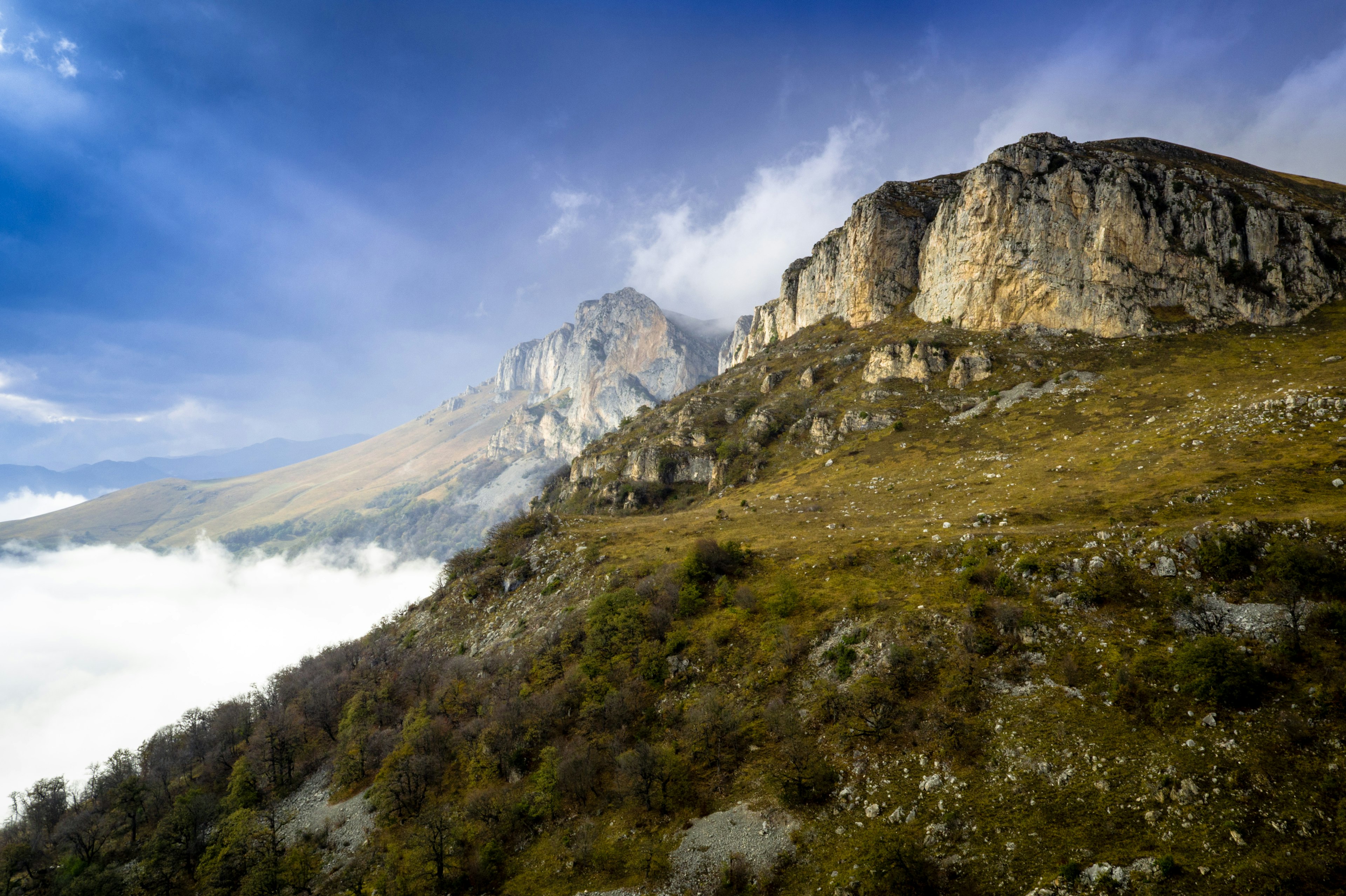
Cliffs in Dilijan National Park, Armenia
A journey along the rugged Transcaucasian Trail turns any hiker into an explorer. Tom Allen/Transcaucasian Trail Armenia

If I could do it again…

I’d do it the same way. On a hike of any length here, the trail is your classroom.

Set aside your preconceptions of what it’s like to do a thru-hike. So you’ve done the GR20? Fantastic: since you’re clearly in great physical shape, much of the TCT won’t be so tough on your body. But instead of a well-marked trail expect lots of bushwhacking, and no cold beer afterwards. Hiked the PCT? Wonderful: you’ve got stamina and are accustomed to being self-sufficient. But expect to multiply the solitude you experienced by a huge factor. On the TCT you can go days without seeing a human face – and when you do, you can expect a large language barrier to contend with. Hikers on the Armenian TCT are almost totally reliant on GPS, so make sure you’ve got a good power bank. Large sections of the trail still have no markings or signposts whatsoever, although this is a work in progress. I’d also recommend carrying a satellite tracker so that you can be located in the event of an emergency. Carry a compass, and if you can get your hands on a physical map, do so.

Most of all, enjoy it. Hiking Armenia is an education about an ancient, rich civilization, and a place that sees comparatively little footfall. A journey here turns you into an explorer.

The best hikes in Bozeman for outdoor splendor

You could spend half a lifetime exploring the forests, lakes and granite peaks of the Gallatin, Madison and Bridger ranges around Bozeman, Montana. Luckily we’ve done the heavy footwork for you – you can experience the very best Montana has to offer on these spirit-restoring hikes.

Bozeman is geared firmly towards the great outdoors, and between June and October, you’ll find yourself sharing the trails with mountain bikers, fly fishers and horse packers, as well as eager trekkers. But with so much wilderness on offer in this stunning corner of Montana, solitude and beauty are only ever just a short hike away. Here’s our pick of the best hikes around Bozeman to get you started.

The M

Best easy detour from downtown

3 miles (4.8km) round trip, 90 mins, elevation gain 850ft (259m), easy to moderate

The short uphill walk to the Montana State University “M” etched into the suburban hills north of Bozeman is easily the most popular hike in town, and a classic choice if you are tight on time. Two dog-friendly trails lead up from the trailhead – the right-hand path is steep and direct, while the left-hand path follows gentler switchbacks and is around a mile longer. Combine the two for a satisfying loop.

Forty minutes of puffing will reward you with expansive views over Bozeman and the snow-capped Gallatin Mountains beyond. If this taster leaves you wanting more, trails continue up the Bridger ridgeline to 8914ft (2717m) Baldy Mountain, for a total return hike of 9.5 miles (15.3km). On the drive back to Bozeman, stop off at Map Brewing for patio views of the M over a pint of aptly named Steep Terrain Double IPA.

A local tip: If the parking lot is full (as it often is), head across the road to the larger Drinking Horse Trailhead, where you’ll often find space.

View of the Bridger Mountains near Bozeman
The Bridger Mountains rise dramatically outside Bozeman © Carol Polich / Lonely Planet

Sacagawea Peak

Best for exhilarating ridgeline views

4.5 miles (7.2km) round trip, 3 hours, elevation gain 2100ft (640m), moderate to strenuous

Most hikers head south from Bozeman towards Yellowstone, so buck the trend by heading northeast into the less-visited Bridger range. A rough drive up Fairy Lake Rd (Forest Road #74) will drop you near the trailhead camping ground and a gorgeous turquoise lake (bookmark this for a deliciously frigid dip on your return).

The trail itself climbs from the get-go, rising through meadows of blazing paintbrush flowers and up lung-busting switchbacks to spit you out above the tree line onto a high saddle. Keep an eye open for Montana’s iconic (and somewhat comical) white-tufted mountain goats as you soak up the immense views.

The final section is a dramatic ridge walk onto the uplifted slab of 9654ft (2943m) Sacagawea Peak, the highest point in the Bridger range, named in honor of the Shoshone woman who guided Lewis and Clark through the valleys west of Bozeman.

Waterfall on Hyalite Trail near Bozeman, Montana
This is just one of 11 waterfalls you’ll pass on Hyalite Creek Trail © Ann Douglas Lott

Hyalite Creek Trail

Best for waterfalls and lakeshore views

11 miles (17.7km) round trip, 5 hours, elevation gain 2000ft (607m), moderate

To get a taste of the rugged wonders of the Gallatin Range south of Bozeman, drive past the paddleboarders at Hyalite Reservoir and make a beeline for the Hyalite Creek trailhead. Over 5 miles (8km) of gradual ascent, you’ll pass 11 – yes, 11! – waterfalls and gain great views of the glacially-carved, U-shaped valley. There’s also a decent chance of spotting elk, bears and even bighorn sheep. Arrive at dramatic Hyalite Lake in time for the perfect lakeshore picnic.

Fit hikers can continue for 2.5 miles (4km) up zigzagging switchbacks to bag 10,295ft (3138m) Hyalite Peak, scoring epic 360-degree views of Lone Mountain, the Paradise Valley and the Gallatin Crest Trail as it snakes towards Yellowstone National Park.

It’s a 20-mile (32km) drive back to Bozeman for dinner, but you could always pack some s’mores and stay in one of the three pine-scented Forestry Service campgrounds in Custer Gallatin National Forest (at Hood Creek, Langohr and Chisholm).

Lava Lake

Best Gallatin day hike

6 miles (9.7km) round trip, 3–4 hours, elevation gain 1600ft (488m), moderate

Leading south from Bozeman towards Yellowstone National Park, the beautiful Gallatin Canyon is lined with tempting side trails, the easiest and most popular of which leads to Lava Lake. The trail follows rushing Cascade Creek through pine forest and lush meadows, before popping out into a gorgeous mountain-fringed bowl, part of the protected Lee Metcalf Wilderness.

There’s exhilarating paddling and trout fishing at the lake and the valley also makes an easy overnight camping trip, though fires are banned within half a mile of the shoreline. The Lava Lake Trailhead is a 30-minute drive from Bozeman, southwest on Hwy 191, but take particular care where the trailhead road joins the fast-moving traffic on the highway.

View of Beehive Basin in Big Sky, Montana near Bozeman
Big sky views are guaranteed on the Beehive Basin trail © Ann Douglas Lott

Beehive Basin

Best for big sky views and microbrews

6.5 miles (10.5km) round trip, 3–4 hours, elevation gain 1500ft (457m), easy to moderate

Our favorite hike at Big Sky, 50 miles southwest of Bozeman, this half-day tramp climbs up through a stunning glacier-carved cirque to two alpine lakes that sublimely mirror the dramatic gneiss walls of the Spanish Peaks behind. En route, you’ll score views of pyramid-shaped Lone Mountain (itself the destination for an epic summer day hike) before winter cloaks its slopes with Montana’s best ski runs.

Pick up a gourmet picnic lunch en route to the trailhead at the Hungry Moose Deli in Big Sky, then round off a perfect Montana day with a post-hike microbrew at Big Sky’s Beehive Basin Brewery, named after this very hike.

Spanish Peaks

Best for sublime backcountry camping

15–25 miles (24–40km), 2–3 days, strenuous

If you’re looking for a classic multi-day backpacking trip, you can’t do better than the rugged and dramatic trip to Spanish Peaks, hidden deep in the Madison range southwest of Bozeman. A stunning group of mountain lakes gather at the base of 11,000ft (3350m) peaks, and the valleys come alive with mountain goats, deer, elk, bears, marmots and cute, rabbit-like pika.

There are dozens of gorgeous lakes to explore. The most popular route leads straight to the four Spanish Lakes, with a detour up a side valley to Mirror Lake. To expand the trek into a three-day/two-nighter, add on Jerome Rock Lakes and Lake Solitude. Alternatively, find your own unnamed tarn, set up camp for the night and watch the alpenglow climb the rock walls above.

The Spanish Peaks Trailhead is 30 miles (48km) from Bozeman, 8 miles (13km) up Spanish Creek Rd. En route, look for the grazing bison of the Flying D Ranch, owned by media mogul Ted Turner, founder of CNN.

Tips for hiking in Bozeman, Montana

  • Stop in at the Custer Gallatin National Forest office in western Bozeman before a hike to get the latest information on trail closures, fire conditions and bear sightings.

  • Montana is grizzly bear country, so carry a canister of bear spray, know how to use it and have it accessible at all times on any wilderness hike.

  • Don’t worry if you don’t have all the gear – Bozeman’s outdoor gear shops sell the essentials, including bear spray, bug spray, local topo maps and hiking guidebooks.

  • Four seasons come in one day in Montana’s mountains – always pack warm clothing, a dry base layer and a sun hat.

  • Don’t rely on cell coverage in the mountains; tell someone where you are going and when you plan to be back in case anything goes wrong.

A first-time guide to Svalbard

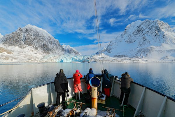
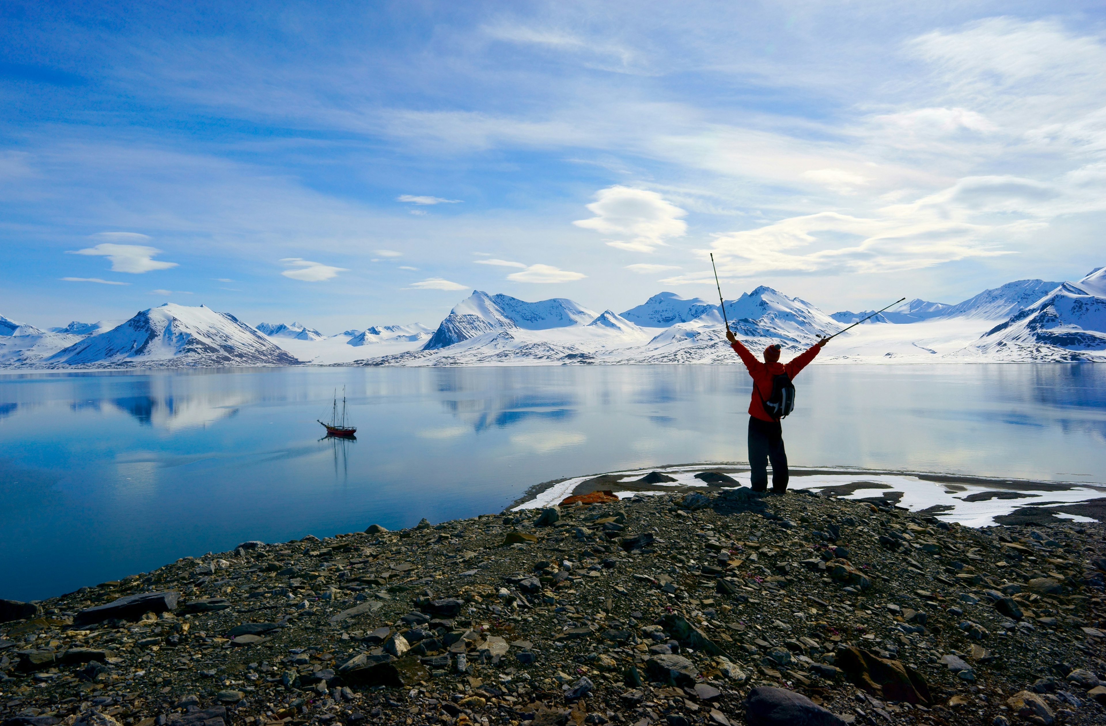
Your first visit to Svalbard may seem a bit daunting – located midway between Norway and the North Pole, this remote Norwegian island is a land of extreme climate, glaciers and polar bears. This, combined with Svalbard’s unique laws, can make it feel far removed from the rest of the world.

The Svalbard archipelago consists of three islands: Spitsbergen, Edgeøya and Nordaustlandet. Most of the tourist activity takes place on Spitsbergen, centered around the settlement of Longyearbyen. Accommodation is limited to mostly traditional hotels, although a small number of hostel rooms and self-catering apartments are available near Longyearbyen.

Here’s what you need to know about visiting Svalbard for the first time.

Why you should visit Svalbard

If you’ve ever dreamed of waking up to a view of glaciers glittering in a sun that never sets or dog-sledding under the northern lights, Svalbard is the destination for you. Accessible from mainland Norway, this archipelago retains a real sense of adventure, and its main town, Longyearbyen, is a frontier outpost poised on the edge of one of the harshest – and most awe-inspiring – wildernesses in the world.

If you’re intrigued by the polar north, Svalbard should definitely be on your list – realistically, this is the farthest north most of us are ever likely to get. Wrap up and spend as much time as you can out in the wild landscape. Wildlife watching and glacier-spotting cruises or kayak trips are great in the summer, or opt for a hike with the proper safety precautions (remember, this is polar bear country). You can hop on a snowmobile or take a ride on a dog-sled at any time of year.

The wilderness and wildlife are the big draws, but there are some conventional sights to see, too. Unfortunately, you can’t visit Svalbard’s remarkable Global Seed Vault without special permission, so you’ll have to make do with snapping a picture from afar. The fascinating Svalbard Museum is well worth a couple of hours of your time, with its displays on the life formerly led by whalers, trappers, seal and walrus hunters and miners.

For something a bit different, head to Svalbard Bryggeri, the northernmost brewery in the world. A tour with tastings costs 429 NOK, and you can book in advance. If you can’t make it to the brewery, pick up some cans in a grocery store.

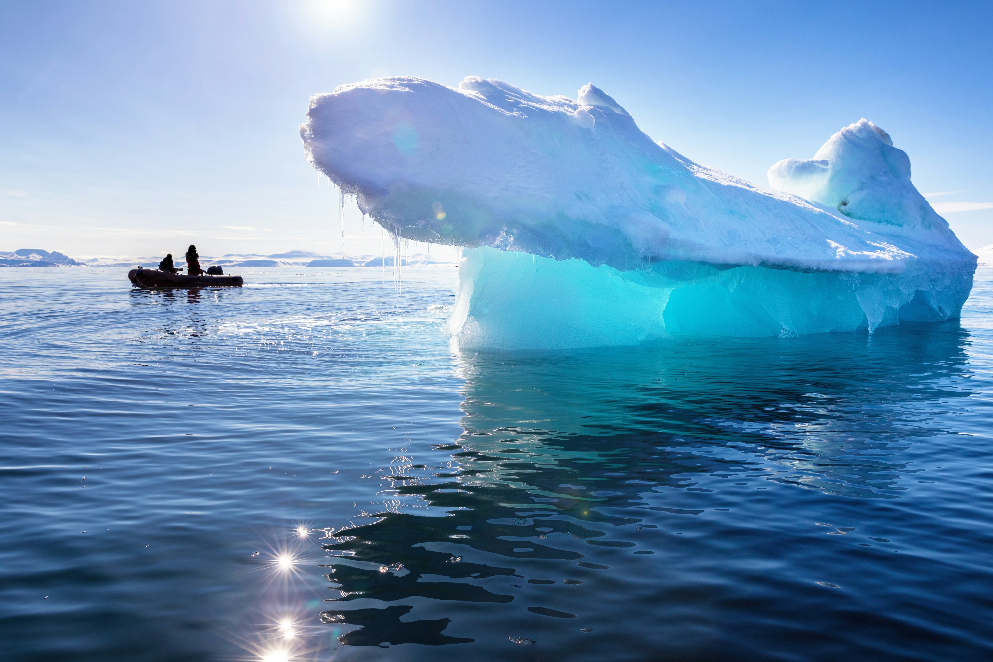
A blue iceberg in Nordfjorden, Svalbard
Boat trips to photograph whales and icebergs are a popular way to explore Svalbard. Rixipix / iStockphoto / Getty Images

Do I need a visa for Svalbard?

You do not need a visa to travel to Svalbard specifically, though you’ll likely pass through mainland Norway on your way, which does require a Norwegian visa.

Interestingly, you do not even need a visa to work here! If you are truly captivated by your trip and wish to move north, it’s legal for anyone of any nationality to immigrate – you just need to acquire employment and housing prior to arriving.

How do I get to Svalbard?

Both Norwegian Air and SAS fly from Oslo to Longyearbyen, and between the two carriers, you’ll be able to get a flight most days of the week. You can also get a flight from Tromsø – in fact, even if your flight says it is direct from Oslo, it may stop at Tromsø, and you’ll have to disembark for passport control.

If you are connecting directly to Svalbard via Oslo airport, you should also check ahead to see if you need a Schengen visa for Norway, as Svalbard is not part of the Schengen area.

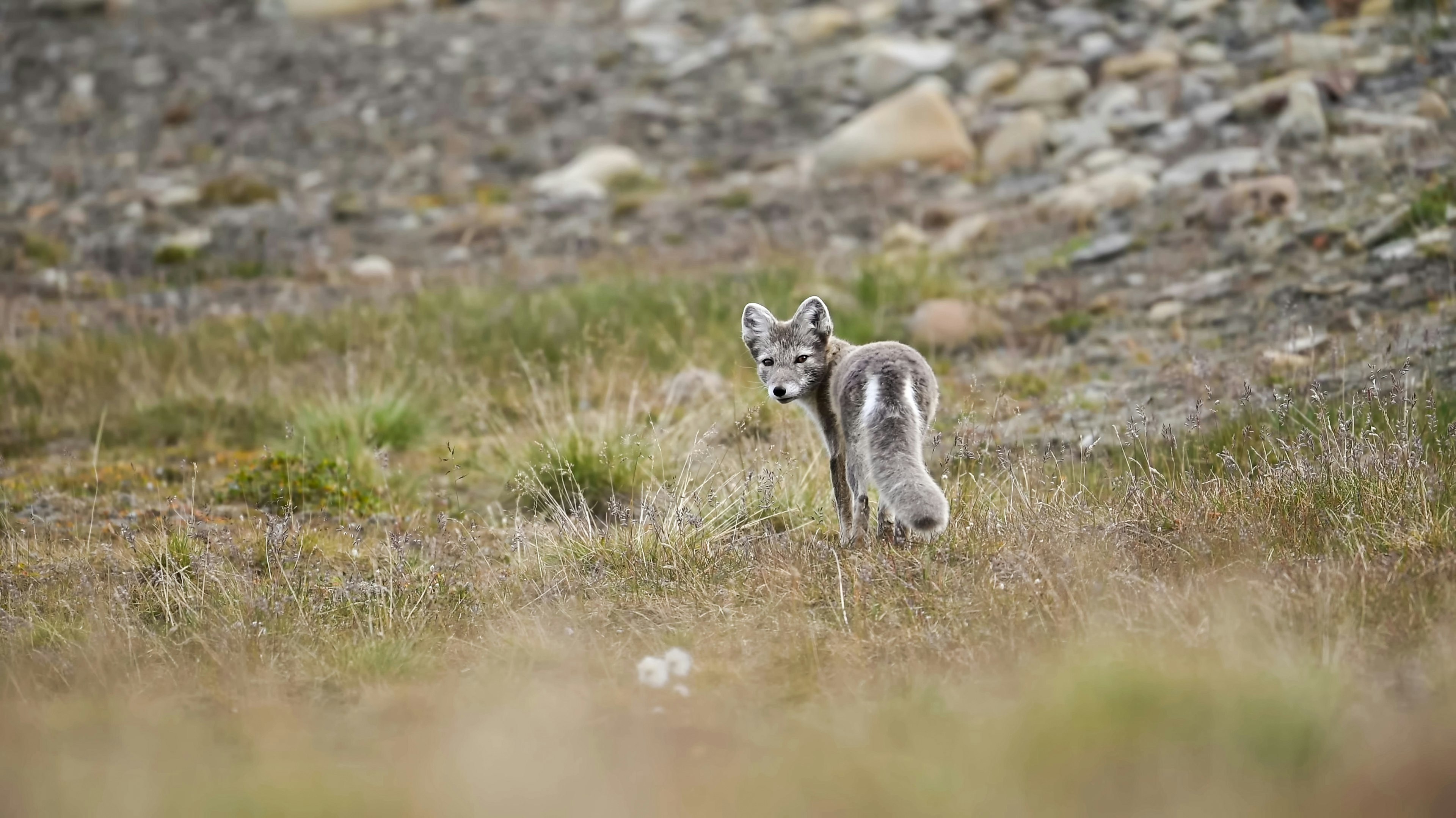
Arctic fox in a tundra landscape, Svalbard
Look out for Arctic foxes, which change color from white to grey with the seasons. Banu R / iStockphoto / Getty Images

The best time to go to Svalbard

Most people visit Svalbard in the summer season (May to September). The snow starts to melt in May, making it easier to get around, and it’s a busier time for tourism, with more flights from Oslo and more cruise ships docking at Longyearbyen.

This is also the best time of year for wildlife watching. Come in June, and you’ll have a good chance of spotting walrus, polar bears and even whales on a cruise. You’ll also be experiencing this under 24 hours of daylight until the end of August, when the sun begins to set again. Overall, it’s an easier experience to visit during the warmer months.

That being said, Svalbard was made for adventurous travel, and some are drawn to its endless polar nights. The sun disappears entirely from the end of October to February, but that doesn’t mean that Svalbard comes to a standstill – you can still enjoy activities such as snowmobiling and dog sledding, and there’s a good chance of spotting the northern lights. Just be sure to pack for the conditions – winter temperatures can drop as low as −20°C (−4°F).

Is it easy to get around Svalbard?

Public transport is almost non-existent in Svalbard, with the exception of the shuttle bus to Longyearbyen from the airport. The journey takes just minutes, and the bus is timed to coincide with all arrivals and departures and will drop you straight to your accommodation. A return ticket costs 170 NOK.

If you leave Longyearbyen, you’ll probably be with a tour guide. Most visitors explore the area outside town on guided excursions, which often include transfers to and from your accommodation. These tours can take you to ice caves, fjords and the active mining settlement of Barentsburg to see the industry that shaped Svalbard. There are also northern lights tours in winter.

Arctic Autorent is the biggest car rental company in Svalbard, and it has an office at the airport. You can book ahead online, and prices start from 1090 NOK a day. However, you should note that roads are limited once you leave Longyearbyen; you will not be able to get to other settlements like Barentsburg or Ny-Ålesund by car. There are also two taxi services in town; call ahead and book if you want to get a lift somewhere.

The most common form of transport you’ll see in Svalbard is the snowmobile; one (or two!) of these vehicles are parked outside practically every home. Plenty of tour operators can arrange a rented snowmobile if you’d like to drive one yourself (electric models are often available).

Don’t let the Arctic weather stop you from exploring Longyearbyen on foot – the locals don’t! Crampons for your shoes will make this an easier endeavor.

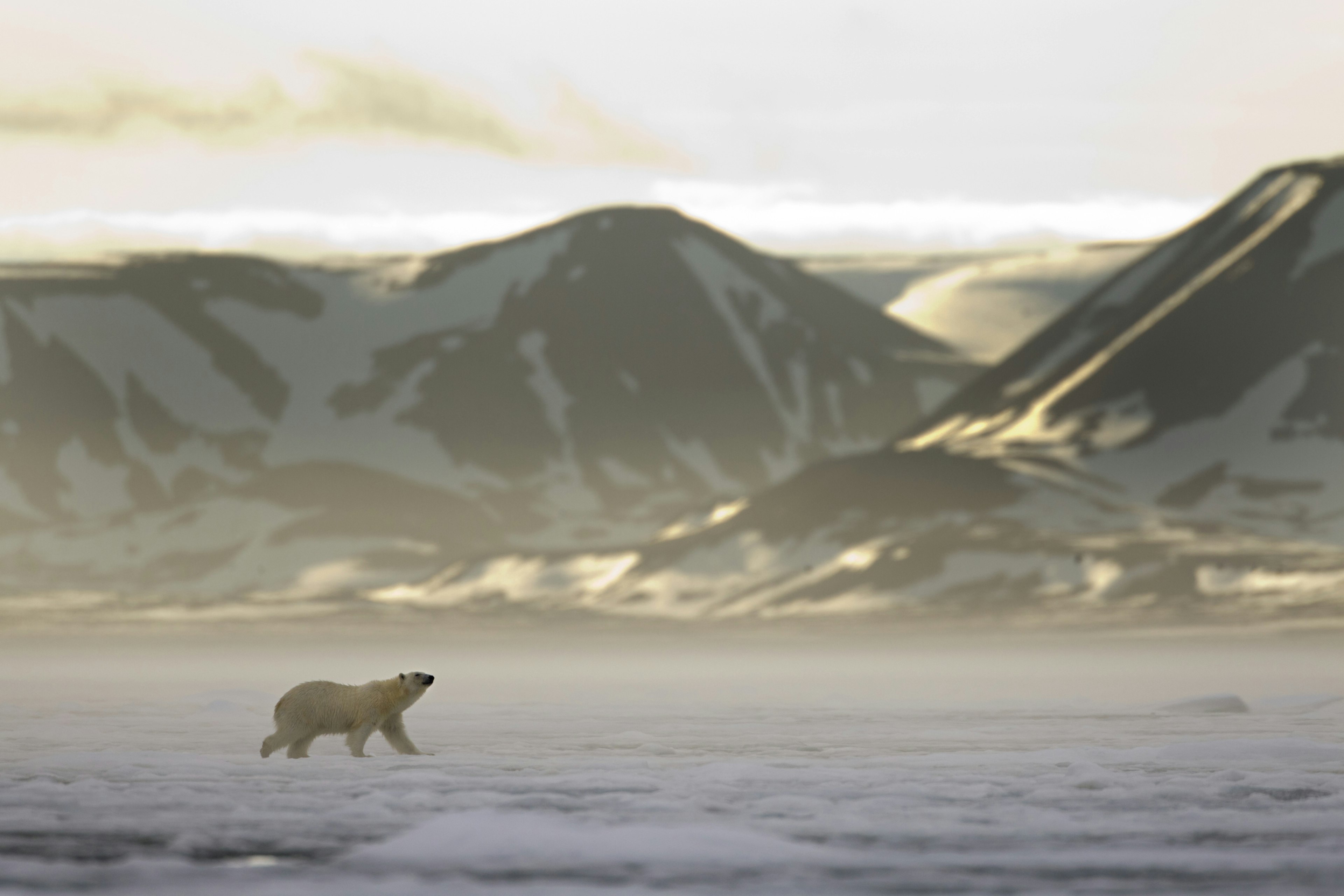
Polar Bear walks across sea ice at entrance to Woodfjorden as midnight sun lights up distant mountains
Polar bears are both the biggest attraction and the biggest danger in Svalbard. Paul Souders / Getty Images

Safety precautions when leaving Longyearbyen

As you approach the town limits of Longyearbyen, you’ll notice striking road signs with a polar bear on them. Go past these signs, and you’ll be required to take safety precautions in case you encounter a polar bear.

At the very minimum, you should have equipment that will scare off polar bears, such as a flare gun with multiple flares. However, a rifle – and the necessary firearms safety experience – is safer still. If you’re leaving on an organized excursion, you won’t need to worry about safety protocols, as your guide will have all the necessary equipment.

It’s always wise to have a professional guide with you whenever you leave the town limits. If you are planning to travel independently, you’ll need to familiarize yourself with the extensive safety precautions and regulations from the Governor’s office far in advance. Ensure that you bring or rent all the necessary equipment, including an emergency beacon, map and compass – and that you have the skills to use them. You also need to alert the Governor’s office of your trip beforehand.

Bring your good socks!

Leave your worn, tired socks at home, because in Svalbard, your shoeless feet will be on show…a lot! Svalbard was dominated by coal mining for a long time, and workers were required to leave their boots at the door to avoid bringing the black dust inside. Coal mining is dwindling on the islands but the tradition remains; you’ll be required to remove your shoes in your accommodation and in restaurants and bars (though not in shops).

Most accommodation places provide you with slippers, but you might want to bring your own for comfort. At the very least, bring decent, warm socks.

Man hiking in the Spitsbergen Mountains in Svalbard
You’ll need the right safety equipment and cold-weather gear if you plan to hike in Svalbard. redtea / Getty Images

How to keep well in Svalbard

If you’re coming from somewhere with a more temperate climate, conditions in Svalbard can feel extreme, even in the summer. You might experience some sleep disruption – it can be difficult to wind down in 24-hour daylight and tough to wake up at the right time in the constant darkness of winter.

Unless you’re visiting at the very height of summer – when temperatures can reach a balmy 10°C (50°F) – it will likely be very, very cold. A heavy-duty moisturizer and lip balm will help protect your skin from getting too dry. Carry some Vaseline and apply a thin layer just inside your nostrils to protect your sinuses from the sudden change to cold, dry air.

For the summer, a good eye mask is essential, and a medicinal supplement such as melatonin may help you drift off to sleep at the right time. Try to maintain a good sleep routine, and close those black-out curtains for a couple of hours before attempting to sleep. If shuteye eludes you, don’t worry – the sun will probably give you enough energy during the day to make it through your activities, even if everything seems difficult when you first get up.

How to protect the landscape in Svalbard while you explore

Although you should be careful when traveling through any natural landscape, even stricter rules apply in Svalbard due to the fragile nature of the High Arctic environment. Don’t disturb the birds or other animals, and familiarize yourself with the no-go areas for vehicles and snowmobiles if you are traveling independently. It’s prohibited to actively bait or pursue polar bears, both for their safety and your own. Rabies is also a risk; the disease can be carried by reindeer and Arctic foxes.

If you visit Svalbard in the summer, don’t pick the flowers. And, of course, don’t leave any evidence of your trip behind in the form of litter or other waste.

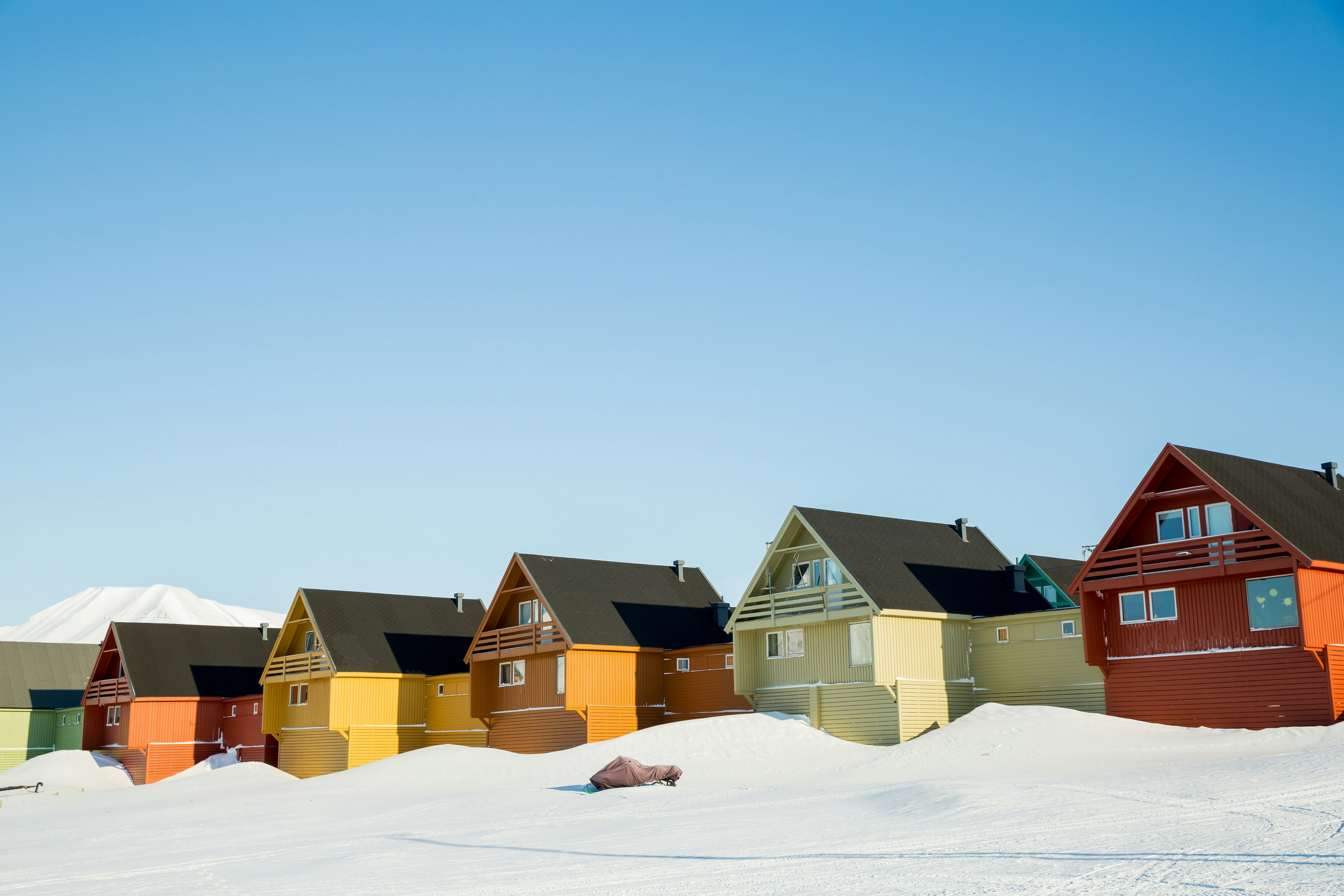
Houses in Longyearbyen in the snow, Svalbard
Be ready for extremes of climate when you visit Longyearbyen. Sasha_Suzi / Getty Images

What to pack for the Svalbard weather

Here’s a packing list to make sure you’re prepared for all the Svalbard adventures you can handle.

  • Long wool underwear

  • Wool socks and gloves

  • Fleece layer

  • Outer wind-proof layer

  • Waterproof boots

  • Slippers

  • Comfortable indoor clothes for your hotel

  • A camera with a long lens

There are some extra seasonal items you’ll need, too. For winter, bring a down jacket, crampons for your shoes, a headlamp and a reflective vest. For summer, bring high-factor sunscreen, good-quality sunglasses and an eye mask.

Mother walrus and her cub on the ice in Svalbard
Bring a camera with a long lens for close-up shots of wildlife. Ondrej Prosicky / Shutterstock

How much money do I need in Svalbard?

As most visitors pack their days with costly excursions, Svalbard isn’t a cheap destination to visit. However, unless you’re planning on taking a hardcore, multi-day trek across the archipelago, you can experience the highlights in a short trip of two to three days.

For day-to-day living, Svalbard has the same high prices as other Scandinavian destinations. All food has to be imported, which increases the cost of meals and provisions, but this is offset slightly by the fact there is no VAT in Svalbard. In fact, if you need to stock up on outdoor gear or clothing, it will probably be cheaper to get it here than in mainland Norway.

Average daily costs in Svalbard:

  • Hostel room – 1000–1900 NOK

  • Basic room for two – 1900–3100 NOK

  • Self-catering apartment (including Airbnb) – 1500–3000 NOK

  • Coffee – 40 NOK

  • Dinner for two – from 300 NOK for pizza to 900 NOK for steaks

  • A pint of beer at the bar – 80 NOK

Keep planning your trip to Norway:

Plan the vacation of a lifetime with the best things to do in Norway
Navigate Norways fjords and islands with this handy guide
What you need to know about chasing the northern lights

AnneMarie traveled to Svalbard at the invitation of Volvo Penta. Lonely Planet staff members do not accept freebies in exchange for positive coverage.

The best places to go in Europe in August

Summer in Europe is sublime ⁠– but it’s also one of the busiest months on the continent for tourism, which means you’ll be sharing the majesty with plenty of other people.

Luckily, we have some recommendations from our book Where to Go When Europe that will take you away from the crowds and to the many magical corners of the continent. Here are six incredible places to go in Europe in August.

Albanian Riveria

Why now? Sizzle on the sand at lesser-known Ionian Sea swathes.

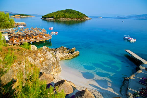
While not quite the hidden gem that it was at the turn of the millennium when empty beaches and truly bargain prices abounded, Albania’s glorious southern shoreline remains a treat for those in search of sun, sand and seafood. Saranda is now a fully-fledged party town, its esplanade lined with bars. For quieter resorts, head up the coast to Himara, flanked by a scattering of good beaches (try Potami, just to the south). In August, you’re guaranteed sun, balmy water and temperatures nudging 30°C (86°F); unsurprisingly, loungers and beach umbrellas are at a premium but you can still seek out peaceful patches of sand at spots such as Palasa, Borsh, pebbly Bunec and the islands off Ksamil. Or head over to the epic Llogara Pass to Vlora Bay, where you’ll find more resorts and boat trips to isolated beaches at the end of the Karaburuni Peninsula. For a break from sand-lolling, head to the archaeological site of Butrint, where Greek, Roman and Byzantine ruins, some dating back 2500 years, are crammed onto a knobbly headland.

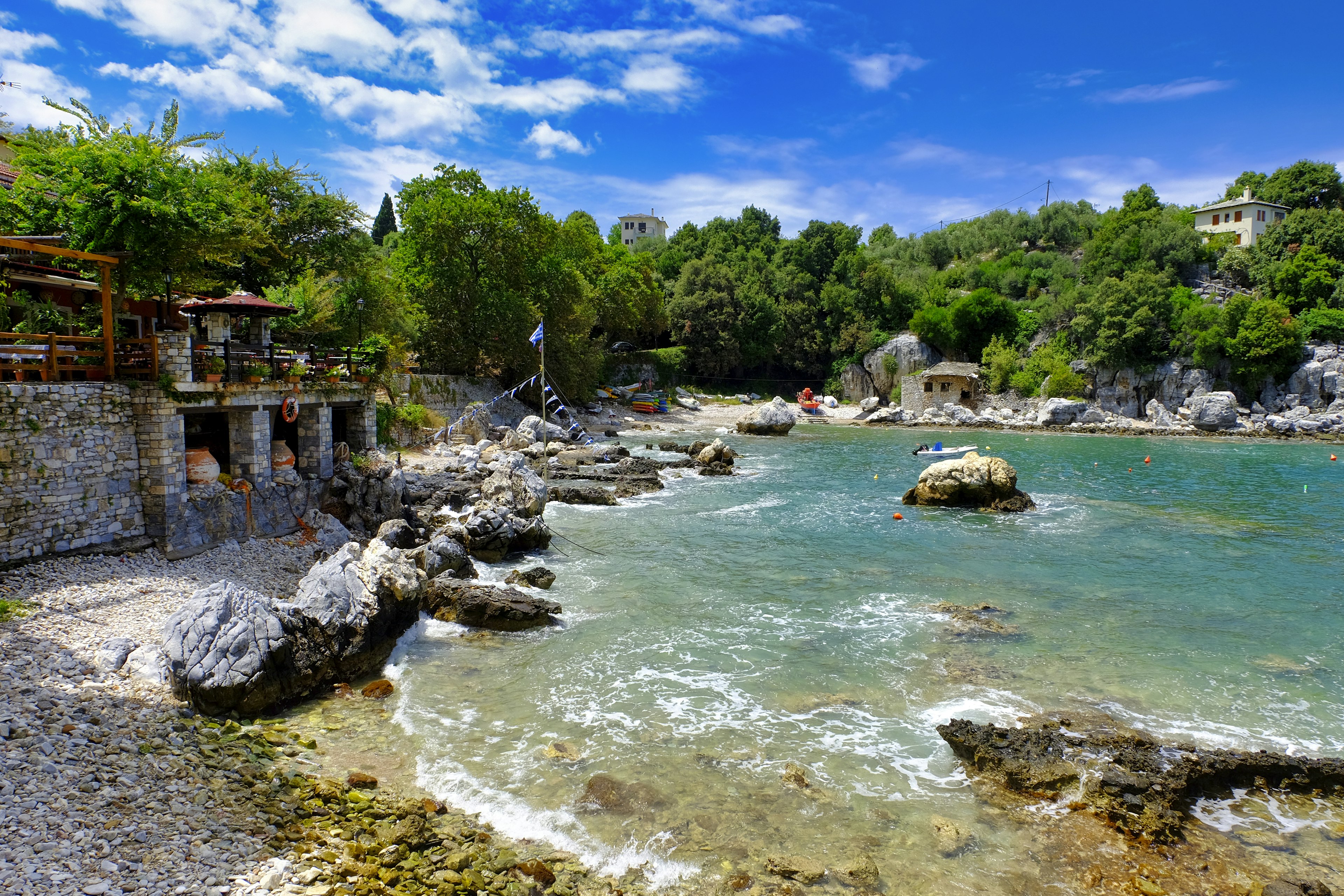
Stone buildings sit on the edge of a light blue coast.
Visit the picturesque Damouchari beach on the east coast of the Pelion Peninsula © Getty Images / iStockphoto

Pelion Peninsula, Greece

Why now? Cool off in balmy waters or traditional hillside villages.

Sure, you could bake on busy beaches on a Greek island. But in sizzling August, head instead for cool Pelion, the gnarled finger curling into the Aegean to tickle the Sporades. There’s a range of coastal resorts, mostly more isolated and peaceful than elsewhere: try Horto or Milina on the sheltered west coast or busier Horefto, Agios Ioannis and cute Damouhari near beautiful Fakistra beach on the east coast. The mountainous interior is packed with natural and cultural appeal – this is where mythical centaurs came to carouse – with ancient cobbled paths linking traditional villages where you can admire church frescoes, sip grape-based, rakı-like tsipouro in the shade of venerable plane trees, and savor local specialties such as spetsofaï (pork-sausage stew), fasoladha (butter bean soup) and lamb in lemon sauce. Up here, the air’s a good few degrees lower than on the coast, and in summer you can board the narrow-gauge train that chugs from Ano Lechonia to Milies, running daily in July and August.

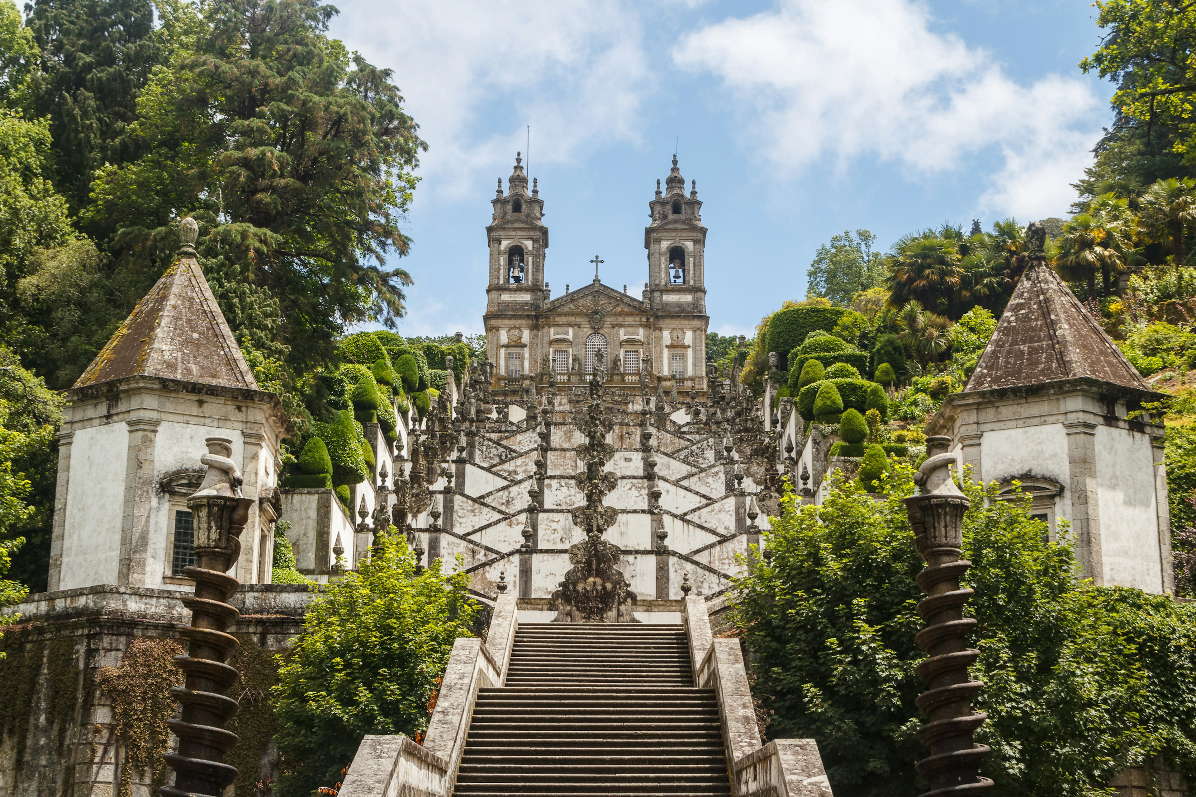
Intricate stairs lead up to a church in Portugal.
Explore beautiful architecture like the Santuário do Bom Jesus do Monte in Braga © Lev Levin / Shutterstock

Minho, Portugal

Why now? Tuck into the tasty green heart of old Portugal.

Where do the Portuguese holiday at home? Those in the know savor staycations in the birthplace of the kingdom: the northerly Minho region, a land of verdant hills, traditional culture and fabulous flavors. The Minho is noted for its vinho verde, literally “green wine,” released just a few months after harvest. As well as those fruity drops (Loureiro and Alvarinho are our picks), the cuisine is delectable, too – the Minho was designated as a European Region of Gastronomy in 2016. There are plenty of local specialties. In Ponte de Lima, Portugal’s oldest town, find a restaurant overlooking the Roman bridge and savor arroz de sarrabulho – rice cooked in pig’s blood and studded with various pork morsels (tastier than it sounds) – and caldo verde, a hearty kale soup. Monkfish, sea bass and bream are fish favorites, along with bacalhau – salt cod, a staple throughout the country. Work up an appetite strolling historic towns such as Braga, Guimarães and Viana do Castelo, where magnificently diverse architecture recalls the wealth of adventurous merchants who made their fortunes during the Age of Discovery and in the subsequent colonial era.

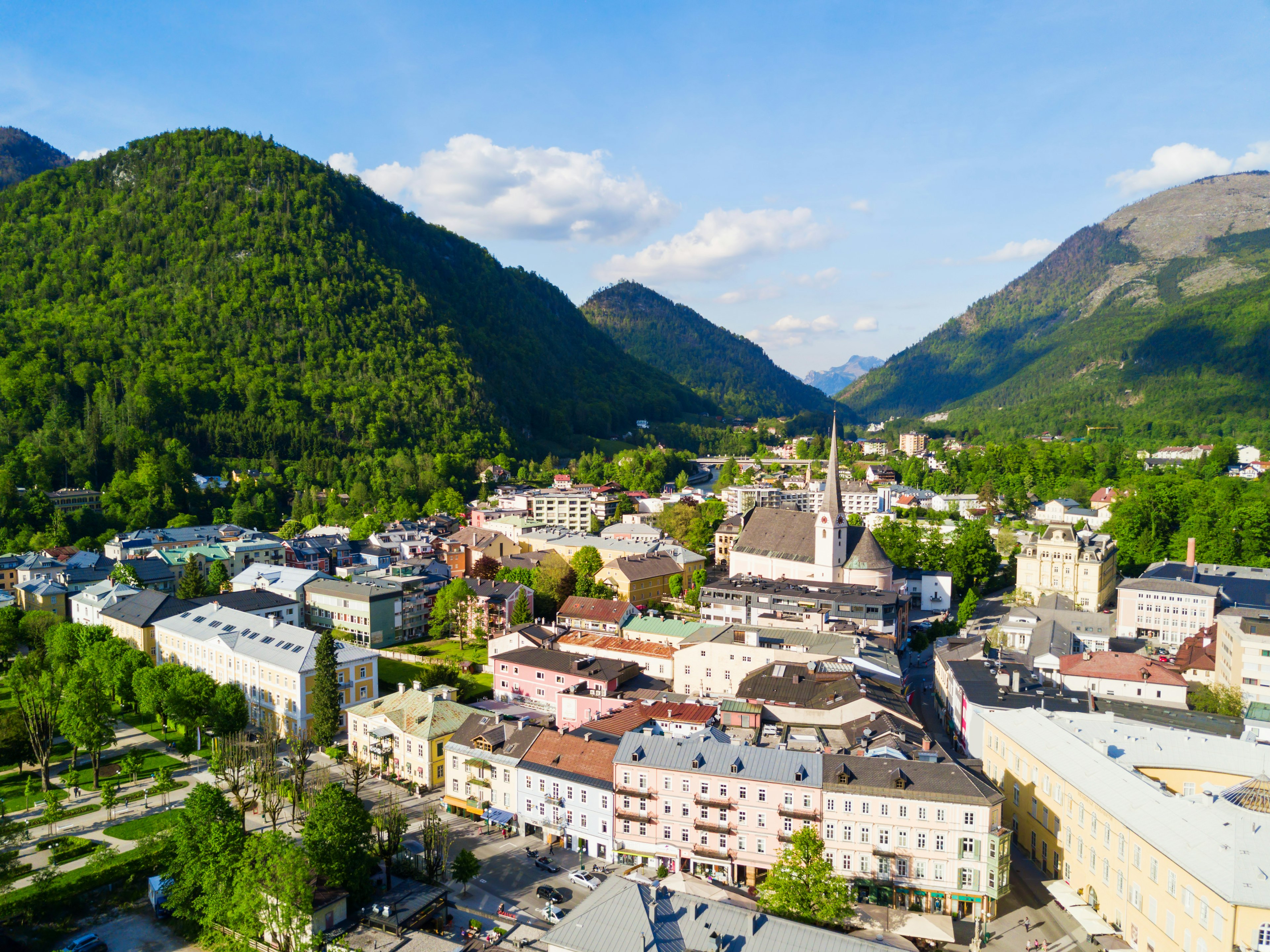
Aerial of Bad Ischl, a spa town in the centre of the Salzkammergut region.
Bad Ischl is a spa town in the centre of the Salzkammergut region © saiko3p / Getty Images

Central Austria

Why now? Spa yourself happy amid glorious mountain scenery.

To find wellness in Austria, look for the Bad in everything – at least, in place names: if it starts with Bad, it’s a spa town. A dense cluster of saunas, treatment centers and thermal waters studs a broad swathe of central Austria east and south of Salzburg, most with a suitably uplifting backdrop of Alpine peaks, meadows and valleys. The focus varies subtly from place to place. In Bad Aussee, expect a healthy diet plus outdoor activity, in line with the concepts of Kneipp therapy. The benefits of brine have been promoted in stately Bad Ischl since it received the imperial seal of approval in the mid-19th century. Natural hot springs feed the action at Bad Gastein, with forest bathing and barefoot walking added to the mix in neighboring Bad Hofgastein, which hosts one of Europe’s largest thermal spa complexes. But you won’t want to stay inside during the long, warm days of August: roam the picturesque paths circling the Salzkammergut’s sparkling lakes, pedal mountain-bike trails above Bad Gastein, or take an invigorating dip in an alpine tarn.

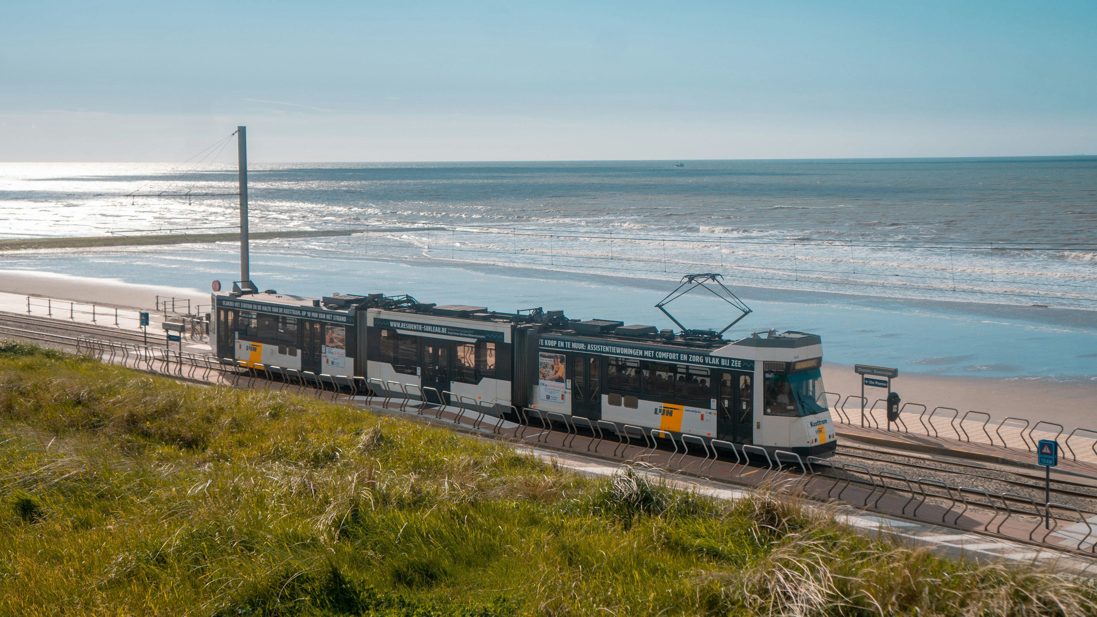
Belgium's coastal tram moves ahead in front of the sea.
Belgium’s coastal tram is a wonderfully scenic way to explore smaller towns along the shore © SankyPix / Shutterstock

Coastal Belgium

Why now? Trundle the world’s longest tram route and taste delectable seafood.

Belgium might not be your obvious go-to destination for a beach break. But with an almost unbroken 70km (44 mile) stretch of white sand fringing the North Sea, perhaps it should be – around the turn of the 20th century, it lured fashionable holidaymakers to its resorts. Today the Belgian coast is studded with attractions – aquariums, theme parks, watersports – all accessible aboard the Kusttram (Coastal Tram). This venerable tram line, established in 1885, is the world’s longest, stretching 67km (42 miles) between De Panne in the west and Knokke-Heist in the east. August, the warmest month, is a great time to ride the rails, with a host of events including a fireworks festival in Knokke- Heist and, at De Haan, a celebration of prawns – these delicious crustaceans are a specialty here. On summer weekends you can ride a vintage tram from the depot at De Panne.

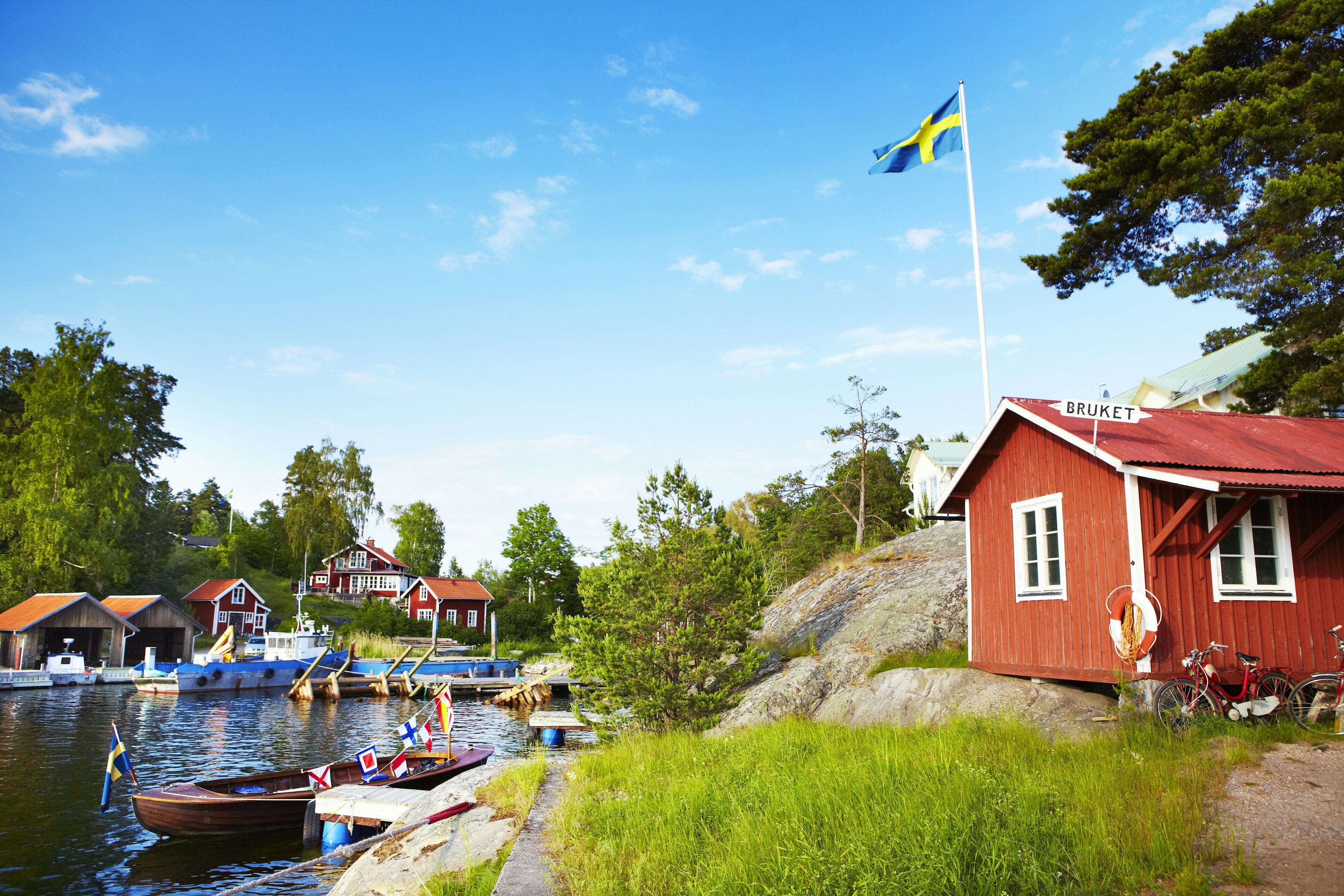
Boat houses on harbour in hamlet of Bruket, a lush part of the Stockholm peninsula.
Soak up the best of summer in Sweden in a town like Bruket © Matt Munro / Lonely Planet

Stockholm Archipelago, Sweden

Why now? Island-hop the coastal capital on long summer days.

Less a city, more a wooded archipelago that happens to host some important buildings, Sweden’s capital is unreasonably attractive – and never more so than in sunny August, when the sun glints on the water and the many parks beckon. Stockholm has enough cultural attractions to pack several days, from the cobbled alleys of Gamla Stan (Old Town) to exceptional contemporary galleries and museums (including open-air Skansen), while the sleek modern shopping district of Nordmalm offers ample welcoming cafés and restaurants for the all-important fika (coffee and cake break). It’s easy to roam the 14 main islands on foot, or by bike or metro, but there are tens of thousands more islets and rocks in the archipelago that are best explored by ferry, on a boat cruise or – better yet – by kayak. Watch for ospreys, beavers and grey seals in various choice spots around the archipelago.

The 11 best places to visit in Vermont

Best known for country farms, farm-to-table restaurants, arts and crafts, rural charm and a wealth of history, Vermont has plenty to offer visitors all year round.

Tucked between the Adirondack Park’s 6 million acres, New Hampshire and the Atlantic Coast, the welcoming Green Mountain State teems with opportunities to explore in all seasons. Whether you splash around on the shores of one of the state’s 800-plus lakes, pick ripe apples from the tree or sample maple syrup as it comes out of the boiler, the state with the smallest capital in the US is ready for adventure. 

Everything feels accessible in Vermont, and it’s easy to put together an itinerary that incorporates many different outdoor activities in one day. Whether you’re visiting for Open Studio Weekend, when Vermont’s artists welcome visitors to the spaces where they create, or you want to follow the state’s beer or spirits trail, here’s our guide to the best places to visit in Vermont. 

People walking Church Street in Burlington
Get your shop on at Church Street in Burlington © Education Images / UIG via Getty Images

1. Burlington

Best for Vermont-style urban exploring

In the heart of Burlington, Vermont’s biggest city, is Church Street, a pedestrian mall lined with charming boutiques, superb restaurants, and (of course) the mandatory Ben & Jerry’s. From here, there’s a lot to see and do within walking distance. 

You’ll find many affordable and free things to do in town. In summer, musicians and street performers delight visitors on Church Street, while food cart vendors offer delicious local snacks. From Church Street, head west on Main or College Street to reach Waterfront Park, where you can discover an outdoor sculpture garden and stroll the boardwalk. On the park’s east end is the Burlington Bike Path, which is includes views of Lake Champlain, the Adirondacks and the city along its 14-miles. If you’re feeling even more adventurous, you can access the lakefront wilderness of Rock Point from North Beach. 

Planning tip: If you’re planning to explore more of the rural areas east of Burlington, you’ll need a car. But if you like the idea of enjoying a car-free Vermont trip, Amtrak’s Ethan Allen Express and Vermonter trains serve the Burlington area and beyond. While you’re in town, you’ll find plenty more hiking and biking trails and Green Mountain Transit buses to get around town. 

2. Montpelier

Best for living history and small-town charm

With 7500 residents, Montpelier is the US’s smallest state capital by population. This city’s focal point is the monumental 1859 Vermont State House, the state’s gold-domed Greek Revival capitol. Take some time to visit the landmark’s excellent art collection which has decorative and fine art exhibits. Next door at the Vermont History Museum, exhibits recount the state’s early history, highlighting Ethan Allen’s 18th-century adventures. Meander through downtown Montpelier for bakeries, restaurants and shops before heading to Hubbard Park’s observation tower for some of the best views of the capital.  

Vermont’s 7 best hiking trails

Old wooden barn surrounded by colorful trees, farm in autumn landscape
Woodstock’s vivid New England countryside attracts city-dwellers year-round © Tibu / Getty Images

3. Woodstock

Best for farm-to-table sophistication

Surrounded by rolling hills and stately horse farms, Woodstock is steeped in history. In 1786, it was a center of commerce, home to both industry and art, and one of Vermont’s largest and wealthiest towns. Relics from that golden era still remain, including the Woodstock Inn & Resort, which attracts city-dwellers to the country for a high-end weekend getaway.  

Visit the circa 1880 pink sandstone Norman Williams Public Library, or Billings Farm & Museum, a functioning dairy farm with an 1890 farmhouse and exhibits that depict farm life like it used to be. 

Nearby, a web of trails in Marsh-Billings-Rockefeller National Historical Park (the state’s first national park) invites walkers and nature lovers to explore. Take a dip or drop a line in the Ottauquechee River. It flows through the center of town and under the area’s three historic covered bridges.

4. Tunbridge

Best for harvest-time festivities

Most of the year, the three Villages that comprise Tunbridge, Vermont are pretty quiet. A few visitors wander to admire their five covered bridges, But in mid-September, Tunbridge comes alive. Vermont has many agricultural fairs, but the Tunbridge World’s Fair, which has taken place in Tunbridge continuously since 1867, is the most famous.

Held in mid-September, the fair features farming and agricultural demonstrations and contests, as well as arm wrestling, ox pulls and displays of the biggest and best produce and pies Vermonters can grow or make. Rides, contra dancing and a fantastic beer garden round out the offerings. But it’s the pig race that steals the show. 

Detour: While you’re in town for the Tunbridge World’s Fair, take some extra time to experience more of what the White River Valley has to offer. More specifically, you’ll find the famed floating bridge in the nearby town of Brookfield. On the other side of the floating bridge, keep driving west to reach Allis State Park. From the top of Bear Hill, you will discover incredible mountain views that extend all the way to Killington, Mt Mansfield and the White Mountains of New Hampshire on clear days. 

Community Church, Stowe, Vermont
Stowe’s most iconic landmark, Community Church, along Scenic Route 100 © Don Landwehrle / Shutterstock

5. Stowe

Best for snowy adventures in the Green Mountains

Just off of Mount Mansfield (Vermont’s highest peak), Stowe is a classic New England town packed with local commerce and surrounded by natural beauty. Landmarked by the historic white spires of Community Church, the town of Stowe is one of the best places to stay in Vermont.

For the best of the area’s nature trails, hop on a mountain bike for a tour of Cady Hill before rewarding yourself with a fresh-from-the-farm lunch at the Sunday farmer’s market. Stay on the bike to glide along Stowe’s riverside recreational path and route to one of the town’s many swimming holes. If you like winter sports, then winter is the best time to visit Stowe for its superb alpine and Nordic skiing. Even if it’s not ski season, Vermont’s Ski History Museum brings skiing alive through its collections of gear and artifacts from ski seasons past. 

Drive the Mt. Mansfield Toll Road or hike the Long Trail to the summit of Mt. Mansfield for sweeping views of New England. Catch the Vermont Symphony Orchestra for a concert at Trapp Family Lodge; the stunning sunset and superb music will make it unforgettable. 

Local tip: Along the Smuggler’s Notch, Stowe and Mad River Valley beer trail, you’ll find several craft breweries, including Stowe’s own Idletyme Brewing Co., Alchemist Beer and von Trapp Brewing. 

Vermont’s best road trips

6. Lake Willoughby, Northeast Kingdom

Best for laid-back lake life

Five miles long and up to 320ft deep, Lake Willoughby is a glacially-formed lake that’s a National Natural Landmark. Carved deep into Vermont’s Northeast Kingdom, the lake lies between Mt. Pisgah and Mt. Hor, which together form the fjord-like Willoughby Gap. 

In the late 1800s, steamboats paraded visitors around the lake. Now, public beaches at the north and south ends provide summer fun for swimmers and paddlers. Fishermen cast a line here for lake and rainbow trout, landlocked Atlantic salmon and native round whitefish. 

At least 100 bird species populate this waterway: thrushes, warblers, hummingbirds, jays, finches, loons, herons, gulls and the rare peregrine falcon, which nests in the cliffs of Mt. Pisgah and Mt. Hor. 

Scenic autumn landscape at Smuggler's Notch State Park
Smuggler’s Notch is one of Vermont’s best seasonal drives © John Greim / LightRocket via Getty Images

7. Smuggler’s Notch

Best for ruggedly beautiful natural scenery

During the War of 1812, the twisty, windy, cliff-lined, boulder-strewn mountain horse path between Underhill and Stowe was the mainline for supplies going to and coming from Canada. It played a similar role for booze during prohibition. And it was also part of the Underground Railroad. Now, a narrow, snaking road replaces the historic path through Mount Mansfield State Forest, making Smuggler’s Notch a key stop for Vermont road trips. 

Drive it and explore the boulder field at the top where smugglers hid, and where now you’ll see rock climbers and boulderers ascending. Though the Notch is closed in winter, it’s just as busy with skiers, snowshoers, sledders and ice climbers. 

A sailboat in autumn on Lake Champlain
Lake Champlain is excellent for sailing during the warmer months © Larry Gerbrandt / Getty Images

8. Lake Champlain

Best for sailing away and navigating the open water

The sixth-largest lake in the United States, Lake Champlain, forms much of Vermont’s western border. At times, it’s been a Revolutionary War battleground, a supplier of ships in the War of 1812, a “line” in the Underground Railroad and home to the mythical monster Vermonters affectionately call “Champ.” 

At 125 miles long and nearly 15 miles wide, the freshwater lake is sprinkled with motorboats, paddle boats and sailboats in the summer. Put in at any of the boat launches, marinas or beaches, and you could follow the lake north to Quebec via the Richlieu and St. Lawrence Rivers, or south to the Hudson River and Manhattan. 

From the Vermont side, you can take a ferry to New York, including the Lake Champlain Ferries (which operate year-round) and the historic Ticonderoga cable ferry (check their website for seasonal operating hours). During the summer season, you can splash around on one of the lake’s many public beaches.

Explore the Champlain Islands, north of Burlington, and sample from the region’s best wineries, or pick apples in the fall in the Lake Shore’s fertile groves. Beneath its sometimes glassy, sometimes turbulent surface lies 300 historic shipwrecks. Dive them or learn about them at Lake Champlain Maritime Museum. Lake Champlain is also one of the top bass fishing lakes in North America. 

9. Quechee

Best for grand scenery and year-round adventures

While the East Coast may not have North America’s tallest mountains or deepest canyons, you will find some exceptionally beautiful mountain and canyon scenery at Quechee State Park. 

Formed by glacial activity some 13,000 years ago, the Quechee Gorge drops 165ft to the Ottauquechee River, making it one of the prettiest places in Vermont. If you’re here for fall leaf-peeping, a Quechee Gorge hike is certainly one of the top things to do in Vermont in the fall. If you come during the winter season, the nearby Quechee Club is one of the best places to visit in Vermont for easy skiing.

Planning tip: Despite the name, SmokyMountains.com provides the most comprehensive and accurate fall foliage map for the entire United States, including Vermont. While early October is usually a good bet to catch peak fall foliage in the Green Mountain State, it’s smart to check before you go. 

10. Shelburne

Best for local flavors

Shelburne may only be about 8 miles south of Burlington, Vermont’s most populous city, but it remains a quiet rural community. 

Visit Shelburne Farms to try artisanal cheese and maple syrup made on-site. Consider a stay at the Shelburne Farms Inn, an 1800s historic estate. The on-site restaurant has fresh and original dishes made from ingredients harvested at the farm and other local farms. 

Beyond the farms, you should explore Northern New England’s most extensive art and cultural institution at the Shelburne Museum. Spanning 45 acres and 39 exhibition buildings, the Shelburne Museum has everything from paintings by famous French Impressionist artists like Claude Monet, Edgar Degas and Mary Cassatt to the beautifully restored 220-ft steamboat Ticonderoga that was built in Shelburne in 1906. 

Planning tip: Shelburne Farms’ welcome center and walking trails are open year-round, but visit between May and October for one of the farm’s famed open wagon tours, to see the animals at the children’s farmyard, or to dine at the restaurant. 

11. Manchester

Best for all-seasons fun

In southern Vermont, Manchester provides many opportunities for year-round fun and games. Whether you’re coming to Manchester to take in all the wondrous fall colors from the heights of Mount Equinox, taste the flavors featured at local restaurants like Raven’s Den and The Dorset Inn, or enjoy some summer tee time at  The Golf Club at The Equinox, Manchester never feels bland. 

While Illinois is officially the Land of Lincoln, you can see how Abraham Lincoln’s descendants continued his legacy at Hildene, a stately Georgian Revival manor built by Robert and Mary Lincoln in 1905. Explore the regal mansion and gardens, then hit the 12 miles of hiking trails, check out the sustainable goat dairy farm and even wander inside the beautifully restored 1903 Pullman car Sunbeam. 

For more arts and culture, the Southern Vermont Arts Center has incredible exhibitions, workshops and local art. During the summer, dive deeper into the local culture with summer festivals like the Taconic Music Festival, Dorset Theatre Festival and the Green Mountain Bluegrass and Roots Festival. In winter, Manchester provides very easy access to various ski resorts to suit skiers of all ages and levels, including Bromley Mountain, Stratton Mountain Resort and Magic Mountain Ski Area. 

Detour: For outdoor adventures in southern Vermont, Manchester may be the ideal base camp since it’s only 4 miles away from the Long Trail that extends the entire length of the State of Vermont, or 272 miles from the Massachusetts state line to the US-Canada border. Also note that this is where the Long Trail connects with the world-famous Appalachian Trail, which will lead you to even more incredible mountain wilderness.

You might also like:

5 US ski towns for people who hate skiing
The 12 best-secluded cabins to rent in the Northeast USA
Audiobooks to narrate your US road trip

A first-time guide to Vietnam

Gone is the era when Vietnam evoked only images of rice fields, floating markets and conical-hat-wearing workers. This Southeast Asian powerhouse has today become a destination known for majestic natural beauty, pristine beaches, unexplored ecological reserves and delectable cuisines.

Halong Bay, Hoi An’s Old Town, Phong Nha – Ke Bang National Park and other Vietnamese sites have joined the UNESCO World Heritage roster. Staple Vietnamese foods like banh mi and pho are common enough to appear in English-language dictionaries. Some of the most discerning travelers in the world are ranking Phu Quoc with the Maldives and Bali on lists of the world’s most beautiful islands.

And that’s only the beginning of what this country has to offer.

An aerial view of apricot trees in bloom on O Long tea hill near Sapa, Vietnam
In August and September, Sapa in the highlands springs into glorious bloom. Tony Duy/Shutterstock

The best time to visit Vietnam

Vietnam is nearly 1650km (1025 miles) from north to south – a length that ensures weather patterns vary widely, and that the best time to visit depends very much on your planned destinations and personal preferences. Most visitors will want to avoid the stormy season, especially in Northern Vietnam and Central Vietnam, as violent rainstorms often lead to flash floods, mudslides and road closures. In contrast, the southern storm season (June to November), while inconvenient, does not pose nearly as significant a risk to travelers.

The storm season starts from May and ends around October in the north; from September to December in the central coastal regions; and from May to August in the central highland regions.

Other than that, the country climate is separated into three general zones:

  • In North Vietnam (Hanoi, Sapa, Ha Giang, Halong Bay) in September and November or March and April, the weather is cool and dry and the local tourism sector is not overwhelmed by intra-Vietnamese travel. August and September are also Sapa’s harvest season and the best time to highland hills in vibrant bloom.

  • Central Vietnam (Hoi An, Nha Trang, Hue, Danang) is best visited from April to August, when you’ll avoid the worst of the storm and flood season and abundant sunshine will help you make the most of the white-sand beaches around Hoi An and Nha Trang.

  • We recommend visiting South Vietnam (Ho Chi Minh City, Mekong Delta, Phu Quoc) from October to April, after plentiful rains from the prior months ensure the rivers and channels of the Mekong Delta are abundantly fed, allowing for smooth travel through this maze of crisscrossing waterways.

We’d recommend avoiding visits during major holidays like Tet (the Vietnamese New Year, usually in late January or early February) due to soaring prices and booked-out accommodations.

People on the white-sand beach under palm trees on Khem Beach, Phu Quoc island, Vietnam
Phu Quoc has caught the attention of the international press for good reason. Shutterstock

How much time should I spend in Vietnam?

To experience the full breadth of experiences here? Months. Acknowledging that’s unlikely for most visitors, two weeks will get you through most of Vietnam’s best-known destinations.

Starting from either Hanoi or Ho Chi Minh City (HCMC), you can travel the length of the country and enjoy a wealth of sights, tastes and experiences. Must-visit places include iconic favorites Sapa and Halong Bay; cultural and historical hot spots such as Hoi An and Hue; river capitals like Can Tho and the sprawling Mekong Delta that surrounds it; and the tropical island paradise of Phu Quoc.

If you’re short on time or money, quick trips of three to four days focusing on a singular area or city like Hanoi, Ho Chi Minh City or Phu Quoc are feasible and offer a satisfying taste of Vietnam’s attractions.

Getting around Vietnam

Vietnam has three major international airports, in Hanoi, Ho Chi Minh City and Danang (the gateway to Hoi An and Hue). In addition, Phu Quoc Island has its own international airport with direct flights to Singapore, Shanghai, Cambodia and Laos – and the airport at Phan Thiet will launch international flights in 2025.

Traveling within Vietnam itself is relatively easy and affordable, with options including trains, buses and domestic flights. Flights are the most convenient and speedy way to travel within the country. Buses are affordable, reach almost everywhere in the country and offer sleeper options for those who want to get between north and south without stopping overnight. In recent years, renewed interest has led to a few train lines being refurbished and revitalized. These days, traveling by train is a great option for those who want to take their time enjoying the scenic routes across the country.

Within cities, cabs, rideshare apps like Grab or Be, and traditional motorbike taxis are easily accessible. For those with the stomach for chaotic traffic, most Vietnamese cities are walkable and a lot of fun to explore on foot – although the tropical heat and humidity coupled with urban city dust and exhaust can make walking long distances unpleasant.

A boat floats by islands in Halong Bay, Vietnam
No visitor to Vietnam will regret setting sail in Halong Bay. Huy Thoai/Shutterstock

Top things to do in Vietnam

All the thrilling things you can do in Vietnam could never fit all on one list. Yet first-time visitors won’t want to pass up a few key experiences.

Cruise Halong Bay. This stunning UNESCO World Heritage Site comprises nearly 2000 towering limestone islands in a massive blue-water bay. An overnight cruise is the best way to take it all in. If you happen to have some extra time, Lan Ha Bay is to the south of Halong: it’s no less beautiful but much less traveled.

Explore Hoi An. With its lantern-lit streets and turbo-speed tailor shops, this ancient town seems frozen in time. In the countryside surrounding the town, a plethora of traditional craft villages await to be explored.

Climb down the Cu Chi Tunnels. This warren of war-era tunnels is already a heart-stopping experience – and as of early 2024, night tours have been offered to travelers with nerves of steel and a taste for reliving wartime thrills.

Hike the highland trails of Sapa. The Northwest Highlands are famous for majestic trails and stunning natural beauty. Sapa serves as the landing pad and base camp for adventurous trekkers looking to explore the rugged region on foot.

Wander the Old Quarter of Hanoi. Get lost in this maze of narrow streets, each named after the goods once sold here. It’s a great place to experience Vietnamese street culture and food.

A woman sells homemade rice cakes filled with black sugar at the market in Lang Son province, Vietnam
What will any visitor to Vietnam remember? The food. Quang Nguyen Vinh/Shutterstock

My favorite thing to do in Vietnam

My favorite thing about Vietnam? The food.

Beyond pho and banh mi, you can slurp up more than 200 distinct noodle dishes from every corner of Vietnam. There are foods unique to a single town. There are herbs unique to a certain patch of a single forest. There are cuisines designed to suit the palates of emperors past. There are simple and humble, cheap and hearty dishes meant to fill peasants’ stomachs.

There’s much to learn about the history of Vietnam and its people through the food they cook to nurture each other. My low-key dream is to travel to every town in Vietnam and try its specialty dish – and hear the backstory behind it. (There’s almost always some wacky story attached to a hometown favorite.) That would make quite a book.

How much money do I need for Vietnam?

While you’ll find luxury resorts, world-class dining and premium experiences in certain parts of Vietnam, the country retains its well-earned reputation for budget travel.

  • Hostel room: US$10–15

  • Basic room for two: US$10–40

  • Self-catering apartment (including Airbnb): US$20–50

  • Local bus ticket: US$0.20–1

  • Coffee: US$1–3

  • Banh mi: US$1–3 (note that the famous and drama-filled Madam Huynh Banh Mi in HCMC charges $3 per sandwich – and one can easily feed two regular adults or one starving weightlifter)

  • Dinner for two in a local sit-down restaurant: US$10–30

  • Beer: US$1–2 per can; $3 per liter of draft beer at a local beer hall

A woman carries baskets with fruits along a canal in the Old Town of Ha Noi, Vietnam
Knowing a few simple phrases in Vietnamese will get you far with locals. Getty Images

More tips for enjoying Vietnam

Bring lots of layers, no matter the season

Especially if you are traveling the length of Vietnam. The country’s climate varies greatly within short distances, so packing for different temperatures and weather conditions is the prudent thing to do.

Respect local customs and etiquette

As in other Asian nations, the Vietnamese value politeness and respect. When visiting temples, remember to dress modestly, and always remove shoes when entering someone’s home.

Stay away from tap water, and choose your street foods carefully

Tap water in Vietnam is not safe to drink, so stick to bottled water everywhere. Enjoying street food is an essential Vietnamese experience – but since food hygiene can be an issue, observe the locals and choose the street vendors they favor.

Prepare for chaotic traffic

The joke in Ho Chi Minh City and Hanoi is that traffic laws are more like suggestions, so be cautious when crossing streets and only consider renting motorbikes if you are an experienced driver.

A few words in Vietnamese go a long way

You can expect English to be fairly widely spoken in Vietnam, especially in big cities. Still, learning a few basic phrases in Vietnamese can only help – and will likely go a long way in demonstrating respect to and forming connections with locals.

The 11 best things to do in Scotland from spotting puffins to bagging peaks

Scotland often feels bigger than it is. That’s in part because of its impact on the world – think Edinburgh’s cultural clout and or Speyside’s famous whiskies – but it’s also because of the sheer range of things to do here.

Two fascinating, but very different, cities dominate Scotland’s central belt, the expansive Highlands feature some of the world’s most beautiful landscapes, while islands pack in wildlife and echoes of the past. There are fine sights all over the country, but these are some of the top experiences in Scotland.

Guru Dudu Silent Disco going around Edinburgh during the Fringe
Get into the spirit of Edinburgh during the Fringe festival. Dan Smith Photography/Shutterstock

1. Experience the creativity of the Edinburgh Festival

The world’s largest arts festival transforms Scotland’s capital in August. Everywhere turns into a venue (literally: swimming pools, fudge shops and public toilets have featured in recent years), the streets throb with performers and festival-goers and pubs are packed until the small hours.

The Fringe, International Festival and Military Tattoo are the biggest events. If you want to see popular shows, booking early is essential, but there’s plenty of diversity beneath the headlines – seek out smaller venues for a unique experience that will make you feel you’ve been in a different city to the crowds.

Local tip: Missed out on tickets for the Royal Edinburgh Military Tattoo? Head to the top of Royal Mile and watch the troops parade down Castlehill, with bagpipes, brass sections, and colorful costumes, after the main performance at 10.30pm each night.

Glasgow, Scotland, UK - People on a night out in Ashton Lane, a sidestreet off Byres Road full of bars and restaurants.
Glasgow comes to life after dark on Ashton Lane, a cobbled backstreet in the West End full of bars and restaurants. Getty Images

2. Get swept away by the music in Glasgow

By day, Glasgow’s grand architecture and resurgent museums are more than worth your time. But you may have the most fun at night, when glorious local scenes come alive and visitors to the city are treated with warm curiosity. Pubs host folk gigs, clubs judder to house and techno and the alt-rock scene bulges with talent. You can check out indie acts at King Tut’s, bounce on a historic ballroom floor at the Barrowland, check out a folk session at the Ben Nevis or get a sweat on at the Sub Club, which has been a temple to electronic music for over 30 years.

Portree, Isle of Skye, Scotland, May 2023:  Scenic view looking out over the colorful village of Portree, capital of the Isle of Skye on a beautiful spring day.
1781965632
The colorful village of Portree, capital of the Isle of Skye. Getty Images

3. Find your own highlights on Skye

With its grand peaks, Gaelic culture and windswept beauty, Skye is the main draw in the Highlands. Rather than trying to cram its many highlights into a single itinerary – and risking getting stuck in a tourist traffic jam as you do so – it can be worth getting your perspective on this special island by choosing the part that most suits you and staying for a few days.

That might mean climbing the knife-edge ridges of the Cuillin Hills, exploring basalt sea stacks on the Trotternish Peninsula, eating roasted hake or devilled pigeon at the Michelin-starred Three Chimneys, or sipping ale at sunset on the little-visited Waternish Peninsula.

Planning tip: Stagecoach operates the main bus routes on the island, linking all the main villages and towns, but you’ll need your walking shoes if you want to go further afield.

4. Take in the lonely peaks of Assynt

Assynt, in the far northwest of Scotland, feels like a land apart. Here, isolated sandstone peaks rise like great monuments from the boggy moorland, giving the landscape an epic eeriness, and meaning the views from the top can – weather, of course, permitting – stretch for miles.

There are some excellent scrambling routes for which you’ll need some experience and a head for heights. An Teallach (1063m/3486ft) has a top-of-the-world traverse, Suilven (723m, 2,372ft) is a long, remote, broken-backed ridge, while Stac Pollaidh (612m/2008ft) reaches up like a ruined crown. It’s also the most accessible of the three. The coast here is also great for sea kayaking.

Local tip: The views from the roads that wind through this wilderness can be almost as good as the ones from the summits.

Exterior of the V&A Museum of Design in Dundee
Detour to the impressive V&A Museum of Design on the Dundee waterfront. DigitalNatureScotland/Shutterstock

5. Soak up the culture on Dundee’s waterfront

Dundee’s docks once exported jute (a fiber used in textiles) around the world, but industrial decline in the 1980s hit the area hard. Regeneration came first in the form of the restored 1901 ship Discovery, which explored the Antarctic under legendary Captain Robert Falcon Scott and was built to withstand being frozen into the icepack.

In 2018, it was joined by V&A Dundee, a state-of-the-art museum whose slatted exterior looks like a spaceship crossed with a sea cliff. In between checking out top-notch visiting exhibitions at the V&A and stepping aboard Discovery, you can explore the city’s textile traditions at the Verdant Works or steer your own course through Dundee’s nautical heritage by going paddleboarding on the Tay.

6. Taste whisky in Speyside

Speyside, in Northeast Scotland, isn’t just about booze: there’s salmon fishing, historic railways and golf courses to experience in these parts. But most visitors are here for the region’s sweet and fragrant whiskies.

Marvel at the vast modern vats that make the stuff, the pleasingly battered casks (often previously used for sherry) that help give batches their unique flavor, and the streams and rivers that run down from the hills and into the distilleries, bringing a touch of local terroir.

There are plenty of great things to do here: you can stay overnight in classic lodges and sup your drinks in hushed, book-lined lounges, or stay at homely B&Bs where the morning smells of kippers and black pudding should add zest to any hangover you might somehow have developed.

Local tip: Speyside is home to the highest number of distilleries in Scotland, the most famous of which is Glenfiddich.

Ring of Brodgar, near Stromnness, Scotland
Step back in time in Orkney: the Neolithic Ring of Brodgar near Stromnness. Jiri Semerad/500px

7. Learn about Stone Age Orkney

The archipelago of Orkney, an hour’s ferry ride from Scotland’s northeast tip, has farmland, fishing villages and some of Europe’s greatest Stone Age remains. Skara Brae, a 5000-year-old settlement that lay preserved under sand dunes till 1850, brings the day-to-day world of Neolithic people to brilliant life.

Houses are connected by tunnels and filled with furniture – beds, fireplaces, dressers and cupboards. The stunning nearby tunnel tomb of Maeshowe, meanwhile, reveals this ancient people’s spiritual side. With its standing stones, giant flocks of seabirds and the mighty sea all around, modern Orkney remains a wild, evocative place.

8. Join the island adventures on Mull

Visiting the Hebrides is highly recommended. The islands are scattered off the west coast, one foot in Scotland, the other in the Atlantic. Mull is one of the finest of these islands, and once you get past its appealing towns (capital Tobermory’s chocolate-box harbor is something else), you can use it as a base for the wonderfully accessible outdoors. There are mountains, cliffs and achingly beautiful beaches, but a boat trip offers the greatest pleasures.

Nearby isles include Iona (whose abbey was a vital staging post in Christianity’s advance through Britain), Staffa (home to surreal pillars that inspired Felix Mendelssohn and Pink Floyd) and Lunga (where thousands of impossibly appealing puffins nest in spring and summer). It’s an especially fun thing to do for families – kids will love the excitement of the short boat trips.

Detour: There are dozens of operators around the coast offering whale-watching boat trips lasting from a couple of hours to all day; some have sighting success rates of 95% in summer.

The Kylesku Bridge spanning Loch a' Chàirn Bhàin in the Scottish Highlands, which is a landmark on the North Coast 500 tourist driving route
Scotland’s most famous driving route heading over the Kylesku Bridge. Helen Hotson/Shutterstock

9. Drive the North Coast 500

Scotland’s most famous driving route starts in Inverness, the Highlands’ likable capital, and makes a great loop around the dramatic west coast and the wild, remote top of Scotland. You’ll pass superb seafood restaurants, distilleries (not all for whisky), villages, farmhouses and pubs.

But the star here is the scenery: lochs that look like they go on forever, huge sea cliffs, rugged mountains, lonely beaches, machair grassland and hills topped with heather. It gets busy in summer: the best time to go is the shoulder season, and a week will allow you to take decent pit stops, breathe in the sea air and treasure the shifting light and the contours of the land. If this doesn’t appeal, Scotland has other amazing road trips to get you exploring.

The most popular through-hike in Scotland is the West Highland Way © kawhia / Shutterstock
The West Highland Way is Scotland’s most popular through-hike but you can tackle a section. Shutterstock

10. Hike the West Highland Way

The West Highland Way takes you from the Lowlands to the Highlands, from the outskirts of Scotland’s biggest city, Glasgow, to the base of Britain’s highest mountain, Ben Nevis. It passes rivers, lochs, mountains and moorland, traveling on old cattle roads and railway lines – meaning that this is one epic journey on which it’s hard to get lost. For the more adventurous hiker, there are other less well-trod paths to also investigate. 

The 96-mile (155km) West Highland Way takes most hikers around a week, although it’s possible to just take on parts of it. You can make it easier, by asking a tour company to drop your baggage at your hotel each night; or harder, by wild camping all the way and rounding it off with the climb up Ben Nevis (4413ft/1345m).

Local tip: Pre-book accommodation or campsites during the European summer as this is a popular through-hike. Some pubs and inns will only serve food to guests who are staying, so if you are wild camping make sure you carry enough food for meals between major towns.

11. Explore historic Edinburgh

Outside of festival time, Edinburgh is one of Britain’s most spectacular cities with plenty of things to do, and its Old and New towns provide a luminous history lesson. The Old Town is crowned by a mighty castle, from where the cobblestoned Royal Mile descends past tangled medieval wynds (alleys) and cozy pubs to the Scottish Parliament.

The neighboring New Town, a mere 200 years old, has Neoclassical streets arranged into an elegant pattern of squares, crescents and boulevards. The city’s hilly nature means that wherever you go, a new view can surprise you. The National Museum is the best of many, although you can also get a vivid sense of Edinburgh’s rich history just by strolling its streets.