healthyng

Category Adventure Travel

Day trips from New Orleans: 9 can’t-miss jaunts from The Big Easy

The truest way to show your love for New Orleans? To leave it for the day.

Whether you’re fleeing from the brutally hot and humid weather, seeking an outdoorsy adventure or simply looking for a respite from the Big Easy’s riot of colors and sounds, here are a few of the best ideas for easy day trips from New Orleans.

1. Explore the swamps of Barataria Preserve

Travel time: 40 minutes by car

One of our favorite ways to experience south Louisiana’s rich wetlands is by visiting Barataria Preserve, a national park about 25 miles south of New Orleans. Easy dirt trails and boardwalks thread through the swamps here, and you may be able to spot local alligators (although wildlife sightings are often hindered by prolific invasive water flora). On your way back to New Orleans, pop into the superlatively good Tan Dinh for some excellent Vietnamese food.

How to get to Barataria Preserve from New Orleans: Take US-90 and cross the Crescent City Connection Bridge over the Mississippi to the New Orleans Westbank. From US-90, take exit 4B to access Barataria Blvd, which leads to the preserve.

2. Feel the beach vibes of Mississippi’s Gulf Coast

Travel time: 1 hour 30 minutes to Gulfport by car

Despite being completely tied to the water, there’s no real beach access in New Orleans, barring a few stretches of not-very-friendly sand on Lake Pontchartrain. While the beaches of Gulf Shores and Dauphin Island, Alabama, are pretty lovely, they’re also a fair distance away. Consider instead the decent sand, friendly restaurants and generally laid-back seashore vibe at Mississippi Gulf Coast towns like Bay St Louis and Gulfport. While this area can get inundated with day trippers on hot weekends, a relatively quiet escape beckons during the week.

How to get to Mississippi Gulf Coast from New Orleans: Heading east on I-10 will take you along the entire Mississippi coast to the Alabama state line.

A Louisiana crawfish boil sits on a bed of newspaper: crawfish, corn, potatoes and lemons.
Don’t miss out on a traditional crawfish boil while touring these Cajun pit stops. Sandra O’Claire/Getty Images

3. Get all Cajun in Lafayette

Travel time: 2 hours 30 minutes by car

As fabled a destination as New Orleans itself, Cajun Country is a land of low prairies, deep swamps, good music and delicious meals that you will probably not want to let your cardiologist know about. “Acadiana,” as the area is known, consists of many small towns scattered around southwest Louisiana. The capital of the region is Lafayette, a small, friendly city located 140 miles west of New Orleans that’s packed with great food and excellent live music venues. Don’t leave without stopping in for a night of dancing at the Blue Moon Saloon.

How to get to Lafayette from New Orleans: Take I-10 west. Part of the route goes through the preserved Atchafalaya Basin, one of the state’s remaining wild wetlands.

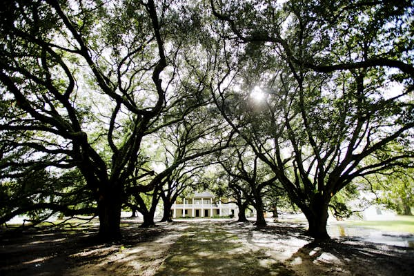
4. Encounter the sobering history of slavery at the Whitney Plantation

Travel time: 1 hour by car

A cluster of restored antebellum mansions sits roughly 50 miles west of New Orleans, with the Whitney Plantation being the most interesting of the bunch to visit. While most plantation sites now at least pay lip service to the history of slavery, the Whitney is a museum dedicated to confronting and unpacking the grim institution head-on. Through a series of thoughtful exhibits, the Whitney demonstrates how the South did not just benefit from but was built upon chattel slavery.

How to get to the Whitney Plantation from New Orleans: Take I-10 west for about 40 miles, then detour south on LA-641 for another 10 miles.

5. See small-town Louisiana in St Francisville

Travel time: 2 hours by car

When the furnace of New Orleans gets too hot, head north about 120 miles to St Francisville, a tiny, tidy bohemian retreat set amid hills and forests. A glut of historical buildings, cute cafes, antique vendors, artsy stores and hiking trails through the woods makes for a perfect break from New Orleans.

How to get to St Francisville from New Orleans: Take I-10 west toward Baton Rouge, getting off at exit 8C and onto I-110 north. From there, take US-61 north to St Francisville.

LSU Tigers head coach Ed Orgeron leads his team onto the football field before a LSU game; day trips New Orleans
Get a real slice of Louisiana sports culture by heading to an LSU football game. Icon Sportswire/Getty Images

6. Experience the spectacle of sporty Baton Rouge

Travel time: 1 hour 30 minutes by car

A lot of New Orleanians blow off Baton Rouge (named for a red stick used as a geographic marker by local Native Americans) as the state’s gray, faceless capital. Yet it’s also a sprawling town with some decent attractions worth checking out. In particular, football games at LSU are a non-stop display of pageantry and spectacle. Game days serve up the football-mad culture of the American South at its liveliest, where team loyalty is tribal, and tailgating is a form of art. For a quieter experience, the Rural Life Museum offers a window onto the state’s past.

How to get to Baton Rouge from New Orleans: The “BR” is an easy 80-mile drive northwest of New Orleans via I-10.

7. Head up to the sleepy (and a little weird) North Shore

Travel time: 1 hour by car

The north shore of Lake Pontchartrain is made up of several bedroom suburbs of New Orleans and radiates a sedate vibe. Make the drive to sample some brews at the Abita Brewery or explore the surreal madness of the Abita Mystery House, one of the state’s great roadside attractions. Need a place to stay? Cabins at Fontainebleau State Park are raised on stilts over Lake Pontchartrain, making for a supremely relaxing, breezy escape.

How to get to the North Shore from New Orleans: To cross Lake Pontchartrain, take I-10 west and exit to cross the Pontchartrain Causeway, one of the longest bridges in the world.

A colorful sunset featuring the Lake Pontchartrain Causeway in Louisiana.
Driving the Lake Pontchartrain Causeway in Louisiana makes for a beautiful road trip. Ty Alexander Photography/Getty Images

8. Smell the flowers and taste the hot sauce in New Iberia

Travel time: 2 hours 30 minutes by car

The hazy, humid town of New Iberia sits about 140 miles west of New Orleans. On its sleepy main streets, you’ll find the well-preserved plantation Shadows on the Teche. Just outside of town is the area’s main attraction: Avery Island (though you’ll have difficulty finding the waterways that make it one), home of a huge salt mine and the headquarters of iconic hot sauce maker Tabasco. If you like heat, take a tour of the Tabasco Factory, then amuse yourself afterward by exploring the nearby Jungle Gardens, a sort of botanical retreat, wildlife preserve, aviary and a slice of historical trivia all in one.

How to get to New Iberia from New Orleans: US-90 West gets you almost the whole way to New Iberia, with plenty of low-lying Louisiana farmland along the way.

9. Paddle Louisiana’s swamps

Travel time: meet in New Orleans; the swamp is about 45 minutes away

While it’s great fun to tread a boardwalk at Barataria or watch an old fisherman point out gators on a motorized boat tour, there’s something utterly otherworldly about paddling the Louisiana swamps. This strange, primal and beautiful experience immerses you in the wildness of the bayou, making you aware that you are but a visitor to this ecosystem – or a fish out of water, if you will (or at least a human gliding across it).

Louisiana Lost Land Tours are led by local environmental experts who give participants an excellent kayaking experience, as well as a solid introduction to the unique environmental issues confronting south Louisiana.

How to get to the Louisiana swamps from New Orleans: Lost Lands will help you coordinate the launching point for your swamp adventure.

The 15 best places to visit in Mexico

Cantinas and cathedrals. Art and archaeology. Mariachis and mountains. Ruins and rainbow reefs. Mexico makes a mesmerizing escape for lovers of adventure, romance, history, culture, food, and fiery festivals.

Then there are the much-lauded beaches with clear, blue waters you’ll want to step right into and silent paradise islands without a soul in sight. From the deep canyons of Chihuahua to the peaks of Veracruz, these are the best places to visit in Mexico.

1. Mexico City

Best place for art and vibrant culture

Wondering where to go for your first trip to Mexico? Start in the bustling capital that brims with skyscrapers, markets, gardens and parks, awe-inspiring museums and more than 22 million residents.

Top Mexico City sights include “Casa Azul,” better known as Museo Frida Kahlo, where the celebrated artist lived and died.

For artsy folks, Mexico City is where many of the country’s top muralists left behind their most important works. Peruse Diego Rivera’s cinematic murals in the Palacio Nacional and the social-realism work of José Clemente Orozco in the Palacio de Bellas Artes.

For a taste of culture, float along the ancient canals of Xochimilco with a mariachi band serenade, or savor piping-hot tacos from the many street-food stalls in the downtown areas before catching a show at one of the city’s 160-odd theaters.

High-spirited high jinks and chihuahua-sized micheladas are on offer when catching a lucha libre (Mexican wrestling) match at the sprawling Arena México. You might be lost for words, but you’ll never be short of things to do in Mexico City.

Planning tip: Couple your Mexico City stay with a trip to see the pyramids at Teotihuacán. This archaeological site is located 50km (31 miles) northeast of Mexico City, and it was one of the largest in the Americas in the pre-Columbian era. Visit during the vernal equinox to celebrate spring.

2. Isla Holbox

Best island for bioluminescence and flamingos

For its size, Isla Holbox packs a strong biodiversity punch. Only a mile wide and 26 miles long, this is one of the best places to visit in Mexico to see bubblegum-pink flamingos in the wild (head to Punta Mosquito), catch a glimpse of whale sharks (between mid-May and mid-September), and witness the mesmerizing show of bioluminescent phytoplankton glimmering in the water.

Comparable to sparkling underwater fireworks, these glowing micro-organisms are best seen on moonless nights.

Holbox (pronounced hol-bosh) is a laid-back dream of an island off the northern coast of the Yucatán Peninsula.

With no vehicles to disturb the peace (cars are banned), sandy streets lead to endless beaches with warm, inviting water that’s waist-deep at most for adults. The island’s one alleged drawback? Unreliable wi-fi (which encourages travelers to disconnect).

Woman admiring the parish church in San Miguel de Allende, Mexico
Wander the colorful streets of artistic haven San Miguel de Allende. Marco Bottigelli/Getty Images

3. San Miguel de Allende

Best place for craft shops and folk art

This Mexican beauty has it all: a fantastic spring-like climate, extraordinary light, breathtaking architecture, superb handicraft shopping, and well-attended art workshops. With a high gallery-to-resident ratio, San Miguel de Allende is one of the best places for creative types to visit in Mexico.

The cobbled city has been luring retirees and bewitching artists since the first art institute opened in a former convent back in the 1930s.

It then enticed Jack Kerouac, Allen Ginsberg, and Neal Cassady, who came to drink, write and read poetry in the 1960s (the latter stayed there until his death).

Today, San Miguel de Allende’s narrow, sloped streets house boutiques and cafes that dangle multicolored ribbons from wrought iron window bars, and its vibe is akin to a sepia-toned postcard from the past.

Buildings in the historic district adhere to a color code of saffron, rusty orange, ochre, terracotta, and mustard yellow. Grab a birdseye view of them from one of the city’s numerous rooftops, like Luna Rooftop Tapas Bar at Rosewood San Miguel de Allende, a firm favorite.

Planning tip: San Miguel de Allende is a three-hour drive north of Mexico City in the state of Guanajuato. Visit in spring to see the purple jacaranda trees in full bloom.

4. Bacalar

Best place for lagoon living and Maldives vibes

Everything about Bacalar is magical. Not only was it recognized by the Mexican government as a Magic Town (Pueblo Mágico) in 2006, but it’s also known for its ethereal jewel-toned lagoon, serene spas offering Mexican healing rituals and a distinct bohemian vibe.

Diners enjoy live music sessions beside bright indoor murals at tropical restaurant-meets-gallery El Manati, and wellness-minded travelers experience temazcal sweat ceremonies and copal cleansings at Casa Hormiga boutique hotel.

The prized activities in Bacalar are kayaking, paddleboarding and boating on the 26-mile Bacalar Lagoon, which is known as the Lagoon of Seven Colors (Laguna de Los Siete Colores) due to its mesmerizing gradient of blues and greens.

The town also has a 90m-deep (295ft) cenote (freshwater pool) and an old Spanish fortress. Nicknamed “the Maldives of Mexico,” unhurried Bacalar is one of the best places to visit in Mexico to get away from it all.

Planning tip: Bacalar is in the state of Quintana Roo, close to Mexico’s border with Belize. To get there using public transportation, take the ADO bus from Cancún, Playa del Carmen or Tulum.

Jimador or Mexican farmer, skilled at harvesting agave for tequila on an gave plantation, Tequila, Jalisco, Mexico. Heavy, manual work, chopping the leaves from the body of the plant.
Find out about harvesting agave for tequila on an agave plantation in Jalisco. Getty Images

5. Guadalajara

Best city for mariachi music, tequila and fine dining

Guadalajara, Mexico’s second-largest city, is a dynamic cultural hub in the state of Jalisco. This is the tequila-producing region where Mariachi music was born, as well as charrería, Mexico’s national sport (don’t miss September’s annual International Mariachi and Charrería Festival).

Must-sees in Guadalajara include a lienzo (a charrería arena), the vivid frescoes of the Instituto Cultural de Cabaña – a testament to the genius of one-handed muralist José Clemente Orozco – and the three-story Mercado San Juan de Dios, Latin America’s largest indoor market.

Despite being deeply rooted in tradition, Guadalajara has recently gained recognition for its modern gastronomic excellence with multiple appearances on the coveted World’s 50 Best lists.

Delight in upscale, globalized Mexican cuisine and cocktails at Alcalde and El Gallo Altanero.

Planning tip: Guadalajara’s allure extends beyond its city limits. Use it as your gateway to Lake Chapala (one of the largest freshwater lakes in the country), the agave-clad fields of Tequila, or other charming Magic Towns like Tlaquepaque or Tapalpa.

6. Puerto Vallarta

Best place for sand, adventure and LGBTIQ+ events

With climactic and wild scenery, Puerto Vallarta is a popular vacation destination for Mexicans and foreign travelers alike. Framed by the Sierra Madre Mountains and the Bahía de Banderas (Bay of Banderas), it’s a place where thrill seekers conquer rugged terrain and rappel down waterfalls, and families frolic on sun-kissed beaches – Playa Conchas Chinas, Playa Las Gemelas and Playa Mismaloya are noteworthy sandy spots.

The city is also popular among LGBTIQ+ travelers; there are gay-friendly Puerto Vallarta hotels, beach bars, restaurants, and nightlife establishments.

Lovers take to the Zona Romantica (Romanic Zone) for alfresco meals, and strolling along the picturesque Malecon boardwalk, with its numerous bronze sculptures and street performers, is one of the best free things to do in Puerto Vallarta.

There’s also plenty going on in the ocean, where you can see humpback whales breaching on the horizon, pods of dolphins rising from the waves, and mother turtles arriving to lay their eggs.

Planning tip: The best time to visit Puerto Vallarta to witness a baby turtle release is between July and December. Selected hotels like Marriott Puerto Vallarta Resort & Spa host newborn turtle release ceremonies.

7. Playa del Carmen

Best place for beach-meets-city vibes

Playa del Carmen is the best of both worlds: a thriving city with a bounty of enticing restaurants and pinch-me-please white-sand beaches (one is even connected to a cenote).

The palm-lined Quinta Avenida is the city’s bustling artery with an eclectic mix of shops, lively street performances, and gourmand-pleasing international eateries.

In this versatile beach destination, families build sandcastles alongside digital nomads and solo travelers seeking spirited adventures, while night owls congregate around Calle 12 (12th St) for throbbing nights at Mandala, La Vaquita and Coco Bongo.

Another Playa del Carmen accolade is the variety of rooftop bars, from the sleek UMI Rooftop and Tokyo Kitchen to the laid-back BeRoof.

From Playa (as locals call it), day trips to Riviera Maya towns like Akumal (known for turtle encounters) are all within easy reach using colectivos (minivans). There is also a direct ferry to Cozumel with Winjet or Ultramar.

Temple of a thousand warriors at Chichen Itza.
There is more to Chichén Itzá than El Castillo pyramid: explore it all at your leisure. Sorin Colac/Alamy Stock Photo

8. Chichén Itzá

Best place to see pre-Columbian architecture

If you’ve always wanted to see one of the New Seven Wonders of the World, Chichén Itzá is one of the best places to go in Mexico. With origins dating back to the 5th century, this is undoubtedly the most popular of Mexico’s ancient sights.

From the imposing, monolithic El Castillo pyramid (where the shadow of the plumed serpent god Kukulcán creeps down the staircase during the spring and autumn equinoxes) to the Sacred Cenote and curiously designed El Caracol observatory, Chichén Itzá is spectacular.

Planning tip: Book a Chichén Itzá tour with an English-speaking guide to learn about the mind-blowing legacy of Maya astronomers. Note that the heat, humidity and crowds in Chichén Itzá can be fierce, so try to explore the site either early in the morning or late in the afternoon, though keep in mind that the 5pm closing is a hard exit. There is also a post-sunset sound-and-light show.

9. Zihuatanejo

Best place for an Old-Mexico feel

Zihuatanejo benefited from the fortunes of neighboring resort town Ixtapa, which Mexico’s tourism body carefully developed in the 1970s. This was a direct attempt to replicate the Caribbean splendor of Cancún on the Pacific coast.

Ixtapa’s hotspot status trickled 6.5km (4 miles) south to Zihuatanejo, which feels like a sleepy fishing village elevated by a handful of relaxed seaside sanctuaries like Thompson Zihuatanejo on Playa La Ropa.

In this blissed-out traditional Guerrero town, there are storied, curiously named beaches that are great for surfing, diving, fishing and seafood-feasting in the presence of crashing waves.

Take a walk on Playa Las Gatas (Cat Beach), reportedly named after land wildcats or the whiskered nurse sharks in Zihua’s waters, or make a dash for the aforementioned Playa La Ropa (Clothes Beach), the town’s most popular beach, which incorporates a legend of a Spanish shore wreckage containing washed silk clothes.

Paddle boarding (SUP) off the island of Espiritu Santo, a Unesco Biosphere Reserve in the Gulf of California, Mexico.
Paddleboarding off the UNESCO-listed Espíritu Santo island in the Gulf of California. Justin Foulkes for Lonely Planet

10. La Paz

Best place for quiet beaches

La Paz, the capital of Baja California Sur, has something for every kind of beach lover. The city is a delightful springboard to adventures on the Sea of Cortez, home to 39% of the world’s marine mammals.

Around 40 minutes from La Paz, Playa El Saltito feels tranquil and isolated during the sweltering days, and its crystal waters come alive with bioluminescence at night. Though competition is tough, Playa Balandra, with its unique mushroom-like rock formation, is heralded as one of Mexico’s most beautiful beaches.

The impossible-to-miss destination in the region is the UNESCO-listed Espíritu Santo island, where you can camp under a canopy of stunning stars, snorkel with playful sea lions and even peek at congresses of clumsy blue-footed boobies. A number of operators run activities here, including kayaking and snorkeling.

11. Tulum

Best place for wellness and boho vibes

Over the years, Tulum shed its former name (Zama), and its position as a secluded and sleepy beach-meets-jungle town in Riviera Maya and subsequently ripened into a world-famous pilgrimage for honeymooners, hedonists and holistic tourists.

The spirituality-focused traveler will find a host of things to do in Tulum ranging from cacao ceremonies to pre-Hispanic sound healing and open-air rooftop yoga classes.

Tulum is a well-rounded destination with scrumptious restaurants and bars, and accommodations for all budgets, from waterfront shacks to top-end resorts and thatch-roofed boutique boltholes like La Valise Tulum.

The beaches are postcard-ready, the most celebrated stretch being Playa Ruinas with its strikingly well-preserved Maya ruins perched on a cliff overlooking the Caribbean Sea.

There are also numerous attractions in the surrounding area, such as the massive Reserva de la Biosfera Sian Ka’an, the secluded fishing village Punta Allen and the ruins of Cobá.

Planning tip: Tulum Pueblo (the town center) is where the really cheap eats and sleeps are found, but it’s a 20-minute bike ride or 12-minute taxi to the beach. Plan ahead to find well-priced beach accommodations if that’s where you’d prefer to stay.

Cabo San Lucas, Mexico. The marina bay.
marina, Mexico, Cabo San Lucas, Los Cabos, boats
Soak up the glamor of Cabo San Lucas marina or head out on a deep-sea fishing trip. Shutterstock

12. Los Cabos

Best place for glitz, glamor and parties

Sister cities Cabo San Lucas and San José del Cabo need no introduction. The former is notorious among party-hearty North American crowds, while the latter is more sedate with art galleries, celebrity-frequented luxury resorts, upscale boutiques and over-the-top decadent tequila tasting rooms.

Together, these perennially sunny spots on the southernmost tip of the Baja California Sur peninsula have become two of the top places to see in Mexico.

Under the blazing Cabo sun, golfers chase their dreams on emerald greens designed by legendary champion Jack Nicklaus, and surfers tackle world-class surf breaks.

Not many beaches are safe for swimming, but other outdoor pursuits like deep-sea fishing, spotting sea lions and whale watching (from mid-December to mid-April) keep water babies coming back.

13. Pico de Orizaba

Best place for a superlative trek

Pico de Orizaba is a symmetrical, snow-capped volcano on the border of Puebla and Veracruz states. Also called Citlaltépetl, it’s the highest peak in Mexico and the third-highest mountain in North America, with a summit elevation of around 5636m (18,491ft) above sea level.

Dormant but not extinct, the last recorded eruption was in 1846, and it is one of the most popular places to visit in Mexico for serious climbers – professionals prep there before taking on Mount Everest.

Treks start from the small village of Tlachichuca, and the ascent requires some technical skills – Pico de Orizaba is the ultimate trekking and climbing challenge in Mexico.

If sea-level thrills are more to your liking, there’s plenty on offer in the town of Orizaba, including a beautiful riverside walk, a couple of impressive museums and galleries and a unique “Iron Palace.”

The perfect introduction to Veracruz state’s most appealing town is to hop into the cable car up to the park atop 1240m (4068ft) Cerro del Borrego.

From this lofty, green perch, you can admire the domes and bell towers of the city’s many historic churches and the surrounding mountainous terrain, including the snowcapped summit of Pico de Orizaba.

View of the side of train carriages winding their way along the Copper Canyon Railway
An eastbound Mexican passenger train winds its way up the Copper Canyon. Bruce Raynor/Shutterstock
​​​​

14. Copper Canyon Railway

Best for a train ride

The Ferrocarril Chihuahua Pacífico (Copper Canyon Railway) remains one of Latin America’s best rail trips. Also known as the Chepe Express (from the “Ch” of Chihuahua and “P” of Pacífico), trains climb from sea level at Los Mochis to the town of Creel via the sensational rocky landscapes of the rust-hued Copper Canyon (the “Grand Canyon of Mexico”).

Vistas from your window during the train journey include alpine forests, subtropical valleys, Tarahumara villages and glimpses of some of the world’s deepest canyons.

Overnight en route at cinematic lodges overlooking the canyon’s edge, or stay for days of exploring, hiking, horseback riding and even zip-lining in one of the best places to see in Mexico.

Woman selling Oaxacan deserts from food cart.
Woman selling deserts from food cart in Oaxaca. Justin Foulkes for Lonely Planet

15. Oaxaca City

Best place for mezcal and cultural celebrations

Once the capital of the Zapotec Civilization, the state of Oaxaca is now better known as Mexico’s primary mezcal-producing region.

Fine mezcals distilled around the state make their way to low-lit, atmospheric establishments in Oaxaca City like La Popular, El Destilado and La Mezcalerita, and savvy locals guide thirsty patrons on popular tours to experience the city one smoky sip at a time (check out Mezcouting and Oaxacking).

The frequent colorful fiestas in Oaxaca City also win smiles from cultural travelers. The city’s population swells at the start of November during Día de los Muertos (Day of the Dead) festivities, when Mexican families honor and celebrate their lost loves with round-the-clock vigils, joyful offerings, and parades.

One of the most unique things to see in Oaxaca City is the merrymaking during Noche de Rábanos (Night of the Radishes) on December 23.

During this competition dating back to 1897, the young and old carve radishes into scenes that are displayed in Zócalo to much fanfare.

Planning tip: Venture two hours outside of Oaxaca City to reach Hierve el Agua, a jaw-dropping petrified waterfall-like formation. You can take a bus, rent a car or hire a driver to take you to these mineral-rich infinity pools.

The 6 best hikes in Jamaica for tropical adventurers

The attractions of Jamaica are easy to sell to travelers. Crystal blue waters, soft sand and a little reggae to go with your rum cocktail as the sun dips on another perfect Caribbean day.

However, venture beyond the beaches and lush banana groves and you’ll discover a side of the country that most visitors don’t see – a hiker’s paradise where incredible trails zigzag through jungles and scramble over mountain ridges, and where rushing waterfalls seem to erupt out of nowhere.

If you’re hitting the trails in the interior, it pays to hire a local guide. Trails (tracks in Jamaica) are often unmarked and overgrown, and advice from locals that your destination is “just a little way” may in fact mean several hours of walking. Here’s a guide to our favorite trails in Jamaica.

YouTube video player

1. Oatley Mountain Trail

Best day hike

2.4km (1.4 miles) round trip, 90 minutes, easy

Run by the Jamaica Conservation & Development Trust, the Holywell Recreation Area in the Blue Mountains above Kingston is the entry point for the beautiful Hardwar Gap.

Here you’ll find 120 hectares of lush Jamaican woodland, with dozens of fern species, epiphytes, flowers and wild strawberries and raspberries.

The mist-shrouded, uppermost slopes are densely covered with rare primary montane forest, dominated by pine trees, and the birdwatching is fabulous.

Well-maintained, easy hiking trails lead off in all directions through the ferny dells, cloud forest and elfin woodland. The 2.4km Oatley Mountain Trail is the best walk, and it leads to a river that’s good for bathing.

Guides aren’t necessary for this hike but they can be great sources of information about the region’s flora and birds – arrange one at the staffed ranger station, just beyond the entrance. After the hike, refresh yourself at Cafe Blue near Irish Town, a short drive downhill from Holywell.

View over the Blue Mountains in Jamaica
The Blue Mountains offer up some of Jamaica’s most dramatic scenery. David Neil Madden/Getty Images

2. Blue Mountain Peak

Best hike in Jamaica

12km (7.4 miles) round trip, 5 hours, moderate

More than two dozen walking trails cross Jamaica’s Blue Mountains, but the hike to the summit of 2256m (7402ft) Blue Mountain Peak to watch the sun rise over the island’s capital, Kingston, is undoubtedly the best in the country.

Visit Casa di Giulietta (Juliet’s House) to see the famous balcony and learn about Verona’s Shakespearean legacy.

The hike starts from the village of Penlyne Castle, and many people spend the night here and set off in the dark before dawn to reach the peak in time for sunrise. One of the most popular accommodations, Whitfield Hall was damaged by fire in July 2022, but is already rebuilding and welcoming guests once again (at a limited capacity).

The first part of the trail – a series of steep switchbacks known as Jacob’s Ladder – is the toughest section, leading to a ranger station where you pay the US$5 park entry fee.

As you climb, the vegetation becomes less tropical, until you’re hiking amid stunted trees draped with old man’s beard (lichen) and giant ferns.

In the predawn cold at the summit, the first rays of the sun wash over the densely forested mountain peaks and out to sea – on a clear day you can see as far as Cuba.

3. Cockpit Country

Best backcountry hike

20km (12.4 miles) round trip, 4–5 hours, moderate

Cockpit Country is Jamaica’s most rugged quarter, with jungle-clad hills intersected by deep and sheer valleys, producing a landscape that once gave shelter to people escaping slavery. Today, the area is rich in hiking opportunities.

The most popular hike is the walk along the abandoned B10 road from Kinloss (easily reached from Montego Bay) to Spring Garden, passing through Barbecue Bottom. Along the way, you’ll gain a real appreciation for Cockpit Country’s beautiful, honeycombed limestone cliffs and verdant valleys.

It’s a long hike, but with gentle inclines, so the route is accessible to any moderately fit hiker. There are beautiful views and shorter hikes along the route are also possible.

It’s essential to take a trusted guide; organize one through the Southern Trelawny Environmental Agency, (STEA) based in Rock Spring. The agency works with reputable local guides, simultaneously empowering local communities and giving visitors access to this little-explored corner of Jamaica.

Ocho Rios Jamaica the blue hole
1342082729
Named after the Bob Marley statue, the One Love Trail takes you to the popular falls at Ocho Rios. Getty Images

4. One Love Trail

Best family hike

4.7km (3.1 miles) round trip, 3 hours, easy

This hike, which is suitable for all ages and abilities, starts in an inauspicious spot – the Island Village shopping center near the cruise ship pier in Ocho Rios.

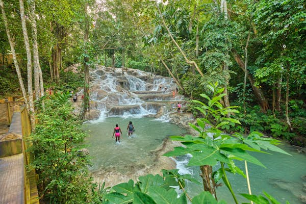
The track takes its name from the large statue of Bob Marley at its entrance, and the mostly level path follows the coastline, with several opportunities to dip down to the waves and paddle in a cove before you reach the point where a small waterfall tumbles into the sea.

This is the sign to turn inland and cross the main road to follow a forested path up to massively popular Dunns River Falls, which you can climb, passing through the cascading water.

This walk can get busy, so we recommend enjoying it on a day when there are no cruise ships docked at Ocho Rios. Head out in the morning before the tourist buses arrive from Montego Bay so you can enjoy having Dunn’s River Falls almost to yourself.

5. Troy–Windsor Trail

Best challenging hike

16km (9.9 miles), 6–10 hours, difficult

For the serious hiker, the old Troy-Windsor Trail is one of the most rewarding hikes in the Caribbean.

Heavy tree cover and steep-sided hills block any expansive views, but the jagged, jungly limestone scenery is never less than enthralling, especially if you hike accompanied by a guide who can recount the history of the region’s slavery days and guerrilla warfare by Maroons (escaped enslaved people).

Look out for the stone walls of the old road, which can be seen along much of the route. The trail is easier to walk from south to north, starting from Troy, but a guide is essential. Do not under any circumstances attempt this hike without one.

Either go with Martell ‘Malibu’ Taylor or Miss Claudine – both live in Sherwood Content – or hire a guide with a machete from the Jamaican Caves Organisation. Take lots of water (a minimum of six liters per person) and food, a flashlight, and plenty of insect repellent – the mosquitoes here are brutal.

Mayfield Falls River Hike
The pummeling power of Mayfield Falls more than justifies the hike out here. Michael Kucsmas/Shutterstock

6. Mayfield Falls River Hike

Best waterfall hike

2km (1.3 miles), 1 hour, easy

Plenty of hikes in Jamaica will have you jumping over streams in places, but the point of the walk to Mayfield Falls is to literally follow a river by wading through it until you reach your destination.

Picture this: you climb into the cool river beneath giant thickets of bamboo and scramble upstream for around 45 minutes, then swim through an underwater tunnel, jump into deep pools and sit bubbling in the froth of a natural Jacuzzi, letting the “washing machine” falls pound your shoulders. There’s no better way to cool off after a walk.

The hike is easily accessible by road from Negril, and the area around the falls has been sensitively developed, with a changing area, water-shoe rental and a restaurant.

Tips for hiking in Jamacia

It’s best to hike from January to April, when the weather is drier and less prone to storms. Wherever your walk carries you, be sure to stay on established trails.

The mountainous terrain in Jamaica is too treacherous to go wandering off the track, with thick vegetation hiding sinkholes and crevasses. Natural habitats are quickly eroded too, and animals and plants are disturbed by walkers who stray from the path.

If a trail is difficult to follow, turn back. Mountain rescues take time in Jamaica and you could be lost for days. If you’re heading into the backcountry, don’t forget to pack the following items:

  • hiking boots

  • mosquito netting

  • bug spray

  • snacks

  • sunblock

  • a flashlight (torch)

  • plenty of drinking water

The 15 best day trips from Pittsburgh

An old joke goes that Pittsburgh is the “Galapagos of Pennsylvania.” The city doesn’t neighbor any other metro areas. Most travelers arrive by plane, or at the end of a very long drive. Even the Pittsburgh dialect is like no other language on Earth. (“Yinz,” anyone?)

When it comes to a long weekend in Pittsburgh, Pennsylvania, there’s actually a lot to see in Western Pennsylvania, from charming rural communities to expansive natural spaces. The counties that neighbor Pittsburgh are rich in rivers, forests and small towns, which are easy to miss while barreling down the Pennsylvania Turnpike.

Hikers and anglers love to lose themselves in these valleys, and history buffs find plenty to love at local museums. The best time to visit Pittsburgh and neighboring communities is during the warmth of summer and during the dry fall months. There are many ways to get around Pittsburgh, but you’ll often need a car. These attractions are all located within a two-hour drive of Downtown Pittsburgh, and visiting can easily be a spur-of-the-moment decision or planned out days in advance.

People in three rafts paddle in the white-water rapids along the Youghiogheny River in Pennsylvania’s Ohiopyle State Park
Camping, hiking and white-water rafting are among the summer pleasures at Ohiopyle State Park. Shutterstock

1. Get soaked in Ohiopyle State Park

Travel time: 75 minutes each way

Situated around the frothing Youghiogheny River, Ohiopyle is the region’s go-to summer playground. It would be easy to spend a solid week camping, hiking and white-water rafting through this 20,500-acre expanse. If you’re visiting for just a day, numerous shorter paths run through Ohiopyle; you’ll also find the trailhead for the 70-mile Laurel Highlands Hiking Trail. The park has several campgrounds with a variety of accommodations, from tent sites and pavilions to cottages and yurts. Visit the Pennsylvania State Parks website to reserve a spot.

For river-runners, “the Yough” has three sections, the Upper, Middle and Lower, which vary in difficulty from Class I to Class V rapids. If you’re a novice (or didn’t pack the kayak), you can book an excursion with any of several licensed operators, such as Laurel Highlands River Tours and White Water Adventurers.

How to get there from Pittsburgh: The drive takes about 75 minutes from Pittsburgh along I-76 East. Take Exit 91 for PA-381 S.

2. Explore the depths of the Laurel Caverns

Travel time: 90 minutes each way

The tunnels that make up the Laurel Caverns burrow underground for four miles, and these interconnected chambers have fascinated the public since the late 18th century. Unlike many subterranean sites, this cave system will appeal to many types of visitors, and families and amateur geologists will enjoy a guided tour on level floors through well-lit passages. If you’re not feeling social – or are short on time – take a self-guided tour over 100 steps and 800ft of tunnels. Feeling intrepid? The “Adventure Caving” option is a full-on spelunking session designed for all skill levels.

How to get there from Pittsburgh: The drive takes about 90 minutes. Take 51S about 53 miles to Uniontown, then Skyline Dr the remaining 6 miles.

Landscape of a bike parked near a warning sign at the approach to a tunnel on the Great Allegheny Passage recreational trail, Pennsylvania
A delight for cyclists, the Great Allegheny Passage follows onetime railway lines for some 150 miles. Dave Jonasen/Shutterstock

3. Pedal down the Great Allegheny Passage

Travel time: varies depending on your starting point

For cyclists, the Great Allegheny Passage is the pinnacle of bike paths, running 150 miles from Pittsburgh to Cumberland, Maryland. The car-free route is composed mostly of crushed limestone and follows former (and some current!) railroad rights of way through scenic river valleys and old mill towns. If you’re feeling ambitious, you can continue on the C&O Canal Towpath, which takes cyclists from Cumberland all the way to Washington, DC.

There’s no need to traverse the entire GAP, though. Any given segment is worth a walk, jog or ski, with each mile bringing its share of gorgeous woodland – plus a good chance of crossing one of 19 historic bridges.

How to get there from Pittsburgh: This trail technically starts in Pittsburgh with the Southside Riverfront Park and Trail; the GAP then intersects with dozens of trailheads throughout Southwestern Pennsylvania.

4. Discover a lost community at Old Economy Village

Travel time: 30 minutes each way

Butler County, just 30 minutes north of Pittsburgh, offers distinctive German character and attractions. For about 100 years, the German-settled Harmony Society maintained a utopian community in rural Pennsylvania. Its legacy is Old Economy Village, a settlement of 17 brick buildings that still stand near the banks of the Ohio River. True to its industrious name, the village’s residents once produced textiles, lumber and spirits.

Visitors can see how this Christian sect lived from 1824 to 1906, thanks to immaculately preserved homes and workshops. Tour the Harmony Museum for more insight.

How to get there from Pittsburgh: The drive takes about 30 minutes. From downtown Pittsburgh, take Route 65 N (also known as Ohio River Blvd) 20 miles to the town of Ambridge.

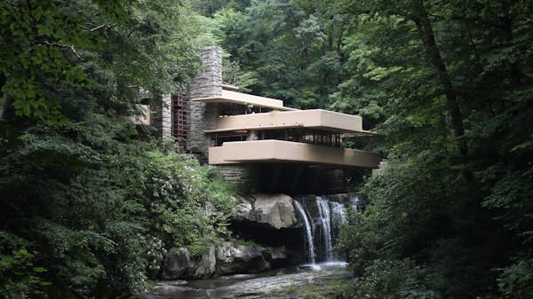
Fallingwater, Frank Lloyd Wright's masterpiece, is a stunning example of organic architecture
Fallingwater is magnificent in all seasons. Taras Vovchuk/Shutterstock

5. Admire the scenery at Fallingwater

Travel time: 70 minutes each way

Of the 532 buildings Frank Lloyd Wright designed, Fallingwater might be the most celebrated. This Modernist masterpiece combines angular concrete walls, sandstone masonry and lush forest, as the eponymous waterfall cascades beneath its cantilevered terraces. The property hosts a range of guided tours, which relate the history and groundbreaking design of the house (built as a retreat for the Kaufmann family, well-known department-store magnates in Pittsburgh). This remote architectural marvel is well with the trip.

How to get there from Pittsburgh: A car is the best way to reach Fallingwater. From Pittsburgh, it’s a 70-minute drive east on the Pennsylvania Turnpike (I-76). Take Exit 91 for PA-381 S.

6. Hop a ride at the Pennsylvania Trolley Museum

Travel time: 30 minutes each way

Pittsburgh was once famous for its trolley system, and the quaint old streetcars even inspired the “Trolley” character from Mister Rogers’ Neighborhood (which was produced in Pittsburgh, Fred Rogers’ hometown). Port Authority buses have long replaced rails and cables, but you can get a taste of what once was at the Pennsylvania Trolley Museum, a sprawling interactive exhibit on the edge of Chartiers Township.

The museum was founded in 1954, and its collection of cars has since expanded from three to 52, encompassing trolley designs from around the world. Guided tours recount the history of mass transit; visitors can also explore on their own and step aboard the vintage cars. Many of the trolleys are still operational and take spins around the property.

While you’re out there, stop into Washington, a sizable college town with a vibrant dining scene.

How to get there from Pittsburgh: The drive along 79 S takes about 30 minutes until you reach Exit 40.

An aerial view of skiers on a cloudy day at Seven Springs Resort, Pennsylvania
At Seven Springs, skiers can explore 33 different runs. CMS Photography/Shutterstock

7. Conquer the slopes at Seven Springs Resort

Travel time: 1 hour each way

The highest elevation at Seven Springs might be a humble 2994ft. Yet the largest ski resort in Western Pennsylvania resort puts these slopes to good use, with skiers and snowboarders able to pick from 33 trails across 285 acres. No fewer than 10 lifts carry visitors to the summits, with a third of the runs designated black diamond.

Seven Springs has drawn skiers to the Laurel Highlands since it opened in 1937. And the on-site golf course, alpine slides and climbing walls have turned the complex into a four-season destination. Replenish calories at any of 14 restaurants, including the beloved Foggy Goggle pub.

If you’re looking for something slightly more intimate, check out Seven Springs’ sister resort Hidden Valley, located just 20 minutes away.

How to get there from Pittsburgh: The drive takes about 1 hour. Follow 1-76E to Donegal Township and take Exit 9. Take County Line Rd the remaining 10 miles.

8. Trailblaze through Western Pennsylvania’s state parks

Travel time: 45 to 55 minutes each way, depending on the park

For nature lovers looking for a scenic escape, Racoon Creek State Park, Moraine State Park and McConnells Mill State Park offer ample hiking and water sports like kayaking, each within a short drive from Pittsburgh. 

Raccoon Creek State Park spans 7,500 acres and has 44 miles of trails winding through rolling hills, woodlands and valleys. Its lake is ideal for visitors who love to kayak, swim and fish.

Just a short drive north, Moraine State Park has another 42 miles of scenic trails that take visitors through lush forests and along the shores of Lake Arthur. This 3225-acre lake is a hub for water activities, including sailing, paddleboarding and fishing.

For a more rugged adventure, nearby McConnells Mill State Park features deep gorges, dramatic landscapes and the scenic Slippery Rock Creek, which once powered the McConnells grist mill. Today, the mill offers demonstrations on how grain is ground using water-powered turbines.

Each park provides a balance of tranquility and recreation without venturing too far from the city.

How to get there from Pittsburgh: The drive to Racoon Creek State Park is 45 minutes west on US22 W, while Moraine State Park is 45 minutes north on I79. For McConnells Mill, it’ll take another 10 minutes via exit 99 for US422 W. Continue toward Butler/New Castle for approximately 7 miles to the park exit.

9. Brave the Kinzua Bridge Skywalk

Travel time: Two hours each way

For an unforgettable experience high above the trees, albeit one of the longer day trips, head to the Kinzua Bridge Skywalk in the vast Allegheny National Forest. 

Once the world’s longest and tallest railroad bridge, the Kinzua Bridge was partially destroyed by a tornado in 2003. Today, the remaining structure has been transformed into the Kinzua Bridge Skywalk, giving visitors a chance to walk 624 feet out over the forest. The skywalk features a glass observation deck at the end, providing breathtaking views of the Kinzua Gorge. 

In addition to the skywalk, Allegheny National Forest, which spans over half a million acres, has over 600 miles of hiking trails.

How to get there from Pittsburgh: The drive along I79 N to US6 W takes about 2 hours, but bus tours take guests on roundtrip drives from Pittsburgh to the Allegheny National Forest.

10. Roam the riverside retreat of Wheeling 

Travel time: One hour each way

Located an hour southwest of Pittsburgh, Wheeling, West Virginia, is a charming town on the banks of the Ohio River. 

Wheeling’s historic downtown is home to the Wheeling Suspension Bridge, a National Historic Landmark that was the longest suspension bridge in the world when constructed in 1849, at 1010 feet. For history buffs, the West Virginia Independence Hall provides a look at how the state was formed during the Civil War. At the nearby 1700-acre Oglebay Resort, visitors can stroll the resort’s manicured gardens and hiking trails.

How to get there from Pittsburgh: The drive along I79 S to 170 W takes about an hour.

11. Soak up the sun at Lake Erie’s beaches

Travel time: Two hours each way

One of the best things to do with kids is to travel to the Lake Erie region, which offers sandy shores and charming lakeside towns. While Presque Isle State Park in Pennsylvania is the most famous beach destination for Pittsburghers, there are several other spots along Lake Erie worth exploring.

Head across the border to Ohio and visit Conneaut Township Park, renowned for its quiet beaches, scenic boardwalk and orange-hued sunsets. Or, venture to Geneva-on-the-Lake to enjoy a classic resort town with a mix of beach activities, arcades and wineries. In Ashtabula, Walnut Beach Park is a great spot for families with a spacious beach, playgrounds and a fishing pier. After a swim, explore the historic Ashtabula Harbor, known for its lighthouses and charming cafes.

How to get there from Pittsburgh: The drive to the shores of Lake Erie and each beach takes about two hours along I79 N. Train travel is available, but it can double the travel time.

12. Go for a touchdown at the Pro Football Hall of Fame

Travel time: 1 hour and 30 minutes each way

Sports fans have plenty to enjoy in Pittsburgh, but when looking for a day trip, head to Canton, Ohio, home of the Pro Football Hall of Fame. Just 90 minutes from Pittsburgh, this institution celebrates the achievements of the National Football League and honors the legends who shaped the sport. The Hall of Fame features immersive exhibits, including the Hall of Fame Gallery, where busts of the greatest players, coaches and contributors are enshrined. Visitors can explore interactive displays, watch historic game footage and admire memorabilia such as Super Bowl rings and iconic jerseys.

How to get there from Pittsburgh: This 90-minute drive follows I76 W toward Ohio. Greyhound, located in downtown, can also get you there in about 2 hours.

13. See remnants of American history at Fort McIntosh

Travel time: 40 minutes each way

Built in 1778 during the American Revolutionary War, Fort McIntosh in Beaver County was the first fort constructed by the Continental Army in the northwest territory. Once serving as the headquarters for the First American Regiment, the earliest version of the US Army, the fort’s remains sit along the banks of the Ohio River and feature informative historical markers detailing the fort’s significance. While much of the original fort has been lost to time, the site is an ideal day trip for anyone interested in early American history.

How to get there from Pittsburgh: Drive about 40 minutes on PA65 N to the town of Beaver and the fort. Buses are available from Liberty Street and will take 2 hours.

14. Admire Kentuck Knob’s architecture

Travel time: 1 hour and 10 minutes each way

You’ll find more architectural marvels at Kentuck Knob, another stunning home designed by Frank Lloyd Wright. Located in the Laurel Highlands and showcasing the architect’s organic signature style, Kentuck Knob blends seamlessly into the natural landscape with its sandstone walls, copper roof and cantilevered design that appears to float above the ground. Visitors can take a guided tour of the home, built in 1956, as well as its sculpture garden.

How to get there from Pittsburgh: Drive for about 70 minutes on PA381 S.

15. Search for black gold in Oil Creek State Park

Travel time: 1 hour and 45 minutes each way

As the site of the world’s first commercial oil well in the mid-1800s, visitors at Oil Creek State Park can learn about Pennsylvania’s rich oil heritage through interpretive signs and exhibits. The park features miles of hiking trails winding through forests and along Oil Creek, with waterfalls, wildlife and a 36-mile bike trail.

How to get there from Pittsburgh: Drive north on I79 for about 80 minutes and take exit 147B to merge onto US-322 W toward Meadville. You’ll then follow PA-27 E for about 20 to 25 minutes to reach the park. Buses can get you there too, in about three hours.

11 top day trips from Split to see more of Croatia

Alongside nearby Dubrovnik, Split draws travelers to the glittering Adriatic Coast of Croatia in droves, and the many attractions within the Roman city walls are just the start of the allure.  With idyllic islands scattered offshore and a hinterland studded with castles, medieval towns and national parks, this historic city is the perfect stop for those who like their city breaks with bonus day trips. 

After discovering all the must-see attractions in Split, you’ll be hungry for more. That’s why three to five days is an ideal time to spend in the city. With a few days to spare, you can find your own island in the sun, splash in thundering waterfalls in the hills, and discover medieval townships away from the (sometimes maddening) downtown crowds. Spring is the best time to visit this idyllic stretch of coastline before the summertime hordes arrive.

Most of the day trips from Split don’t require any special preparation. Pack light, have your camera ready and enjoy the dazzling Adriatic charms. Just don’t forget to always carry swimming attire – the local beaches are irresistible.   

Inexpensive car hire is available from local companies and there are excellent local bus services, so getting there and back at the end of the day is easy too. Here are our 11 favorite day trips from Split to explore more of the Adriatic Coast and see the best of Croatia. 

1. Find medieval magic in Trogir

Travel time: 40 minutes

Just along the coast from Unesco-listed Diocletian’s Palace in Split is another wonderful World Heritage wonder – historic Trogir, fêted for its extraordinarily well-preserved Romanesque and Renaissance architecture and unique and beautiful location. The old town sits on a small island, separated by narrow channels from the mainland on one side and from forested Čiovo Island on the other. It’s a charming jumble of imposing fortifications, leafy gardens and seafront promenades.

Trogir has a laid-back vibe, and is a lovely place to while away a few hours, either wandering through the narrow marble-paved streets or sitting in a seafront cafe watching the world go by. The town’s showpiece is St Lawrence’s Cathedral, which has some incredibly ornate and beautiful carvings around the door and inside the Chapel of St Ivan. The views from the tower are well worth the thigh-busting climb.

How to get to Trogir from Split: It takes about 40 minutes to drive west along the coast to Trogir from Split. There’s a direct intercity bus, or in summer you can catch the shuttle boat run by Bura Line.

The sun sets behind towering mountains, as the Cetina river flows through Omiš ©Andrey Omelyanchuk / 500px
The attractive old town in Omiš is surrounded by dramatic rocky outcrops © Andrey Omelyanchuk / 500px

2. Discover seafaring history in Omiš

Travel time: 30 minutes

The legendary pirates’ lair of Omiš has a dramatic location at the mouth of the Cetina river, where freshwater carves its way through a maze of towering limestone outcrops to reach the Adriatic sea. In the Middle Ages, pirates based here terrorized the surrounding coastal and island communities, using special ships known as sagittas, which had very shallow keels, allowing the pirates to withdraw beyond the underwater fortifications at the mouth of the river that kept larger ships out at sea.

The pirates constructed two medieval fortresses high above the town to protect it from attackers, and both can be visited for grand views over the town, if your legs can take the climb. It’s also well worth taking an excursion up the Cetina river; the most sedate option is a river cruise, stopping off in a riverside restaurant on the way to sample local specialties such as frogs, eels and snails.

To get the adrenaline pumping, sign up for whitewater rafting on the rapids a little further upstream. You’ll paddle your way through the turquoise waters of Cetina Canyon that carve a channel through a lush valley, with tall mountains on either side. Another exciting way to enjoy the spectacular scenery is shooting down the canyon by zipline. Eight wires of varying length and steepness zigzag through the gorge, crossing the river several times on the way.

How to get to Omiš from Split: Omiš is a 40-minute drive east of Split via the coastal highway. City bus 60 heads here every half hour from central Split.

Boats in the harbor in the village of Maslinica, Croatia
Maslinica is just one of the charming small towns and fishing villages on the island of Šolta © RPBMedia / Getty Images

3. Relax in charming island getaway Šolta

Travel time: 1 hour

Often overlooked by tourists in favor of its more famous neighbors, the bucolic island of Šolta is ideal for anyone who wants to get away from it all. The island’s most attractive settlements are the seaside towns of Maslinica and Stomorska, which wrap around pretty harbors at opposite ends of the island. Maslinica is the ritzier of the two, with a yacht marina and a luxurious hotel in a restored castle. Stomorska, the island’s oldest coastal settlement, has a more traditional vibe, and is a great place to eat a simple yet delicious lunch of grilled fish and vegetables right by the water.

Inland, the villages are less polished but no less charming, with cobbled streets and shuttered stone cottages, some worn and faded from centuries in the sun. Exploring them provides a great opportunity to sample the island’s local produce – bee and honey lovers will enjoy a visit to Tverdić Honey in Grohote, while top-quality olive oil is available at Olynthia in Gornje Selo. Also in Gornje Selo, Agroturizam Kaštelanac offers tastings of traditional dark red and innovative rose wines made with Dobričić grapes.

How to get to Šolta from Split: Ferry company Jadrolinija has several ferries and catamarans each day from Split to the port of Rogač. From there you can explore the island by bus, bicycle or even on foot.

Tourists swim in the Krka River in the Krka National Park, Croatia
The cool, fresh waters of the Krka River in Krka National Park are a gorgeous place to swim © Anton_Ivanov / Shutterstock

4. Have a splash at the sublime Krka National Park

Travel time: 1 hour and 30 minutes

Extending along the scenic Krka River, Krka National Park runs from the Adriatic coast near Šibenik to the rugged mountains of the Croatian interior. It’s a magical place of waterfalls and gorges, with the river gushing at one point through a canyon 200m (656ft) deep. Along with Plitvice Lakes, Krka is among the best road trip stops in the heart of Croatia. The highlight of the park is an hour-long loop following boardwalks that connect islands in the emerald-green river, ending at the park’s largest waterfall, Skradinski Buk.

This broad cascade drops almost 46m (151ft) before crashing into the lower lake, where visitors gather to splash and swim. Further north, the waterfalls of Roški Slap are best visited on a boat tour. They begin with shallow steps that continue in a series of branches and islets to become 23m-high cascades.

The area’s remoteness attracted monks who constructed several monasteries here. Occupying a peaceful position above the river, Krka Monastery is the most important monastery for the Serbian Orthodox faith. Visit mid-June to mid-October to have a national park guide show you around the Byzantine and Mediterranean architecture. At other times you’re welcome to visit the church and wander the lakeside path.

How to get to Krka National Park from Split: Krka has five main entrances – at Skradin, Lozovac, Roški Slap, Krka Monastery and Burnum – and all are accessible by car but hard to reach by public transport. Allow about an hour to drive here from Split. 

View of the Klis fortress near Split in Croatia
Klis Fortress is a classic Adriatic castle, lording over the hills inland from Split © Kiril Stanchev / Getty Images

5. See cinematic views at Klis Fortress

Travel time: 30 minutes

Just 7 miles (12km) from the city center, Klis Fortress makes for a perfect day excursion from Split, combining an atmospheric and historic castle with impressive views over the Dalmatian coastline. The fortress is spectacularly located high on a ridge, defending the valley that leads to Split. Cobbled ramps and walls zigzag up the hillside, with the castle’s towers and ramparts piled precipitously on top.

The most dramatic event in the fortress’s history happened in 1537, when Ottoman invaders captured Klis from local defenders and mounted their captain’s severed head on a spike. More recently, Klis shot to fame as a Game of Thrones filming location – the terraces and ramparts stood in for the city of Meereen, where Daenerys vengefully crucified the city’s slave masters.

Exploring the ruined castle is great fun, and there are displays of historic armor and weapons in the armory, and Game of Thrones filming stills in the artillery barracks. The fortress is a good spot for a picnic too – you can admire the views of Split and the surrounding islands while gentle breezes keep you delightfully cool. Alternatively, head to the village of Klis Grlo, just below the castle, which is famous for its spit-roast lamb, which is sold by the kilo and eaten with spring onions.

How to get to Klis Fortress from Split: Klis Fortress is a 30-minute drive inland from Split, or you can catch a local bus from the city center, or visit on a guided tour.

A view from above of Hvar Town's square harbour, with the Pakleni Islands in the distance © Evgeniya Moroz / Shutterstock
A giddying view of Hvar town and the Pakleni Islands from the Fortica castle © Evgeniya Moroz / Shutterstock

6. Visit Hvar for a definitive Adriatic island experience

Travel time: 2 hours

With historic architecture, gorgeous swimming spots and lively nightlife, the beautiful island of Hvar is one of Croatia’s most popular destinations in its own right. Though it’s worth staying here at least a night or two if you can, it’s also possible to visit Hvar Island as a day trip from Split – you’ll want to get the fast catamaran direct to Hvar Town, the island’s largest and most charming settlement.

For a picture-perfect view of terracotta-roofed buildings clustered attractively around Hvar’s square harbor, climb up to the ramparts of the medieval castle that looms high above the town. Then take a wander through the atmospheric streets of the old town, stopping to try the island’s delicious hvarska gregada (fish stew) at one of the harbor-side restaurants.

If you can tear yourself away from Hvar town, there are plenty of great ways to spend the rest of your day. Stroll along the seafront promenade to find yourself a great spot to swim in the crystal-clear waters of the Adriatic, or take a taxi boat out to one of the Pakleni Islands that lie just off the coast.

If you fancy something more active, & Adventure offers half-day kayaking, cycling and rock-climbing tours. Alternatively, get a feel for the less-visited interior of the island on a jeep safari through abandoned villages and lavender fields to the island’s highest point, where you can enjoy panoramic views of the whole island.

How to get to Hvar from Split: The fastest way to Hvar from Split is by catamaran, which takes just over an hour. In summer (June to September), the earliest departure from Split is at 8:30am with Jadrolinija with the last return at 9pm. Outside of the high season, if you want to visit Hvar from Split in a day, it’s probably best to take an organized tour.

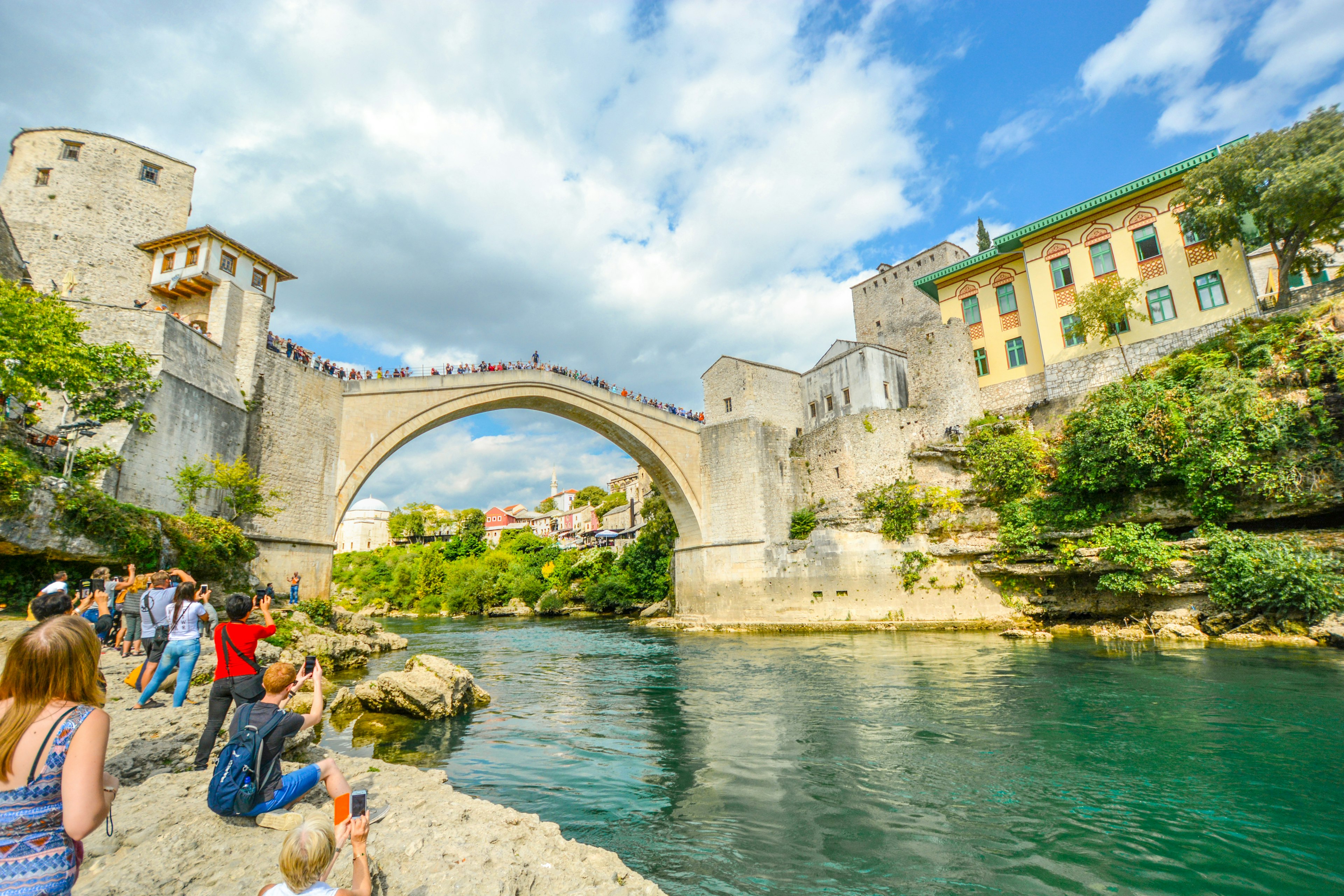
Tourists watch a daredevil diving into the Neretva River in Mostar, Bosnia and Herzegovina
Watching daredevils dive into the Neretva River is one of the most popular activities in Mostar © Kirk Fisher / Shutterstock

7. Find more medieval thrills at Mostar in Bosnia and Herzegovina

Travel time: 3 hours

This little cross-border jaunt will take you to Mostar, the largest city in Hercegovina, with a small but thoroughly enchanting old town center. Visitors gather to admire the Balkans’ most celebrated bridge, Stari Most, which forms a majestic stone arc between medieval towers. The bridge’s swooping arch was originally built between 1557 and 1566 on the orders of Suleiman the Magnificent.

In fact, the current structure is a very convincing 21st-century rebuild following the bridge’s bombardment during the civil war in the 1990s. The span reopened in 2004 and is now a Unesco World Heritage site, famed for its bridge divers, who leap daringly into the deep waters 24m (79ft) below.

Make time for a stroll along narrow Kujundžiluk, where historical stone-roofed shop-houses bustle joyously with trinket sellers offering inexpensive souvenirs. Beyond the cobbled lanes of the attractively restored Ottoman quarter are whole blocks of bombed-out buildings, a poignant legacy of the 1990s conflict.

The summer welcomes hordes of day-trippers, so, if you’re able to stay into the evening, you’ll be able to enjoy the lights of numerous millhouse restaurants that twinkle across gushing streams at dusk without the daytime crush of people.

How to get to Mostar from Split: The city of Mostar is around a 2.5-hour drive from Split and the trip here crosses the Croatia–Bosnia border, so be sure to bring your passport and visas (if needed). There are bus services, but they can take up to 4 hours, so hiring a car is a better option.

8. Sail to the most famous beach in Croatia on Brač Island

Travel time: 1 hour and 30 minutes

Split’s strategic location in the middle of Dalmatia makes it a perfect base for island-hopping. One of the best destinations for beach lovers is the small town of Bol in the southern part of Brač Island. The trademark attraction is Zlatni Rat (or Golden Horn), a pebbly, horseshoe-shaped stretch of beach that changes its appearance with the tide. Pine trees flank the beach, the mountainous Brač landscape rises above, and the cozy cobblestone streets of Bol Old Town nearby invite exploration. 

During summer, get to Zlatni Rat early in the morning to beat the crowds. In the afternoon the west thermic wind called Maestral makes the beach a popular windsurfing spot. 

But this day trip isn’t only about the beach, as Bol possesses charms of its own. It’s a typical Croatian fishing village-turned-resort town with picturesque old stone houses, a romantic seaside promenade and a good selection of konobas (tavernas) serving local fare. Konoba Dalmatino is a classic choice with its harbor-faced terrace. 

How to get to Bol from Split: Jadrolinija runs ferries from Split to Brač Island. There are car ferries to Supetar, a small town in the island’s north. You can also take a ferry directly to Bol. Alternatively, you can use the KSC catamaran to reach Zlatni Rat from Split in an hour. 

9. Take a plunge at the Blue Lagoon of Veliki Drvenik

Travel time: 1 hour

Almost every country hugged by the Mediterranean Sea has a blue lagoon. You can easily reach this one from Split. The swimming spot is located on the coast of the island of Veliki Drvenik, just 30 minutes from Split via speedboat. 

On a sunny day the water is incredibly clear and a beautiful azure hue. However, as with other blue lagoons across the world, overtourism is an issue here. During the peak season (July and August), the lagoon may become crowded with boats, making it not so idyllic. As such the best time to visit is May, June or September, when the water is warm enough to swim but the crowds are relatively low. 

How to get to the Blue Lagoon from Split: The best way to get to the Blue Lagoon is on a boat tour. Check out GetYourGuide or Viator options. Some tours also include visiting nearby islands. Prices start from €50 (or $52) for a half-day trip. The closest blue cave attraction is on Biševo Island

10. Experience the mesmerizing beauty of Plitvice Lakes National Park

Travel time: 3 hours

Plitvice Lakes National Park is a must on Croatia itineraries and one of Europe’s bucket list places to visit. At Plitvice you enter a kingdom of cascading waterfalls and emerald waters. The panoramas resemble fantasy landscapes – except it’s all a very real (and fragile) ecosystem and Croatia’s largest and oldest national park. 

Sixteen lakes cascade their way through the beautiful karst terrain, reaching a crescendo of roaring waterfalls. Visitors traverse wooden pathways to witness the show. 

As with Dubrovnik – another ultra-popular Croatian destination – Plitvice Lakes receives millions of visitors yearly, and the park’s narrow pathways have their limits. Considering that there’s no bad time to visit the fairytale-looking lakes, coming during spring, autumn and winter gives you the most rewarding experience as there are no crowds. 

How to get to Plitvice Lakes National Park from Split: The park is 150 miles from Split, so you’re looking at a full-day journey. There are direct buses to the national park’s Entrance 1 and Entrance 2. The ride takes approximately 3.5 hours and costs around €20 (or $21) one-way. Taking a rental car is a good alternative during the off-season. Opt for a guided day tour for the most hassle-free experience.  

11. Explore one of Croatia’s most beautiful medieval cores in Šibenik

Travel time: 2 hours

Central Dalmatia’s third-largest town Šibenik is a fantastic day trip destination from Split if you want to learn more about Croatia’s history. While Hvar and Trogir are beautiful, they can also feel touristy. Šibenik has no crowds and comes with the same wow factor. 

Its city center blends Venetian and Habsburg influences, and the epic medieval St. Michael’s Fortress watches overhead. The must of the must-visits is the UNESCO-protected St James’ Cathedral, a Renaissance treasure from architect Juraj Dalmatinac, built from the white stone of Brač Island. 

Game of Thrones fans will recognize Šibenik as Braavos in the show’s fifth season.  

How to get to Šibenik from Split: Šibenik is 50 miles north of Split and the two cities are connected by frequent buses. A trip by Flixbus takes 1.3 hours and tickets start from €9 (or $9.40) one way. 

You might also like:

See the best of Croatia with this week-long itinerary
Are these the best places to visit in Croatia?
Where to find Game of Thrones tours and attractions after the finale

Anna Tyler traveled to Split in 2018 with support from the Croatian National Tourist Office. The article has since been updated with additional information. Lonely Planet contributors do not accept freebies in exchange for positive coverage.

12 unmissable things to do in Türkiye

Whether your ideal vacation involves sunbathing on a Mediterranean beach, trekking in rugged mountains, exploring ancient ruins, or learning about a rich culture spanning more than five thousand years of history, Türkiye (Turkey) has something to captivate every kind of traveler.

From sand-hemmed coves to the snow-capped summit of 5137m (16,854ft) Mt Ararat, Türkiye serves up an
abundance of natural landscapes, alongside fascinating ancient sites, energetic cities, tantalizing food and plentiful opportunities for adventure.

However, you’ll never cover everything there is to see and do in just one vacation. To help you whittle down the list, here’s our pick of the best things to do in Türkiye to get you started.

A woman taking photos of the Library of Celsus at Ephesus, Turkey.
The Library of Celsus is one of the most impressive Greco-Roman relics in the Mediterranean. Shutterstock

1. Tour the ancient city of Ephesus

The well-preserved streets of ancient Ephesus offer a fascinating taste of what daily life was like for the ancient Greeks and Romans who inhabited this city for hundreds of years. Alongside grand civic buildings, you can tour the remains of ordinary shops and schools, temples and even public toilets.

Highlights of the site include the intricately carved facade of the Library of Celsus – once the third-largest library in the world, after the libraries at Alexandria and Pergamum – plus a huge open-air theater, a Roman bathhouse and numerous monumental fountains and gateways.

Planning Tip: It’s worth paying the separate admission fee to view the Terraced Houses – a collection of luxurious residences once occupied by the Roman elite. The interiors are full of mosaics, frescoes and marble worthy of an episode of “Lifestyles of the Rich and Famous.”

A man relaxes in the marble interior of the Cagaloglu Hammam in Istanbul.
Traditional bathhouses like the Cagaloglu Hammam in Istanbul are endlessly atmospheric. Izzet Keribar/Getty Images

2. Soak in a Turkish bath

In the days when homes lacked indoor plumbing, hamams (bathhouses) played a crucial role in Turkish society, both as a place to get clean and a place to socialize. Today, they’re typically a special-occasion treat, visited more often by tourists than locals, but a trip to a hamam is still a luxury worth indulging in.

A visit typically includes a scrub and massage by a same-gender attendant, but you can also opt for a slow, revitalizing steam bath. The interiors of these traditional spas are usually marble-lined and lit by skylights set into the domed roof.

The grandest hamams – such as the Hürrem Sultan Hamamı, the Cağaloğlu Hamamı and the Kılıç Ali Paşa Hamamı in Istanbul – are a treat for the eyes as well as the body. In the old Ottoman capital of Bursa, hamams such as Eski Kaplıca and Yeni Kaplıca feature pools fed by the area’s natural thermal springs.
3. See Cappadocia from above and below

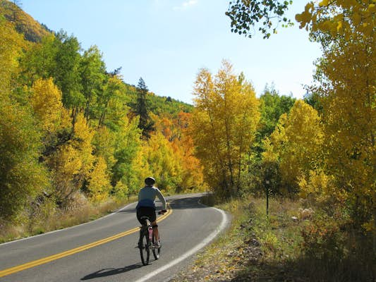
First thing in the morning, the skies above Cappadocia fill with hot-air balloons that take visitors soaring above the area’s canyons, fairy chimneys and other fantastical rock formations. Even if you don’t fancy a flight, it’s worth getting up early to see the colorful aerial display from the ground.

For a more (ahem) down-to-earth experience, follow labyrinthine tunnels many stories below the ground at ancient underground cities such as Derinkuyu and Kaymaklı, where thousands of Byzantine-era residents took shelter from invaders for months at a time. In addition to living quarters, these subterranean settlements included facilities to stable animals, cook, worship and even make wine.

Planning Tip: Balloon trips typically leave at sunrise to catch the best light, so be ready for an early start. Book ahead and note that flights can be canceled due to high winds or heavy rain.  

A fish market on the waterfront at Galata, Istanbul.
Dozens of varieties of fish are used to prepare meze dishes in Türkiye. Martina I Meyer/Shutterstock

4. Feast on a fish meze

A rakı-balık meal is a quintessential Turkish custom, particularly in Istanbul and along the Aegean and Mediterranean coasts. The name explains this popular dining experience – rakı is a strong anise-flavored liqueur typically mixed with water and ice, and balık is fish. These lavish spreads typically start with an assortment of meze dishes, which are often the real stars of the show.

Intended for sharing, meze plates feature creative combinations of vegetables, herbs and seafood, often topped with yogurt or cooked in locally pressed olive oil. If you do manage to save room for the main course, popular fish choices include grilled levrek (sea bass) and çipura (sea bream), or lightly fried istavrit (mackerel), barbun (red mullet) and hamsi (anchovies).

People shopping in the Grand Bazar in Istanbul.
Istanbul’s Grand Bazaar is one of the world’s most evocative market places. Shutterstock

5. Shop in Türkiye’s colorful bazaars

Despite the proliferation of modern shopping malls and supermarkets, traditional bazaar culture remains strong in Türkiye. Most historic town centers will have at least one çarşı – a maze-like traditional marketplace with vendors selling everything from cheap souvenirs to handmade leather and metal crafts. Istanbul’s Grand Bazaar (known as the Kapalı Çarşı, or “covered marketplace” in Turkish) is one of the world’s most famous markets, but the bazaars in Gaziantep and Şanlıurfa are arguably more atmospheric and authentic.

Equally important to local life is the pazar, an open-air market for fresh seasonal fruits and vegetables, food products, clothing and household goods. Depending on the town or city neighborhood, these local markets might be set up in the street under rigged-up tarps, in an emptied parking lot or garage, or in a purpose-built market hall.

Held in different areas on set days of the week, these local markets are cheap and lively places to buy staples and seasonal fruit and veg, and discover which ingredients locals are using in their kitchens at home.

Planning Tip: Bring an appetite – larger pazars, such as the weekly market in the resort town of Fethiye, feature stalls selling gözleme (stuffed flatbreads) and other tasty local dishes to sate hungry shoppers.

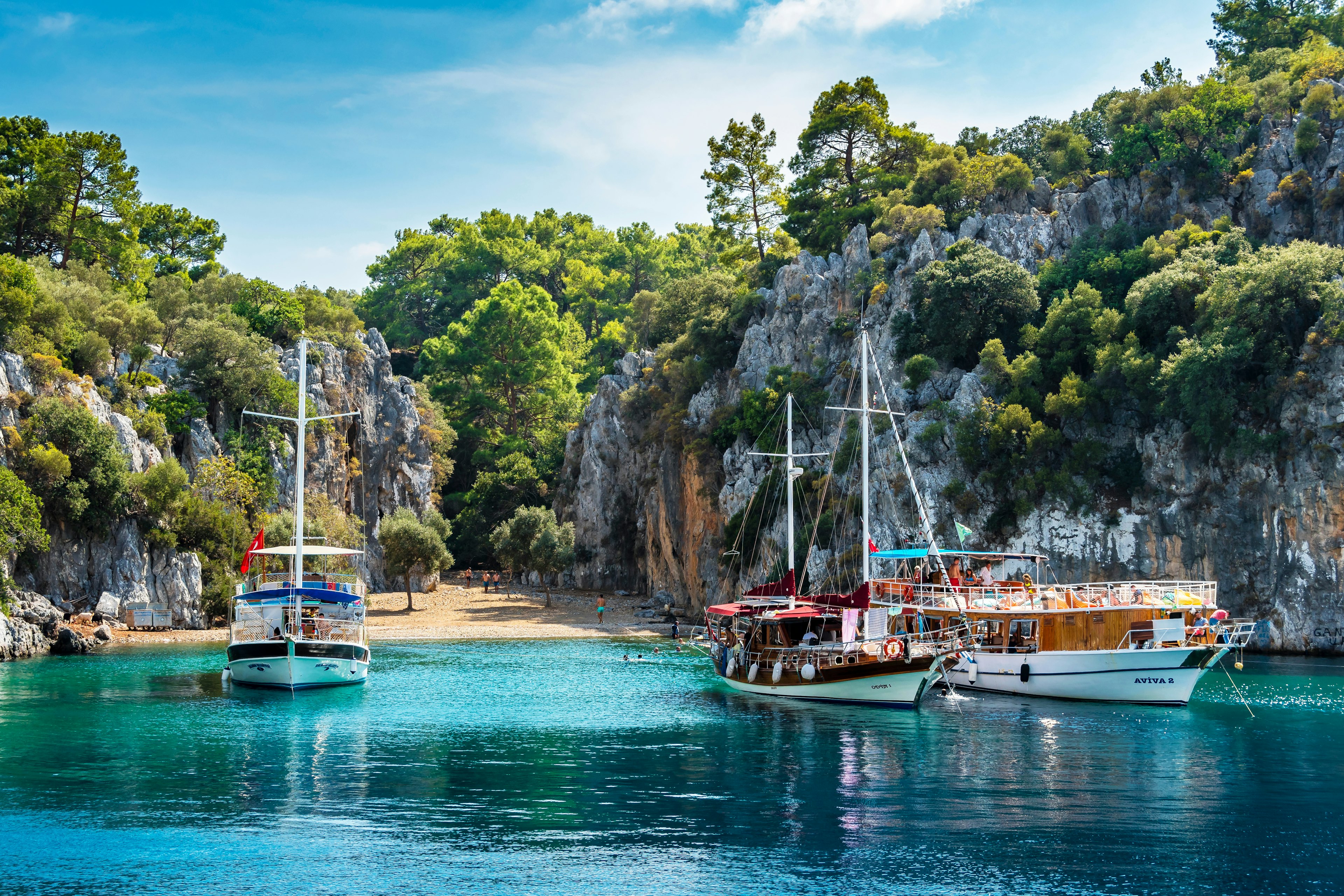
People relaxing on cruise boats in the Gocek Gulf in Turkey.
A cruise on a gület sailing boat is a classic Turkish experience. Nejdet Duzen/Shutterstock

6. Cruise turquoise waters on a gület

Few experiences are more relaxing than a multi-day cruise aboard a gület (traditional wooden yacht), plying the vivid blue waters of Türkiye’s southwestern coastline between Bodrum and Antalya. You can while away long, sunny days swimming in secluded coves, reading or playing tavla (backgammon) on deck, eating fresh-caught fish, drinking rakı as the sun sets and sleeping out under the stars.

If you get tired of blissfully lazing around, you can always hop ashore along the way. Interesting stops include the ancient ruins of Knidos, the dramatic Crusader Castle in Kaleköy and Kaş with its cool cafe-restaurants.

Planning Tip: Gület holidays are easy to arrange with international tour companies, but you can also book day trips and longer cruises locally in resorts such as Bodrum, Antalya and Dalaman. 

The ornate interior of the Hagia Sophia in Istanbul.
Hagia Sophia in Istanbul is one of the world’s most incredible buildings. Bernardo Ricci Armani/Getty Images

7. Admire architectural splendor in Istanbul

The rulers of the city once known as Byzantium and Constantinople left their mark on Istanbul. The soaring dome of the Hagia Sophia still leaves visitors awestruck a millennium and a half after its construction, while the towering Aqueduct of Valens and the vast subterranean Basilica Cistern attest to the impressive engineering know-how that the Romans used to supply the ancient city with drinking water.

With a prime position overlooking the confluence of the Bosphorus, Golden Horn and Marmara Sea, the legendary Topkapi Palace evokes the might of the Ottoman Empire at its peak, with lavishly decorated royal apartments, a treasury dripping with jewels and a kitchen that could feed 4000 people.

Istanbul’s minaret-studded skyline was a gift from the Ottomans as well. The architecturally refined Blue Mosque gets the most attention, but visitors shouldn’t miss the tiny, tile-bedecked Rüstem Paşa Mosque and the graceful Süleymaniye Mosque, perched atop one of the old city’s seven hills. History buffs can dig into the different cultural eras in Istanbul by exploring its wealth of museums.

8. Hike the Lycian Way

For a more active way to explore the Turquoise Coast, consider hiking a section of the Lycian Way, a long-distance trekking path stretching 540km (335 mi) from Fethiye to Antalya. Best walked in spring or fall, the sometimes challenging trail winds along spectacular coastal cliffs, through bucolic villages and beach towns, past ancient ruins and up into the mountains in the hinterland.

Most sections of the trail offer accommodation in small pensions as well as places to stop and camp. Highlights along the way include the secluded valley of Kabak, the long sandy beach at Patara, the massive rock tombs of Myra, the ruins of ancient Olympos and the Chimaera, or “burning rock,” at Çıralı.

Planning Tip: If you want to see more of Türkiye’s incredible landscape on foot and escape the crowded tourist spots, extend your trip and spend some time exploring the country’s stunning array of national parks.

Beautiful ancient mosaic from Antakya, Hatay Region, Turkey.
Türkiye’s Roman, Greek and Byzantine mosiacs are so well preserved they could have been created yesterday. Shutterstock

9. See incredible ancient mosaics

Tiny colored cubes of glass, ceramic or stone were used during the Greek, Roman and Byzantine eras to make amazingly detailed tableaux depicting mythological tales, heroic battles, lavish banquets and other scenes. Later Byzantine mosaics created shimmering visions of the saints on the domes of medieval Christian churches.

Splendidly preserved examples can be seen in situ on the floors of grand palaces and villas at ancient sites, but some of the most impressive mosaics are displayed in museums such as the Gaziantep Zeugma Mosaic Museum, the Hatay Archaeology Museum and the Haleplibahçe Mosaic Museum in Şanlıurfa.

Planning Tip: Don’t overlook the mosaics inside Türkiye’s Byzantine-era basilicas – those inside the Hagia Sophia and Kariye Mosque in Istanbul are particularly spectacular.

10. Linger over a leisurely Turkish breakfast

It’s hard to think of a better way to fuel up for a big day of sightseeing than with a Turkish breakfast spread (serpme kahvaltı) – a fabulous fusion of sweet and savory. Start with the nibbles – olives, cheeses, sliced tomatoes and cucumbers, and perhaps a slice of sucuk (beef sausage) and some spicy pepper paste along with your eggs.

Next, satisfy your sweet tooth with myriad pastries, homemade jams and a decadent swirl of honey and thick cream (kaymak). Different parts of the country have their own additions. Sample fresh herbs along the Aegean coast, cornmeal cooked with melted butter and cheese (called mıhlama or kuymak) in the Black Sea region, and fermented cheese and hot peppers in Hatay. Endless small glasses of sweet, black tea are served as standard.

The heads of toppled statues at Nemrut in Turkey.
You would struggle to find a more fantastical setting than the ruins at Nemrut. Getty Images

11. Watch the sunrise from atop Mt Nemrut

The surreal sight waiting at the summit of Nemrut Dağı is a testament to both the extent of the power that can be wielded by one ruler and to its inevitable decline. In the 1st century BCE, the Hellenistic king Antiochus I of Commagene had massive statues of deities, mythic beasts and other figures erected on top of a rocky peak as a monument to his own greatness. Earthquakes over the centuries toppled the heads of these statues from their bodies and they now sit scattered around a stark, remote landscape – a reminder of how even the mighty fall.

Planning Tip: Tour groups typically bring visitors to the ruins at sunrise or sunset, but if you stay overnight at one of the simple lodgings set below the summit, you can experience both.

12. Imagine the beginnings of human civilization

Türkiye is home to some of the world’s most important Neolithic sites, which are still yielding new insights – and raising new questions – about how humans lived more than 10,000 years ago. In the center of the country near Konya, the excavations at Çatalhöyük have provided clues about early “urban” life, when people started to transition from a nomadic lifestyle to living in settled agrarian communities.

In the southeast, outside of Şanlıurfa, the findings at the ritual complex of Göbeklitepe – thought to be the world’s first place of worship – have transformed our understanding of when humans began to develop religious beliefs and practices.

Everything you need to know about getting around Montréal

A seamless blend of French and Canadian influences, Montréal is a chic, vibrant city packed with cultural gems, historic architecture and a thriving dining scene. As Québec’s largest city, you’ll find all these wonderful things to do scattered across charming neighborhoods as well as the city center.

But there’s no need to worry about finding your way around Montréal – the metro and bus network is Canada’s busiest rapid-transit system and does an incredible job of moving locals and visitors around efficiently and safely. The whole network is operated by Société de Transport Montréal (Montréal Society of Transportation), but it’s commonly referred to as STM by Montréalers.

Apart from those shiny blue metro cars and widespread buses, the city also has a great bike-sharing network as well as trains that can take you out to the suburbs and beyond. This is everything you need to know about getting around Montréal.

People wait on a subway station platform in Montréal, Québec, Canada

Get there faster by metro

Montréal has an extensive metro network, with four numbered, color-coded lines connecting 68 stations. The service runs entirely underground – a blessing when the wintry winds are howling outside. In general, the metro has a reliable reputation and provides a speedy means of getting around the city. Unlike most other underground networks in North America, Montréal’s rolling stock runs on rubber tires, an obvious French influence (Paris pioneered this technology back in the 1950s) that is quieter and allows faster acceleration.

The orange ligne deux (line 2) is the most useful line for visitors, as it connects Old Montréal with both downtown and key neighborhoods to the north: the Quartier Latin, the Plateau, Mile End and Little Italy. While each line has slightly different hours, they all generally run from 5:30am to about half past midnight on Sunday through Thursday, continuing around 30 minutes later on Friday and Saturday nights.  

Take the bus for better views of city neighborhoods

STM is also responsible for Montréal’s bus network, which fills in the gaps between metro stations with 200-plus lines that crisscross the city. Since metro stations can sometimes leave you with a long walk from your ultimate destination, Montréalers mix and match as needed since transfers between the two networks are free. Late at night, the bus may be your only means of getting around apart from taking a pricier taxi or Uber. Around two dozen all-night bus routes operate. 

A woman waits for an approaching bus in Montréal, Québec, Canada

Stretch your budget on longer stays with an OPUS card

Montréal’s integrated transit network makes it a breeze to travel between the metro and bus. Fares are determined by zone, with zone A covering all of Montréal. A single bus or metro ticket costs CA$3.75 and allows transfers between bus and metro for up to 120 minutes of the first trip. Two-ride tickets ($7) are also available in metro stations as well as in pharmacies and dépanneurs (delis). On the bus, you can also pay in cash, but no change is available.

If you’re staying in Montréal for more than a few days, you can save money by buying a rechargeable OPUS card. The card costs $6 upfront but can be recharged at a discounted rate for 10 rides ($33.25), 24 hours of unlimited rides ($11), or three consecutive days ($21.25). You can also buy a one-week ($31) pass – but keep in mind that the passes begin on Monday and end on Sunday, making them a less-than-ideal choice if purchased mid-week.

Zip around downtown Montréal on a Bixi bike. Lissandra Melo/Shutterstock

Enjoy the fresh air and a bit of exercise on a Bixi bike

Launched in 2014, Montréal’s bike-sharing network has since grown in leaps and bounds. There are 865 docking stations and more than 10,000 bikes (including over 3500 electric ones) available for quick jaunts around the city. 

Before hopping into the saddle, you’re probably wondering if Montréal is bike-friendly. The answer? Bien sûr! (Of course!) With over 435 miles of bike paths, including traffic-separated express lanes, Montréal is a leader in the urban cycling world and has been ranked by various organizations (including the Copenhagen Design Index) as one of the most bikeable big cities in North America. If you come in the winter, however, you’ll find Bixi in hibernation: the bikes are only available from mid-April to mid-November since snow piles often cover bike lanes in winter, making cycling dangerous.  

Download the official Bixi app to find stations nearby and rent a bike through the app (allowing you to scan a QR code of your chosen bike to unlock it). If you don’t have your phone handy, you can also buy a one-way pass with a credit card and get a five-digit code to unlock a bike. If you plan to ride more than a few times, save money by purchasing a $22 monthly membership (via the app), which gives unlimited 45-minute rides on regular bikes. For non-members, the one-way pass costs $1.35 to unlock the bike, plus 20¢ a minute for regular bikes (35¢ per minute for e-bikes), and a $100 security deposit will be held on your card until the bike is returned.    

Take the train to explore beyond the city

Exo (also known as RTM) operates Montréal’s commuter train network. Five rail lines link the city center with suburbs stretching north, south, east and west. While not often used by first-time visitors to Montréal, these trains offer the chance to get off the beaten path and visit places like the First Nations reserve of Kahnawà:ke, and the city of Saint-Jérôme, the gateway to adventures in the Laurentian Mountains. 

Canada’s excellent long-distance network, Via Rail, can take you even further. Trains from Gare Centrale in downtown make the journey to Québec City in a little over three hours. You can keep going all the way to Halifax (22 hours) or head the other way toward Ottawa (two hours) and on to Toronto (five hours). 

Visitors ride the Reseau Express Metropolitain (REM) light rail in Montréal, Québec, Canada

Accessible travel in Montréal

The city has ambitious plans when it comes to improving the accessibility of its public transport network. STM has invested heavily in renovating metro stations with the ultimate goal of making all 68 universally accessible. Unfortunately, there’s a lot of work still to be done. Only 26 stations currently are accessible from street to platform, with another five stations under renovation and due for reopening by 2025. 

Even though the work is incomplete, the stations that are accessible tend to be of great benefit to travelers, including Place d’Armes in Old Montréal, Bonaventure in downtown, Mont-Royal for the Plateau, Jean-Talon for Little Italy and Viau for Parc Olympique.

The bus is even more useful for travelers with disabilities. All buses are now wheelchair accessible, with the ability to “kneel” and lower ramps (activated by the driver). Not all bus stops are accessible, however. You can get help planning an accessible route by using the STM route planner. Enter the start (origin) and end (destination) points and tick the “wheelchair accessible” option.

Where to ski in Switzerland from popular resorts to off-piste slopes

In a country with a staggering amount of vertical angles, the Swiss are practically born on skis. Even the dinkiest hamlet has a ski lift in the Alps, so the question is not so much where you can ski but how. Whether your idea of ski heaven is a remote log chalet or a party-hard resort, virgin or veteran, black run or blue, Switzerland has a slope to suit when the flakes fall in winter.

The big-hitter resorts get all the fuss. St Moritz, Gstaad and Verbier, Davos-Klosters and Zermatt of Matterhorn fame are the A-listers of Switzerland’s skiing scene – and justifiably so. While they offer sensational downhill skiing, boarding and pristine backcountry for all to explore, they really are just the tip-of-the-iceberg for Swiss ski resorts.

Your magic moment might come elsewhere: in the Bernese Oberland, with Eiger’s fearsome north face looming over your shoulder as you hurtle down the pistes; in the snowy wilds of Graubünden; or on less-skied slopes in deepest Valais, where the glacier-capped Swiss Alps are at their highest as they peek across to Italy.

Read on for our take on the best places to ski in Switzerland.

Panorama of Zermatt in the evening, with the Matterhorn beyond
Overlooking Zermatt in the early dusk light with the Matterhorn in the background. Oliver Foerstner/Shutterstock

1. Switzerlands big-name resorts

The scenery takes a dramatic turn for the wild in remote Graubünden in eastern Switzerland, where you’ll find some truly legendary slopes to pound the powder. First up is the supermodel of Swiss ski resorts, St Moritz, enshrined in Swiss skiing legend, with Olympic heritage, 350km (217 miles) of groomed, snow-sure slopes (some topping the 3,000m/9,842ft), glacier descents and plenty of freeride opportunities.

The twin resorts of (pretty) Klosters and (popular) Davos share 300km (186 miles) of runs spread across six resorts, with some good terrain parks in the wintry mix. Davos is geared mostly toward intermediates and experts, with some terrific black runs and backcountry to play on. Boarders also rave about the terrain parks, freeriding and après-ski scene in Laax.

Family-oriented sister resorts Arosa and Lenzerheide are scenic picks for beginners, intermediates and cross-country fans, with lots of appeal for families and non-skiers with their glorious winter walking and sledding trails. Arosa has gentler well-groomed, tree-lined slopes, slick lift systems and accessible off-piste, while Lenzerheide’s steeper sections, superb views and mountain dining are just a gondola ride away.

Local tip: Want to give the crowds the slip? Glide across to the serene, uncrowded slopes of Pizol, Scuol, Samnaun or glacier-rimmed Pontresina, all a snowball throw away from St Moritz.

Old wood chalet in Davos, Switzerland on sunny winter day.
A postcard-perfect chalet in the Swiss Alps on sunny winter day. Shutterstock

2. Best of neighboring Valais and Vaud ski regions

Nudging up to Italy in southern Switzerland, Valais is the winter dream, with the country’s highest peaks rising like natural skyscrapers above the 4,000m (13,123ft) mark.

Nothing beats skiing in the shadow of the Matterhorn, soaring 4,478m (14,691ft) above Zermatt – the perfect pyramid-shaped peak says Switzerland like no other. Snowboarders, intermediates and off-pisters all rave about the car-free resort’s 360km (224 miles) of scenic runs.

Reaching up to 3,883m (12,740ft), the Matterhorn Paradise enthralls with some of Europe’s highest slopes and year-round glacier skiing. Sidling up to Italy and easily reached by train, car-free Zermatt has recently upped its sustainable game, too, with a photovoltaics system powering its 3s cableway valley station, electric ski buses and snow groomers that run on eco-speed diesel.

Almost as gorgeous is Crans-Montana, a cracking beginners’ choice with gentle, sunny, south-facing slopes and Matterhorn and Mont Blanc puncturing the skyline.

Verbier has some terrifically challenging runs for experts. The terrain is vast here, with 410km (255 miles) of slopes spread across four valleys.

Hard-core skiers and boarders favor snow-sure, high-altitude Saas Fee for its long runs and glacier skiing.

Snuggling up to France’s mammoth Les Portes du Soleil ski arena, Champéry has access to 650km (404 miles) of slopes.

Queues are few, and families are welcome in Bettmeralp, tucked away in a quiet corner of Valais. With the mighty Aletsch Glacier unfurling alongside it, the cute-as-a-button resort combines classic Alpine timber-chalet looks with a phenomenally wild backdrop.

Jumping skier at jump with alpine high mountains
If you want off-piste and back-country adventures, head to Central Switzerland. Getty Images

3. Discover off-piste treasures in Central Switzerland

Surprisingly little known given its snow-sure slopes and staggering mountain backdrop, Engelberg (Angel Mountain) is framed by glacier-capped Mt Titlis. The real treasures here are off-piste, including Galtiberg, a 2,000m (6,561ft) vertical descent from the glacier to the valley.

Contrasting low-key village charm with big wilderness, Andermatt is another backcountry ski-touring and boarder favorite. This is one of Europe’s great untapped freeriding resorts. While intermediates will enjoy the pistes connecting Andermatt with Sedrun (lift tickets are valid for both resorts), experts can take the gondola to the foreboding 2,961m (9,715ft) Gemsstock. With limited pistes, this mountain is a powder hunter’s dream – hire a guide to take you on the backcountry route to the nearby village of Hospental.

4. Be bowled over by the Bernese Oberland

Mountains of myth with Christmas card scenery make the Bernese Oberland pure winter wonderland stuff. Right at its phenomenally pretty Alpine heart, the Jungfrau Region is crisscrossed with 211km (131 miles) of well-maintained slopes, ranging from easy to hair-raising, that grant fleeting views of the “Big Three”: Eiger, Mönch and Jungfrau.

Ski here, and you can tag on a once-in-a-lifetime ride up to Europe’s highest train station, 3,454m (11,332ft) Jungfraujoch, where an icy wilderness of swirling glaciers and 4,000m (13,123ft) turrets unfolds.

Grindelwald, Wengen and Mürren bombard you with some of the most gorgeous views anywhere in the Swiss Alps, with highly varied skiing and a relaxed, family-friendly vibe.

Tougher runs appealing to experts include the Inferno and World Cup Lauberhorn. For more glitz, swing west to Gstaad, which has fine downhill on 220km (137 miles) of slopes and pre- and post-season glacier skiing at nearby Glacier 3000.

Skiers rest on deckchairs in the snow at the restaurant on mount Titlis
Skiers taking a well-earned break on the deckchairs at Mt Titlis. Stefano Ember/Shutterstock

What you need to know before your ski trip to Switzerland

When to go skiing in Switzerland

The winter ski season in Switzerland typically runs from December to April, with the slopes buzzing with skiers and boarders until Easter. Prices skyrocket during school holidays, so avoid the crush and visit during the shoulder seasons (early December, January and March) for quieter pistes, slightly cheaper rooms and a greater choice of accommodation.

Which slopes are right for you?

Ski runs are color-coded according to difficulty:

  • Blue: easy, well-groomed runs that are suitable for beginners.

  • Red: intermediate runs that are groomed but often steeper and narrower than blue runs.

  • Black: for expert skiers with polished technique and skills. They are mostly steep and not always groomed, and they may have moguls and vertical drops.

How much are ski passes and lessons?

We’ll be honest: skiing in Switzerland is not cheap. But with a bit of pre-planning, there are several ways you can save some francs.

Ski passes are a hefty chunk out of your budget and will set you back around Sfr75 (US$80) per day or Sfr350 (US$400) for six days. Factor in around Sfr45 (US$50) to Sfr70 (US$80) per day for ski gear and Sfr20 (US$22) for boots, which can be reserved online at Intersport.

Equipment for kids is roughly half price. For discounts of up to 60%, pre-book ski and snowboard gear at Ski Set or Snowbrainer.

If you want to skip to the front of the queue, consider ordering your ski pass online. Swiss Passes gives reductions of up to 25% on standard ski-pass prices.

Covering 40 ski areas – many of them in lesser-known resorts – the Magic Pass is a good deal for skiers. It’s valid for an entire year and is substantially cheaper if you pre-order it online.

All major resorts have ski schools, with half-day group lessons typically costing Sfr50 (US$58) to Sfr80 (US$90). Schweizer Skischule has a clickable map of 169 ski schools across the country.

21 best things to do in Aspen

From its snowy ski slopes to its tree-lined hiking trails, it’s no secret that Aspen is a great base for outdoor adventurers.

While Aspen may be best known for skiing (and celebrity sightings), this scenic mountain town in Colorado’s Roaring Fork Valley also has a vibrant arts and culture scene, world-class shopping, luxury hotels and lauded bars and restaurants, making it a crowd-pleasing vacation destination for just about anyone. Whether you’re a frequent visitor or arriving for the very first time, these are the most quintessentially Aspen things to do.  

1. Jam out at a concert at Belly Up

Belly Up is an intimate concert venue with a big reputation – it’s been a downtown Aspen staple since 2005 and regularly attracts big-name artists – recent acts include Zach Brian, Wiz Khalifa and Keanu Reeves’ Dog Star. The Colorado venue’s intimate size is a major draw: fans can get up close and personal with their favorite musicians. With a diverse lineup and a jam-packed schedule of performances, you could attend a gig nearly every night of the week and have a different experience every time. 

Detour: After a show, enjoy downtown Aspen’s walkability by taking a late-night stroll down Hyman Avenue and grabbing a little something at one of the nearby bars and restaurants that stay open late. 

2. Drive or bike over Independence Pass

Topping out at 12,095 feet, Independence Pass is a two-lane (and, at times, one-lane) highway that traverses the Continental Divide. It’s a scenic summertime drive (the pass is closed from October through May), where you’ll encounter blooming wildflowers (orange Indian paintbrushes, lavender Columbines) along the side of the road in July and August. The pass is also popular among road cyclists, though it’s a challenging climb that requires a high level of fitness and constant vigilance for cars. Whether you drive or bike, stop for a break at Independence Ghost Town, where you can wander among restored miners’ cabins and the remains of abandoned buildings from the 1880s. 

Detour: If you’re driving the pass, make a pit stop at Grottos Trail. A short hike will lead you to stunning ice caves and cascading waterfalls.

Sunrise and reflections at Maroon Bells lake
Head up to Maroon Bells to get an iconic sunrise photo of the lake © Zhukova Valentyna / Shutterstock

3. Snap a sunrise photo of the Maroon Bells

The Maroon Bells – a pair of 14,000-foot peaks reflecting in an alpine lake near Aspen – are some of the most photographed mountains in North America. Their natural beauty has made them incredibly popular, but you can ditch some of the crowds by waking up before dawn to reach Maroon Lake. Plus, sunrise is a stunning time to photograph the Bells, which become pink and sparkly as the sun hits them. You can also start one of Aspen’s best hikes from there.

Planning tip: The most important thing to know when visiting the Maroon Bells is that you can’t just drive there and park wherever you want – access is strictly controlled. Most visitors will need to park at the Aspen Highlands – it’s very pricey, so we recommend taking the free RFTA bus from Rubey Park in Aspen – and then take a half hour shuttle ride (late May through October). You must reserve shuttle tickets in advance.

4. Find the shrines on Aspen Mountain

Keep your eyes peeled while skiing at Aspen Mountain, aka Ajax, and you might suddenly find yourself immersed in a colorful shrine to Jerry Garcia or John Denver. There are dozens of shrines hidden among the trees at Ajax, as well as Aspen Highlands, Buttermilk and Snowmass, paying homage to everyone from celebrities to beloved deceased locals; there are even shrines honoring dogs who have crossed the rainbow bridge. Some are somber, others are lighthearted and fun – but they offer a window into Aspen’s unique culture and identity.

5. Go mountain biking at Snowmass Bike Park

While there are hundreds of miles of mountain bike trails throughout the Roaring Fork Valley, a good place to start is Snowmass Bike Park, which is open from June through September. In the summer and fall, the snowy ski slopes transform into lush, wildflower-speckled singletrack trails for all skill levels. The bike park makes it easy to spend all of your time going downhill, since you can hop on the Elk Camp Gondola with your bike for the ride up the mountain – no huffing and puffing required (unless you want to ride cross-country!). There are 25 miles of downhill trails spanning nearly 3,000 vertical feet, with terrain for beginner, intermediate and advanced riders. If you’re new to the sport, Snowmass Bike Park is also a great place to take a lesson or sign up for a skills clinic; you can rent gear there, too. Beyond that, there are more than 300 miles of mountain bike trails throughout the valley, which has been designated a gold-level ride center – the highest rating possible – by the International Mountain Bicycling Association.

Planning tip: Plan your ride around the sunset and bring a headlamp for a twilight descent on Bonus Bike Nights. On Tuesdays from June 27–August 8, experience golden hour lighting that makes the trails magical.

6. Enjoy music under the tent at Aspen Music Festival

In the summer, Aspen is brimming with music students and professional musicians from around the world, who travel to the Roaring Fork Valley for the renowned Aspen Music Festival and School (you’ll often hear and see students playing expert-level classical music downtown to make a little extra cash!). Since 1949, students have been able to rehearse and perform alongside principals from major orchestras, attend lectures, participate in masterclasses and listen to panel discussions.

Members of the public, meanwhile, benefit from the hundreds of public performances that students and professionals put on, many of them taking place in the open-air Benedict Music Tent on the Aspen Institute campus. Though the venue seats more than 2,000 people, many concert-goers lounge on the grassy lawn surrounding the tent, with a picnic or a book to read, while listening to the world-class live music.

7. Stroll through the Aspen Art Museum

Designed like a woven picnic basket, the Aspen Art Museum is a great place to spend an afternoon, no matter the season. The museum, one of the many free things to do in Aspen, hosts rotating exhibitions featuring mostly contemporary art; there’s also a gorgeous, sunny cafe on the third floor that’s perfect for a light lunch or catching up on emails. Expect to spend about an hour here – it’s not a very big museum, but the architecture and building design are also inspiring. 

Planning tip: After exploring the exhibitions, head up to the rooftop café, Swedish Hill, for mountain views and a light lunch or coffee (note the café closes at 3pm). It has stunning views of the mountain.

Cable car moving up over forested snow covered mountains, Aspen, Colorado, USA
Skip the cable car queue and

8. Go uphilling at Buttermilk

To work up a little sweat while you ski – or “earn your turns,” as some skiers say – try uphilling at Buttermilk, one of Aspen Snowmass’ four mountains. Uphilling is exactly what it sounds like: skiing uphill. It’s a workout for sure, but also allows you to skip the lift lines and avoid many of the crowds, which can make for a more peaceful, serene experience on the snow.

To uphill, you’ll need some special equipment – chiefly, skins, which are grippy strips that attach to the bottom of your skis to prevent you from sliding backward as you glide uphill. There are special hours for uphilling to avoid getting in the way of fast-moving downhillers, and you’ll need to buy an uphill season pass for $69.

A popular route for uphilling is Tiehack, which climbs 1,600 feet to Buttermilk’s east summit. Once you get to the top, take off your skins, tighten your boots and let it rip to ski back down.

9. Eat pancakes at Bonnie’s

Take a break from skiing at Ajax to refuel and warm up at Bonnie’s a cozy, mid-mountain spot that’s known for its pancakes and apple strudel. On bluebird days, it’s also a great place to grab a beer and soak up the sun on the deck while skiers and snowboarders cruise by.

Another must-visit on-mountain restaurant is the Sundeck, located a few paces from the top of the Silver Queen Gondola (the main lift from downtown Aspen). It’s a cafeteria-style setup, but this is far from cafeteria food – perfectly cooked burgers, gourmet pizzas, creative sandwiches and other hearty, fresh foods prepared by the top chefs at the Little Nell, one of the most luxurious hotels in Colorado. Even if you’re not hungry, the Sundeck is worth a stop for the views of the surrounding 14,000-foot peaks. 

10. Walk back in time with Aspen Historical Society

Aspen’s active historical society keeps the city’s history alive and relevant with museums and ghost towns. The Aspen Historical Society also offers an array of informative and entertaining walking tours around town, including a Victorian West End walking tour that explores the historical characters and distinctive architecture of the West End neighborhood. The historians are highly knowledgeable and often wear period-appropriate clothing, helping you imagine what Aspen was like decades ago.

11. Ride an e-bike to Pine Creek Cookhouse

Cycling is a popular sport in Aspen, but the city’s already high starting elevation (8,000 feet) and even higher mountain roads can make it a challenge for visitors, particularly those coming from sea level. Enter the electric bike, or e-bike for short, which will give you a little extra oomph while you pedal and is one of the best ways to get around Aspen.

Rent an e-bike for the day from one of Aspen’s many bike rental shops, then begin the 12.5-mile climb toward Pine Creek Cookhouse, a popular lunch restaurant in a log cabin. Even with the electrical assistance of your bike, this ride is still a challenge, so you’ll be hungry by the time you arrive. The ride back to Aspen, however, is a breeze as it’s all downhill: don’t be afraid to eat every last bite of your massive Castle Creek Knife Burger.

In the winter, you can also cross-country ski or take a scenic horse-drawn sleigh ride to the restaurant, which is just up the road from Ashcroft Ghost Town.

12. Go birding at Hallam Lake

Founded in 1968, the Aspen Center for Environmental Studies (ACES) is a beautiful 25-acre environmental learning facility and nature preserve – and one of the best spots to go birding year-round in Aspen. Hallam Lake, located on the center’s grounds along the Roaring Fork River, is home to dozens of species of resident and migratory birds, including colorful waterfowl, delicate warblers and impressive birds of prey.

ACES hosts monthly group birding outings led by naturalist and writer Rebecca Weiss – and there’s even a bird club you can join to help support the center’s work. 

People walking by vendors selling products in stands in farmers market with displays in outdoor
Summer in Aspen includes outdoor concerts and farmers markets © Getty Images

13. Sip an Aspen Crud at the Hotel Jerome’s J-Bar

The Hotel Jerome has been an Aspen landmark since 1889. Its stately brick building, on the corner of Main and Mill streets, survived the mining boom, the silver crash, the quiet years, the start of Aspen’s ski area, the Hunter S. Thompson years (when gonzo journalist Thompson ran for sheriff in 1970, he made the hotel’s J-Bar his unofficial office) and, finally, the glitz and glimmer of the present day.

The J-Bar, inside the hotel, was also a very popular hangout spot during Prohibition. According to legend, the bartender would surreptitiously toss a few shots of bourbon into a vanilla milkshake for those who asked for “that Aspen Crud.” The boozy milkshake is still on the menu today – and yes, it’s delicious.

14. Ride bikes along the Rio Grande Trail

This 42-mile “rails-to-trails” route connects the communities in the Roaring Fork Valley from Aspen to Glenwood Springs. It’s a popular trail for cycling, running, walking, jogging and rollerblading because it’s protected from vehicle traffic (except for a handful of well-marked spots where it intersects with roads) as it meanders through varied scenery along the Roaring Fork River. The trail, which is mostly paved and relatively flat, can also connect you with dozens of other trail systems, which means you can roam to your heart’s content without needing to rely on a car.

15. Get swept up in a Theatre Aspen show

Head to Hurst Theatre, an elegant enclosed tent structure located right along the Roaring Fork River, to be transported to another time and place during a Theatre Aspen musical or play. The professional theater company puts on Broadway shows like Chicago and Guys and Dolls during its annual summer season.

Detour: Don’t miss the opportunity to explore the nearby John Denver Sanctuary. This peaceful garden with river views is dedicated to the legendary singer-songwriter, with boulders engraved with the lyrics of his most beloved songs.

16. Strap on cross country skis or snowshoes at Ashcroft 

Glide through the pristine winter wonderland of Ashcroft, the same location as the Pine Creek Cookhouse, as it is also the perfect spot for Nordic skiing and winter hiking on snowshoes. Ashcroft Ski Touring serves 20 miles of groomed trails through 600 acres of backcountry – it’s a bit more wild than your typical Nordic center. They also rent classic cross-country ski equipment and snowshoes and run guided tours.

17. Visit a ghost town

Next to Ashcroft Ski Touring is Ashcroft Ghost Town, a silver-mining town founded in 1880. What remains are mostly miners’ cottages (log cabins with tin roofs), a couple of broken-down wagons stranded in the waist-high grass, a post office and a saloon. At its height in 1893 about 2500 people worked here, but the silver veins were quickly exhausted and by 1895 the town’s population had plummeted to 100 residents.

At the foot of Independence Pass is another boomtown gone bust, Independence. This one-time tent camp exploded in the summer of 1879, when a lucky miner struck gold on the 4th of July. The site offers the chance to see the remains of the old livery, the general store and a miner’s cabin or three. After its population peaked at 1500 residents, the town fell away during the harsh winter of 1899, when supply routes were severed.

18. Discover the charm of the Wheeler Opera House

Built in 1889 by Jerome B. Wheeler of Hotel Jerome notoriety, the Wheeler Opera House is an iconic venue that is a cornerstone of Aspen’s cultural and social life. Restored to its original grandeur, the opera house hosts an array of performances that cater to all tastes, ranging from live concerts and film screenings to operas (of course), plays and lectures. Visitors can also explore the gallery spaces, which feature exhibitions from local artists.

Detour: Book a pre-show dinner at one of Aspen’s fancier restaurants, such as Prospect at Hotel Jerome or Bosq, where you can choose from two different tasting menus.

19. Take a scenic gondola ride on the Silver Queen Gondola

For amazing views of the Rocky Mountains, hop on the Silver Queen Gondola, located at the base of Aspen Mountain on East Durant Avenue. In 1946, it was the single-seat Lift 1 – the longest chairlift in the world. The 14-minute ride takes you 3,267 vertical feet up to the 11,212 ft summit. In the summer, the summit hosts live music, yoga classes, and other activities, and whether you go up for a hike or to ski, the Sundeck restaurant awaits to fuel you in between.

20. Hike popular – and off-the-beaten-path – trails

The Maroon Bells trailhead is the starting point for some of Aspen’s most famous hikes (the Four Pass Loop, Crested Butte), but if you want to avoid the crowds and shuttle logistics, there are plenty of other trails to explore.

The Hunter Creek Trail leaves right from town (N Mill St to Lone Pine Rd), following the creek northeast for about 4 miles, after which it links up with a plethora of other trails, including the popular network at nearby Smuggler Mountain (10,700ft). 

Castle Creek Valley is also a great spot to explore. Here you’ll find the steaming Conundrum Hot Springs, west of Castle Peak (14,265ft), which are the reward for 8.5 miles and over 3000ft of climbing on the Conundrum Creek Trail (USFS Trail 1981). The pools here have outrageous alpine views, including glimpses of steep avalanche chutes and waterfalls. It’s hugely popular, and you must make reservations on recreation.gov in advance to stay at one of the campsites here. Bear canisters are also required.

21. Learn about conservation at ACES

The Aspen Center for Environmental Studies manages the 25-acre Hallam Lake wildlife sanctuary that hugs the Roaring Fork River and miles of hiking trails in the Hunter Creek Valley.

With a mission to advance environmental conservation, the center’s naturalists provide free guided hikes and snowshoe tours, raptor demonstrations (eagles and owls are among the residents) and special programs for families.

Popular guided tours include the Ice Age walk in Snowmass, hikes to Crater Lake in the Maroon Bells and year-round birding excursions.

Keep planning your trip to Aspen

The easiest ways to get around Aspen
Aspen experiences that don’t cost a penny
The best time to visit Aspen

These 7 hikes reveal Bora Bora beyond the beaches

Most visitors head to Bora Bora for a blissful island vacation that centers around relaxing in an overwater bungalow on the sparkling lagoon. So you may be surprised to learn that it’s possible to work up a sweat with a vigorous hike on this gem of French Polynesia.

Given its small size and mountainous, jungle-covered interior, you really don’t have to venture far to feel like you’ve left civilization behind on Bora Bora. The payoff to any sweaty trek? Your astonishment at just how many different shades of blue you can see from your viewpoint as you gaze out on one of the world’s most beautiful lagoons.

Here are seven ways to make it happen.

1. Faanui Cannons

Best short hike
Less than 300m (0.25 mile), 10 minutes, moderate

During WWII, the USA chose Bora Bora as a strategic military supply base – and, as on many South Pacific islands, decided not to take the big stuff home. At four locations in Bora Bora, eight giant cannons were installed high on the hills, and they remain there today. Some are difficult to find, but they’re waiting to be discovered. If you are willing to explore a bit, that is.

Anyone who finds the Faanui Cannons will enjoy spectacular views of Bora Bora’s iconic lagoon as a reward. Once you leave the sealed circle island road, it will take around 10 minutes of uphill walking; views of the motu (little islands) in the lagoon serve as a welcome distraction from your burning calves. As will the satisfaction of actually finding the cannons (even if one of the barrels has gone missing).

Trailheads are notoriously hard to find in Bora Bora due to a lack of signage. Yet the Faanui Cannons can be found on Google Maps, near Tereia Point in the northwest of the main island. Heading clockwise on the circle island road, make your way to the Pearl Beach Resort ferry departure (lagoon side of the road) a few kilometers past Faanui. Once you spot the sign to the ferry, the track to the cannon site is about 30m (98ft) further up the road on the right.

An old war cannon faces out over a bay and a mountain beyond on a tropical island
It can be a scramble to reach some of the decommissioned WWII-era cannons on Bora Bora – but the views are worth the effort. Sven Kiesser/Shutterstock

2. Point Fitiuu Cannons

Best hike for picnicking with a view
Around 1.2km (¾ mile) round trip, easy

Hikers seeking the well preserved Point Fitiuu Cannons – in Anau, on the eastern side of the main island – will be treated to stunning views of both Mt Otemanu and that magnificent lagoon (again!). Partway along this walk, an interestingly shaped geological feature juts dramatically out of the ground: it’s commonly known as Hiro’s Finger. (Some describe it using another part of the male anatomy.)

Take a picnic and make a morning or afternoon out of it, making use of the simple benches at the cannons. While snacking, you’ll notice that one of the guns faces the Four Seasons Resort and the other faces Mt Otemanu.

The trailhead can be a little tricky to find. The easiest way is to head toward Point Fitiuu on the main circle island road, where you’ll soon find yourself heading up a small hill as you near it on Google Maps. At the sharp bend in the road, views of Mt Otemanu will come into sight, and you’ll see a track leading out onto the peninsula. The trail starts behind a cement building on private land. If the owners are about, you’ll need to ask their permission to cross their land.

3. Valley of the Kings

Best hike for Polynesian history
Around 3 hours, easy to moderate

It’s said that the giant banyan tree you’ll spot on this hike was the inspiration for the “Tree of Souls” in the blockbuster Avatar movie. Whether or not that’s true, there’s no doubt the tree has great cultural significance, since it’s said to serve as the final resting place of Bora Bora’s ancient kings.

The Valley of the Kings hike is best taken with a guide – not just because hikes on Bora Bora are rarely signed, but because this particular trail passes by relics of the island’s early history. Hikers can explore remnants of ancient villages and marae (Polynesian temples), which only expert guides will be able to point out.

You can also enjoy opportunities to eat the island’s bounty straight from the tree – and, of course, take in those iconic views of the turquoise-blue lagoon.

A close-up shot of misty clouds hugging rocky, spiky peaks of a mountain on a tropical island
While you can’t summit the spiky peaks of Mt Otemanu, you’ll enjoy major bragging rights for getting close. Cedric Serni/Shutterstock

4. Mt Otemanu

Best hike for bragging rights
Around 6 hours round trip, difficult

Can you hike Mt Otemanu? As soon as hikers eye this craggy peak, the question immediately occurs. As the highest feature on Bora Bora, Otemanu dominates the landscape – and given its prominence on both travel brochures and the feeds of nearly every social media influencer who visits, it’s possibly one of the most recognized geological features in all of French Polynesia. Who wouldn’t want to brag about conquering it?

Hikers can’t physically get to the very top of the mountain’s 727m (2385ft) summit, as the towering twin peaks are both crumbly and vertical. Yet it’s still a hard slog just to get to the “shoulders” of the mountain, with a few sections requiring the ability to heave yourself up via strategically placed ropes.

The cave on Mt Otemanu’s northeastern side is not to be missed. Said to be a final resting place for royalty in the distant past, the cave offers views that are nothing short of breathtaking. Hikers can see across the brilliant blue see all the way to the islands of Tahaʻa and Raʻiatea.

Although it’s possible to do this hike without a guide, I don’t recommend this, since independent trekkers can (and do) get lost and even injured due to the difficult terrain and lack of signage.

5. Farepiti Cannons

Best hike for an intense start and smooth finish
Approx 2.4km (1.5 miles) round trip, 20min one way, easy to moderate

Perched on the mountainside above Point Pahua on the western point of the island, these cannons also boast superb views. One cannon is positioned toward the main town of Vaitape and Teavanui Pass, while the other other looks out over the expanse of the lagoon toward Pearl Beach Resort.

The initial section will give your calves a workout and make you sweat in the tropical humidity – but things ease up about 450m (1476ft) in, when you reach a plateau with nice views over to Motu Ahuna in the lagoon. From here, its an easier hike to the cannons.

The track can be found by heading clockwise around the island on the main road. Around 350m (1148ft) past the cargo-vessel quay in Farepiti, you’ll see a dirt road to the cannons snaking up the hill to your right. Along the way, you’ll hear the drone of 4x4s and quad bikes, which rumble up a narrow track behind you. While this can be noisy, the sound of these vehicles makes it hard to get lost.

A double-peaked mountain is visible in the distance behind bright blue waters fringed with dense palms
If you can believe it, the views are even better looking down from Mt Pahia. Danita Delimont/Shutterstock

6. Mt Pahia

Best hike for fabulous views
Around 6–8 hours round trip, difficult

Mt Pahia is Mt Otemanu’s shorter sibling, topping out at 658m (2159ft). On the ascent, fabulous panoramic views will open up not only across Bora Bora, but well out to the Pacific Ocean, too. Like Otemanu, Pahia is a challenge – yet on this mountain, you can actually reach the peak. Due to the dangerous hiking conditions, which involve climbing, ropes and forging through an unmaintained track, I wouldn’t tackle this hike without a guide.

The track can be found near Hine Pearls, just south of the pretty Protestant church with the red spire in Vaitape. As ever, it’s best to ask around when you get there as nothing is signposted.

7. Bora Bora Loop

Best hike for multiday discovery
20 mile (32km), easy to moderate

For those who have a few days to spare and are comfortable with the concept of multiday hiking, this 32km (20-mile) loop is simply dreamy. Following the coastal road around the entirety of the main island, the Bora Bora Loop is the only hike that’s all-weather accessible, as the road is paved and not too mountainous.

The highlight of this hike is, well…everything: every single stunning stretch of coastline, view of the lagoon, village and fabulous restaurant. The best part? You get to choose where you stay each night and how far you walk each day.

Top tips for hiking in Bora Bora

  • Hire a guide when tackling Bora Bora’s interior tracks. This is due to the lack of signage, overgrown trails and the mountainous terrain.

  • Never hike the off-road tracks during or after rain. The trail will be too slippery and downright dangerous.

  • Many tours only operate during the dry season, from May to October.

  • The hikes to Mts Otemanu and Pahia are not for the faint-hearted. You will need to have a reasonable level of fitness and know your body’s limits. Don’t attempt the hikes if you can’t deal with heights or suffer from vertigo.