healthyng

Archives December 2022

The 7 best hikes in Morocco for wildlife, Roman ruins and mountain summits

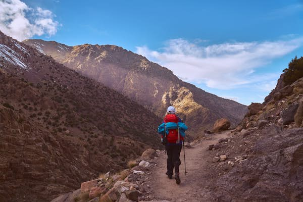
Morocco is home to some of the world’s most striking mountain landscapes. Ramble through fragrant forests of cedar trees and walk along verdant valleys where time has stood still. More adventurous hikers scale North Africa’s tallest peak or head off on demanding multi-day treks across rugged massifs.

With peaks and valleys to suit all abilities, atmospheric eco-friendly lodgings, and a tasty tagine waiting for you at the journey’s end, here are our top picks for hiking in Morocco.

there are several checkpoints on the way to the summit of Jebel Toubkal, Morocco
Replenish at one of the village shops on the way to the summit of Jebel Toubkal © Shutterstock / Ondrej Bucek

1. Jebel Toubka

Best high-altitude hike

27km (16.7 miles), 2 days, hard

The High Atlas – Morocco’s loftiest mountain range, known to the locals as Idraren Draren or Mountains of Mountains – runs diagonally across the country for almost 1000km (620 miles) and is a trekker’s paradise, especially in spring and autumn.

The biggest draw is the ascent of Jebel Toubkal, North Africa’s highest peak at 4167m (13,670ft). Much of the trekking is done on the first day, a six-hour hike zigzagging upwards through a craggy valley. Stop to acclimatize and share campfire tales with fellow climbers at a rustic refuge, before setting off at first light to scale the snow-dusted summit. You’ll need snow equipment in the winter months, but if you’re blessed with brilliant blue skies, you’ll have views all the way to the Sahara.

With more time, you can take on the challenging week-long Toubkal Circuit and, as well as tackling Toubkal, you’ll meander between remote Amazigh (Berber) villages, crossing fertile valleys, rocky massifs, and panoramic passes.

The mountain village of Imlil (90 minutes from Marrakesh) is a hub for hikers and the place to hire a mountain guide (compulsory in Toubkal National Park) and book a bed at one of the refuges. There are plenty of other treks to try: stay in style at the sustainable Kasbah du Toubkal and you can hike to their remote lodge in the Azzaden Valley.

Barbary Apes in a cedar forest tree near Azrou, Northern Morocco, Africa
Spot the one-of-a-kind Barbary macaques in the cedar forest of Morocco on this hike © Ekaterina Pokrovsky / Shutterstock

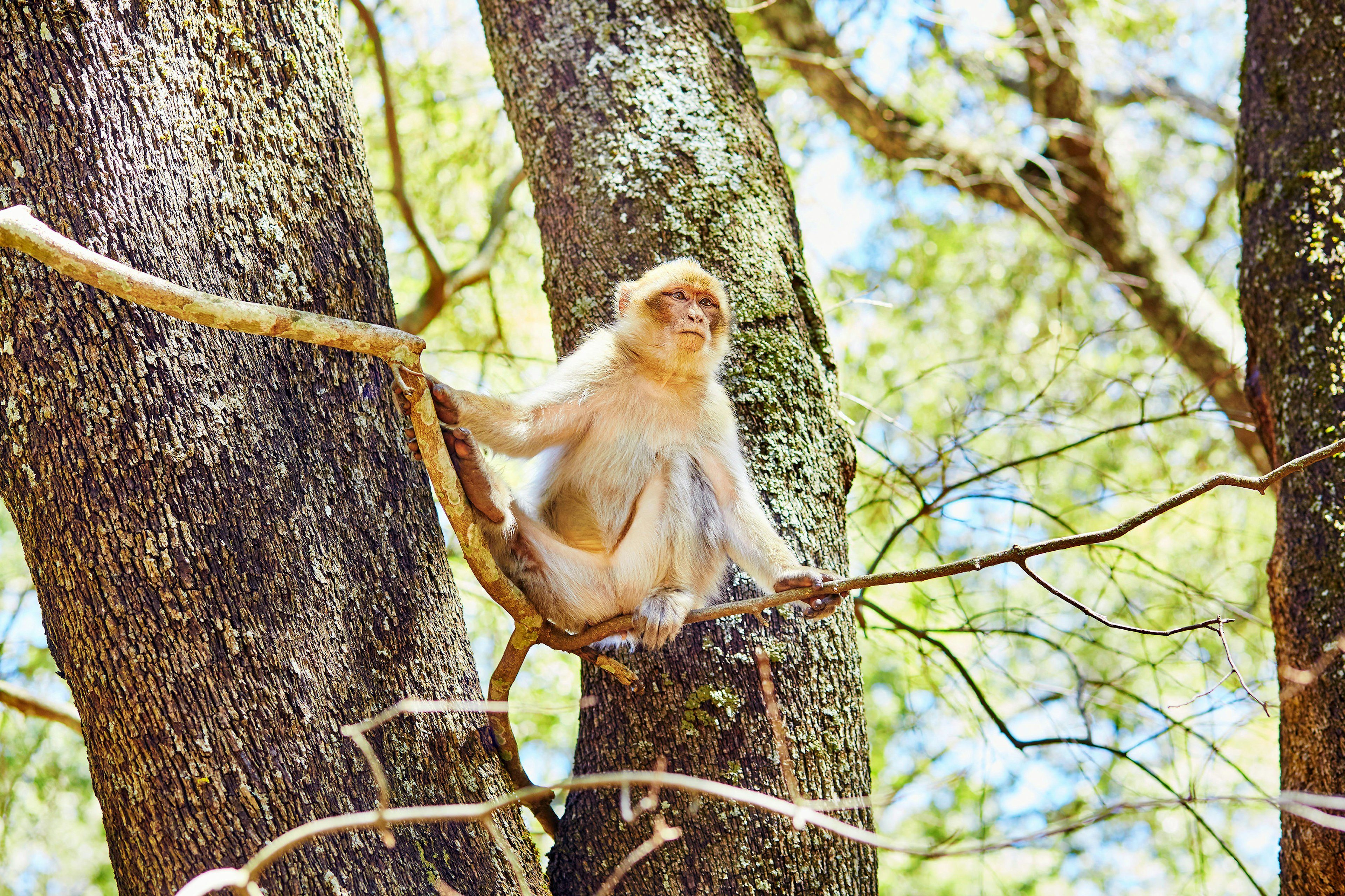
2. The Monkey Trail (3M Squared Loop Trail)

Best for wildlife watching

7.4km (4.6 miles), 2.5 hours, moderate

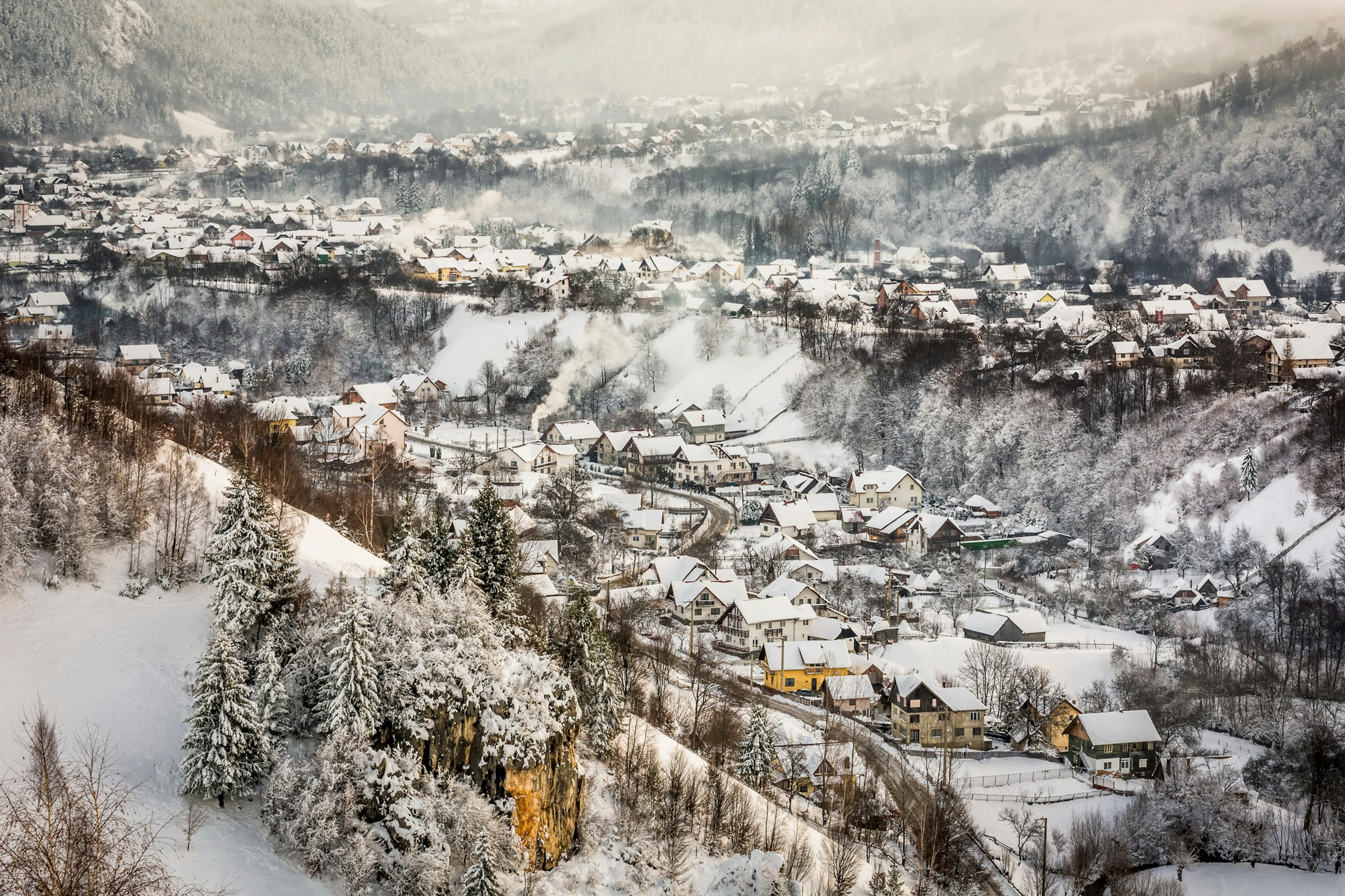
Close to Ifrane – aka Morocco’s Little Switzerland, thanks to its Alpine architecture and spotless streets – Ifrane National Park is spread over 500 sq km (310 sq miles) of the Middle Atlas mountains. It’s famed for its fragrant forests of Atlas cedars and troops of endangered Barbary macaques. The one-of-a-kind primate was once widespread in Europe and North Africa, but is now only found in small pockets of Morocco and Algeria’s northern mountain ranges.

The park has several well-marked, easy-to-moderate trails, but – as the name suggests – the Monkey Trail will give you a good chance of spotting the mischievous macaques, as well as other forest residents, such as foxes and wild boar. It’s great for trail runners and mountain bikers too, since it’s shaded by lofty oak and cedar trees.

Enlist a guide, such as Saleh Boudaoud, to discover more about the park’s flora and fauna and the threats the macaques face from human interaction and poaching for the exotic pet trade.

A clear natural pool in Akchour, Talassemtane National Park, Morocco
Take a dip in a natural pool at the Akchour Waterfall – 45 minutes from Chefchaouen © Shutterstock / Stefano Zaccaria

3. Akchour Waterfall and God’s Bridge

Best for waterfall lovers

13.8km (8.6 miles), 5 hours, moderate

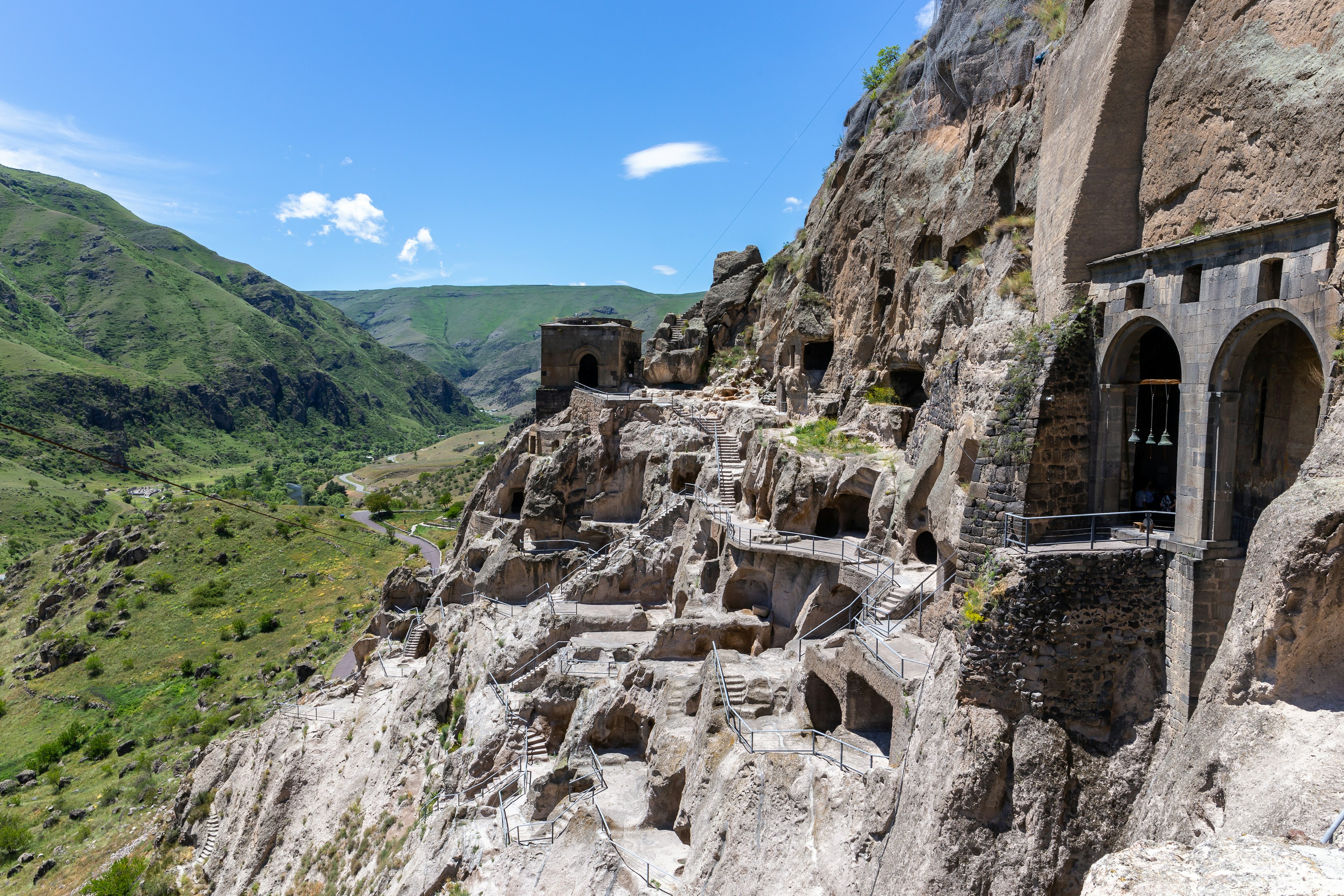
Tucked into the green folds of the Rif Mountains, charming Chefchaouen is famed for its endlessly photogenic blue-hued medina. But once you’ve explored its cobbled streets and people-watched from its pretty squares, take to the trails of the vast Talassemtane National Park with its luminous waterfalls and forests of firs.

This popular hike starts in the village of Akchour, around 45 minutes from Chefchaouen by grand-taxi. Head towards the hydroelectric dam and a fork in the road where the well-trodden left-hand trail dips through evergreen forest and between moss-covered rock formations. After around 45 minutes you’ll reach the first waterfall, but keep going until you reach the larger cascade that plunges into an emerald-green pool – perfect for a refreshing dip before you make your way back to the dam.

Once there, you can extend the hike by taking the right-hand trail and the steep scramble to God’s Bridge, a natural arch straddling two cliffs. Then stop at one of the roadside stalls near the Akchour end of the trail for a well-earned tagine, or immerse yourself in the park with a stay in a stunning wood-and-stone cabin at the eco-friendly Ermitage d’Akchour.

4. Jebel Saghro Circuit

Best for off-the-beaten-track trekking

90km (56 miles), 5 days, moderate

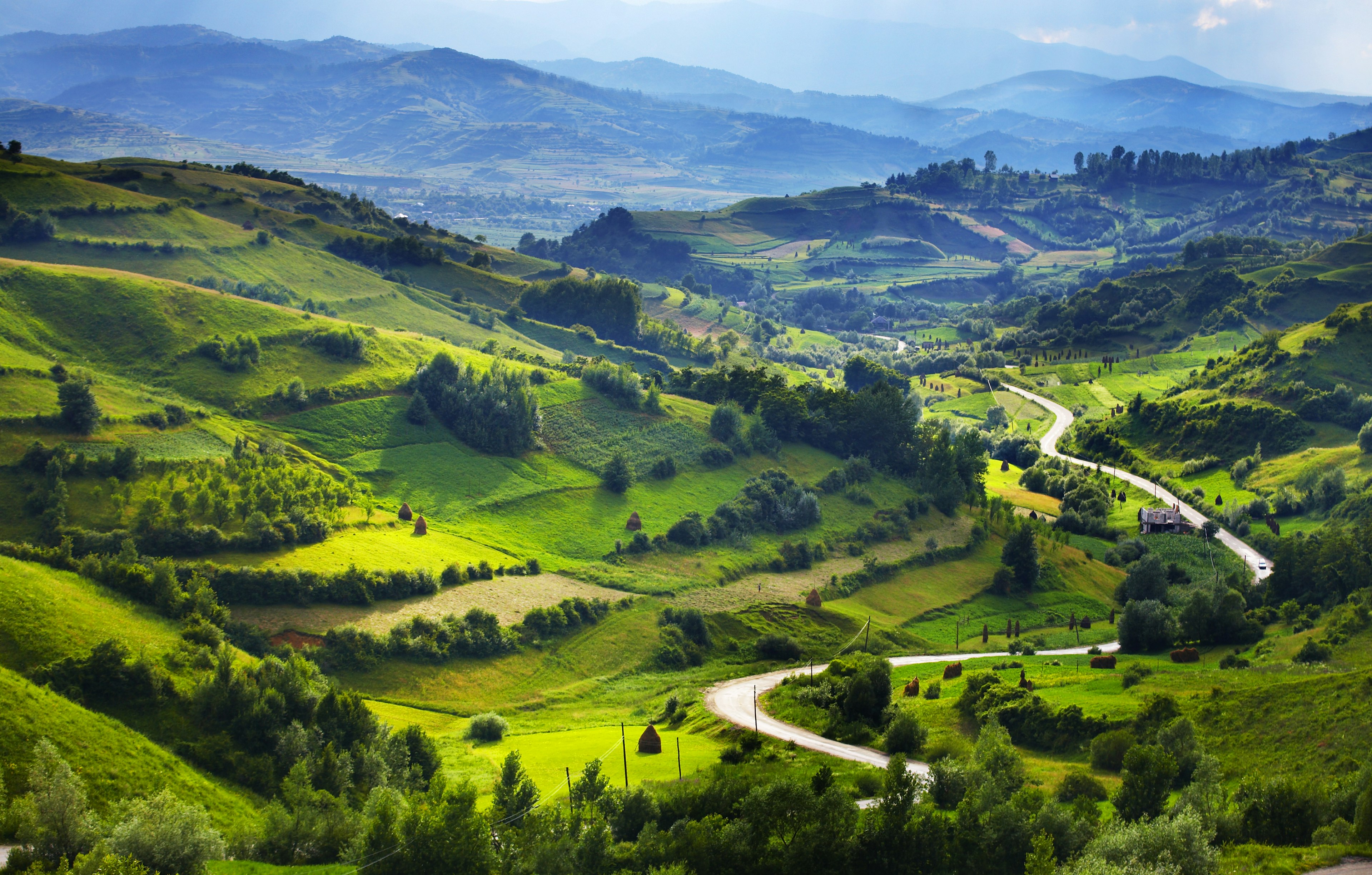
Sandwiched between the High Atlas and the Sahara’s shifting sands in southeast Morocco, the Saghro Massif possesses a stark beauty, with yawning canyons, flat-topped mesas, otherworldly rock formations, and arid desert-scapes.

Its stony tracks are frequented more by the semi-nomadic Aït Atta tribe than tourists. And while there are steep ascents and descents, trails are generally lower-lying and less challenging than the High Atlas. Its highest peak, Amalou n’ou Mansour, sits at 2712m (16,85ft) and most passes are between 1500m (932ft) and 2500m (1553ft).

The Saghro Circuit takes five days starting at Tagdilt near Boumalne Dadès and ending at Kalaat M’Gouna. Add an extra day to reach the peak of Jebel Kouaouch (2595m/1612ft) with views to rival those from Toubkal. If you’re going without a guide, you’ll need to be confident at navigating and stock up on supplies before you set off.

And there are plenty of shorter out-and-back trails and one-way walks. To the south, the Kasbah Hôtel Aït Omar in the kasbah-studded, oasis town of Nkob makes a great base, with its vegetarian-friendly restaurant and insider tips for routes and local guides.

Man walks through the remains of the Roman city of Volubilis
You can ramble to – and around – the ancient Roman city of Volubilis near Fez © Doug McKinlay / Lonely Planet

5. Moulay Idriss to Volubilis

Best for culture vultures

4km (2.5 miles), 45 minutes one-way, easy

Just 90 minutes from Fez and 40 minutes from Meknes, the holy, hilltop town of Moulay Idriss Zerhoun is the perfect starting point for a leisurely ramble to the archaeological site of Volubilis, a far-flung outpost of the Roman Empire turned Unesco World Heritage Site.

Walk downhill from the bus station to a roundabout where signs point you in the direction of a slower pace of life, as you wind your way through pine forests, olive groves, and across a fertile plain towards triumphal arches, ancient columns, and glittering mosaics. Head back to the whitewashed town on foot, by taxi or donkey and refuel with a traditional three-course feast on the terrace of Dar Zerhoune while you drink in the views.

6. Todra Gorge

Best for day hikes

11.4km (7.08 miles), 4-5 hours, easy

The Loop Hike trail at Todra Gorge is one of the most popular day trips on the eastern side of the Atlas Mountains. Intrepid travelers with experience on this trail say it’s safe for unguided hiking, with inspiring 360-degree views of the gorge’s 300m-high walls along the path. The gorge is the starting point for several hiking trail options, but the Loop Hike keeps things scenic and easy. Panoramic views on this trail also afford stellar views of surrounding mountainscapes without a strenuous climb. 

Intrepid travelers recommend this adventure as a worthwhile day stop while commuting between Marrakesh and the Sahara Desert. The self-guided loop trail starts at the northern end of the gorges to Tizgui, a Berber village at the southern entrance. In addition to otherworldly activities on foot, rock climbing is also a major draw for mountaineers. 

Standout stays nearby include Hotel Xaluca Dadès, a 106-room accommodation north of the city center, and Auberge Le Festival, a tranquil 7-room eco-hotel. Due to its remote nature, both hotels are great places to dine, and Auberge Le Festival is said to regularly entertain with live music. Restaurant La Petite Gorge is one the best spots for traditional Moroccan eats, and the natural beauty surrounding Kasbah Petit Nomade while eating tagine or couscous adds to the majestic feel of your visit. 

7. M’Goun Circuit

Best for extended multi-day hikes

200km (124.3 miles), 5-10 days, hard

This lesser-visited hiking path is arduous, but the epic trek takes hikers through the Ait Bougamez and M’Goun valleys. The rewards of choosing this circuit include lush valley views, snow-dusted mountains and what many consider one of the best places to visit in Morocco for hiking. Plus, its high point – Jebel M’Goun (4,071m) – is the second-highest peak in North Africa.

Hiring a local guide is highly recommended for this trail since the journey is virtually unmarked, and it’s more tricky after a snowfall. Navigating the terrain can be challenging at times, and guides can assist with following local customs or facilitating support during an emergency. Local Berber guides also typically provide a cook, tents, mules and other supplies for the multi-day trek. 

The primary accommodation options are trekking refuges and homestays. For a high-end stay and the area’s best formal dining setting, consider a modest mix of old and new worlds at La Kasbah du M’Goun. 

Tips for hiking in Morocco

Finding others to hike with

Hiking in Morocco is a bucket list item for many, so finding hiking partners is fairly simple. Before you depart, check out travel groups on social media. They’re a great place to connect with other travelers on similar itineraries. The best times to visit Morocco are spring and fall, and if you’re planning a trip during these seasons, you’re more likely to find large groups with whom you can plan a last-minute trek.

As for finding local guides to lead your hike, that depends on your trail of choice, as each trail has its own operating procedures. Many trails are fairly challenging, so it’s important to confirm if your hike requires local guidance. Before hiring a guide, it’s essential to ask questions to get a feel for the guide and manage each other’s expectations.

Is it safe to hike solo in Morocco?

In many cases, hiking solo in Morocco is generally safe when following a few  precautions. A Moroccan contact should know where you are at all times (and when you’ll be back). Reserve solo hiking for daytime hours and always remain aware of your surroundings, especially if you’re a a woman hiking alone.

How to travel the Amalfi Coast using only public transport

Wine-dark seas, lemon groves and stacks of pastel-hued houses perched perilously on a stretch of craggy coastline. It’s not a dream: you’re on Italy’s Amalfi Coast.

Now your only worry is reaching its most stunning destinations. Maybe you love driving overseas; maybe you, like Jennifer Coolidge in The White Lotus, harbor an Italian dream of whizzing around on a Vespa, your Peppa Pig–pink scarf fluttering in the wind.

Let’s take a reality check. The Amalfi Coast is notoriously hard to navigate due to its cliff-top roads, hairpin curves and perilous drop-offs toward the surging sea. Driving through this hugely popular region can mean dealing with insane traffic, and parking is shockingly expensive – if you can even find it. A scooter is convenient, but only if you’re already an experienced driver.

Now here’s the good news: there’s an extensive public transit network in the region that will get you nearly anywhere you want to go, provided you plan carefully. As in all of Italy, the public-transport options can be spotty – but trust me: they’re still better than driving the anarchic, razor-narrow SS163 state road in high season.

Apart from Sorrento and Vietri sul Mare, this mountainous coast is not reached by Italy’s train system. But there are frequent buses and an excellent fleet of speedy ferries between cities, as well as from Naples. It will also be easier to reach certain towns along the Amalfi when the new airport near Salerno opens on July 11.

Read on to learn how to navigate the Amalfi Coast’s best places in five steps, with just a ticket and a smile. Flowing pink scarf optional.

A bus on a curved road against a rocky cliff in the Amalfi Coast, Catania, Italy
When you stick to public transport, there’s no need to stress over the Amalfi Coast’s famously narrow, twisty and crowded roads © Alexandree / Shutterstock

Step 1: Create a watertight itinerary…but be realistic

Find the right amount of activities you can fit into your time

So much to see, so little time: believe me, I empathize. But if you’re relying on public transport, it’s wisest to limit your itinerary to just a few places, and resisting the urge to program two or more experiences on the same day. Here are the region’s greatest hits, broadly in order of public-transport-friendliness.

The superstar coastal villages

The towns between Amalfi and Salerno are a breeze to reach by ferry or 5570 SITA bus (barring unforeseen issues). Note that the last ferry from Positano leaves in the late afternoon in the high season, with service diminishing in the low season. It’s best to plan to leave via SITA bus.

Ravello

Hilltop Ravello is inland, a brief bus ride from Amalfi (SITA 5110). You’ll have to transfer if you’re based elsewhere.

The Path of the Gods

Catch the 5080 bus from Amalfi to Agerola (Bomerano), this iconic clifftop hike’s starting point. The hike finishes in the hamlet of Nocelle, where you can reward yourself with a lemon-stand slushie, then walk down the (1700!) steps to Positano, and get a bus or ferry back to your base.

Coastal beaches and natural wonders

The 5570 SITA bus will get you to the Fiordo di Furore and Conca dei Marini beaches, as well as the Grotta dello Smeraldo, a natural cave with phosphorescent green waters. I recommend choosing just one – while they’re only a few kilometers apart, it can be tricky to coordinate bus schedules. My pick? If you don’t mind tons of steps, do the Fiordo di Furore. This secluded pebble beach’s iconic arched bridge makes for an unforgettable backdrop, and the atmosphere is pure joy.

A view of Baia di Ieranto beach, Massa Lubrense, Sorrento Peninsula, Campania, Italy
Take the bus to Nerano, then hike to glorious Baia di Ieranto beach © Lucamato / Shutterstock

The Sorrento Peninsula

The bigger towns on the peninsula’s west coast – Sorrento, Vico Equense and Castellammare – are linked by the Circumvesuviana train line. As of September 2023, the rail line Trenitalia has increased connections between Naples and Salern. In total there are about 40 trains a day from Naples to Salerno, including fast direct trains and slower trains which require a change. You’ll need the SITA Nord or EAV buses to reach villages like Nerano, the crux of the Baia di Ieranto and Punta Campanella hikes as well as the stop for Marina del Cantone beach.

Here’s where it gets tricky. Nerano’s main piazzetta is the start of the Baia di Ieranto hike – but it’s a 35-minute upward schlep to Termini, where the Punta Campanella hike starts, and a 20-minute downward walk to Marina del Cantone. Like me, you may be tempted to do all the Nerano experiences in one day – but I strongly advise against this if you value your health. I’d recommend three discrete itineraries instead.

Itinerary 1: Pack a panino alla caprese, made with tomatoes and juicy mozzarella di bufala. Take the bus to Nerano, then hike to the Baia di Ieranto, a stunning cliff beach with views of Capri.

Itinerary 2: Catch the bus to Nerano and up to Termini to hike to Punta Campanella, the Sorrento Peninsula’s southernmost point. Back in Termini, reward yourself with some cheesy spaghetti alla Nerano at Ristorante Eughenes.

Itinerary 3: Head to Nerano on the bus and down to Marina del Cantone, where you’ll share the bay with majestic sailboats. Sit down for lunch at Mary’s Beach or Ostello le Sirene, famous for its mermaid kitsch. (Or is it art?)

For more-involved experiences on the Sorrentine peninsula or inland on the Amalfi Coast, you’ll need to brave it and get behind the wheel.

Step 2: Ace your base

Be strategic and mindful of your budget

Which town serves as the best base in the region for non-drivers? Amalfi is your most strategic choice as it has direct connections to every point of interest on the coast and the Sorrento Peninsula. Sorrento and Salerno are also great, as they’re major bus, train and ferry hubs. Salerno is also close to the new airport, Salerno Costa d’Amalfi Airport, which will start welcoming flights from Spain, France and other parts of Italy from July 11. Shuttle buses will connect from the airport to bring passengers to nearby towns.

For slightly cheaper digs, consider Sant’Agnello, a village within walking distance of Sorrento; Atrani, a six-minute walk from Amalfi; or Maiori, a village between Amalfi and Vietri sul Mare with good ferry service.

A woman in the sea admiring the view of Positano, Amalfi Coast, Catania, Italy
With a little planning, you can enjoy the pleasures of the Amalfi Coast using only public transport © FilippoBacci / Getty Images

Step 3: Consider the time of year

Each season comes with a compromise

It’s a sucker’s game: if you visit the Amalfi Coast during high season (Easter to August) you’ll fight (yes, literally) for space on the buses, yet if you come during off or shoulder season, public transit service – especially ferries – will be drastically reduced. No matter when you go, study up on transit times to avoid unwelcome surprises.

During high season, leave enough time in your itinerary to allow for buses falling behind schedule due to insane summer traffic, or the chance that the bus you’ve been waiting for under the hot sun is full and just zips past as you gawp helplessly. Always have water and a charged phone so you can track buses and – if all else fails – call a cab.

Step 4: Get techy with it

Apps are a public-transport user’s friend

Make things way easier by downloading the free Unico Campania app, which gives you real-time bus and train data and (if you have a European credit card) lets you buy tickets. Sites like ferryhopper.it or traghettilines.it and their associated apps will get you a roundup of ferry times and tickets, too. If you can’t buy tickets online or via your phone, you’ll have to go old school and buy bus tickets at the newsagents and tobacconists – look for the giant T sign. You can buy ferry tickets at the port.

Passengers enjoying a ferry boat ride near the famous city of Amalfi, Campania, Italy
Public ferries connect towns along the Amalfi Coast – and offer unparalleled views © Imgorthand / Getty Images

Step 5: Choose your horse

Stay on land – or take to the sea

Bus or ferry? The SITA bus runs late at night and can take you to mountain villages and the coast’s natural wonders. Taking the SITA is an unforgettable experience: you’ll taste agony and ecstasy as the bus squeezes past cars and careening scooters while drivers honk their horns furiously, or in warning to other vehicles.

If you’re just moving along the coast, take the ferry, since they’re less crowded and often quicker, even in high season. And just think of the views from the sea as that magical coastline comes into focus.

If I could do it all again:

I’d master driving a Vespa. Just kidding! (Or am I?)

My best advice – apart from not traveling to this region during high season – is to not pack too many experiences in one day, as I did in Nerano. Just take it slow: pick a spot, sip a spritz and savor the pink sun sinking into the Gulf of Naples. After all, isn’t that why you came?

On the Cajun music trail in Louisiana

A fiddle scratches out a sweet wail in a sweatbox dance hall. The wheeze of a button accordion adds a waltzing rhythm. These are the beginning bars of Cajun music, the aural legacy of rural southern Louisiana. It’s a soundtrack that can alternately move you to tears or intense dancing (and sometimes both) in the space of a few bars.

Cajun band playing at the Festivals Acadiens et Creoles in Lafayette. Image by Judy Bellah / Lonely Planet Images / Getty Images

Who are the Cajuns?

Many people think the terms ‘Cajun’ and ‘Creole’ are interchangeable, but they actually refer to two distinct populations. In Louisiana, Creoles are either the descendants of 18th-century French and Spanish colonists, or racial mixes of African Americans, white Louisianans and sometimes, Native Americans. The Cajuns on the other hand descend from Francophone refugees who fled the maritime provinces of Canada after they were conquered by Britain during the Seven Years’ War (also known as the French and Indian War).

These maritime provinces (New Brunswick, Prince Edward Island and Nova Scotia) were, under French rule, known as Acadie, and the refugees deemed themselves Acadiens (Acadians). A homeless population of Acadians searched for a place to settle for decades until seven boatloads of exiles arrived in New Orleans in 1785. By the early 19th century some 3000 to 4000 Acadians, or Cajuns as they became known, lived in southern Louisiana. Some farmed rice, some worked crops and livestock on the prairies, and some occupied the swampland, where they eked out a living based on fishing and trapping.

Acadian village in Lafayette. Image by Stephen Saks / Lonely Planet Images / Getty Images

Cajun vs zydeco

Cajun music tends to be built around a fiddle and accordion; modern ensembles often add a bass and rhythm guitar, and sometimes a drum set. Traditional songs address subjects such as frontier life, death, love and even the supernatural, such as Hippy To-Yo, a Cajun classic about a pair of ghost dogs.

Zydeco merges Cajun instrumentation and techniques with African-influenced beats and rhythms. Ensembles originally comprised a fiddle, a diatonic button accordion, guitars and a triangle; the rhythm section usually also includes a frottoir: a metal washboard-like instrument that’s worn like armor and played with spoons. The end result is a genre of music that is made for dancing.

Cajun fiddles playing at the Festivals Acadiens et Creoles. Image by Judy Bellah / Lonely Planet Images / Getty Images
Cajun fiddles at the Festivals Acadiens et Creoles. Image by Judy Bellah / Lonely Planet Images / Getty Images

Strictly speaking, Cajun music is the music of those descended from the Acadians, while zydeco is the music of French-speaking people of all backgrounds who share the region. We know that many musicologists (to say nothing of Louisianan music fans) would consider it a heresy to lump the two genres together. But as both come from Cajun country, for now, we’re considering both to be Cajun music.

Where to hear Cajun music in New Orleans

Cajun music pops off in New Orleans here and there, but the most consistent show in town is at the Rock ‘n’ Bowl. On Thursday nights, this bowling alley-turned-main-stage-venue hosts a zydeco act that’s been consistently wowing audiences for years. Patrons flow in from across the city and suburban parishes and engage in an enormous dance party; when your feet wear out, you can hit the bowling lanes.

Zydeco band playing at Mid City Rock n Bowl. Image by Bruce Tuten / CC BY 2.0
Zydeco band at Mid City Rock & Bowl. Image by Bruce Tuten / CC BY 2.0

Mulate’s restaurant in the Warehouse District isn’t exactly a hole in the wall with sawdust on the floor – the sort of place many people think of when they imagine a Cajun dance hall. Despite the tourist-y vibe you can catch live Cajun music here any night of the week.

The other sure shot means of hearing zydeco and Cajun music in New Orleans is during Jazz Fest. This is the city’s iconic music festival, and one stage – the Fais Do-Do stage – is a nonstop showcase of the best of Louisiana’s Cajun and zydeco sound (‘Fais Do-Do’ is Cajun slang for a party). Locals tend to flock to the the Fais Do-Do stage as it is often a respite from the crowds at bigger main stages, and there’s always dancing to boot.

Lafayette, Breaux Bridge & Henderson

About three hours west of New Orleans is the city of Lafayette, which is the heart of Louisiana’s Cajun country. Lafayette and nearby Breaux Bridge have a number of excellent venues for Cajun music, but by far the most famous is the Blue Moon Saloon. Check the website for Cajun music events, as the lineup is often pretty eclectic. Whatever is playing, a show here is always a winning proposition.

La Poussiere hosts a more traditional Cajun dance hall experience (and an older crowd), and has been reeling in the crowds for over five decades. Randol’s is a seafood restaurant and dance hall combo that has Cajun bands playing seven nights a week. Be prepared to get up and dance or have your excuses ready.

Cajun band performing at the Blue Moon Saloon. Image courtesy of Blue Moon Saloon & Guesthouse.
Cajun band performing at the Blue Moon Saloon. Image by Gwen Aucoin Photography / courtesy of Blue Moon Saloon & Guesthouse

If you want some Cajun food to go with your Cajun music, the zydeco breakfast at Buck and Johnny’s in Breaux Bridge is a wonderful intersection of decadent cuisine and the sort of danceable tunes that will help you shake the calories off.

About 20 minutes east of Lafayette is the tiny town of Henderson, a waterfront community situated near the glassy wetlands of the Atchafalaya Basin. It’s long been a magnet for Cajun concerts, which regularly pop off at the enormous dance hall at the Atchafalaya Club.

In the Cajun Prairie

North of Interstate 10, bayous and swamps give way to grasslands, prairies and (yes!) dancing cowboys. The small towns of Opelousas, Eunice and Mamou are a hotbed of Cajun and zydeco music with museums, radio shows and venues dedicated to the genre. The best time to visit all three communities is Saturday, when you can take in a live show at Fred’s Lounge, follow with the Cajun jam at the Savoy Music Center in Eunice, spend the afternoon in the region’s museums and (if you’ve still got some accordion left in you), dance the night away in Opelousas.

Motorbikes outside Fred's Lounge. Image by Stephen Saks / Lonely Planet Images / Getty Images
Motorbikes outside Fred’s Lounge. Image by Stephen Saks / Lonely Planet Images / Getty Images

Fred’s Lounge, Mamou

On Saturday mornings, this smoky little sweatbox of a bar hosts a packed Cajun music concert that draws in crowds from across the state, many of whom speak Louisiana French as a second, if not mother, tongue. Doors open in the morning (around 9am), and a few minutes later, people are several sheets to the wind and dancing to boot. It’s a step back in time, and a reminder that for all Louisiana is a part of the USA, the Cajun frontier is very much its own entity. Fred’s Lounge is found at 420 6th St in Mamou; the music usually wraps around 1:30pm.

Eunice

Saturday is also the day to head into Eunice, a short drive south of Mamou, where the Savoy Music Center, an accordion factory and shop, hosts a Cajun-music jam from 9am til noon. Anyone can join in, although be warned: only one triangle player is allowed to jam at any one time. The shop sells Cajun music CDs and instruments.

After the jam, learn more about Cajun instruments and famous players at the Cajun Music Hall of Fame, and the Prairie Acadian Cultural Center. The latter holds a Cajun French demonstration at 1pm on Saturdays, and a music, food and culture demonstration at 2:45pm and 4pm on Saturdays.

When Saturday evening rolls around, it’s time for the ‘Grand Ole Opry’ of Cajun music. At the Liberty Theater, locals dance in front of the stage where a variety of bands play for the broadcast of Rendez-vous des Cajuns, the live musical variety show that’s played out on local radio from 6pm.

Metal frottoir being played with spoons in a zydeco band. Image by Stephen Saks / Lonely Planet Images / Getty Images
Zydeco performance at the Liberty Theater. Image by Stephen Saks / Lonely Planet Images / Getty Images

This article was originally published in 2015 and updated in 2018.

10 signs you’re travelling with ‘the one’

Travelling as a couple can make or break a relationship – and the longer or more challenging the trip, the greater the test of your compatibility.

Could you be a match made in Havana? Are you really Seoul mates? Here are 10 ways to know if you’ve found a travel partner for life.

1. They give you the best seat on the plane

Sure, giving up a window seat will get you brownie points, but praise be for the true heroes who take one for the team and switch to the middle seat so you can snooze without fear of dribbling on a stranger’s shoulder.

2. You don’t have to be together 24/7

Joined at the hip? That’s cool, you do you. But being able to spend time apart is often a sign of longevity.

“Will is quite the adrenaline junkie and I am… not. He lets me sit and read while he jumps off cliffs. I love that there’s no pressure for us to do everything together, meaning we both get our dream holiday.” – Becky Gillard, loved up since 2012.

3. You’ve survived traveller’s tummy together

Once you’ve shared a windowless en suite after a dodgy prawn curry, you’ve reached new heights of intimacy. Still fancy each other after that? It has to be true love.

A young man and woman smile and laugh as they talk to a barista in a bright coffee shop.
If your plus-one treats the strangers you meet with respect and kindness, they could be a keeper. alvarez / Getty Images

4. They’re kind to you, and to others

“Pete still brings me coffee in bed even when we’re 3000 miles from home.” – Jane Chico Mendes, who recently honeymooned in Bali with her partner of 8½ years.

It’s the little things, right? But pay heed to this classic relationship wisdom: if your guy or gal is polite, respectful and kind to others (not just to you), you know they’re worth holding on to. This is easy to assess while travelling, as you’ll encounter loads of strangers at airports, in hotels and hostels, on public transport and beyond – sometimes in stressful circumstances.

5. It’s what’s inside that counts

A hair wax or make-up free vacation is one thing, but throw in 100 mozzie bites, patchy sunburn, overnight-bus hair and and a pair of dodgy patterned baggy pants, and you’ll both be rocking an entirely different look. If the attraction endures, it could be the real deal.

A couple hold hands as they relax, lying side-by-side on sunloungers by a pool.
It pays to know when your significant other needs a snack – or a disco nap – to recharge. Thomas Barwick / Getty Images

6. They know when you’re hangry

When your other half can spot and stave off your impending hunger-fuelled tantrum before you even know it’s coming – feeding you snacks, keeping you hydrated and sharing their ice cream – you’ve probably found a keeper.

7. They stick around when things get tough

Arguments happen – especially on the road. The mark of a strong partnership is your ability to compromise as a couple.

“For me the destination is the journey, but my boyfriend wanted to just get straight to places and not dawdle. It sparked a few arguments, but talking about what was important to each of us when we travel was super helpful. That, and taking turns to do what we wanted to do, which balanced things out!” – Adrienne Pitts, recently returned from a New Zealand road trip with her partner of 18 months.

8. They encourage you to try new things

Nervous about that skydive? Not sure about that surf lesson? Ms or Mr Right will coax you into achieving your goals and experiencing something new but support your decision if today’s not the day. Hopefully you’ll do the same for them. Together, you’ll feel like you’re making the most of your time away, creating memories that will last a lifetime.

9. Their skills complement yours

Teamwork makes the dream work – and life can be mighty fine when you both have different strengths to bring to the table.

“My partner is amazing with directions – it’s like he has a built-in satnav. He’ll spend a plane journey looking at maps on his phone and basically memorises a whole city before we arrive. I could get lost in an empty room so he’s handy to travel with!” – Monica Stott, navigating life with her other half for 15 years.

“Due to Megan’s disability to her left hand, Whitney always deals with our heavy luggage; she puts our hand luggage up in the overhead bins and gets it off the conveyor belt at baggage. We understand each other’s strengths and weaknesses and work as a great team!” – Megan and Whitney Bacon-Evans, together for 12 years.

10. Even the boring bits are fun

Flight delays, long train journeys, queuing for that ‘must-see’ museum exhibition – whatever patience-stretching scenario you’re faced with, you know how to see the upside and keep each other entertained. Because really, it doesn’t matter where you are or what you’re doing – you’re simply happy together.

You might also like:

Pop the question at the world’s best engagement destinations
Read, stay, love: 6 trips inspired by the greatest literary romances
How to find – and survive – a holiday romance

9 best places to visit in Georgia

Where Europe and Asia grind up against each other, magical Georgia sits on the southern slope of the Great Caucasus mountain range, whose snowcapped peaks run from the Black Sea to the Caspian.

Though relatively small in terms of area, Georgia offers a huge variety of scenery and activities, and its mountainous landscape and limited transport infrastructure combine to make getting about more time-consuming than you might imagine. While there’s no need to limit yourself to just one region, you’re best off deciding what kind of trip you want to have, and then choosing a few parts of the country to focus on.

To help you do that, here are some of the very best places to consider including in any itinerary.

Colorful traditional houses with wooden carved balconies in the Old Town of Tbilisi, Georgia
Admire Tbilisi’s colorful traditional houses with wooden carved balconies in the Old Town © Getty Images/iStockphoto

1. Tbilisi

Best place for urban pursuits

Quickly beguiling anyone who visits, the Georgian capital offers up a fascinating Old Town, a wealth of avant-garde Soviet architecture, traditional sulfur baths, and an extraordinary array of medieval churches. Spread out along the narrow valley of the Mtkvari River, Tbilisi is the kind of place you have to get up high to really appreciate – try taking the cable car to the Sololaki ridge where you’ll find the Narikala Fortress and iconic Mother Georgia (aka Kartlis Deda). You can also take the funicular to the city’s highest point, Mtatsminda, where, on top of stellar city views, you also get a campy fairground and a huge Ferris wheel.

Tbilisi is also the best place in Georgia to eat out, drink wine and go partying, with dozens of innovative menus available at establishments such as Barbarestan, Azarphesha, Alubali and Keto & Kote. This is also one of the best places in the country to sample a range of Georgia’s famous wines and take part in its thumping nightlife. Tbilisi offers you plenty to keep you entertained for days, but can also serve as a base from which to do day trips to various other parts of central Georgia.

Planning tip: Book at least a week ahead for the best Tbilisi restaurants in the summer months.

Crowds of people are relaxing on a pebble beach on a sunny day
Batumi draws in holidaymakers from across Georgia in the summer months © David_Bokuchava / Getty Images

2. Batumi

Best city on the Black Sea

Batumi, Georgia’s second city, is the subtropical yin to Tbilisi’s yang, with its beachfront location, charming Old Town, seemingly endless seaside esplanade and an ever-growing number of glitzy skyscrapers – Georgia’s answer to Dubai, locals will tell you with a grin.

The city is built for pleasure, and functions as Georgia’s unofficial temporary capital during the height of summer, when most of Tbilisi’s locals decamp en masse to the Black Sea’s beaches for sunshine, cocktails and partying on the seafront. Georgia’s best beaches can be found to the south of the city, between Batumi and the Turkish border. Inland, the autonomous Adjaran region offers wonderful rafting and hiking, as well as the famously rickety cable car in Khulo.

A group of people are paddling a raft along a blue-green river in a canyon
Kutaisi makes a perfect base for exploring outdoor attractions including the Martvili Canyon © OlyaSolodenko / Getty Images

3. Kutaisi

Best base for exploring nature

Sleepy Kutaisi has found itself relegated to Georgia’s third-largest city in recent years as coastal Batumi booms. But this ancient town, which may once have been home to the golden fleece of Greek legend, has nonetheless managed to establish itself as the center of Georgia’s burgeoning tourist industry.

The nearby David the Builder Airport brings dozens of low-cost airline flights to Kutaisi from all over Europe each week, and there are dozens of hostels and a competitive short-term apartment rental market. Not only is Kutaisi bang in the center of the country (making it a more obvious base than either Tbilisi or Batumi), but it’s also surrounded by a wealth of sights, natural wonders and diverse attractions including the Martvili Canyon, Okatse Canyon, the Gelati Monastery and two astonishing relics of communism, the towns of Tskaltubo and Chiatura.

A monastery in Georgia sits atop a hill, with incredible snowy mountains in the background.
Georgia’s Tsminda Sameba Church makes for an incredible view © Alexey Krasilov/500px

4. Stepantsminda

Best for easy access to the High Caucasus

The extraordinary Georgian Military Highway takes you to the town of Stepantsminda (still commonly referred to by its Soviet-era name, Kazbegi), on the border with northern neighbor Russia. Though the epic journey here has lost some of its charm in recent years (it’s become a busy truck route for imports to Russia), there is no denying the incredible setting of the town, not least the iconic silhouette of the hilltop church Tsminda Sameba against the glacier of Mt Kazbek. It’s truly a sight that never ceases to amaze, despite its reproduction on a million postcards.

Planning tip: Head to Tsminda Sameba Church first thing in the morning or late in the afternoon when the light is better, and – crucially – when you’ll not have to share this magical spot with the crowds.

A remote mountain village is surrounded by steep hills and mountains, and there's a variety of different buildings including unique stone towers.
You can reach the remote village of Ushguli on a four-day hike from Mestia © bortnikau / Getty Images

5. Svaneti

Best mountain scenery

Georgia’s mountains are extraordinary and jaw-dropping wherever you encounter them. But if you want to see the best scenery in the country, there’s nowhere that can compete with the ancient and mysterious region of Svaneti. As well as Georgia’s highest peak, Shkhara (5068m; 16,627ft), which towers over the wonderful highland village of Ushguli, there is almost limitless potential for hiking here, not least the now well-known Mestia to Ushguli four-day hike, which allows you to sleep each night in a different village.

Planning tip: You can skip the taxing eight-hour drive to Svaneti from Tbilisi and get there in under an hour by taking one of the affordable daily flights to Mestia with Vanilla Sky.

A mountain escarpment with caves, tunnels and dwellings carved into the rock. There's a river valley in the background.
Vardzia is a magnificent cave monastery complex carved into a cliffside © Aleksandra Tokarz / Getty Images

6. Vardzia

Best monastery

In a country with more than its fair share of staggering monasteries and churches in perilously remote places, Vardzia is unquestionably the most magnificent of the lot. Its 13 floors are hewn into a cliffside and boast no fewer than 13 churches among its 400-plus rooms. The monastery’s jaw-dropping setting in a dramatic river valley makes it a real showstopper, and the undulating drive to get here from Akhaltsikhe is a wonderful treat to boot.

A wine shop has shelves filled with different varieties of Georgian wine; the walls behind the shelves are covered in graffiti-style writing.
Sighnaghi is located in Georgia’s premier wine-producing region © Kadagan / Shutterstock

7. Sighnaghi

Best place to enjoy Georgian wine

There’s magic in the air in Sighnaghi, and that’s not just down to its high altitude and the vertiginous views it affords into the vast valley below. This hilltop delight has more than a hint of Tuscany about it, with its terracotta roofs, cobbled streets and enviably slow pace of life.

Take a walk along the incredibly well-preserved city walls and visit the town museum, which has one of the best collections of paintings by Georgia’s most famous artist, Niko Pirosmani. Then settle in at one of Sighnaghi’s many wine bars to sample the result of the grape harvest in the country’s premier wine-producing region.

Planning tip: Call ahead to enjoy a delicious, organic lunch at the Lost Ridge Inn, just a few kilometers outside Sighnaghi.

An ancient monastery stands on a hilltop; two rivers meet in the valley below, and there's a town on the opposite riverbank.
Jvari Church holds deep religious significance for Georgians © Dmitrii Sakharov / Shutterstock

8. Mtskheta

Best place for a spiritual experience

So close to Tbilisi that the sprawling capital’s suburbs threaten to engulf it, Mtskheta enjoys a magical setting at the picturesque confluence of two rivers. It was also the location of one of Georgia’s most important historical events – its conversion to Christianity at the hands of St Nino in the 4th century. That vital event, which still forms a huge part of Georgian national identity, is memorialized in the Jvari Church, Georgia’s holy of holies, which commands terrific views over the town from its soaring hilltop location. Meanwhile, down in the town itself is the stunning 11th-century Svetiskhoveli Cathedral, an architectural gem of Georgia’s early Golden Age.

Planning tip: You only need a couple of hours to see Mtskheta, and its location just northwest of Tbilisi makes it an obvious pit stop on any journey up to Stepantsminda or west towards Kutaisi.

A light-blue pergola over a spring water fountain in the spa town of Borjomi in Georgia
Surrounded by forests, Borjomi is a spa town famous for its mineral water © Travel Faery / Getty Images

9. Borjomi

Best spa town

There’s more than a little touch of the Russian empire about this glorious 19th-century spa town tucked away amid the thickly wooded hills of the Lesser Caucasus. Borjomi’s salty-sour mineral water is Georgia’s most famous export and is instantly familiar to almost anyone from the former Soviet Union. However, the elegant resort town that produces it is worth a visit even if you’ve never heard of its eponymous sulfurous water.

As well as visiting the sprawling Borjomi Central Park ⁠(once you get past the tacky rides and children’s entertainments it opens up into a gorgeous riverside walk that brings you to a trio of delightful thermal pools), you can use the town as an excellent base for hiking in the Borjomi-Kharagauli National Park, and take the small gauge railway line to the nearby alpine resort of Bakuriani.

5 ways to seek out an outdoor adventure in Malaysia

On either of its beautiful halves, Malaysia beckons with exciting – even thrilling – adventures in nature.

On its peninsular side, a sprinkle of forest-clad tropical islands spills off the 2989 miles (4810km) of beach and mangrove-studded coasts that cut this eel-like strip of land out of the sea. Forming the spine of the peninsula, the little-visited Titiwangsa Mountains offer visitors relatively easy nature treks – as well as a range of offbeat trails to delight the most daring hikers.

Across the South China Sea on Borneo, the East Malaysia states of Sarawak and Sabah boast some of the world’s largest caves, extraordinary dive sites and Mt Kinabalu, the country’s tallest peak and a sacred place to the indigenous Kadazan-Dusun people.

Got your attention yet? Read on for some of the best ways to get up close to Malaysia’s natural wonders.

A man and a woman stand next to the gigantic root structure of a mengkundor tree in the rainforest of Malaysia
The Cherok Tokun Forest Reserve features a mengkundor tree with buttressed roots taller than the average human. Kit Yeng Chan for Lonely Planet

1. Hike to the heart of the rainforest

Off the peninsula’s northwestern coast, UNESCO-listed Penang Island attracts plenty of foodies and culture vultures – yet relatively few know about its more than 30 excellent hiking trails. Treks of all difficulties crisscross both 2733ft (833m) Penang Hill – a protected UNESCO Biosphere Reserve since late 2021­ – and Seberang Perai, the slice of the province on Malaysia’s mainland.

Only 3 hours from the futuristic capital Kuala Lumpur, the 1677-square-mile Taman Negara in Pahang state is the peninsula’s best-protected virgin rainforest. Indeed, at 130 million years old, the tropical forest is one of the oldest in the world – and a principal habitat for elusive and highly endangered Malayan tigers. You can get an easy orientation to this pristine ecosystem on the trail that gently climbs up to Bukit Teresek, or the one down toward the Tahan River and the Lata Berkoh waterfalls.

You need a guide for the two-day Keniam Trail, which includes an overnight stay in a cave and hops between settlements of Orang Asli (Peninsular Malaysia’s 18 aboriginal groups) in a long-tail boat on your return. Yet the park’s most challenging and soul-changing trek is the guided week-long, completely self-supported traverse from Kuala Tahan to 7175ft-high (2187m-high) Gunung Tahan – which aptly translates to “Mount Endurance” and is the highest in Peninsular Malaysia. With loads of luck, you may meet wild elephants, tapirs, sun bears…or at least their fresh footprints.

A hiker seen from above scaling a rock face on a mountain covered with tropical vegetation, with wispy clouds in the distance
The week-long trek to the peak of Gunung Tahan will thrill advanced adventurers. Kit Yeng Chan for Lonely Planet

If a week of camping in the wild is too much, head for the treetop walkway at Sungai Relau near Merapoh, one of Taman Negara’s two other access points (and a caving paradise). It’s a wonderful way to admire Gunung Tahan from afar.

Off the peninsula’s northwestern coast, UNESCO-listed Penang Island attracts plenty of foodies and culture vultures – yet relatively few know about its more than 30 excellent hiking trails. Treks of all difficulties crisscross both 2733ft (833m) Penang Hill – a protected UNESCO Biosphere Reserve since late 2021­ – and Seberang Perai, the slice of the province on Malaysia’s mainland.

Don’t miss the Cherok Tokun Forest Reserve near Bukit Mertajam, where you can hike to abandoned dams built during the colonial British era and take in a century-old mengkundor tree (Tetrameles nudiflora) whose extraordinary buttressed roots are taller than the average human.

For a scenic peek over the limestone karst separating Malaysia from the border with Thailand, drive up to the village of Kaki Bukit in often-overlooked Perlis state, and try the easy hike to the 997ft (304m) Wang Kelian Viewpoint. At sunset or sunrise, this vantage point offers a bird’s-eye view above rice fields, green mountains and a dazzling sea of clouds.

A person stands in the opening of a cave, as light penetrates to reveal sculptural calcite formations
The Deer Cave in Mulu National Park is one of the world’s largest cave openings. Kit Yeng Chan for Lonely Planet

2. Explore caves galore

Malaysia is a veritable spelunker’s paradise – and Sarawak is the place to get going underground. With a chamber that could fit 40 Boeing 747 airplanes, the Deer Cave in UNESCO-listed Gunung Mulu National Park in eastern Sarawak is the second-largest cave opening in the world. (The largest is Hang Son Doong in neighboring Vietnam.)

The Niah Caves in nearby Miri are where archeologists unearthed some of the oldest human remains ever found in Southeast Asia, including a Paleolithic human skull at least 40,000 years old (not to mention cave art and wooden boat-shaped coffins, too). In the town of Bau near the state capital of Kuching, two other caves, called Wind and Fairy, are smaller but no less beguiling thanks to their intricate boxwork: thin calcite fins that resemble honeycombs.

Back on the peninsula, the offbeat town of Gua Musang in southern Kelantan offers an adventurous climb up to a large cave nestled inside the limestone massif that towers above the old train station. And in the south of Pahang, the less-visited Gunung Senyum limestone massif near Temerloh is pierced by 19 caves, Gua Terang Bulan, with its tall ceiling and large chamber, being the most impressive.

Don’t forget that the Bukit Kepala Gajah massif – a central attraction in the cluster of historical sites scattered across Perak state’s Lenggong Valley, Malaysia’s fourth UNESCO Heritage Site – has plenty of caves such as Gua Kajang, Gua Teluk Kelawar and Gua Gunung Runtuh. The last is where archaeologists found the remains of 10,000-year-old “Perak Man”: the oldest, most complete human skeleton ever found in Southeast Asia.

Another easy and exciting cave is the 1213ft-long (370m-long) Gua Kelam in Perlis, in the northern reaches of the peninsula. Piercing the bottom of a hill, it’s equipped with a suspension bridge and atmospheric lights, and evokes the era when miners scoured its reaches for iron ore. Once in Perlis, check out the village of Kodiang and the challenging rock climbing on the pinnacles and craggy limestone rock face of Bukit Mok Cun. The formation lies on the border with Kedah state, near the Kodiang station on the main railway line.

A scuba diver takes a photo of brightly colored corals
The scuba diving in Malaysia is among the best in the world. Shutterstock

3. Dive into Malaysia’s turquoise waters

No less an authority than legendary French oceanographer Jacques Cousteau ranked the marine life of Sipadan, a small volcanic island off Semporna in the southeast of Sabah, among the best in the world. Its surrounding islets of Mabul, Kapalai and Bohey Dulang all have equally gin-clear water, white beaches and endless schools of tropical fish.

Snorkeling and diving are permitted at Sarawak’s first marine park, which was established in 1999 to protect four species of endangered turtle. The park consists of the coastline and waters around four islands: the two Pulau Satang, known as besar (big) and kecil (small); and the two Pulau Talang-Talang, also besar and kecil. Advanced divers can explore four wrecks off Kuching, two of them Japanese World War II warships sunk by the Dutch in the days after the attacks on Pearl Harbor in Hawaii.

The peninsula might be less known for its underwater wonders than Sabah and Sarawak. Yet off its East Coast, beautiful islands like diving-focused Pulau Tenggol are ripe with sites and a corridor for whale-shark passage. Further north, the two Perhentian Islands are more touristy but also one of the least expensive places in the world to get a scuba certification.

From the port at mainland Mersing, ferries depart for some of the other 64 lesser-known and idyllic islands.  The eastern side of Tioman Island, off Juara Beach, faces the open ocean and is best for encounters with big fish. Pulau Besar has several resorts, and has been seen regularly on the reality TV program Robinson. Tiny Pulau Rawa has just one resort and a perfect white-powder beach, while Pulau Sibu, closest to the mainland, is a cluster of four islets ringed by walls of offshore coral. Further away, the gorgeous lagoons and offshore pools of secluded Pulau Aur beckon keen swimmers, while the hat-shaped Pulau Tinggi, with the archipelago’s tallest hill, offers even more hours of blissful hiking and snorkeling.

People in an orange raft navigate white-water rapids in Kuala Kubu Baru, Selangor, Malaysia
Malaysia’s fast-flowing rivers offer fabulous rafting opportunities. Shutterstock

4. Get your adrenaline pumping by rafting or surfing on the water

Beyond diving, Malaysia is excellent for rafting and other water sports. Just south of Perak’s capital Ipoh, you can set out on Grade-1, -2, or -3 white-water rafting excursions on the Kampar River, near the tiny village of Gopeng. You can also abseil off waterfalls, and explore even more caves. Don’t miss the 2-mile-long Gua Tempurung, one of the peninsula’s longest caverns.

Not far away in neighboring Kedah state, the Sedim River offers more sloshing fun, camping and a treetop walk. In Sabah, beginners can start on the Kiulu River and then take on the much more challenging Grade-3 and Grade-4 waters of the Padas River.

With so much coastline, it would be odd not to find at least one suitable spot for surfing – which Malaysians do best at Cherating Bay just north of Kuantan, on the peninsula’s central East Coast. Yet there are surfable waves all along this coast, from Johor to Kelantan states. The best time to catch them is during the northeast monsoon season from October to March.

Intrepid surfers can keep driving further north along the largely empty coast of Terengganu state to such lesser-known beach breaks as Teluk Kalong, near Kijal, and Batu Buruk beach, in state capital Kuala Terengganu.

An aerial soot of boats in the clear blue waters off of Pulau Lang Tengah Island, with docks off a white-sand beach and a slope covered in green palm trees, Malaysia
Off the eastern coast of Peninsular Malaysia, Pulau Lang Tengah promises sheer beach bliss. Alejandro Medina/Shutterstock

5. After all that exertion, relax on a perfect beach

Ever-popular Langkawi is not just a geopark featuring stunning, millennial rock formations: it’s also one of the country’s top beach destinations. And with more than 10 different coves and a choice of accommodation ranging from some of Asia’s best resorts to backpacker hostels, Langkawi satisfies every taste and budget.

Further down the peninsula’s West Coast, offbeat Pangkor Island blends soft, curvy beaches with chances to experience the local Malay and Chinese fishing village culture, including visits to boat-making workshops.

For a final dose of pure tuck-your-toes-in-the-sand bliss, head back to the East Coast resort islands of Lang Tengah and Redang, which feel like you stepped onto some of the best atolls in the Maldives.

10 things you need to know before visiting Transylvania

Driven by vampire lore and mystery appeal, Transylvania has become Romania’s most popular region for travelers. But legends aside, this magical land of castles, medieval bastions and old-world villages packs in a lot of charm.

A paradise for nature and adventure seekers, the vast wilderness of the Carpathian Mountains preserves some of the last virgin forests in Europe and a simpler way of life. Here are the things you need to know before you explore “the land beyond the forest” – the literal translation of Transylvania’s medieval name.

Spectacular view over Bran Castle near Brasov, Transylvania.

1. Dracula is just a myth, or is it?

Transylvania is famous for its vampire legends and bloodthirsty Count Dracula, popularised by Bram Stoker’s 1897 fantasy novel. But the Vlad Ţepeş that inspired the book was very real – referred to throughout history as “Vlad the Impaler” for his agonizing method of empaling his enemies on long spikes.

In fact, the 15th-century prince of Wallachia never actually lived at clifftop Bran Castle – popularly known as Dracula’s Castle and attracting close to one million visitors per year. Nor did Stoker himself ever set foot in Transylvania.

But the castle is still a must-visit on any Transylvania trip. Try to come during the off-season, to avoid long lines. Better yet, arrange a private tour at night without the crowds, when the atmosphere is more suitably eerie for a fortress famed for spooky mystery.

2. Transylvania has castles in abundance

If you find Bran Castle too crowded, there are many more castles to keep you busy in Transylvania. Just 50km (31 miles) south of Bran, the mountain resort of Sinaia has the country’s most resplendent castle – Peleș Castle, picked by King Carol I of Romania as a summer residence in 1875 due to its magnificent Bucegi Mountains backdrop. The flamboyant neo-Renaissance architecture honors the family’s German heritage.

A 20-minute train ride to Bușteni will take you to Cantacuzino Castle, a neo-Romanian castle built on the orders of Prince Gheorghe Grigore Cantacuzino, prime minister of Romania in the late 18th and early 19th centuries. Set on the premises of a former hunting lodge, this was the filming location for the Nevermore Academy in Tim Burton’s ultra-popular Addams Family spin-off, Wednesday, on Netflix.

View over the rooftops of Brasov in Transylvania, with the Black Church catching the sun.

3. Medieval towns are everywhere

Romania’s medieval past bursts to life across Transylvania. Start by exploring the Siebenbürgen, the “seven citadels” built by Saxon merchants brought in to protect the region from invading Turks and Tatars in the 12th and 13th centuries.

One of the best-preserved fortress towns, Brașov is picture-perfect with its tall Gothic spires and orange-hued rooftops. Conveniently close to the Poiana Brașov ski resort, it’s the most visited destination in Romania, and a brand-new international airport was inaugurated in 2023, providing easy access. Just outside Brașov at the foot of Mount Tâmpa – accessible on foot or by cable car – a Hollywood-like white-lettered sign glistens on the horizon.

Head to storybook Sighișoara to explore the last inhabited medieval fortress in Europe and its 14th-century clock tower, as well as the rainbow-colored buildings of Sighișoara’s UNESCO-listed old town. A former European Capital of Culture, nearby Sibiu charms with its peculiar “houses with eyes” – buildings of Saxon heritage, graced with eyelid-shaped windows on their rooftops.

4. Transylvania is a multi-ethnic, multi-faith region

Set in a verdant landscape, small towns and villages settled hundreds of years ago preserve a form of multiculturalism specific to Transylvania. Alongside Saxon settlers with their Germanic influences, Transylvania has a large Hungarian community dating back to the time of the Kingdom of Hungary and the Austro-Hungarian Empire.

Big cities such as Cluj-Napoca and Târgu Mureș stand testament to an enduring convergence of cultures. Similarly, while most of Romania is Christian-Orthodox, churches of other denominations abound, hosting congregations speaking multiple languages.

A snowy view over village houses at Bran, Transylvania, Romania.

5. Authentic Transylvania endures in the villages

To get a real feel for the Transylvanian idyll, head to the villages and enjoy some slow travel. Seven Transylvanian villages are inscribed on the UNESCO World Heritage list because of their fortified churches – six of them Saxon and one Székely – and traditional crafts are still practiced, with authentic Saxon houses wonderfully restored in bright colors.

While the German-speaking population of Romania has declined since the collapse of Communism in 1989, conservation efforts and ecotourism have flourished in this former Saxon heartland. Plan a stay in a traditional guesthouse in Biertan or Viscri, to wake up to the sound of bird song and the smell of wood smoke wafting through the crisp morning air. Staying at Casa Eva Wagner in Biertan, the Fortified Church of Biertan, the largest of its kind, is in full view as you soak in an alfresco hot tub.

6. Beware Transylvania’s ever-present bears

The Carpathian Mountains are home to a huge variety of wildlife, from wolves and lynxes to chamois antelopes. The mountains also provide a home for Europe’s largest population of brown bears – some 8000 of them, a number that has significantly increased.

Bear-spotting is exciting and sightings are almost guaranteed when traveling on mountain roads, but staying alert is key. In recent years, bears have started migrating out of their natural habitats, descending into mountain resorts and attacking farm livestock. It’s not uncommon to receive warning R0-ALERT text messages or see posters at hotels warning about the presence of bears while traveling in the region.

Many tourists make the mistake of feeding bears, which raises the risk of dangerous encounters. After a fatal bear attack, Romania introduced a bear control law in 2024 to reduce the growing bear population. Stay safe by making noise when moving through woodland areas, and stay clear of bears with cubs.

To see bears safely, visit the Libearty Bear Sanctuary in Zărnești, where 100 brown bears have been rescued from harsh living conditions in captivity, and now roam free in 69 hectares (170.5 acres) of coniferous forests.

The winding path of the Transfagarasan mountain road, Romania, in the sunshine.

7. Romania offers some amazing road trips

Dubbed the best drive in the world by the motor show Top Gear, the Transfăgărășan road is a thrilling bucket list experience. Connecting Transylvania with historic Wallachia, and winding up and over the highest peaks of the Făgăraş Mountains, the journey peaks at 2034m (6673ft) near the glacier lake of Bâlea with its cascading waterfall. En route, you can spot the rugged ruins of Poienari Citadel, the real residence of Vlad the Impaler.

This lofty highway was constructed in the 1970s as a response to the 1968 invasion of Czechoslovakia by the Soviet Union. Nicolae Ceaușescu wanted a safe route across the mountains for his troops should the same happen in Romania, but the road is only usable by traffic in summer. Come from mid-June to the end of October, and check the road is open before you head into the mountains, as sporting events and bad weather can close the route temporarily.

8. Be ready to be stuffed with grub by locals

You wouldn’t be in Romania if you didn’t feel open to eating more than you planned. Rural hospitality generally works on the premise that ‘more is more’, and in Transylvania, the food and drinks are particularly enticing.

Local specialties include rose hip jam and the rich tarragon soups that are a specialty of the area, typically served with a shot of pungent pălincă – a plum brandy containing between 40 and 50% alcohol – to start things off. To experience Transylvanian hospitality at its finest, set aside a few days to stay at a family guesthouse that grows its own food, where you can enjoy wholesome country fare in abundance.

Overview of a road winding through a lush green valley in Transylvania.

9. Transylvania is a great place to hike

For active immersion into bucolic village life, the bedrock of the Romanian experience, try trekking the new long-distance Via Transilvanica trail, crossing seven of Romania’s historical regions. Inaugurated in October 2022, the route is already a Europa Nostra award winner for its pioneering role in promoting sustainable local development and heritage protection. Following this 1420km-long hiking, cycling and horseback riding trail is like stepping back in time into rural communities that have barely changed in generations.

Passing by a string of fascinating UNESCO World Heritage Sites, the “path that unites” is the most complete journey you can take into the forests and lush meadows of Transylvania and beyond. Along the way, you’ll meet and lodge with villagers who grow their own food, travel in horse-drawn carts and harvest hay to dry in the sunshine, as they have for centuries.

10. You can stay in a king’s retreat

Unexpectedly, Transylvania is a favorite destination for King Charles III. The English monarch has been making regular visits to Transylvania since 1998. As most European royal families are distantly related, it turns out Vlad The Impaler is also his ancestor!

Fascinated by the region’s unaltered beauty, King Charles is heavily involved in the conservation of Transylvania’s rural heritage, restoring a number of Saxon farmhouses that visitors can book for overnight stays, including a private nature retreat in the Zalán Valley just north of Brașov, built in the 17th century and restored in authentic Transylvanian style.

The King’s House in Viscri is a testament to the monarch’s passion for traditional architecture, sustainable agriculture and conserving biodiversity. Open to the public between April and October, it hosts exhibits and training sessions promoting local craftsmanship.

Top 10 things to do in Paris in spring

Paris is beautiful to explore any season. But spring is the time to soak up that special ‘April in Paris’ charm that Sinatra sung about so well: chestnut groves blossom, city parks burst into flower, plane trees sprout foliage over boulevards, and cafe terraces buzz with new-found energy as Parisians head outdoors to enjoy spring’s soft warm days.

Editor’s note: During COVID-19 there are restrictions on travel and opening hours may vary. Check the latest guidance in France before planning a trip, and always follow local health advice.

Here are our top 10 things to do in Paris in spring.

Eiffel Tower

No Parisian landmark embraces springtime blue skies as enthusiastically as the Eiffel Tower – its spire is frequently half-lost in fog in winter. On clear spring days, the 324m-tall tower is striking from any angle. And with glass flooring on the 1st floor – peer down at Paris beneath your feet – views are even sharper.

For a panorama of the city from the tower, lunch at 58 Tour Eiffel or Michelin-starred Le Jules Verne. For ringside views of the icon and its webbed ironwork imprinted on blue sky, consider Les Ombres or the more casual Café Branly.

The Islands

Romance oozes out of every historic nook and cranny of Île St-Louis and Île de la Cité, both perfect for a springtime stroll. These two islands on the Seine have quaint car-free streets full of old-world boutiques. Start on a high with the bestial rooftop of Cathédrale Notre Dame, then relax on a bench beneath pink cherry blossoms in the Seine-side garden of Square Jean XXIII.

The stained glass windows inside Notre Dame and at nearby Sainte-Chapelle are dazzling at this time of year when the sunlight streams in. Cool down afterwards with une glace (an ice cream) from Paris’ most famous ice cream maker, Berthillon.

Manicured garden at Jardin du Luxembourg in the Paris 6th district.
The gardens in Jardin du Luxembourg are beautiful in spring. Daniele Schneider / Getty Images

Jardin du Luxembourg

Lounging on a sage-green deckchair in this mythical city park is a Parisian spring essential. Chasing a vintage wooden sail boat around the park’s octagonal Grand Bassin pond is brilliant fun – kids have done this since the 1920s. Puppet shows entertain at the Théâtre du Luxembourg and art exhibitions take place at the Musée du Luxembourg, both in the park.

Musée Rodin

Spring marries perfectly with the Musée Rodin, one of Paris’ loveliest art museums in the former studio and showroom of sculptor and painter Auguste Rodin. Sculptures inside the 18th-century mansion are world-class (don’t miss Rodin’s L’Eternel Printemps (Eternal Spring) and The Kiss, both sculptures of two lovers embracing) but the museum gardens are most memorable. Roses mingle with The Thinker and other iconic works, while wooden sun lounges offer peaceful contemplation between springtime blossoms.

Other art museums with gorgeous gardens are Musée du Quai Branly; the Musée de l’Orangerie in the fashionable Jardin des Tuileries; and the Musée Marmottan-Monet, home to the world’s largest collection of Monet’s works, overlooking the delightfully local Jardin du Ranelagh.

Nuit des Musées

The annual Nuit des Musées in May is a prime opportunity to revel in Paris’ second-to-none portfolio of museums and monuments: sights stay open late and admission is free.

Two girls drinking coffee and chatting at a Parisian street cafe.
The streets come alive in spring, the perfect time to enjoy cafe culture. Encrier / Getty Images

Cafe culture

Watch the world go by over un café (a coffee) or early evening apéro (pre-meal drink) on one of the city’s zillions of cafe pavement terraces – there is no finer time of year to indulge in Parisian cafe culture than spring as outdoor heaters are put away and tables multiply.

Traditional neighbourhood cafes with sunny terraces and bistro chairs meticulously arranged in tight rows include Le Petit Fer à Cheval and Café Charlot in Le Marais neighbourhood; Le Progrès, loaded with ambience in Montmartre; Café Saint Régis, footsteps from Notre Dame; and Café La Palette where art dealers and fashionistas congregate on the Left Bank. At dusk place du Marché Ste-Catherine is a pretty cafe-laced square to sit beneath fairy lights and sip an apéro.

Chez Prune is the cafe-bar that put Canal St-Martin on the map. Café Marly overlooks the Louvre’s inner courtyard, while homemade ginger lemonade and hibiscus flower cordial make L’Ebouillanté, footsteps from the Seine, an artsy favourite.

Canal Saint Martin in Paris.
Enjoy cycling or boating on the Canal St. Martin. TkKurikawa / Getty Images

Canal St-Martin

The tranquil, 4.5km-long Canal St-Martin in northeastern Paris was surely created with sunny spring days in mind – reflections on the water are superbly photogenic and a stroll or cycle along the canal’s leafy towpaths or between trendy boutiques is like a scene straight out of a film. Watch canal boats pass through locks and beneath vintage swing bridges that pivot 90 degrees when boats approach.

Al fresco dining

Spring in Paris is about sitting outside and feasting on the city’s extraordinarily varied cuisine. Gastronomic restaurants rarely have outdoor seating, but budget and midrange places do.

Hot spots near the Eiffel Tower – popular among the local office crowd for a brasserie lunch in the midday sun – are La Mascotte and Upper Crèmerie. In Le Marais, a trendsetting crowd lunches in the hidden courtyard of Derrière, while the terrace at Mini Palais is magnifique for soaking up the old-world atmosphere of art nouveau Paris. Beloved Left Bank addresses include casual Le Square and Yves Camdeborde’s raved-about gourmet bistro Le Comptoir du Relais. Chez Nathalie is a sweet spot in the 13th arrondissement to dine on modern French cuisine.

Paris’ open-air street markets, such as Marché Bastille, burst with fresh seasonal produce at this time of year and are a treat to explore and to pick up goods for a park picnic.

Panorama of a swan in the lake in front of Chateau de Versailles.
The gardens at Versailles in the spring only add to the opulence of the Château. Hannah-Mac / Getty Images

Château de Versailles

Late spring ushers in the start of Les Grandes Eaux Musicales (Musical Fountain Show) in the magnificent gardens of Château de Versailles, France’s most colossal palace is very much in a class of its own when it comes to over-the-top opulence. Its seasonal ‘dancing water’ fountain displays – set to music composed by baroque- and classical-era composers – are unique, magical and a highlight of any day trip from central Paris to Versailles.

Street entertainment

Spring raises the curtain on Paris’ fantastic gaggle of clowns, mime artists, living statues, acrobats, inline skaters, musicians and other street entertainers. Best spots to catch a fun, free show outside include Pont St-Louis near Cathédrale Notre Dame, place du Tertre in Montmartre, place Georges Pompidou in front of the Centre Pompidou, and place Joachim du Bellay by the Fontaine des Innocents in the 1st arrondissement.

You might also like:
The first thing you should do in Europe’s top destinations
How to spend a perfect weekend in Paris
Where to stay in Paris: which arrondissement is right for you?

This article was first published in June 2015 and updated February 2021

How to hike the Jordan Trail, a cross-country trek in the Middle East

Just as Spain has the Camino and the United States has the Appalachian Trail, so too Jordan has the Jordan Trail.

This epic long-distance path that threads its way through the country’s most sublime landscapes, and in some way, also works as a journey into the national soul.

Its very existence is remarkable. The Jordan Trail is in a part of the world sadly beset by conflict: where borders are shut and the land is divided by concrete and checkpoints – where roaming freely might seem like an impossibility under the surveillance of so many watchtowers. Jordan itself, however, endures as a pocket of peace. Those travelers who tread its greatest trail earn a perspective on the Middle East you would never get just by watching the news.

The Jordan Trail is one of the best regions to visit next year. See our full list of Best in Travel 2025 winners.

You can find deep tranquillity in sandstone canyons silent but for the gurgle of springs. You might take a midday nap in the shade of olive groves – or amble along Roman cobbles and beneath the ramparts of Crusader castles and feel the ancient past close at hand. Hiking Jordan’s wide open spaces you get a precious sense of liberty – on foot, you meet locals more readily than any passenger aboard an air-conditioned coach.

There is also an ethos behind this trail. It was conceived 10 years ago as a social enterprise where communities help accommodate and feed hikers along the way. Part of the appeal is being guided by locals: stopping by Bedouin tents, pausing for cups of tea boiled on campfires. Another part is in sharing the path with others – shepherds or nomads on the move – as it winds its way from the waves of the Red Sea to the orchards along the Syrian border.

Hikers follow a track in a hilly desert landscape
The Jordan Trail spans the full length of the country from Umm Qais to the Red Sea at Aqaba © Ali Barqawi Studios

Step 1: Which part should I hike?

The Jordan Trail is a serious undertaking – to hike its total 675km (420 mile) extent you should allow around 40 days (just like another famous wanderer of the Middle Eastern desert). Every so often the Jordan Trail organization runs guided “thru-hikes” for anyone looking to complete its length in one go – check the official website to see if any are planned.

alt text

The best way to stay connected.

Saily provides a hassle-free solution to travel data — just choose your data plan and prepare for your trip. When you get to your destination, you can go online right away.

Get your eSIM

Many choose to take on shorter stages. If you’re sensitive to the heat, the northernmost stretch is the coolest, running 80km (50 miles) from the colonnades of ancient Gadara through shadowy forests of oak and pistacchio to reach the mediaeval castle at Ajloun. For adventurers, the section parallel to the Dead Sea is probably the craggiest, crossing the deep-gouged canyon of Wadi Mujib. The 80 km (50 miles) between the Dana Biosphere Reserve and Petra is one of the most dramatic and most popular parts of the Jordan Trail, with the path burrowing through remote gorges before approaching the ancient rock-hewn city of the Nabateans.

What marks out the Jordan Trail is the diversity of landscapes and historical sites encountered along the way – on two feet you can watch world-famous sites, such as Petra and Wadi Rum, slowly emerge from the heat haze.

Step 2: When should I go?

It’s wise to avoid the northern hemisphere summer on the Jordan Trail – furnace-like heat means walking in desert environments like Wadi Rum can be dangerous. November to February is a good time to embark on the southern end of the trail, while the window stretches a little longer the further north you go: March and April see wildflowers and blossoms brighten the rolling northern hills.

A hiking guide prepares a pot of tea during a trek
Experienced hikers could take on the Jordan Trail solo but it’s sensible to trek with a registered guide © Justin Foulkes / Lonely Planet

Step 3: Should I go it alone, or go with a guide?

The Jordan Trail comes with caveats. It is, in large part, not waymarked or signposted in any form. For significant sections it is also distant from food, accommodation, help and – most critically – water. Some easier bits, such as the 13km-stretch (8 mile) from Little Petra to Petra can be tackled independently by confident hikers. For the rest, going solo entails significant backcountry experience, employing expedition-level planning and navigating using GPS files sourced from the Jordan Trail website. Be conscious that the route often strays from touristic centers – so basic Arabic is helpful as English may not be spoken.

For most people, the most sensible way to embark on a Jordan Trail hike is to join one of the licensed tour operators currently running itineraries, or else to contact one of the registered guides – directories of both can be found on the official website. As well as blazing the trail, guides should be able to organize food and wild camps in remote spots (often as simple as a barbeque dinner and a mattress pitched under the stars). They’ll also be able to advise on the level of fitness required (for the most part, you’ll need to be of a moderate to high level). It’s very likely they’ll be able to unlock the stories of the land underfoot, providing insight as well as company over the many parched miles.

Two hikers follow a dirt trail across a desert landscape
Pack good boots and sun cream, and carry plenty of water at all times © Justin Foulkes / Lonely Planet

Step 4: What should I pack?

You’ll need the obvious essentials – strong boots and sun cream – plus warm layers for surprisingly cold desert nights. Rainfall (and even snowfall) is not unknown in winter in certain spots, so you may also need a waterproof shell. Above all else you will need water – allow as much as 5L per person per day for drinking, ideally kept in a large bladder. Be aware that this, combined with water needed for cooking, can sometimes make for a very heavy pack. Never set out without knowing where you can top up your water supply.

Step 5: Safety precautions

Jordan has been a safe and popular holiday destination for decades and – with the exception of a thin strip along the Syrian border – there is no part of the country to which entities like the British Foreign Office or US Department of State currently advise against travel. A 2024 drone attack on US troops took place at a remote base close to the Iraqi border – this location was far from tourist centers and indeed far from the Jordan Trail. Crime levels are low in Jordan, and locals are, as a rule, extraordinarily friendly and welcoming.

Take some safety precautions on the trail: be cautious of wadis that can quickly become dangerous during flash floods, especially in winter, and always carry a phone with the telephone number of Jordan’s Tourist Police should you run into any trouble (117777).

Above all, remember this is a path on which to forget your worries, and enjoy the freedom of roaming across wadi and desert, forest and plain.

8 things to do in Northwest Spain – beyond hiking the Camino de Santiago

On a cliffside in Fisterra, Spain, I sipped orujo de hierbas (herbal brandy) while victorious hikers rested on rocks overlooking the Atlantic Ocean. Yet unlike those tourists with battered clothes and stamped Pilgrim Passports, I hadn’t arrived at Spain’s Costa da Morte by foot. Rather, I was road-tripping across the Camino de Santiago, one of the world’s most popular pilgrimage routes. 

While the Camino splinters into multiple paths with various starting points, the Camino Frances ranks as the most popular track. It intersects with the Spanish regions of Galicia and Castilla y León, which widely appeal to hikers in search of spiritual clarity, a sense of accomplishment, or, quite simply, a nice, long walk. 

Northwest Spain, however, is far more than its trails. The Way of St. James pairs the landscapes of Green Spain with Gothic cathedrals, family-run wineries and longstanding traditions that range from the crafty to the spooky. Here, you’ll find eight reasons why Galicia and Castilla y León warrant a pilgrimage in their own right — with or without your hiking boots. 

1. Chase waterfalls en route to the end of the world

While the Camino technically ends in Santiago de Compostela, many pilgrims extend their journeys further west to Muxía and Fisterra, fittingly nicknamed “the end of the world” as one of mainland Spain’s westernmost points. Because I was traveling by car, I visited both locations in one scenic day, breaking up the drive with a stop at the Ézaro waterfall. The peaceful landscape counts as Europe’s only river to meet the ocean via waterfall.

Also leading to the world’s end is the quaint fishing town of Muros, where curious dolphins frequently surface in the harbor. 

Planning tip: Access to the waterfall is both free and straightforward; there’s a parking lot with a boardwalk that leads to Ézaro, as well as bathrooms, food stands and kiosks to stamp your pilgrim passport. A little ways away, the Mirador de Ézaro overlooks the coastline, with sweeping vistas that demonstrate where, exactly, the river meets the sea. 

A breathtaking panoramic view of the Miño River flowing through the lush green vineyards of Ribeira Sacra in Chantada, Galicia, Spain
Take a boat trip through the wineries of the Ribeira Sacra. Martin Boujon Zappino/Shutterstock

2. Take a boat trip to the wine region of Ribeira Sacra 

For an experience that’s truly off the beaten path, head to the Ribeira Sacra: a dramatic wine landscape known for the production of Mencía. Divided by a series of rivers, the Ribeira Sacra’s steep mountains contain sloping vineyards that are best explored by boat. 

I took a boat tour that drifted along the Miño River before stopping at a riverfront wine cellar. There, I savored a lunch of chestnut jamón, Galician-style empanadas, and, of course, plenty of red wine. Some boat tours serve wine onboard, while others – particularly those near the Sil Canyon – beckon to birdwatchers with peregrine falcons and the occasional golden eagle.

Planning tip: Pricing and hours for boat experiences depend on your length of visit and group size; my group tour cost roughly €42 Euros (US$45) and spanned two and a half hours — the perfect amount of time for a leisurely lunch and sightseeing. Even if you’re visiting the Ribeira Sacra by car, you should pre-book your tasting. Some wineries accommodate walk-ins, but depending on the winery’s size, you’re never guaranteed a seat without a reservation. 

3. Tour an 18th-century palace-turned-winery 

If you prefer your wineries on land, you’ll find one of the most memorable tasting experiences in Castilla y León’s El Bierzo wine region. Palacio de Canedo, an 18th-century palace, functions as a hotel, restaurant and winery, specializing in red Mencía and white Godello wines, with more than 30 hectares (74 acres) of vineyards. 

Before you pick up your fork, hop aboard the property’s open-air trolley and embark on something of a wine safari. As you weave between the vines, you’ll feel the terrain firsthand – and whet your appetite for a wine-paired tasting menu. Don’t leave El Bierzo without trying botillo, a regional meat specialty.

Planning tip: A tour on Palacio de Canedo’s “Carroviñas” costs between €48 and €60 (US$52-65) for two people and, like most attractions along the Camino, is best reserved prior to your arrival. If you’re planning to eat, the restaurant tends to fill up, so make your reservation in advance. 

Burgos Cathedral with people and tourists walking in the square next to the Cathedral of Saint Mary, in Burgos, Spain
Relax and people watch outside the stunning Burgos Cathedral. Shutterstock

4. Go city-hopping between Burgos and León 

It’s easy to mistake the Camino de Santiago for a quiet respite that’s all about nature. The trail certainly overlaps with some of Spain’s most pristine scenery, but it also passes through lively cities brimming with Gothic architecture and tapas bars. The equally spectacular – yet very different – cathedrals in Burgos and León anchor large plazas, perfect for sightseeing and people-watching in tandem. In León’s San Isidoro Museum, you’ll also find a gilded, bejeweled chalice rumored to be the Holy Grail. 

If you’re not tired from your hike – or if you, like me, are following the Camino’s shell-engraved footpaths insofar as they guide you to dinner – don’t hesitate to wander. Whether you stroll along the riverbank in Burgos or embark on a tapas crawl in León’s Barrio Húmedo (try Rúa 11)end your outing with a generous pour of vermouth. I ordered a glass steps from Burgos’ cathedral at Vermuteria Victoria, which also serves its trademark spirit in the form of vermouth-fried cod.

Planning tip: Situated roughly two hours apart, Burgos and León warrant at least one day each. Hotels abound in each city’s old town, though neither destination is particularly huge. Regardless of where you stay, you’ll never be too far from your chosen activity. 

5. Play cheesemonger for the day 

Less than two miles from the Camino’s path, Ecoagroturismo Arqueizal pairs tours of traditional farmhouses with lessons in cheesemaking. While visiting the farm, I turned milk into cow cheese, stirring, straining, and forming it by hand. This activity not only supplied me with a spread for the next morning’s pan gallego (traditional bread), but also grounded me in rural Galician life. 

Alternatively, if you prefer sweet to savory, head west to the “living honey museum,” Enredo do Abelleiro. For a few euros, you’ll don a beekeeping suit and witness the intricacies of worker bees directly from their hive. In between these two sites, the women-run Milhulloa Coop directly overlaps with the Camino Frances and teaches tourists how to make natural cosmetics of their choosing. 

Planning tip: If you’re not hiking, you’ll need a car to reach any of the above locations, all of which are an hour or less from Santiago de Compostela. Make sure to book any hands-on activities or tours in advance, whether you want to make toothpaste or cheese. If you’re looking to simply shop for a jar of fresh honey or shampoo, however, you can stop by either the Milhulloa Coop or Enredo do Abelleiro according to their hours listed online. 

Episcopal Palace of Astorga by architect Antoni Gaudi.
Enjoy Gaudí’s work without the crowds at the Palacio de Gaudí in Astorga. Shutterstock

6. Marvel at Gaudi’s designs and eat your fill of chocolate

Barcelona’s Sagrada Familia may be under construction until 2026, but Astorga’s Palacio de Gaudí can help fill that architectural void. Antoni Gaudí started work on the palace in 1988, and his trademark style characterizes the building’s airy, whimsical interior and curved, Neo-Gothic facade. Outside the palace’s grounds, however, chocolate is akin to the town’s architect, with a presence in Astorga that dates back to the 1600s. For tourists with a sweet tooth – or pilgrims in search of a sugar rush – tour the museum of chocolate. Then, sip thick, Spanish-style hot chocolate from La Cepedana, the city’s most historic chocolatier.

Planning tip: Astorga condenses the best of a Spanish city – world-class architecture, traditional dishes like Casa Maragata’s cocido maragato, and one-of-a-kind pastries in La Flor y Nata’s merles – into a charming, walkable town. Even if you’ve rented a car, you likely won’t need it to explore Astorga as most activities are centrally located. 

7. Step back in time at a 7th-century forge 

As one of Spain’s oldest blacksmiths, Ponferrada’s Herrería de Compludo transports visitors to the 7th century with technology that’s withstood the test of time. After a short trail hike to the forge’s stone building, I met fourth-generation blacksmith, Manuel Sanchez, who demonstrated his family’s hydraulic system; operations depend on a water wheel, which helps fuel the fire. In a matter of minutes, Sanchez made and engraved a sharp iron tool over that crackling flame. What better indicator of medieval engineering’s longevity? 

Planning tip: The trail hike begins in the parking lot and requires a few minutes of walking over mostly flat terrain. However, the route isn’t paved, and parts of the ground are slightly rocky, so good shoes and a sunny day make for an ideal visit. The blacksmith opens at set times in both the morning and afternoon, though the forge’s website recommends booking your visit in advance. At the very least, double-check the forge’s hours before driving, as they’re subject to change. 

A bowl of traditional Galician queimada punch set alight in a Spanish restaurant
Plan ahead and book a traditional queimada ceremony in Galicia. Luis Diaz Devesa/Getty Images

8. Boost your spirits with queimada 

If a visit to the forge isn’t fiery enough, up the ante with a ceremonial queimada: a flaming alcoholic beverage that combines orujo, coffee beans, citrus peels, and sugar. Intended to dissuade sinister spirits, the punch catches fire while a spell is recited. Tourists can book queimada shows and tastings, though many of Galicia’s bars, hotels, and restaurants also offer the option.

While the tradition is rumored to have Celtic roots, Galicians still make queimada for June’s “Witches Night,” as well as select celebrations and family gatherings. Given Northwest Spain’s reputation for rainfall, you need a way to stay warm, after all.

Planning tip: I participated in my first queimada at the restaurant of Pazo Santa Maria. As the ritual requires a clay pot and matching set of cups, it’s not an experience the hotel – or most Galician restaurants – readily advertises on the menu, so my group asked about partaking before we even arrived. To guarantee your own queimada, book a specific experience online or inquire with your restaurant when making a reservation.

How to travel the Camino by car

Rent a car: If you’re not doing the Camino by foot, a car is a must-have. You can rent a vehicle in any of the trail’s major cities, many of which also have airports. You’ll likely find the most options for car rentals in Madrid, which sits less than three hours from Burgos. Directly on the trail, you can alternatively rent a vehicle in Santiago de Compostela, Burgos, and León. 

Try a bus tour: If you’d rather not drive yourself, base yourself at the Camino’s end in Santiago de Compostela, and choose from a variety of bus tours that visit Fisterra, Ézaro, and Muxía. You can also rent a car for day trips from Santiago to less-trafficked Galician sites, none of which are too far from the city. 

When to go: As for when to take your getaway, plan for fall or spring. While summer has the best weather, it’s also the Camino’s busiest time; pilgrims tend to hike between April and October. The shoulder seasons, therefore, come with limited crowds and still-decent sunshine, though you’ll always want to pack a raincoat and extra layers.